- DL manuals
- C-Nav
- Receiver
- C-Nav3050
- User Manual
C-Nav C-Nav3050 User Manual
Summary of C-Nav3050
Page 1
C-nav3050 user guide revision 7 page 1 of 189 7/16/2014 c-nav3050 user guide revision 8 revision date: july 8, 2014 c-nav solutions 730 e. Kaliste saloom road lafayette, la 70508 u.S.A. Www.Cnav.Com.
Page 2
C-nav3050 user guide revision 7 page 2 of 189 7/16/2014 release notice this is the april 2014 release of the c-nav3050 user guide (p/n cnv96-310034-3001) revision history 8 7/08/2014 updated options’ part numbers lc 7 4/8/2014 introduced the c-nav3050 without the standard antenna. Removed the high l...
Page 3
C-nav3050 user guide revision 7 page 3 of 189 7/16/2014 rev. E appendix g – type approval certificates added rs-232/rs-422 dual-data adapter and 1pps adapter pin assignment to chapter 3 – communication ports section nct rev. D jan 2011 removed c&c technologies name from title page, replaced with c-n...
Page 4
C-nav3050 user guide revision 7 page 4 of 189 7/16/2014 chapter 2 - antennas section; added information on equipment required to pass the conducted med type emission criteria to chapter 3 - electrical power section and appendix a - physical and environmental section; changed positronic socket type c...
Page 5
C-nav3050 user guide revision 7 page 5 of 189 7/16/2014 replaced all references, logos and urls, e- mail addresses to ‘c-nav gps’ with ‘c-nav gnss’; removed all references to high-latitude l- band antenna and signal combiner; removed all references to nct rtk 0x5d message type. Nct rev. A sept 2009 ...
Page 6
C-nav3050 user guide revision 7 page 6 of 189 7/16/2014 trademarks the c-nav logo is a trademark of c & c technologies, inc. C-nav, c-setup, c-monitor , c-navigator , and c-nav3050 are trademarks of c & c technologies, inc. All other brand names are trademarks of their respective holders. Disclaimer...
Page 7: Table Of Contents
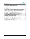
C-nav3050 user guide revision 7 page 7 of 189 7/16/2014 table of contents trademarks ....................................................................................................... 6 disclaimer of warranty .........................................................................................
Page 8
C-nav3050 user guide revision 7 page 8 of 189 7/16/2014 standard .......................................................................................................... 47 airborne ........................................................................................................... 48 base ...
Page 9
C-nav3050 user guide revision 7 page 9 of 189 7/16/2014 profiles ............................................................................................................ 79 section 6 - safety instructions ............................................................................ 81 transport ....
Page 10
C-nav3050 user guide revision 7 page 10 of 189 7/16/2014 c-nav corrections service (ccs) satellites ................................................. 106 ccs over-the-air c-nav licensing .............................................................. 107 how to obtain a c-nav license ...................
Page 11
C-nav3050 user guide revision 7 page 11 of 189 7/16/2014 ministry of transport of the russian federation - certificate of type approval ...................................................................................................................... 150 appendix h - software license agreement ....
Page 12: List Of Figures
C-nav3050 user guide revision 7 page 12 of 189 7/16/2014 list of figures figure 1: c-nav3050 rear view ......................................................................... 24 figure 2: c-nav3050 led indicator panel .......................................................... 25 figure 3: c-nav305...
Page 13
C-nav3050 user guide revision 7 page 13 of 189 7/16/2014 figure 33: antenna, adaptor and mounting pole ................................................ 69 figure 34: c-nav3050 antenna mast installation ............................................... 70 figure 35: communication port connections ........
Page 14: List Of Tables
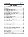
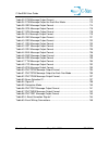
C-nav3050 user guide revision 7 page 14 of 189 7/16/2014 list of tables table 1: c-nav3050 gnss sensor kit (cnv92-310416-3001lf) - supplied equipment. .......................................................................................................... 27 table 2: c-nav3050 without the standard...
Page 15
C-nav3050 user guide revision 7 page 15 of 189 7/16/2014 table 33: dtm message output format ........................................................... 112 table 34: dtm message output for each nav mode ....................................... 113 table 35: gbs message output format ...................
Page 16
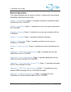
C-nav3050 user guide revision 7 page 16 of 189 7/16/2014 manual organization this section describes how the manual is laid out. It gives one or two sentence descriptions about each major section. Section 1 - getting started (page 23 ) provides instructions to enable the robust functionality of the c...
Page 17
C-nav3050 user guide revision 7 page 17 of 189 7/16/2014 appendix f - event input configuration (page 145 ) provides the user information on event input configuration. Appendix g - type approval certificates (page 146 ) provides med and russian type approval certifications for the c-nav3050. Appendi...
Page 18
C-nav3050 user guide revision 7 page 18 of 189 7/16/2014 fcc notice this device complies with part 15 subpart b class b of the fcc rules. Operation is subject to the following two conditions: 1. This device may not cause harmful interference, and 2. This device must accept any interference received,...
Page 19
C-nav3050 user guide revision 7 page 19 of 189 7/16/2014 global navigation satellite systems global navigation satellite systems (i.E., gps and glonass) are under the control of the respective governmental agency and the operation of these satellites may be changed at any time without warning. Gps s...
Page 20
C-nav3050 user guide revision 7 page 20 of 189 7/16/2014 icd-gps-200 navstar gps space segment / navigation user interfaces standard. Arinc research corporation; 2250 e. Imperial highway; el segundo, california 90245 nmea-0183 national marine electronics association standard for interfacing marine e...
Page 21
C-nav3050 user guide revision 7 page 21 of 189 7/16/2014 gagan (gps aided geo augmented navigation) indian space research organization. Antariksh bhavan, new bel road, bangalore - 560 094, india. Msas (mtsat satellite-based augmentation system) japan civil aviation bureau. Ministry of transport. Kas...
Page 22
C-nav3050 user guide revision 7 page 22 of 189 7/16/2014 manual conventions arial font is used for plain text in this document. Arial italic font is used for settings names. “arial quoted” font is used for settings values. Arial bold font is used for button names. Arial bold italic font is used for ...
Page 23
C-nav3050 user guide revision 7 page 23 of 189 7/16/2014 section 1 - getting started hardware setup this chapter provides instructions to enable the robust functionality of the c- nav3050. Confirm that all ordered equipment is delivered. Refer below for the following tables: supplied equipment: tabl...
Page 24
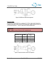
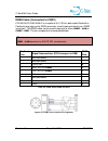
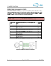
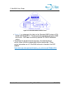
C-nav3050 user guide revision 7 page 24 of 189 7/16/2014 figure 1: c-nav3050 rear view 1. Use one of the two supplied data cables for communications: ethernet rj45 / db9s female y-cable (nav94-310272-3006lfb): connect the positronic 9-pin connector of the cable to com1 - lan at the rear of c-nav3050...
Page 25
C-nav3050 user guide revision 7 page 25 of 189 7/16/2014 the connector labeled power , at the rear of the c-nav3050. Insert an ac power cord into the 2-prong receptacle on the psu, based on regional ac power availability (110, 220 or 240 vac power cords provided) and plug into an appropriately rated...
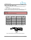
Page 26
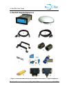
C-nav3050 user guide revision 7 page 26 of 189 7/16/2014 c-nav3050 supplied equipment figure 3: c-nav3050 gnss sensor kit (p/n cnv92-310416-3001lf) - supplied equipment.
Page 27
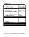
C-nav3050 user guide revision 7 page 27 of 189 7/16/2014 1 c-nav3050 gnss sensor cnv92-310413-3002lf 2 gnss antenna, tnc, 5/8” mount nav82-001020-3001lf 3 y-cable, positronic 9-pin male to usb 2.0 device plug & db9s (rs-232 / rs-422), 6 ft nav94-310273-3006lf 4 y-cable, positronic 9-pin male to ethe...
Page 28
C-nav3050 user guide revision 7 page 28 of 189 7/16/2014 c-nav3050 without standard antenna for the end users who wish to utilize a non-standard antenna with the c- nav3050, they can do so by ordering the c-nav3050 without the antenna (p/n cnv92-310416-3001b). Please note: the c-nav3050 without the ...
Page 29
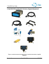
C-nav3050 user guide revision 7 page 29 of 189 7/16/2014 c-nav3050 without standard antenna, supplied equipment figure 4: c-nav3050 without the standard antenna (cnv92-310416-3001b) - supplied equipment.
Page 30
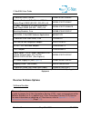
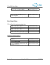
C-nav3050 user guide revision 7 page 30 of 189 7/16/2014 table 2: c-nav3050 without the standard antenna (cnv92-310416-3001b) - supplied equipment receiver software options software bundles please note: in order to access the c-nav corrections service (ccs), users must purchase either software bundl...
Page 31
C-nav3050 user guide revision 7 page 31 of 189 7/16/2014 gps l1/g1/ + c-nav enabled nav97-310041-3101 table 3: software bundle a (nav97-310041-3101) gps l1/l2/l5, glonass g1/g2 + c-nav enabled nav97-310041-3103 table 4: software bundle g (nav97-310041-3103) data output rates pvt and raw data maximum...
Page 32
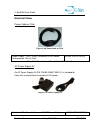
C-nav3050 user guide revision 7 page 32 of 189 7/16/2014 electrical power power cable w/ filter figure 5: dc power cable w/ filter cable, power / 1pps / event, positronic 9-pin female unterminated, 10ft, w/ filter nav94-310274-3010lf table 7: dc power cable w/ filter (nav94-310274-3010lf) ac power s...
Page 33
C-nav3050 user guide revision 7 page 33 of 189 7/16/2014 110-220 vac, 12 vdc, 1.50 a ac power cord, iec320-c7, shotgun termination, us 4250011-110 ac power cord, iec320-c7, shotgun termination, euro (not shown) 4250012-220 ac power cord, iec320-c7, shotgun termination, uk (not shown) 4250013-240 tab...
Page 34
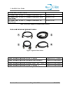
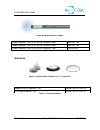
C-nav3050 user guide revision 7 page 34 of 189 7/16/2014 figure 8: optional antenna cables table 10: optional antenna cables antennas figure 9: optional base, airborne & l1 / g1 antennas table 11: optional antennas cable, antenna, tnc-m to tnc-m, lmr400, 45m 4000100-150 cable, antenna, tnc-m to tnc-...
Page 35
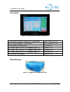
C-nav3050 user guide revision 7 page 35 of 189 7/16/2014 controllers figure 10: c-navigator iii control & display unit c-navigatoriii control & display unit, touchscreen hatc-navigator-iii ac/dc power adapter, c-navigator iii hatht00255-opt-a1 c-navigator usb flash drive 7cng002-0 ac power cord, iec...
Page 36
C-nav3050 user guide revision 7 page 36 of 189 7/16/2014 table 13: miscellaneous (option) ruggedized case, c-nav3050, black , 20” x 14” x 7.7” cnv3050case ruggedized case, c- navigator, black, 20” x 14” x 7.7” 3gtr005-0
Page 37: Section 2 - Introduction
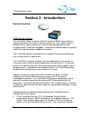
C-nav3050 user guide revision 7 page 37 of 189 7/16/2014 section 2 - introduction system overview gnss sensor system the c-nav3050 global navigation satellite systems (gnss) sensor delivers superior accuracy to the marine / offshore community. This unique receiver is designed with a robust and long-...
Page 38
C-nav3050 user guide revision 7 page 38 of 189 7/16/2014 for more information on the c-nav corrections service and obtaining a license, refer to appendix c - c-nav corrections service (ccs) (page 103 ). Signal reception: the c-nav3050 gnss engine provides exceptional signal tracking performance by i...
Page 39
C-nav3050 user guide revision 7 page 39 of 189 7/16/2014 railway, ship, and aircraft precision tracking port operations and container tracking survey and gis boundary survey topographical surveys in rough terrain construction site stake-out high-accuracy data collection for post-processing hydrograp...
Page 40
C-nav3050 user guide revision 7 page 40 of 189 7/16/2014 accuracy l1-rtk l1-rtk supports 1 cm accuracy (1 ơ) and is valid for up to a 5 km baseline. Sbas when waas, egnos, msas, or gagan (rtca / do-229d compliant) sbas correction signals are used, the system provides (1ơ). System accuracy with waas,...
Page 41
C-nav3050 user guide revision 7 page 41 of 189 7/16/2014 signal to noise (chnlstatus1b) measurement quality (pvt1b and pseudorangestatsb) c-nav signal status (sfstatus1b) installed software components (msgversion) product type, serial no. And revision no. (msgproductinfo) rtcm data the following rtc...
Page 42
C-nav3050 user guide revision 7 page 42 of 189 7/16/2014 rtcm1033: receiver and antenna nmea-0183 data the c-nav3050 is capable of outputting several standard nmea-0183 data strings (see appendix d - nmea data output messages (page 111 )) and several proprietary data strings. Each data is headed wit...
Page 43
C-nav3050 user guide revision 7 page 43 of 189 7/16/2014 unique features the c-nav3050 gnss sensor has many unique features: performance upgrade path the c-nav3050 is designed with a robust and long-term performance upgrade path to meet changing needs via software upgrades. Increased functionality d...
Page 44
C-nav3050 user guide revision 7 page 44 of 189 7/16/2014 positioning flexibility the c-nav3050 is capable of using waas, egnos, msas, and gagan (rtca / do-229 d compliant) code corrections via two internal satellite based augmentation system (sbas) channels. The c-nav3050 automatically configures to...
Page 45
C-nav3050 user guide revision 7 page 45 of 189 7/16/2014 heading and position of both antennae up to a rate of 10 hz. Applications include construction equipment such as excavators and marine applications such as dredging. Coordinated machines a c-nav3050 configured as a moving base is located on a ...
Page 46
C-nav3050 user guide revision 7 page 46 of 189 7/16/2014 continuously operating reference station (cors) support when optioned as an rtk base station, the c-nav3050 is capable of computing and outputting rtk message streams in multiple formats and raw satellite measurement data for post-processing s...
Page 47
C-nav3050 user guide revision 7 page 47 of 189 7/16/2014 please note: to comply with marine equipment directive (med) type approval (wheelmark), the c- nav3050 compass safe distance is 250mm (9.8”) for standard and steering magnetic compasses. The rugged design of the c-nav3050 system components pro...
Page 48
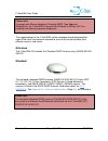
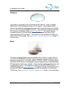
C-nav3050 user guide revision 7 page 48 of 189 7/16/2014 airborne the airborne integrated antenna (nav82-001022-3001lf) tracks all gnss, sbas and c-nav corrections service (ccs) signals. The compact gnss antenna has excellent tracking performance and a stable phase center for gps (l1, l2, l2c, l5), ...
Page 49
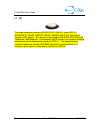
C-nav3050 user guide revision 7 page 49 of 189 7/16/2014 l1 / g1 the single-frequency antenna (nav82-001017-0001lf) tracks gps l1, glonass g1, waas / egnos / msas / gagan, and c-nav corrections service (ccs) signals. This antenna is not listed on the noaa gps antennae calibration table web site. Thi...
Page 50: Section 3 - Interfacing
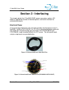
C-nav3050 user guide revision 7 page 50 of 189 7/16/2014 section 3 - interfacing this chapter details the c-nav3050 gnss sensor connectors, cables, led displays, appropriate sources of electrical power, and how to interface the communication ports. Electrical power a rear panel 9-pin positronic male...
Page 51
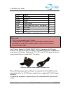
C-nav3050 user guide revision 7 page 51 of 189 7/16/2014 color signal pin no blue 1pps out * 1 brown ignition 2 yellow event 3 black power return 5 red power input (9 to 32vdc, 6w typical) 6 green not used 7 violet not used 8 gray gnd 9 table 14: dc power cable pin assignments please note: pin 4 has...
Page 52
C-nav3050 user guide revision 7 page 52 of 189 7/16/2014 unterminated dc power cable with filter (nav94-310274-3010lf) approved dc to dc power converter. The converter isolates the c- nav3050 power and chassis grounds. The gnss sensor is protected from reverse polarity with an inline diode. It will ...
Page 53
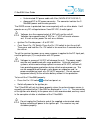
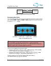
C-nav3050 user guide revision 7 page 53 of 189 7/16/2014 power source c-nav3050 12 vdc ground 12 vdc ignition figure 15: proper external power source setup communication ports the c-nav3050 provides two 9-pin female positronic connector communication ports labeled com1 - lan and com2 - usb located a...
Page 54
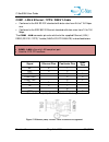
C-nav3050 user guide revision 7 page 54 of 189 7/16/2014 com1 - lan & ethernet / 1pps / db9s y-cable conforms to the eia rs-232 standard with data rates from 9.6 to 115.2 kbps max conforms to the ieee 802.3 ethernet standard with data rates from 10 to 100 mbps the com1 - lan connector pin-outs relat...
Page 55
C-nav3050 user guide revision 7 page 55 of 189 7/16/2014 com2 - usb & usb / db9s y-cable conforms to the eia rs-232 / rs-422 standard with data rates from 9.6 to 115.2 kbps max usb 2.0 compliant with 12 mbps maximum data rate. The com2 - usb connector pin-outs relative to the supplied usb device / d...
Page 56
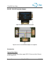
C-nav3050 user guide revision 7 page 56 of 189 7/16/2014 rs-232 / rs-422 dual-data adapter figure 19: rs-232 / rs-422 dual-data adapter figure 20: rs-232 / rs-422 dual-data adapter pin assignment accessories optional data cables the optional interface data cables support usb 2.0 device and host, eth...
Page 57
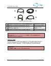
C-nav3050 user guide revision 7 page 57 of 189 7/16/2014 figure 21: optional data cables 1 positronic 9-pin male to usb 2.0 host receptacle, 6 ft nav94-310271-3006lf 2 positronic 9-pin male to ethernet rj45 plug, 6 ft nav94-310265-3006lf 3 positronic 9-pin male to db9s (rs-232 / rs-422 / 1pps) data ...
Page 58
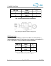
C-nav3050 user guide revision 7 page 58 of 189 7/16/2014 table 18: optional usb host cable pin assignment figure 22: optional usb host cable pin assignment usb device cable p/n nav94-310266-3006lf is an optional 6ft (1.83m) data cable fitted with a positronic plug type and a usb a plug type, used to...
Page 59
C-nav3050 user guide revision 7 page 59 of 189 7/16/2014 figure 23: usb device cable pin assignment ethernet cable p/n nav94-310265-3006lf is an optional 6 ft (1.83 m) data cable fitted with a positronic plug type and an ethernet rj45 plug type, used to connect directly to an ethernet connector. The...
Page 60
C-nav3050 user guide revision 7 page 60 of 189 7/16/2014 db9s cable (connected to com1) p/n nav94-310260-3006lf is an optional 6 ft (1.83 m) data cable fitted with a positronic plug type and a db9s connector, used to connect directly to a db9p serial port. The db9s cable can be used to connect to ei...
Page 61
C-nav3050 user guide revision 7 page 61 of 189 7/16/2014 db9s cable (connected to com2) p/n nav94-310260-3006lf is an optional 6 ft (1.83 m) data cable fitted with a positronic plug type and a db9s connector, used to connect directly to a db9p serial port. The db9s cable can be used to connect to ei...
Page 62
C-nav3050 user guide revision 7 page 62 of 189 7/16/2014 event the c-nav3050 accepts an event input pulse to synchronize external incidents requiring precise gnss time tagging, such as aerial photography. For example, the action of a camera’s shutter creates an input pulse to the event port. The c- ...
Page 63
C-nav3050 user guide revision 7 page 63 of 189 7/16/2014 figure 27: 1pps adapter figure 28: 1pps adapter pin assignment.
Page 64
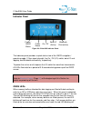
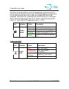
C-nav3050 user guide revision 7 page 64 of 189 7/16/2014 indicator panel figure 29: c-nav3050 indicator panel the indicator panel provides a quick status view of the gnss navigation / operating mode, c-nav signal strength, the on / off (i/o) switch, data i/o and logging, and bluetooth connectivity, ...
Page 65
C-nav3050 user guide revision 7 page 65 of 189 7/16/2014 start when all memory buffers are full at the beginning, and continue for ten minutes and five seconds, and then stop. When data logging is started, every five minutes statistical data such as data loss and data loss ratio will be computed. Wh...
Page 66
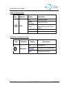
C-nav3050 user guide revision 7 page 66 of 189 7/16/2014 data i/o active leds table 26: data i/o active led indication (serial connections only) bluetooth connectivity leds table 27: bluetooth connectivity led indication icon indicator status description data off no data output green blinking data i...
Page 67: Section 4 - Installation
C-nav3050 user guide revision 7 page 67 of 189 7/16/2014 section 4 - installation this chapter provides guidance on hardware installation for optimum performance. Prior to commencing any installation, discuss proposed mounting locations / methods and cable routes with those involved to ensure all pa...
Page 68
C-nav3050 user guide revision 7 page 68 of 189 7/16/2014 antenna location locate the antenna where it has a clear view of the sky, to an elevation angle of 7º if possible. Obstructions below 15º elevation generally are not a problem, though this is dependent on satellite availability for the local r...
Page 69
C-nav3050 user guide revision 7 page 69 of 189 7/16/2014 a clear line of sight between the antenna and the local inmarsat satellite is required to track the c-nav corrections service (ccs) signal. Inmarsat satellites are geo-synchronized 35,786 kms above the equator. Antenna mounting pole included w...
Page 70
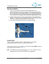
C-nav3050 user guide revision 7 page 70 of 189 7/16/2014 antenna installation 1. Once the antenna location has been determined based on the aforementioned criteria, mount the antenna onto an antenna-mounting pole via the antenna mounting pole adaptor. This should be done on deck prior to climbing th...
Page 71
C-nav3050 user guide revision 7 page 71 of 189 7/16/2014 cable route when choosing a cable route for coaxial cable, consider the following: avoid running coaxial cable across, or parallel too power cables and high power rf cables. Ensure that the cable route is free of sharp edges or places where th...
Page 72
C-nav3050 user guide revision 7 page 72 of 189 7/16/2014 2. Slacken the coaxial cable and tape firmly to the antenna-mounting pole. This will prevent any undue strain on the cable connector and antenna. 3. With the cable connected to the antenna, run the cable down the mast, securing with zip ties e...
Page 73
C-nav3050 user guide revision 7 page 73 of 189 7/16/2014 support for more information on available lightning protection solutions. Gnss sensor mount the c-nav3050 gnss sensor to a flat surface. Shock isolators suitable for 0.50 kg (1.1 lbs) may be necessary for environments with high vibration, i.E....
Page 74
C-nav3050 user guide revision 7 page 74 of 189 7/16/2014 figure 35: communication port connections basics of rtk surveying rtk (real-time kinematic) is a gnss system that yields very accurate 3d position fixes immediately in real-time. A reference station (base station) transmits its gnss position t...
Page 75
C-nav3050 user guide revision 7 page 75 of 189 7/16/2014 sensor above the roving sensors is recommended to enable transmission to all rovers in all directions with minimal obstruction. High frequency radio signals generally travel a shorter distance than lower frequency signals, and do not penetrate...
Page 76: Section 5 - Configuration
C-nav3050 user guide revision 7 page 76 of 189 7/16/2014 section 5 - configuration the c-nav3050 has a rich interface and detailed control language, allowing each unit to be individually programmed to a specific application. There are essentially four methods available to configure and control the c...
Page 77
C-nav3050 user guide revision 7 page 77 of 189 7/16/2014 these five ports (com1, eth1, eth2, eth3, and eth4) normally used to input and output proprietary messages used for navigation and receiver setup. It is also the only port that can be used to receive ntrip or ccs oti through the rj- 45 etherne...
Page 78
C-nav3050 user guide revision 7 page 78 of 189 7/16/2014 pdop, tracked satellite identity, satellite elevation and azimuth, c/no for tracked signals and correction age for each satellite. Ephem1b (packed ephemeris): individual satellite tracking information including gps week number of collected eph...
Page 79
C-nav3050 user guide revision 7 page 79 of 189 7/16/2014 rtcm24: base position (combined rtcm3 and rtcm22) rtcm31 and rtcm34: code glonass corrections rtcm1001: l1-only gps rtk observables rtcm1002: extended l1-only gps rtk observables rtcm1003: l1 and l2 gps rtk observables rtcm1004: extended l1 an...
Page 80
C-nav3050 user guide revision 7 page 80 of 189 7/16/2014 please note: a new profile sent to the receiver replaces the currently used profile, but it does not necessarily replace all the current parameter settings. The new profile replaces only those parameter settings that it specifies. For example:...
Page 81
C-nav3050 user guide revision 7 page 81 of 189 7/16/2014 section 6 - safety instructions the c-nav3050 gnss sensor is designed for precise navigation and positioning using the gps and glonass. Users must be familiar with the use of portable gnss equipment, the limitations thereof and these safety in...
Page 82
C-nav3050 user guide revision 7 page 82 of 189 7/16/2014 if your chosen external power source is a disposable battery, please dispose of the battery in accordance with your local regulations. Safety first the owner of this equipment must ensure that all users are properly trained prior to using the ...
Page 83: Appendix A - Gnss Sensor
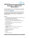
C-nav3050 user guide revision 7 page 83 of 189 7/16/2014 appendix a - gnss sensor specifications the technical specifications of this unit are detailed below. C-nav is constantly improving, and updating our technology. For the latest technical specifications for all products go to: www.Cnav.Com this...
Page 84
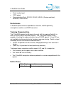
C-nav3050 user guide revision 7 page 84 of 189 7/16/2014 event marker input 1pps output communication ports: rs-232, rs-422, usb 2.0 (device and host), bluetooth, and ethernet performance c-nav3050 performance is dependent on location, satellite geometry, atmospheric condition and gnss correction. T...
Page 85
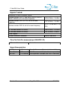
C-nav3050 user guide revision 7 page 85 of 189 7/16/2014 signals tracked navigation & public correction signals services include: gps l1, and sbas (waas, egnos, msas, gagan); all at the same frequency: 1575.42 mhz, 16 mhz services include: gps (l2, l2c); all at the same frequency: 1227.60 mhz, 16 mh...
Page 86
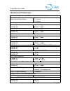
C-nav3050 user guide revision 7 page 86 of 189 7/16/2014 measurement performance measurement precision (1ơ/rms, unless otherwise stated) raw c/a code: raw carrier phase noise: 7.50 cm l1: 0.7 mm l2: 0.9 mm rtk positioning - multi-frequency position (h): position (v): + 1 cm + 0.5 ppm + 2 cm + 1 ppm ...
Page 87
C-nav3050 user guide revision 7 page 87 of 189 7/16/2014 please note: the specifications herein are based on the following: pdop (65%), 24-hour averaged set of data. Further, performance is dependent upon, but not limited to, location, satellite geometry, atmospheric conditions (i.E., solar storm ac...
Page 88
C-nav3050 user guide revision 7 page 88 of 189 7/16/2014 please note: to comply with marine equipment directive (med) type approval (wheelmark), the c-nav3050 compass safe distance is 250 mm (9.8”) for standard and steering magnetic compasses. 1pps data latency and memory connector assignments accur...
Page 89
C-nav3050 user guide revision 7 page 89 of 189 7/16/2014 physical and environmental specifications satellite based augmentation system signals (sbas) please note: by default, the two female positronic ports are available for command inputs and data input / output. Refer to section 3 - interfacing (p...
Page 90
C-nav3050 user guide revision 7 page 90 of 189 7/16/2014 led display functions input / output data messages gnss acquiring / tracking gnss satellites c-nav verifying c-nav license acquiring / tracking c-nav satellites data i/o data i/o activity bluetooth bluetooth connectivity control commands (inpu...
Page 91
C-nav3050 user guide revision 7 page 91 of 189 7/16/2014 ccs rapid recovery the ccs rapid recovery feature provides a way to more quickly recover from the loss of ccs corrected positioning after loss and recovery of navigation. The receiver starts using these corrections when the link to the navigat...
Page 92
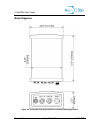
C-nav3050 user guide revision 7 page 92 of 189 7/16/2014 block diagrams figure 38: c-nav3050 base plate dimensions without mounting brackets.
Page 93
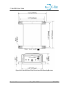
C-nav3050 user guide revision 7 page 93 of 189 7/16/2014 figure 39: c-nav3050 base plate dimensions with mounting brackets.
Page 94
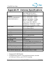
C-nav3050 user guide revision 7 page 94 of 189 7/16/2014 appendix b - antenna specifications part numbers standard: nav82-001020-3001lf base: nav82-001021-3001lf airborne: nav82-001022-3001lf frequency (frequency is dependent on software bundle options.) gps l1: 1575.42 mhz, 16 mhz gps l2: 1227.60 m...
Page 95
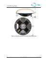
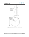
C-nav3050 user guide revision 7 page 95 of 189 7/16/2014 figure 40 : standard gnss antenna offset figure 41 is a drawing of the label on the standard gnss antenna (p/n nav82-001020-3001lf). The phase center provided is based on ngs test results. Ngs does not currently provide glonass calibrated valu...
Page 96
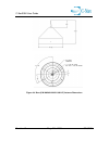
C-nav3050 user guide revision 7 page 96 of 189 7/16/2014 figure 41: standard (p/n nav82-001020-3001) antenna dimensions.
Page 97
C-nav3050 user guide revision 7 page 97 of 189 7/16/2014 figure 42: airborne (p/n nav82-001022-3001lf) antenna dimensions.
Page 98
C-nav3050 user guide revision 7 page 98 of 189 7/16/2014 figure 43: base (p/n nav82-001021-3001lf) antenna dimensions.
Page 99
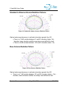
C-nav3050 user guide revision 7 page 99 of 189 7/16/2014 standard & airborne antenna radiation patterns figure 44: standard & airborne antenna radiation pattern optimal antenna performance is realized at elevations greater than 25º. There is a 10 db variation between 0º and 90º elevation (factor 10x...
Page 100
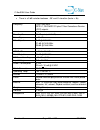
C-nav3050 user guide revision 7 page 100 of 189 7/16/2014 there is a 9 db variation between ~35º and 0º elevation (factor > 8x) frequency 1525-1660 mhz gps l1, glonass g1 plus c-nav corrections service (ccs) signals polarization right hand circular (rhcp) pre –amplifier 35 db gain (+/- 1.2 db) noise...
Page 101
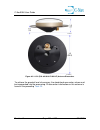
C-nav3050 user guide revision 7 page 101 of 189 7/16/2014 figure 46: l1/g1 (p/n: 82-001017-0001lf) antenna dimensions to achieve the greatest level of accuracy, the absolute phase center values must be incorporated into the processing. Phase center information on this antenna is found in the precedi...
Page 102
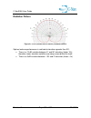
C-nav3050 user guide revision 7 page 102 of 189 7/16/2014 radiation pattern figure 47: l1/g1 (p/n: 82-001017-0001lf) radiation pattern optimal antenna performance is realized at elevations greater than 30º. There is a 10 db variation between 0º and 90º elevation (factor 10x); therefore, lower elevat...
Page 103: Service (Ccs)
C-nav3050 user guide revision 7 page 103 of 189 7/16/2014 appendix c - c-nav corrections service (ccs) description the ccs dual frequency service is a global system for the distribution of sbas corrections giving the user the ability to measure their position anywhere in the world with exceptional r...
Page 104
C-nav3050 user guide revision 7 page 104 of 189 7/16/2014 the key to the accuracy and convenience of the c-nav corrections service (ccs) is the source of sbas corrections. Gnss satellites transmit navigation data on several l-band frequencies 1 . The c-nav reference stations are all equipped with ge...
Page 105
C-nav3050 user guide revision 7 page 105 of 189 7/16/2014 reliability the entire system meets or exceeds a target availability of 99.99%. To achieve this, every part of the infrastructure has a built-in back-up system. All the reference stations are built with duplicate receivers, processors, and co...
Page 106
C-nav3050 user guide revision 7 page 106 of 189 7/16/2014 clock, as well as orbit correctors. It provides a fully independent suite of clock and orbit correction algorithms, and fully independent servers in geographically separated processing centers. Features also include a second independent globa...
Page 107
C-nav3050 user guide revision 7 page 107 of 189 7/16/2014 ccs over-the-air c-nav licensing ccs over-the-air (ota) c-nav licensing is the easiest way to install a c-nav license. The installation of a purchased license is accomplished via radio broadcast. Ccs over-the-air c-nav licensing is especially...
Page 108
C-nav3050 user guide revision 7 page 108 of 189 7/16/2014 vessel info and brief project description (name / number, location) customer info (company name, po / ref. Num. Point of contact) c-nav equipment details (receiver type, firmware version, serial number, p/n’s, etc.) required start / stop date...
Page 109
C-nav3050 user guide revision 7 page 109 of 189 7/16/2014 for special-case scenarios, customers may request to receive the c-nav license via email to manually upload via a c-nav controller solution. The request must be specified in the p.O. The broadcast procedure for over-the-air c-nav corrections ...
Page 110
C-nav3050 user guide revision 7 page 110 of 189 7/16/2014 hardware setup and configuration for information regarding the setup and configuration of ccs oti, please refer to the c-nav3050 ccs oti manual ..
Page 111: Messages
C-nav3050 user guide revision 7 page 111 of 189 7/16/2014 appendix d - nmea data output messages nmeaalm (ascii) this output message reports orbital data (almanac) for the specified gps satellite, and is in compliance with nmea-0183 standards version 3.0. Output format: $gpalm,total,message,prn,week...
Page 112
C-nav3050 user guide revision 7 page 112 of 189 7/16/2014 nmeadtm (ascii) this output stream reports the local geodetic datum and datum offsets from a reference datum. It is in compliance with nmea-0183 standards version 3.0. Default: the nmeadtm message will be scheduled to display automatically be...
Page 113
C-nav3050 user guide revision 7 page 113 of 189 7/16/2014 navigation mode [datum] (user command) local datum reference datum offsets non-diff, sbas default or wgs84 w84 w84 0 gda94 or userdatum 999 w84 offsets from wgs84 c-nav correction services default 999 999 0 wgs84 w84 w84 0 gda94 or userdatum ...
Page 114
C-nav3050 user guide revision 7 page 114 of 189 7/16/2014 nmeagbs (ascii) this output stream reports receiver autonomous integrity monitoring (raim) data. Given that a gnss receiver is tracking enough satellites to perform integrity checks of the positioning quality of the position solution, this se...
Page 115
C-nav3050 user guide revision 7 page 115 of 189 7/16/2014 nmeagfa (ascii) this sentence is used to report the results of the data quality check associated with a position solution. If only a single constellation (gps, glonass, etc.) is used for the reported position solution, the talker id is gp, gl...
Page 116
C-nav3050 user guide revision 7 page 116 of 189 7/16/2014 example: $gngfa,224229.00,0001.7,0002.9,000.43,000.22,014.4868,000.83,0010.0,scc*0c in rtk mode, fields f2, f3, f4 and f5 are zeroes. They are correct values since rtk provides very accurate solutions, beyond the resolution provided by the nm...
Page 117
C-nav3050 user guide revision 7 page 117 of 189 7/16/2014 nmeagga (ascii) these output messages reports position and fix related status information and is in compliance with nmea-0183 standards version 3.0. Output format: $xxgga,time,lat,n/s,lon,e/w,quality,used,hdop,alt,m,separation,m,age ,id*check...
Page 118
C-nav3050 user guide revision 7 page 118 of 189 7/16/2014 earth ellipsoid surface. Note: if no geiod is loaded, geoidal separation is reported as 0. F12 m units for geoidal separation (m = meters) f13 age time since last dgps data was received, in seconds f14 id reference station id number (0000 -10...
Page 119
C-nav3050 user guide revision 7 page 119 of 189 7/16/2014 nmeagll (ascii) this output message reports geographic position (latitude and longitude) information and is in compliance with nmea-0183 standards version 3.0. Output format: $xxgll,lat,n/s,lon,e/w,time,status,mode*checksum field# field name ...
Page 120
C-nav3050 user guide revision 7 page 120 of 189 7/16/2014 nmeagns (ascii) this output message reports geographic position (latitude and longitude) information for single or combined satellite navigation systems and is in compliance with nmea-0183 standards version 3.0. Output format: $xxgns,time,lat...
Page 121
C-nav3050 user guide revision 7 page 121 of 189 7/16/2014 f13 status navigational status indicator s= safe (if the horizontal position error is less than or equal to the selected accuracy level) c= caution (if there is no valid horizontal position error (no raim data)) u= unsafe (if the horizontal p...
Page 122
C-nav3050 user guide revision 7 page 122 of 189 7/16/2014 nmeagrs (ascii) this output stream reports receiver autonomous integrity monitoring (raim) data, reporting range residuals in compliance with nmea-0183 standards version 3.0. Nmea-0183 version 4.1 are given by the addition of fields f9 and f1...
Page 123
C-nav3050 user guide revision 7 page 123 of 189 7/16/2014 nmeagsa (ascii) this output message reports 2d / 3d solution mode, dop values and active satellite information, and is in compliance with nmea-0183 standards version 3.0. Field f7 is added to comply with version 4.1 of the nmea standard. Outp...
Page 124
C-nav3050 user guide revision 7 page 124 of 189 7/16/2014 nmeagst (ascii) this output message reports pseudo-range noise (prn) statistic information, and is in compliance with nmea-0183 standards version 3.0. Output format: $xxgst,time,rms,majoraxis,minoraxis,orientation,lateer,loner,alterr*c hecksu...
Page 125
C-nav3050 user guide revision 7 page 125 of 189 7/16/2014 nmeagsv (ascii) this output message reports data associated with satellites in view, based on almanac data. Data includes prn number, elevation, azimuth, and snr values. Note that one gsv sentence can only provide data for up to 4 satellites,...
Page 126
C-nav3050 user guide revision 7 page 126 of 189 7/16/2014 nmeamla (ascii) this output stream reports orbital data (almanac) for the specified glonass satellite and is in compliance with nmea-0183 standards version 3.0. Output format: $glmla,total,sentence,sid,na,ch,eccentricity,tn,perigee,tmsb,dtn a...
Page 127
C-nav3050 user guide revision 7 page 127 of 189 7/16/2014 nmearmc (ascii) this output message reports minimum recommended gps information, including position, velocity, and time information, and is in compliance with nmea-0183 standards version 3.0. The update of field f12 and the addition of field ...
Page 128
C-nav3050 user guide revision 7 page 128 of 189 7/16/2014 p= precise (nmea v4.1 only) r= rtk solutions (except rtk float) (nmea v4.1 only) f= float (nmea v4.1 only) f13 nav status navigational status indicator (nmea v4.1 only) s= safe. C= caution. U= unsafe. V= not valid f14 checksum table 45: rmc m...
Page 129
C-nav3050 user guide revision 7 page 129 of 189 7/16/2014 nmearre (ascii) this output stream report receiver autonomous integrity monitoring (raim) data, reporting range residual errors. Note that this command is not defined in nmea-0183 standards version 3.0. Output format: $xxrre,count,...,herr,ve...
Page 130
C-nav3050 user guide revision 7 page 130 of 189 7/16/2014 nmeattm (ascii) this output stream is only supported on mbrtk rover and displays baseline information including the baseline distance, bases speed and direction and closest point of approach based on nmea-0183 standards version 4.0. Output fo...
Page 131
C-nav3050 user guide revision 7 page 131 of 189 7/16/2014 example: $gnttm,30,16.75,134.27,t,0.03,34.96,t,15.99,2.63,k,530,t,r,201345.00,a*45 please note: there will be some noise in the base velocity due to the baseline velocity of the rover. This noise will increase if the rover is moving in a non-...
Page 132
C-nav3050 user guide revision 7 page 132 of 189 7/16/2014 nmeavtg (ascii) this output message reports velocity and course over ground information, and is in compliance with nmea-0183 standards version 3.0. Output format: $xxvtg,track,t,track,m,speed,n,speed,k,mode*checksum (as nmea v3.0) field# fiel...
Page 133
C-nav3050 user guide revision 7 page 133 of 189 7/16/2014 nmeazda (ascii) this output message reports date and time information, and is in compliance with nmea-0183 standards version 3.0. Output format: $xxzda,time,day,month,year,offset_hour,offset_min*checksum field# field name description f1 time ...
Page 134
C-nav3050 user guide revision 7 page 134 of 189 7/16/2014 nmeapnctdtm (ascii) this output stream reports local geodetic datum and datum offsets from a reference datum. It is in compliance with nmea-0183 standards version 3.0. The difference between nmeadtm and nmeapnctdtm is the added datum codes fo...
Page 135
C-nav3050 user guide revision 7 page 135 of 189 7/16/2014 table 51: pnctdtm message output for each nav mode please note: there will be some noise in the base velocity due to the baseline velocity of the rover. This noise will increase if the rover is moving in a non-linear path. Navigation mode [da...
Page 136
C-nav3050 user guide revision 7 page 136 of 189 7/16/2014 nmeapnctgga (ascii) this message reports position and fix related status information. It is a c-nav proprietary nmea type message, and it conforms to the header, checksum and electrical characteristics of a standard nmea string, but is not re...
Page 137
C-nav3050 user guide revision 7 page 137 of 189 7/16/2014 earth ellipsoid surface and mean-sea-level (geoid) surface. “-“ = mean-sea-level surface below wgs-84 earth ellipsoid surface. Note: if no geiod is loaded, geoidal separation is reported as 0. F12 m units for geoidal separation (m = meters) f...
Page 138
C-nav3050 user guide revision 7 page 138 of 189 7/16/2014 table 54: signal id system signal id signal channel gps 0 1 2 3 4 5 6 7 8 9-f all signals l1 c/a l1 p(y) l1 m l2 p(y) l2c-m l2c-l l5-i l5-q reserved glonass 0 1 2 3 4 5-f all signals g1 c/a g1 p g2 c/a glonass (m) g2 p reserved.
Page 139
C-nav3050 user guide revision 7 page 139 of 189 7/16/2014 id (yy) gps correction signal 00 non dgps 01 dgps, rtcm type 1 (gps-code); and type 31 (glonass – code) or type 9 (gps – code); and type 34 (glonass partial correction set – code), single freq. And dual freq. 02 waas/egnos, single freq. (gps)...
Page 140
C-nav3050 user guide revision 7 page 140 of 189 7/16/2014 table 55: navigation mode 26 rtk extend active (c-nav correction services filling in for missing rtk epochs) (gps) 33 gnss, single freq., no “tides” 34 gnss, dual freq., no “tides” 35 gnss, single freq., adjusted for “tides” 36 gnss, dual fre...
Page 141
C-nav3050 user guide revision 7 page 141 of 189 7/16/2014 nmeapnctgst (acsii) this message satisfies the ukooa compliance requirements by starting with the standard nmea gst message and scaling all error statistics by 1.96, and by adding a value for the f-test of unit variance. Output format: $pnctg...
Page 142
C-nav3050 user guide revision 7 page 142 of 189 7/16/2014 nmeapnctmde (ascii) this output stream reports the marginally detectable error (mde) generated by the receiver as part of the self-monitoring duties performed to support receiver autonomous integrity monitoring (raim). It is a c-nav proprieta...
Page 143
C-nav3050 user guide revision 7 page 143 of 189 7/16/2014 nmeapnctset (ascii) this output message reports c-nav proprietary set (solid earth tides), pt (polar tides) and ol (ocean loading) values. It is a c-nav proprietary nmea type message, and it conforms to the header, checksum and electrical cha...
Page 144: Signals
C-nav3050 user guide revision 7 page 144 of 189 7/16/2014 appendix e - l-band correction signals the c-nav3050 gnss receiver can obtain c-nav corrections service (ccs) corrections from six separate and independent geostationary communication satellites. The satellite-based augmentation system (sbas)...
Page 145: Appendix F - Event Input
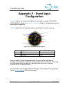
C-nav3050 user guide revision 7 page 145 of 189 7/16/2014 appendix f - event input configuration figure 50 details the wiring of the optional event cable assembly (p/n nav94- 310274-3010lf). Refer to section 3 - interfacing (page 50 ) for detailed electrical specifications and details. Table 60 deta...
Page 146: Certificates
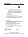
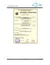
C-nav3050 user guide revision 7 page 146 of 189 7/16/2014 appendix g - type approval certificates med certificate of type approval for c-nav3050 version 3.3.10.0 please note: the med certificate of type approval only applies to the c-nav3050 using the standard antenna (cnv92-310416-3001lf)..
Page 147
C-nav3050 user guide revision 7 page 147 of 189 7/16/2014.
Page 148
C-nav3050 user guide revision 7 page 148 of 189 7/16/2014.
Page 149
C-nav3050 user guide revision 7 page 149 of 189 7/16/2014.
Page 150
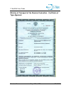
C-nav3050 user guide revision 7 page 150 of 189 7/16/2014 ministry of transport of the russian federation - certificate of type approval.
Page 151
C-nav3050 user guide revision 7 page 151 of 189 7/16/2014.
Page 152: Agreement
C-nav3050 user guide revision 7 page 152 of 189 7/16/2014 appendix h - software license agreement software license agreement for c-nav, a division of c&c technologies, inc. C- nav3050™ receiver. Important – read carefully: this software license agreement is a legal contract between you and the licen...
Page 153
C-nav3050 user guide revision 7 page 153 of 189 7/16/2014 instructions supplied in the user manual(s) – will make those features operational. You are responsible for maintaining the confidentiality of all activation licenses and will not disclose them to any third party or permit any third party to ...
Page 154
C-nav3050 user guide revision 7 page 154 of 189 7/16/2014 receiver to the place of purchase for repair or replacement of the non- performing software. As used in this agreement, the " warranty period " is 12 months from the date you take delivery of the receiver. 6. Disclaimer of warranties . You he...
Page 155
C-nav3050 user guide revision 7 page 155 of 189 7/16/2014 to you or to any other party for any losses or damages resulting from any claims, lawsuits, demands, or actions arising from or relating to use of the software exceed your total payment for the receiver and for the license of the software. 8 ...
Page 156
C-nav3050 user guide revision 7 page 156 of 189 7/16/2014 12 . Trademark . C- nav3050™ is a trademark of licensor. No right, license, or interest to such trademark is granted hereunder, and you agree that no such right, license, or interest shall be asserted by you with respect to such trademark. 13...
Page 157
C-nav3050 user guide revision 7 page 157 of 189 7/16/2014 then section 6 does not apply, instead, licensor warrants that the software provides the functionalities set forth in the operators manuals (the " agreed upon functionalities ") for the warranty period. As used in this section, "warranty peri...
Page 158
C-nav3050 user guide revision 7 page 158 of 189 7/16/2014 obtained the software and on whose behalf it is used; and, (d) agree to perform the obligations of this agreement. 20. Identification of licensor and notices . The licensor is c-nav, a division of c&c technologies, inc. All notices to licenso...
Page 159
C-nav3050 user guide revision 7 page 159 of 189 7/16/2014 see the end of this section for a special exception to the general public license (gpl). Preamble the licenses for most software are designed to take away your freedom to share and change it. By contrast, the gnu general public license is int...
Page 160
C-nav3050 user guide revision 7 page 160 of 189 7/16/2014 gnu general public license: terms and conditions for copying, distribution and modification 0 . This license applies to any program or other work which contains a notice placed by the copyright holder saying it may be distributed under the te...
Page 161
C-nav3050 user guide revision 7 page 161 of 189 7/16/2014 this license. (exception: if the program itself is interactive but does not normally print such an announcement, your work based on the program is not required to print an announcement.) these requirements apply to the modified work as a whol...
Page 162
C-nav3050 user guide revision 7 page 162 of 189 7/16/2014 with the major components (compiler, kernel, and so on) of the operating system on which the executable runs, unless that component itself accompanies the executable. If distribution of executable or object code is made by offering access to ...
Page 163
C-nav3050 user guide revision 7 page 163 of 189 7/16/2014 sole purpose of protecting the integrity of the free software distribution system, which is implemented by public license practices. Many people have made generous contributions to the wide range of software distributed through that system in...
Page 164
C-nav3050 user guide revision 7 page 164 of 189 7/16/2014 program prove defective, you assume the cost of all necessary servicing, repair or correction. 12 . In no event unless required by applicable law or agreed to in writing will any copyright holder, or any other party who may modify and/or redi...
Page 165
C-nav3050 user guide revision 7 page 165 of 189 7/16/2014 gnomovision version 69, copyright (c) year name of author gnomovision comes with absolutely no warranty; for details type `show w'. This is free software, and you are welcome to redistribute it under certain conditions; type `show c' for deta...
Page 166
C-nav3050 user guide revision 7 page 166 of 189 7/16/2014 is accompanied by a written statement that details to the recipient the version of freertos used and an offer by yourself to provide the freertos source code should the recipient request it. Any freertos source code, whether modified or in it...
Page 167
C-nav3050 user guide revision 7 page 167 of 189 7/16/2014 * warranties, including, but not limited to, the implied warranties of * merchantability and fitness for a particular purpose are disclaimed. In no event * shall the author be liable for any direct, indirect, incidental, special, * exemplary,...
Page 168: Glossary
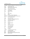
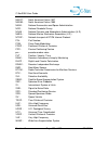
C-nav3050 user guide revision 7 page 168 of 189 7/16/2014 glossary abbreviations 1pps - 1 pulse per second 2drms - twice the distance root mean square a/s - antispoofing apc - antenna phase center ber - bit error rate bps - bits per second bsw - british standard whitworth c/a - coarse/acquisition cc...
Page 169
C-nav3050 user guide revision 7 page 169 of 189 7/16/2014 glonass - globalnaya navigatsionnaya sputnikovaya sistema gmt - greenwich mean time gnss - global navigation satellite system gps - global positioning system hdop - horizontal dilution of precision hf - high frequency how - hand over word hz ...
Page 170
C-nav3050 user guide revision 7 page 170 of 189 7/16/2014 nad27 - north american datum 1927 nad83 - north american datum 1983 nasa - national aeronautics and space administration ngs - national geodetic survey noaa - national oceanic and atmospheric administration (u.S.) nmea - national marine elect...
Page 171
C-nav3050 user guide revision 7 page 171 of 189 7/16/2014 wadgps - wide area differential global positioning system wdop - weighted dilution of precision wgs84 - world geodetic system 1984.
Page 172
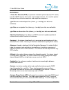
C-nav3050 user guide revision 7 page 172 of 189 7/16/2014 definitions 1 pulse per second (1pps) is a precision electronic pulse output (at ttl levels) from the gnss receiver that marks exact second intervals. It is used for precise timing and to synchronize receivers and acquisition computers. .Yym ...
Page 173
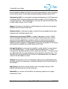
C-nav3050 user guide revision 7 page 173 of 189 7/16/2014 be calculated by adding the height to an easily measured point, such as the base of the antenna mount, to the known distance between this point and the apc. Antispoofing (a/s) is an encryption technique developed by the us department of defen...
Page 174
C-nav3050 user guide revision 7 page 174 of 189 7/16/2014 baseline is the resultant three-dimensional vector (v) between any two stations from which simultaneous gp data have been collected and processed. Generally given in earth-centered cartesian coordinates where: v = (Δx, Δy, Δz) base station se...
Page 175
C-nav3050 user guide revision 7 page 175 of 189 7/16/2014 can bus is a balanced (differential) 2-wire interface that uses an asynchronous transmission scheme. Often used for communications in vehicular applications. Carrier is a high-frequency radio wave having at least one characteristic (frequency...
Page 176
C-nav3050 user guide revision 7 page 176 of 189 7/16/2014 com is the shortened form of the word communications. Indicates a data communications port to/from the gnss receiver to a controller or data collection device. Compact measurement record (cmr / cmr+) is a standard format for dgnss corrections...
Page 177
C-nav3050 user guide revision 7 page 177 of 189 7/16/2014 db9s a type of electrical connector containing 9 contacts. The s indicates a slot pin (female). Dce data communications equipment. Defined pin assignments based on the ieee rs-232 signaling standard. See figure 51 : figure 51: dte to dce rs-2...
Page 178
C-nav3050 user guide revision 7 page 178 of 189 7/16/2014 and observed ranges to the satellites being tracked. The coordinates of the unknown location can be computed with sub-meter level precision by applying these corrections to the satellite data received by the rover. Dilution of precision (dop)...
Page 179
C-nav3050 user guide revision 7 page 179 of 189 7/16/2014 elevation mask the lowest elevation, in degrees, at which a receiver can track a satellite. Measured from the horizon to zenith, 0º to 90º. Ellipsoid is a mathematical model approximating the earth’s surface, generated by rotating an ellipse ...
Page 180
C-nav3050 user guide revision 7 page 180 of 189 7/16/2014 geodetic leveling network is a network of vertical control or benchmarks whose heights are known as accurately as possible, and whose horizontal position is known only approximately. Geoid is the gravity-equipotential surface that best approx...
Page 181
C-nav3050 user guide revision 7 page 181 of 189 7/16/2014 handover word is the word in the gps message that contains time synchronization information for the transfer from the c/a-code to the p-code. Horizontal geodetic network is a network for which the horizontal, coordinate, latitude, and longitu...
Page 182
C-nav3050 user guide revision 7 page 182 of 189 7/16/2014 l1 carrier frequency is the primary l-band carrier used by gps satellites to transmit satellite data. The frequency is 1575.42 mhz. It is modulated by c/a code, p-code, or y-code, and a 50-bit / second navigation message. The bandwidth of thi...
Page 183
C-nav3050 user guide revision 7 page 183 of 189 7/16/2014 meridian one of the lines joining the north and south poles at right angles to the equator, designated by degrees of longitude, from 0° at greenwich to 180°. Meteorological (.Yym) files one of the three file types that make up the rinex file ...
Page 184
C-nav3050 user guide revision 7 page 184 of 189 7/16/2014 national marine electronics association (nmea) is a worldwide organization promoting the standardization of digital interfaces to marine electronics devices. Observation (.Yyo) files one of the three file types that make up the rinex file for...
Page 185
C-nav3050 user guide revision 7 page 185 of 189 7/16/2014 position dilution of precision (pdop) is a measure of the magnitude of dilution of position (dop) errors in the x, y, and z coordinates. Post-processing is a method of differential data correction, which compares data logged from a known refe...
Page 186
C-nav3050 user guide revision 7 page 186 of 189 7/16/2014 pseudo-range is the apparent distance from the reference station’s antenna to a satellite, calculated by multiplying the time the signal takes to reach the antenna by the speed of light (radio waves travel at the speed of light). The actual d...
Page 187
C-nav3050 user guide revision 7 page 187 of 189 7/16/2014 relatively close to the reference station. A reference station is used to improve the quality and accuracy of gnss data collected by roving receivers. Right hand circular polarization (rhcp) is used to discriminate satellite signals. Gnss sig...
Page 188
C-nav3050 user guide revision 7 page 188 of 189 7/16/2014 single-frequency is a type of receiver that only uses the l1 gps signal. There is no compensation for ionospheric effects. The c-nav3050 could be optioned as a single frequency receiver. Space segment is the portion of the gnss system with ma...
Page 189
C-nav3050 user guide revision 7 page 189 of 189 7/16/2014 user segment is the portion of the gnss system with major components that can be interfaced by the user (e.G., gnss receivers). Wide area augmentation system (waas) is a set of corrections for the gps satellites, which are valid for the ameri...

