- DL manuals
- Echo Flight
- GPS
- EchoMap 3.0
- User Manual
Echo Flight EchoMap 3.0 User Manual - 3.10.1
EchoMap v3.0
21
situations.
Color
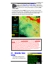
displays the roads using coloring similar to a
standard road map.
The
Range Ring
setting lets you display a thin white ring a
particular range around your aircraft. This can be using in
addition to the standard green compass ring to help you
determine your distance to objects on the map, including weather.
You can set the range ring size from 5 to 100 nautical miles.
3.10
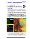
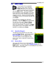
Map Menu - Layers
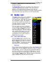
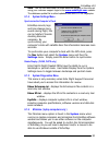
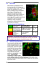
The
Layers
menu allows you to configure
multiple pages of navigational data for
your moving map. Each page can contain
any combination of data. For example,
you could have airports and airspace on
one page, airways on another and roads
and state borders on another.
Once you pages have been configured,
you can quickly change between them by
pressing the
Up
and
Down
arrow keys
from the moving map. You can create as
many separate data pages as you wish.
The system comes with several layers
preconfigured, you can add, change or
delete these as you wish.
3.10.1
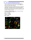
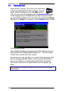
Add or Delete a Map Layer
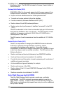
From the
Layers
menu, you can turn on
and off individual data layers by using the
Up
and
Down
keys to select it in the list
and press
Enter
. The green dots indicate
which layers are currently displayed.
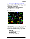
Add a Layer
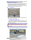
Once a desired group of data layers is active, select
Insert
in the
Layers
menu (or press
Insert
on keyboard) to add as a preset
map data page. You can create as many preset data pages as
you want, containing any combination of data layers. You can
then cycle through your preset pages of data from the moving
map using
Up
+
Down
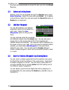
arrows. The list of layers for the active
page is displayed on the lower left of the map.
Summary of EchoMap 3.0
Page 1
Echomap 3.0 user’s guide 1919 14 th st. Suite 601 boulder, co. 80302 customer support 1-888-739-7161 support@echoflight.Com www.Echoflight.Com.
Page 2: 1/22/2002
Echomap v3.0 2 this manual is for users of echomap, on an echo flight flight cheetah multi- function-display or a windows® laptop. An electronic version of this manual will be installed to /echomap/docs/echomapguide.Pdf 1/22/2002 version 3.0
Page 3
Echomap v3.0 3 please read the following information • echo flight provides weather and messaging only in the continental u.S. And surrounding offshore areas • echo flight continues to develop new technologies to provide pilots with new and exciting ways to gather information in the cockpit. For a f...
Page 4: Table of Contents
Echomap v3.0 4 table of contents 1. Introduction ...............................................................................7 1.1 system requirements ..........................................................7 1.2 data-link and gps...............................................................7 ...
Page 5
Echomap v3.0 5 4.1.1 airport facility page........................................................ 24 4.1.2 airport frequency page.................................................. 25 4.1.3 airport map page............................................................ 25 4.1.4 airport metar weather pa...
Page 6
Echomap v3.0 6 7.4.6 how to read graphical wind speed and direction .........48 7.4.7 how to read graphical temperature dew-point spreads49 7.4.8 how to view weather overlays ......................................49 7.5 text metar reports ................................................................
Page 7
Echomap v3.0 7 1 1 . . I i n n t t r r o o d d u u c c t t i i o o n n this manual is for users of the echomap software running on a either an echo flight flight cheetah multi-function-display or a windows laptop/tablet computer. Reading this manual will introduce you to the powerful features and fu...
Page 8
Echomap v3.0 8 2 2 . . F f l l i i g g h h t t d d i i s s p p l l a a y y i i n n d d i i c c a a t t o o r r s s echomap has been optimized for maximum flexibility, capability and ease of use in flight. Please take a few moments to review its functions to get the most of its capabilities . The fli...
Page 9
Echomap v3.0 9 2.1 heading indicator the first section of the flight display is the heading indicator in the upper left corner of the screen. The top yellow number is the magnetic heading to your waypoint. The lower white number is your actual current track. The visual aircraft indicator shows the n...
Page 10
Echomap v3.0 10 2.4 position indicators directly below the direct to indicator is the navigation box. This box displays current navigational information during flight. The first two lines are distance to the waypoint and ground speed . The third line displays the estimated time enroute ( ete ) to th...
Page 11: 2.5.1
Echomap v3.0 11 2.5.1 satellite indicator colors the orbcomm status indicator shows whether you have established a link with the satellites and whether you are transmitting or receiving. Color orbcomm satellite indications (upper left) red no signal is being received on the serial port or the satell...
Page 12: 2.5.2
Echomap v3.0 12 green send queue empty and waiting. 2.5.2 satellite indicator examples you have no connection with the satellite transceiver. All indicators are red. You have a connection with the satellite transceiver, but no lock with either gps or orbcomm satellites. You have made one wx request,...
Page 13
Echomap v3.0 13 2.6 moving map panel the sixth and largest section of the echomap display is the moving map that shows your aircraft’s current position in relation to airports, airspaces, navaids, weather and a wide range of other data. To maximize situational awareness of presented data, colors are...
Page 14
Echomap v3.0 14 3 3 . . G g p p s s m m o o v v i i n n g g m m a a p p echomap has an extremely flexible gps moving map. It has been optimized for maximum capability in flight with minimum heads down time. Please take a few moments to review its functions to get the most of its capabilities . Most ...
Page 15
Echomap v3.0 15 map - the map menu lets you customize the display options for the moving map, including which layers of navaid data are displayed on the map as well as filtering options. Routes - the routes menu lets you create user defined routes and waypoints. Gps settings - the mode menu lets you...
Page 16
Echomap v3.0 16 3.4 navaid overlays the up arrow and down arrow allows you to scroll through different customized layers of navigational data such as airspace, highways and airways. To read more on how to customize your own layers please refer to 3.10 3.5 terrain contour the terrain contour backgrou...
Page 17
Echomap v3.0 17 positioned below the heading indicator. If there is no gps altitude available, this area will display as a red and white slashed bar that says no alt or no gps . Terrain and tower alert conditions are always calculated, even when terrain and towers are not being displayed on the map....
Page 18
Echomap v3.0 18 the terrain alert overlay shows only terrain that is within 1500 feet of your current gps altitude. The terrain alert overlay is color- coded so that areas within 500 feet of your altitude display red , 500-1000 feet are in yellow and 1000 feet-1500 feet green . Anything in excess of...
Page 19
Echomap v3.0 19 press the nav button, select terrain . In the terrain menu select map: on and mode: both . Next press enter to remove the menu. You can toggle this function on and off your moving map display by pressing nav enter enter . The image below shows both the terrain contour map and alert o...
Page 20: 3.9.1
Echomap v3.0 20 compass and aircraft position on the screen. In addition you have the option to display your course line for your route of flight as well as runway extensions and 45 degree lines of entry. To open the map display settings menu, press the nav button, select map , then select display s...
Page 21: 3.10.1
Echomap v3.0 21 situations. Color displays the roads using coloring similar to a standard road map. The range ring setting lets you display a thin white ring a particular range around your aircraft. This can be using in addition to the standard green compass ring to help you determine your distance ...
Page 22: 3.10.2
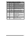
Echomap v3.0 22 delete a layer while viewing an unwanted preset map page, select delete in the layers menu to delete that preset page (or press delete on keyboard). 3.10.2 keyboard shortcuts for layers you can insert or delete layers directly from a keyboard… layer names keyboard shortcut layer data...
Page 23: 3.11.1
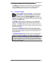
Echomap v3.0 23 important information with minimum heads down time. The filters menu allows you to change the cut off range distance, and the layers menu allows you to set up multiple pages of navigational information to overlay on the moving map. 3.11.1 change filter settings press the nav button, ...
Page 24: 4.1.1
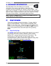
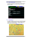
Echomap v3.0 24 4 4 . . D d a a t t a a b b a a s s e e i i n n f f o o r r m m a a t t i i o o n n the information menu (f2) allows you to access information about various map features. Select the type of object you want information for: airports, vors or ndbs. Then either enter an identifier or se...
Page 25: 4.1.2
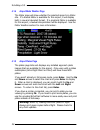
Echomap v3.0 25 4.1.2 airport frequency page the frequency page lists the communications frequencies used at the airport, including tower, approach, departure, atis, gnd, unicom and others. 4.1.3 airport map page the map page displays a map of the airport and landmarks around the facility. The map s...
Page 26: 4.1.4
Echomap v3.0 26 4.1.4 airport metar weather page the metar page will show whether the selected airport is a metar site. If a textual metar is available for this airport, it will display both in raw and decoded format. If a graphical metar is available for this airport, a textual interpretation will ...
Page 27
Echomap v3.0 27.
Page 28
Echomap v3.0 28 4.2 vor info page vor information pages display the name, frequency, and elevation of each vor. Arrow down to highlight the vor. 4.3 ndb info page ndb information pages display the name, frequency, and elevation of each ndb. Arrow down to highlight the ndb or enter an identifier..
Page 29
Echomap v3.0 29 5 5 . . R r o o u u t t e e s s & & a a p p p p r r o o a a c c h h o o v v e e r r l l a a y y 5.1 create a new route from the nav menu, select route and then use the down arrow to select create and press enter . In the create box, enter a name for your route and then press enter . ...
Page 30
Echomap v3.0 30 the route will automatically be stored for later use from the direct to menu. 5.2 select an existing route existing routes can be accessed through the routes menu under select existing . Select the route and press enter . Or, to delete a stored route, select the route and press the d...
Page 31: 5.5.1
Echomap v3.0 31 5.5 direct to menu to go directly to any waypoint, airport or user route, press the direct to button (f5), and then select the desired type of destination with the enter button. Once the waypoint type is selected, a box will appear on the left hand side of the screen displaying waypo...
Page 32: 5.5.3
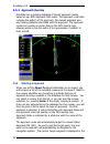
Echomap v3.0 32 5.5.3 approach overlay echomap has a growing database of airport approach routes, based on our nos approach plate scans. The approach route data includes the path(s) of the approach, the missed approach and any holding patterns associated with the approach. The approach routes can ov...
Page 33: 5.5.5
Echomap v3.0 33 target indicator and the point is highlighted in yellow on the map. You can manually select the next waypoint in the approach, or change the selected runway or approach from the direct to menu. 5.5.5 viewing the approach (requires plates subscription) when in approach mode, pressing ...
Page 34: 6.1.1
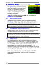
Echomap v3.0 34 6 6 . . S s y y s s t t e e m m m m e e n n u u the system menu is used for shutting down the computer, accessing system settings and diagnostics, updating database or software, minimizing the window display and providing some diagnostic information. To access the system menu, press ...
Page 35: 6.1.4
Echomap v3.0 35 note - you can also download the latest database update on the internet using your customer support login to the www.Echoflight.Com website. The database update file is called updatedb.Exe and is 15-20 megabytes . 6.1.4 system settings menu synchronize the computer’s clock echomap re...
Page 36
Echomap v3.0 36 you can also toggle between windowed and full screen modes by pressing f10 on a keyboard ..
Page 37
Echomap v3.0 37 7 7 . . D d a a t t a a - - l l i i n n k k w w e e a a t t h h e e r r one of the most powerful features of echomap is data link weather using the orbcomm satellite constellation. The network operates similar to a paging system in that it transmits and receives relatively small comp...
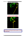
Page 38
Echomap v3.0 38 correct way to use data link weather incorrect way to use data link weather! Note: the airman’s information manual recommends that pilots should circumnavigate inclement weather by at least 25 nautical miles!.
Page 39
Echomap v3.0 39 7.1 data link weather vs. Onboard radar data link weather is different from onboard weather radar in several important ways. Onboard radar has the advantage of providing instantaneous information on echo returns in front of the aircraft, making it ideal for tactical decision making w...
Page 40
Echomap v3.0 40 nexrad radar composites incorporate extensive processing on the ground. Updates arrive at the echo flight network center every five minutes. The age of the weather update returned to you greatly depends on when your request arrives at the echo flight network center. For instance, you...
Page 41: 7.2.1
Echomap v3.0 41 7.2.1 requesting a nexrad image to request a nexrad weather picture, press the wx key and select nexrad in the menu. If the current request settings are correct, simply press the enter key. If you are connected to the satellite transceiver, the request will be sent to an orbcomm sate...
Page 42: 7.2.4
Echomap v3.0 42 7.2.4 automatic nexrad requests the interval menu lets you program the system to automatically send weather requests on a regular time interval. The interval can be set from 0 to 60 minutes in 15-minute increments. Interval preset is 0 (off). To activate this function select interval...
Page 43
Echomap v3.0 43 7.3 interpreting nexrad radar pictures the figure above shows a nexrad image with green, yellow and red cells being displayed, the wx07 indicator shows that the image is 7 minutes old . This will automatically count upwards as time increases so you always know the age of the data. Yo...
Page 44: 7.3.1
Echomap v3.0 44 7.3.1 storm cells storm activity is displayed on the moving map with cells measuring from 2km to 12km in size. The detail levels vary depending on many factors, including size of requested area, amount of weather, and distance from center of picture. Although a higher level of detail...
Page 45: 7.4.1
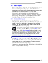
Echomap v3.0 45 7.4 metar reports metar weather data is collected by the echo flight weather server from individual airports as they report. While nexrad shows precipitation over a large area, metar displays many types of data supplied from the requested airports in a given range. Metar reports can ...
Page 46: 7.4.2
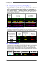
Echomap v3.0 46 7.4.2 interpreting graphical ceiling / visibility reports a graphical metar report has three pages of information. The first page of information shows ceiling, visibility and precipitation for each reporting airport. A vertical bar displays ceiling status and a horizontal bar visibil...
Page 47: 7.4.5
Echomap v3.0 47 7.4.5 metar ceiling/visibility example mcn has a low ifr ceiling and vfr visibility, with the age of the report less than 30 minutes. Aby has an ifr ceiling and vfr visibility with moderate rain reported, with the age of the report 30-60 minutes. Amg has a low ifr ceiling and low ifr...
Page 48: 7.4.6
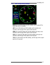
Echomap v3.0 48 7.4.6 how to read graphical wind speed and direction when you request an area metar the second page of data you receive is the wind speeds and directions. Use the enter key to change which metar page is displayed. The wind layer shows the wind speed and direction on the ground at the...
Page 49: 7.4.7
Echomap v3.0 49 7.4.7 how to read graphical temperature dew-point spreads when you request an area metar the third page layer you receive is the temperature/ dew point spread. This is particularly useful to find areas where fog is likely to exist. The bars are color coded to show the likelihood of f...
Page 50
Echomap v3.0 50 7.5 text metar reports the text request option in the metar menu lets you request a complete textual metar report for a specific airport. To select the desired airport, enter the identifier or select from the list. Once you select an airport, press enter to send the request. When the...
Page 51
Echomap v3.0 51 8 8 . . I i n n f f l l i i g g h h t t e e m m a a i i l l press the msg button (f3) to activate the message menu where you can send and receive email, or send position reports. Any messages you send through the echo flight network will automatically log you in, allowing you to rece...
Page 52
Echomap v3.0 52 8.2 receiving email when email is received, a bar at the top of the map will tell you that email has been received. To view newly received messages, press the msg button (f3). You can view old messages with the received mail option in the message menu. All email that has been receive...
Page 53: 8.2.1
Echomap v3.0 53 8.2.1 email login you must be logged on to the echo flight network to receive email. Any message sent through the system (mail, position reports, or weather requests) will automatically log you on. To manually login, select email login and press enter . You will be logged off two hou...
Page 54
Echomap v3.0 54 9 9 . . T t h h e e o o r r b b c c o o m m m m d d a a t t a a l l i i n n k k n n e e t t w w o o r r k k the orbcomm system operates using a new generation of satellite technology called low-earth orbit satellites ("leos"). The orbcomm constellation is the world's first commercial...
Page 55: 9.2.1
Echomap v3.0 55 9.2 network operation the three main components of the network are: the space segment - the constellation of orbcomm satellites. The ground segment - network gateways located around the world. This includes the gateway control centers ( gcc s), gateway earth stations ( ges s), the ne...
Page 56
Echomap v3.0 56 washington state. The fifth ges is located in curacao, french antilles in central america. Gateway earth station (ges) orbcomm's gess link the ground segment with the space segment from multiple locations worldwide. The gess provide the following functions: • acquire and track satell...
Page 57: 9.2.3
Echomap v3.0 57 gateway control center (gcc) the gateway control centers are located in south america, europe, asia and provides switching capabilities to link mobile transceivers with terrestrial-based customer systems via standard communication modes including x.400, x.25, leased line, dial-up mod...
Page 58
Echomap v3.0 58 placed upon the glareshield of the aircraft, and a special vhf antenna mounted on the top of the fuselage for two-way communications with the orbcomm satellites. The vhf antenna is the only permanent installation required . Refer to the antenna installation manual..
Page 59: 1 -888-739-7161
Echomap v3.0 59 1 1 0 0 . . T t e e c c h h n n i i c c a a l l s s u u p p p p o o r r t t if you have questions call 1 -888-739-7161 from 10am to 7pm est mon. Through fri. Or email support@echoflight.Com . 10.1 log files there are several log files generated to help us track down any unforeseen is...
Page 60
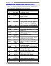
Echomap v3.0 60 a a p p p p e e n n d d i i x x a a : : k k e e y y b b o o a a r r d d s s h h o o r r t t c c u u t t s s there are many keyboard shortcuts that can be used to access echomap functionality without using the menus. Key action what it does f1 nav menu navigation menu. F2 info menu in...
Page 61
Echomap v3.0 61 key action what it does j jet airways toggle jet airway display. N ndbs toggle ndb display. O obstacles toggle obstacle / tower display. P pjas toggle parachute jump area display. R arrivals toggle arrival path display. S special use toggle special use airspace display. T trip path t...
Page 62
Echomap v3.0 62 a a p p p p e e n n d d i i x x b b : : g g l l o o s s s s a a r r y y alt (gps altitude): altitude, calculated by the gps receiver. A substantial difference between this altitude value and altitude referenced above sea level may exist due to accuracy degradation by the military; al...
Page 63
Echomap v3.0 63 magnetic north : the region, some distance from the geographic north pole where the earth’s magnetic lines concentrate. The angle between where the magnetic compass points to, magnetic north, and true north is the magnetic variation. Magnetic variation is measured in east or west. To...


