- DL manuals
- Garmin
- GPS
- 012-01097-00
- Owner's Manual
Garmin 012-01097-00 Owner's Manual
Summary of 012-01097-00
Page 1
Tracking system p/n 012-01097-00 receiver p/n 012-01113-00 transmitter owner’s manual draft not for reproduction tracking system owner's manual f1 1 1/16/2007 1:51:36 pm.
Page 2
All rights reserved. Except as expressly provided herein, no part of this manual may be reproduced, copied, transmitted, disseminated, downloaded or stored in any storage medium, for any purpose without the express prior written consent of garmin. Garmin hereby grants permission to download a single...
Page 3
Tracking system owner’s manual - draft i i ntroduction > i ntroduction thank you for choosing the garmin ® 010-001097- 00 receiver/010-01113-00 transmitter tracking system. This system uses the proven performance of garmin gps and full-featured mapping to create an unsurpassed portable gps receiver....
Page 4: Table of Contents
Ii tracking system owner’s manual - draft i ntroduction > table of contents introduction ....................................................... I manual conventions ................................................ I software license agreement ............................ V product registration .......
Page 5
Tracking system owner’s manual - draft iii i ntroduction > finding a city ........................................................16 finding an interstate exit ......................................16 finding an address ................................................17 finding an intersection ........
Page 6
Iv tracking system owner’s manual - draft i ntroduction > map page setup ....................................................35 routing setup ........................................................35 geocache setup .....................................................36 marine setup ..................
Page 7: Software License Agreement
Tracking system owner’s manual - draft v i ntroduction > software license agreement by using the 010-01097-00/010-01113-00 tracking system, you agree to be bound by the terms and conditions of the following software license agreement. Please read this agreement carefully. Garmin grants you a limited...
Page 8
Vi tracking system owner’s manual - draft i ntroduction > important: read this information before using your 010-01097-00/010-01113-00 system: exposure to radio frequency signals—your wireless handheld tracking system is a low power radio transmitter and receiver. When it is on, it receives and also...
Page 9
Tracking system owner’s manual - draft vii i ntroduction > other medical devices—if you use any other personal medical device, consult the manufacturer of your device to determine if it is adequately shielded from external rf energy. Your physician may be able to assist you in obtaining this informa...
Page 10
Viii tracking system owner’s manual - draft i ntroduction > caring for the tracking system the cases are constructed of high-quality materials and does not require user maintenance except cleaning. Cleaning the cases clean both unit’s outer casing (except for the receiver’s screen) using a cloth dam...
Page 11: Warning
Tracking system owner’s manual - draft ix i ntroduction > warning failure to avoid the following potentially hazardous situations could result in an accident or collision resulting in death or serious injury. When installing the receiver in a vehicle, place the unit securely so that it does not inte...
Page 12: Caution
X tracking system owner’s manual - draft i ntroduction > failure to avoid the following potentially hazardous situations may result in injury or property damage. Use the gps functionality of the receiver only as a navigational aid. Do not attempt to use the receiver for any purpose requiring precise...
Page 13: Receiver Overview
Tracking system owner’s manual - draft g etting s tarted > g etting s tarted receiver overview carry lanyard attachment slot battery compartment cover usb external data/ auxilary power port (under weather cap) internal gps antenna battery compartment locking d-ring radio receiver antenna keypad lcd ...
Page 14
Tracking system owner’s manual - draft g etting s tarted > installing the batteries the receiver operates on two aa batteries (not included), which are located in the back of the unit. You can use alkaline or nimh batteries. See page 67 for information on setting the battery type. To install the bat...
Page 15: Using The Keypad
Tracking system owner’s manual - draft g etting s tarted > using the keypad back key • press and release to cancel data entry or exit a page. Enter key • press and release to enter highlighted options, data or confirm on-screen messages. In/out zoom keys • press to zoom in or out on the map page. • ...
Page 16: Transmitter Overview
Tracking system owner’s manual - draft g etting s tarted > charging the transmitter battery the transmitter operates on a rechargeable lithium- ion battery, which is located in the unit. The battery can be charged using either the ac or dc charging accessory. The battery has been partially charged a...
Page 17: Turning On The Receiver
Tracking system owner’s manual - draft g etting s tarted > turning on the receiver when the receiver is turned on, the introduction page appears, followed by the satellite page. The unit must collect satellite data and establish its current location. To turn the receiver on and off: 1. Press and hol...
Page 18
Tracking system owner’s manual - draft g etting s tarted > initializing the gps receiver the first time you turn on your receiver, the gps receiver must collect satellite data and establish its current location. To ensure proper initialization, the gps receiver is shipped from the factory in autoloc...
Page 19: Using The Receiver
Tracking system owner’s manual - draft g etting s tarted > using the receiver this section explains how to enter and select information with the receiver. Understanding terms as you progress through this owner’s manual, you are directed to press a specific key or highlight a field on the screen. Whe...
Page 20
Tracking system owner’s manual - draft g etting s tarted > selecting options and entering data to enter data and select options, use the rocker to highlight, select, or choose an item in a list or a field on the screen. To select and activate an option: 1. From any page, press menu. An options menu ...
Page 21
Tracking system owner’s manual - draft g etting s tarted > on-screen messages when a significant event in the operation of the unit occurs, an on-screen message appears to advise you of the occurrence. In each case the condition is described and often a remedy provided. Press enter to acknowledge th...
Page 22
0 tracking system owner’s manual - draft g etting s tarted > transferring data to a microsd card some units are equipped with a pre-installed microsd card. To install or remove the microsd card: 1. Remove the battery compartment cover from the back of the unit and remove the two batteries. 2. Locate...
Page 23: Overview of The Main Pages
Tracking system owner’s manual - draft b asic o peration > overview of the main pages the receiver has three main pages: the home page (main menu), the map page and the tracker page. You can cycle through these pages by pressing the back key. An active route page appears only when you are navigating...
Page 24
Tracking system owner’s manual - draft b asic o peration > the setup menu this setup menu provides a method for customizing the tracking system to meet your personal needs. You can setup the system, display, alert tones, the page sequence, the map page, routes, time, units of measure, etc. The navig...
Page 25
Tracking system owner’s manual - draft b asic o peration > the tracker page the tracker page provides distance and direction information for each transmitter being tracked. Up to three transmitters can be displayed on the tracker page at one time with a compass indicating the direction of each and a...
Page 26: Gps O
Tracking system owner’s manual - draft b asic o peration > gps o peration this section explains some of the more common operations you can perform with your receiver including creating and using waypoints, using the find menu, and how to create and use tracks and routes. Creating and using waypoints...
Page 27: Using The Find Menu
Tracking system owner’s manual - draft b asic o peration > note: you must have a gps satellite fix before you can average a waypoint’s location. You cannot average a waypoint after it has been saved to the waypoints list and mark waypoint page closed. Projecting a waypoint you can create a new waypo...
Page 28
Tracking system owner’s manual - draft b asic o peration > recent finds the recent finds page shows a list of the last 50 items you have searched for or gone to recently. Using the find item information page when you select an item from the find item list and press enter, an information page shows d...
Page 29: Using Tracks
Tracking system owner’s manual - draft b asic o peration > finding an address if you downloaded detailed mapping data, use the addresses icon on the find menu to find an address. When you enter the street number, street name, and city, the find feature matches that data with addresses in the map dat...
Page 30: Creating and Using Routes
Tracking system owner’s manual - draft b asic o peration > track profiles after you save a track, you have a record of the path you traveled and a track altitude profile. You can create a track elevation profile from digital elevation models (dem) maps (mapsource u.S. Topo 24k), which include elevat...
Page 31
Tracking system owner’s manual - draft b asic o peration > page, the receiver creates a route composed of several user waypoints or find menu items, with the last being your destination. It navigates directly from point to point. Before each turn in the route, a turn page shows a guidance message an...
Page 32: Satellite Page
0 tracking system owner’s manual - draft m ain p ages > using the route page options the route page shows all points stored in memory for the route selected on the routes page. Press menu to open the route page options menu. • remove all—removes all waypoints from the saved route. • route—reverses t...
Page 33: Map Page
Tracking system owner’s manual - draft m ain p ages > using the satellite page options menu- press menu to open the options menu. Use with gps off/on —enables you to turn the gps receiver on or off. Track up/north up—indicates whether satellites are shown with the rings oriented with north toward th...
Page 34
Tracking system owner’s manual - draft m ain p ages > you can add and configure up to four optional data fields to the top of the page to provide a variety of travel and navigational information. Using additional map data optional mapsource mapping data disks enhance the versatility of your tracking...
Page 35
Tracking system owner’s manual - draft m ain p ages > map orientation there are two map orientation options: north up orients the map like a paper map. Track up orients the map in the direction of travel. When using track up, the north arrow indicates the orientation. Set the map orientation using t...
Page 36
Tracking system owner’s manual - draft m ain p ages > if you select always show, a guidance message always appears whether or not you are navigating. If you select show when navigating, a guidance message appears until you select stop navigation from the options menu. Setting up the map page use the...
Page 37
Tracking system owner’s manual - draft m ain p ages > map setup – points page us the map setup – points page to set the map scale at which map points, user waypoints, street label, and land cover appear on the map page. Select auto, off , or a specific zoom level. Map setup – text page use the map s...
Page 38: Compass Page
Tracking system owner’s manual - draft m ain p ages > restoring defaults use the restore defaults option to return the map settings to factory settings. Compass page during active navigation, the compass page guides you to your destination with a graphic compass display and a bearing or course point...
Page 39
Tracking system owner’s manual - draft m ain p ages > to turn the electronic compass on or off: 1. Press and hold the page key to turn the electronic compass on or off. The compass icon appears in the status bar when the electronic compass is on. When you are not using the electronic compass, turn i...
Page 40: Altimeter Page
Tracking system owner’s manual - draft m ain p ages > sight ‘n go navigation sight ‘n go allows you to set a course to a point you can see in the distance. Using the course pointer or bearing pointer the bearing pointer and course pointer work independently of each other. The bearing pointer indicat...
Page 41
Tracking system owner’s manual - draft m ain p ages > you can configure the profile field in the center of the page to show either elevation or ambient pressure plots as selected from the altimeter page options menu. Data fields at the top of the page are user selectable and show a variety of record...
Page 42
0 tracking system owner’s manual - draft m ain p ages > plot to view a record of changes in barometric pressure for a set period of time. When one option is active, the other option is shown on the options menu. Zoom ranges you can set the zoom ranges for elevation, distance, or time when you show t...
Page 43: Trip Computer Page
Tracking system owner’s manual - draft m ain p ages > trip computer page the trip computer page provides you with a wide variety of travel data that can be useful when navigating a long distance. It indicates your current speed, average speed, trip odometer, and many other helpful statistics useful ...
Page 44: Tracks
Tracking system owner’s manual - draft m ain m enu > m ain m enu the main menu contains settings and features not found on the main pages and sub-menus. The time and date are shown at the bottom of this page. The main menu is accessible from any page by pressing menu twice. To select an item on the ...
Page 45: Route Page
Tracking system owner’s manual - draft m ain m enu > route page use the routes page to create a route to a destination. For more information, see routes on page 32. Highway page when navigating a route, the highway page guides you to the destination using data fields and a graphic highway. Up to fou...
Page 46
Tracking system owner’s manual - draft m ain m enu > off) when external power is removed from the unit. • proximity alarms—indicates whether custom points of interest (poi’s) proximity alarms are on or off. System setup menu the system setup menu contains restore defaults and software version. Use r...
Page 47
Tracking system owner’s manual - draft m ain m enu > • text out—allows ascii text output of location and velocity information. No input. • none—provides no interfacing capabilities. If you select nmea in/nmea out or text out, additional fields appear. The baud rate for nmea in/nmea out is locked at ...
Page 48
Tracking system owner’s manual - draft m ain m enu > faster time—calculates routes that are faster to drive but might be longer in distance. Shorter distance—calculates routes that are shorter in distance but take more time to drive. • next turn pop-up—turns the next turn pop- up window on or off. F...
Page 49
Tracking system owner’s manual - draft m ain m enu > • off course alarm—sets an alarm to sound when you are off your chosen course. • deep water alarm/shallow water alarm— sets an alarm to sound when you enter an area of water that is too deep or too shallow. Time setup use the time setup page to se...
Page 50
Tracking system owner’s manual - draft m ain m enu > heading setup use the heading setup page to specify the type of heading display and the type of north reference used to calculate your heading. Note: unless you have a working knowledge of headings and north referencing, it is recommended that you...
Page 51
Tracking system owner’s manual - draft m ain m enu > jumpmaster jumpmaster is an accessory designed for experienced skydivers. A jumpmaster is the individual in charge of a group of skydivers coordinating a group or cargo drop. A list of abbreviations and acronyms for jumpmaster settings can be foun...
Page 52
0 tracking system owner’s manual - draft m ain m enu > the following is a list of abbreviations and acronyms commonly used and relate specifically to this feature: agl—(above ground level) indicates the altitude measurement. Cd—(canopy drift) measured while the parachute is open. Dip—(desired impact...
Page 53: Proximity Waypoints
Tracking system owner’s manual - draft m ain m enu > proximity waypoints use the proximity waypoints page to define an alarm circle around a stored waypoint location. The alarm circle can help you avoid restricted locations. For more information on proximity waypoints, see the “proximity waypoints” ...
Page 54: Hunt and Fish
Hunt and fish the hunt and fish tables provide you with a listing of predicted best times for hunting and fishing for a chosen date and location. Games menu the games menu contains six games (memory race, virtua maze, gekosmak, nibbons, gekoids, and beast hunt) for entertainment. Some games use gps ...
Page 55
Tracking system owner’s manual - draft a ppendix > power source: two 1.5 volt aa batteries, usb data cable, 12 volt dc adapter cable battery life: up to 18 hours (typical use)* *alkaline batteries lose a significant amount of their capacity as the temperature decreases. Use lithium batteries when op...
Page 56: Interfacing
Tracking system owner’s manual - draft a ppendix > interfacing the following formats are supported for connection of external devices. Garmin proprietary sentences—pgrme (estimated error), pgrmm (datum string), and pgrmz (altitude). The nmea 0183 version 3.01 interface format is supported by the rec...
Page 57: Data Field Definitions
Tracking system owner’s manual - draft a ppendix > data field definitions the following list provides a brief definition of each data field option. Accuracy of gps—the current accuracy of your gps- determined location. Ambient pressure—the uncalibrated current pressure. Ascent - average—the average ...
Page 58
Tracking system owner’s manual - draft a ppendix > off course—the distance off your direct course line. Pointer—the arrow that indicates the direction to travel to the next point on a route. Speed—your current vehicle speed measured in miles per hour, kilometers per hour, or knots. Speed - maximum—t...
Page 59: Optional Accessories
Tracking system owner’s manual - draft a ppendix > optional accessories several optional accessories are available to enhance the operation of the tracking system. To obtain replacement parts and optional accessories, contact your garmin dealer, or garmin product support in the u.S.A. At 800/800.102...
Page 60
Tracking system owner’s manual - draft a ppendix > connecting your receiver to a com- puter you can connect your receiver to your computer using either a serial port or usb connector cable. Note: fully install the supplied mapsource trip & waypoint manager software on your computer before connecting...
Page 61: What Is Waas/egnos?
Tracking system owner’s manual - draft a ppendix > what is waas/egnos? The wide area augmentation system (waas) is an faa funded service to improve the overall integrity of the gps signal for users in north america. The european geostationary navigation overlay service (egnos) is the european versio...
Page 62: Map Datums and Location
0 tracking system owner’s manual - draft a ppendix > map datums and location formats what are map datums? A datum is a mathematical model of the earth that approximates the shape of the earth, and enables calculations to be carried out in a consistent and accurate manner. The datum is physically rep...
Page 63: Fcc Compliance
Tracking system owner’s manual - draft a ppendix > fcc compliance this device complies with part 15 of the fcc rules. Operation is subject to the following two conditions: (1) this device may not cause harmful interference, and (2) this device must accept any interference received, including interfe...
Page 64: Limited Warranty
Tracking system owner’s manual - draft a ppendix > limited warranty this garmin product is warranted to be free from defects in materials or workmanship for one year from the date of purchase. Within this period, garmin will at its sole option repair or replace any components that fail in normal use...
Page 65
Tracking system owner’s manual - draft a ppendix > garmin international, inc. 1200 e 151st street, olathe, kansas 66062 u.S.A. Tel. 913/397.8200 fax. 913/397.8282 garmin (europe) ltd. Unit 5, the quadrangle, abbey park industrial estate, romsey, so51 9dl u.K. Tel. 44/0870.8501241 fax 44/0870.8501251...
Page 66
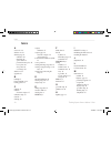
Tracking system owner’s manual - draft i ndex i ndex a accessories 46 altimeter 28–32 altimeter page 28 calibration 30 data fields 30 options menu 29 pressure/elevation plots 29 reset options 30 view points 30 zoom ranges 30 altitude 28–32 appendix 43 b backlight 5 battery installation 2, 4 bearing ...
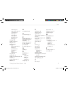
Page 67
Tracking system owner’s manual - draft i ndex marine setup 36 page sequence setup 35 system setup 33 time setup 37 tones setup 35 units setup 37 sun and moon 41 tracks page 32 main pages 20 manual conventions i mapsource 48 map datums 50 map page 21 additional map data 22 declutter 25 options menu 2...
Page 68
Tracking system owner's manual f56 56 1/16/2007 1:51:50 pm.
Page 69
Tracking system owner's manual f57 57 1/16/2007 1:51:51 pm.
Page 70
For the latest free software updates (excluding map data) throughout the life of your garmin products, visit the garmin web site at www.Garmin.Com. © 2007 garmin ltd. Or its subsidiaries garmin international, inc. 1200 east 151 st street, olathe, kansas 66062, u.S.A. Garmin (europe) ltd. Unit 5, the...


