- DL manuals
- Garmin
- GPS
- AERA 660
- Pilot's Manual
Garmin AERA 660 Pilot's Manual
Summary of AERA 660
Page 1
Model: 660 ™ pilot's guide.
Page 3: Overview
Overview navigation flight planning hazard avoidance additional features appendices index.
Page 4
Copyright © 2016 garmin ltd. Or its subsidiaries. All rights reserved. This manual reflects the operation of system software version 1.0 or later. Some differences in operation may be observed when comparing the information in this manual to earlier or later software versions. Garmin international, ...
Page 5
Garmin ® , ant+ ® , flitecharts ® , safetaxi ® , and mapsource ® are registered trademarks of garmin ltd. Or its subsidiaries. Aera ™ is a trademark of garmin ltd. Or its subsidiaries. These trademarks may not be used without the express permission of garmin. This product is ant+ ® certified. Visit ...
Page 6: Warnings, Cautions & Notes
Garmin aera 660 pilot’s guide 190-02017-20 rev. A warnings, cautions & notes warning: when installing the aera ™ , place the unit so it does not obstruct the field of view or interfere with operating controls. Warning: the indicators represented on the panel are based on gps-derived data and may dif...
Page 7: Warnings, Cautions & Notes
Garmin aera 660 pilot’s guide 190-02017-20 rev. A warnings, cautions & notes warning: do not use the indicated data link weather product age to determine the age of the weather information shown by the data link weather product. Due to time delays inherent in gathering and processing weather data fo...
Page 8: Warnings, Cautions & Notes
Garmin aera 660 pilot’s guide 190-02017-20 rev. A warnings, cautions & notes warning: the data contained in the terrain and obstacle databases comes from government agencies. Garmin accurately processes and cross-validates the data, but cannot guarantee the accuracy and completeness of the data. War...
Page 9: Warnings, Cautions & Notes
Garmin aera 660 pilot’s guide 190-02017-20 rev. A warnings, cautions & notes note: this product, its packaging, and its components contain chemicals known to the state of california to cause cancer, birth defects, or reproductive harm. This notice is being provided in accordance with california’s pr...
Page 10: Warnings, Cautions & Notes
Garmin aera 660 pilot’s guide 190-02017-20 rev. A warnings, cautions & notes blank page.
Page 11: Part Number
Garmin aera 660 pilot’s guide 190-02017-20 rev. A rr-11 part number change summary 190-02017-20 initial release rev date description a march, 2016 production release.
Page 12
Garmin aera 660 pilot’s guide 190-02017-20 rev. A rr-12 blank page.
Page 13: Table of Contents
Garmin aera 660 pilot’s guide 190-02017-20 rev. A i table of contents section 1 overview ............................................................................................................... 1 1.1 unit overview ..................................................................................
Page 14: Table of Contents
Garmin aera 660 pilot’s guide 190-02017-20 rev. A ii table of contents 2.3 vertical navigation (vnav) ........................................................................................... 43 using the vnav feature ...................................................................................
Page 15: Table of Contents
Garmin aera 660 pilot’s guide 190-02017-20 rev. A iii table of contents section 5 additional features ................................................................................ 113 5.1 safetaxi .......................................................................................................
Page 16: Table of Contents
Garmin aera 660 pilot’s guide 190-02017-20 rev. A iv table of contents appendix g: utilities ........................................................................................................... 155 flight log .......................................................................................
Page 17: Overview
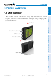
Garmin aera 660 pilot’s guide 190-02017-20 rev. A 1 overview overview navigation flight planning hazar d a voidance additional f eatur es appendices index section 1 overview 1.1 unit overview the aera 660 presents gnss-derived analog flight instrumentation, position, navigation, and hazard avoidance...
Page 18: Overview
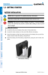
Garmin aera 660 pilot’s guide 190-02017-20 rev. A 2 overview overview navigation flight planning hazar d a voidance additional f eatur es appendices index 1.2 getting started battery installation note: refer to appendix e for additional battery information. Caution: always keep the battery installed...
Page 19: Overview
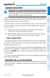
Garmin aera 660 pilot’s guide 190-02017-20 rev. A 3 overview overview navigation flight planning hazar d a voidance additional f eatur es appendices index charging the battery note: while in charge mode, the unit draws a current from the aircraft. To avoid discharging the aircraft’s battery, disconn...
Page 20: Overview
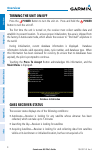
Garmin aera 660 pilot’s guide 190-02017-20 rev. A 4 overview overview navigation flight planning hazar d a voidance additional f eatur es appendices index turning the unit on/off press the power button to turn the unit on. Press and hold the power button to turn the unit off. The first time the unit...
Page 21: Overview
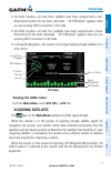
Garmin aera 660 pilot’s guide 190-02017-20 rev. A 5 overview overview navigation flight planning hazar d a voidance additional f eatur es appendices index •2d gnss location—at least three satellites have been acquired and a two- dimensional location fix has been calculated. “2d differential” appears...
Page 22: Overview
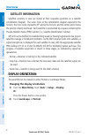
Garmin aera 660 pilot’s guide 190-02017-20 rev. A 6 overview overview navigation flight planning hazar d a voidance additional f eatur es appendices index satellite information satellites currently in view are shown at their respective positions on a satellite constellation diagram. The outer circle...
Page 23: Overview
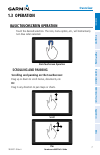
Garmin aera 660 pilot’s guide 190-02017-20 rev. A 7 overview overview navigation flight planning hazar d a voidance additional f eatur es appendices index 1.3 operation basic touchscreen operation touch the desired selection. The icon, menu option, etc., will momentarily turn blue when selected. Bas...
Page 24: Overview
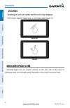
Garmin aera 660 pilot’s guide 190-02017-20 rev. A 8 overview overview navigation flight planning hazar d a voidance additional f eatur es appendices index zooming zooming in and out on the touchscreen map displays: pinch fingers together (zoom out), or pull fingers apart (zoom in). Zoom in zoom out ...
Page 25: Overview
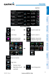
Garmin aera 660 pilot’s guide 190-02017-20 rev. A 9 overview overview navigation flight planning hazar d a voidance additional f eatur es appendices index nearest airports page dedicated page icons scroll up or touch to zoom out scroll down or touch to zoom in nearest group icons (nearest page only)...
Page 26: Overview
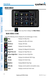
Garmin aera 660 pilot’s guide 190-02017-20 rev. A 10 overview overview navigation flight planning hazar d a voidance additional f eatur es appendices index main menu touch and hold the icon at any time to display the main menu. Main menu icons touch the following icons to display the associated page...
Page 27: Overview
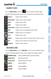
Garmin aera 660 pilot’s guide 190-02017-20 rev. A 11 overview overview navigation flight planning hazar d a voidance additional f eatur es appendices index main menu touch and hold the icon at any time to display the main menu. Main menu icons touch the following icons to display the associated page...
Page 28: Overview
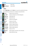
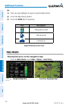
Garmin aera 660 pilot’s guide 190-02017-20 rev. A 12 overview overview navigation flight planning hazar d a voidance additional f eatur es appendices index tfr displays tfrs. Pilot reports displays pireps. Tools from the main menu, touch the tools icon to access the second-level tools icons. Touch t...
Page 29: Overview
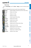
Garmin aera 660 pilot’s guide 190-02017-20 rev. A 13 overview overview navigation flight planning hazar d a voidance additional f eatur es appendices index s etup i cons from the main menu, touch the tools > setup to access the third-level setup icons. Touch the following third-level icons to perfor...
Page 30: Overview
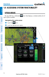
Garmin aera 660 pilot’s guide 190-02017-20 rev. A 14 overview overview navigation flight planning hazar d a voidance additional f eatur es appendices index 1.4 accessing system functionality option menus the aera 660 has a dedicated icon that displays a context-sensitive list of menu options availab...
Page 31: Overview
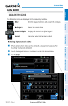
Garmin aera 660 pilot’s guide 190-02017-20 rev. A 15 overview overview navigation flight planning hazar d a voidance additional f eatur es appendices index data entry data entry icons the following icons are displayed in the data entry window. Enter exits the keypad function and accepts the changes....
Page 32: Overview
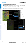
Garmin aera 660 pilot’s guide 190-02017-20 rev. A 16 overview overview navigation flight planning hazar d a voidance additional f eatur es appendices index entering predetermined data options: touch the data option button to display a vertical list of data options (if applicable), or toggle two data...
Page 33: Overview
Garmin aera 660 pilot’s guide 190-02017-20 rev. A 17 overview overview navigation flight planning hazar d a voidance additional f eatur es appendices index 1.5 using map displays note: refer to the gps navigation section for more information on map display setup. Map displays are used extensively in...
Page 34: Overview
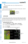
Garmin aera 660 pilot’s guide 190-02017-20 rev. A 18 overview overview navigation flight planning hazar d a voidance additional f eatur es appendices index or: pinch fingers together (zoom out), or pull fingers apart (zoom in). Overzoom when the selected range exceeds the resolution of the map data,...
Page 35: Overview
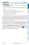
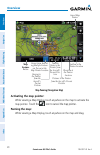
Garmin aera 660 pilot’s guide 190-02017-20 rev. A 19 overview overview navigation flight planning hazar d a voidance additional f eatur es appendices index map panning map panning allows the pilot to: •viewpartsofthemapoutsidethedisplayedrangewithoutadjustingthemap range •highlightandselectlocations...
Page 36: Overview
Garmin aera 660 pilot’s guide 190-02017-20 rev. A 20 overview overview navigation flight planning hazar d a voidance additional f eatur es appendices index map panning (navigation map) lat/lon at the pointer location bearing to the pointer from the aircraft's present position distance to the pointer...
Page 37: Overview
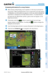
Garmin aera 660 pilot’s guide 190-02017-20 rev. A 21 overview overview navigation flight planning hazar d a voidance additional f eatur es appendices index reviewing information for a map feature: while viewing a map display, touch anywhere on the map to activate the map pointer. When the map pointe...
Page 38: Overview
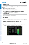
Garmin aera 660 pilot’s guide 190-02017-20 rev. A 22 overview overview navigation flight planning hazar d a voidance additional f eatur es appendices index map overlays the vfr, ifr, terrain, topography, or weather map overlays can be displayed or removed. Displaying/removing map overlays: 1) from t...
Page 39: Overview
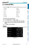
Garmin aera 660 pilot’s guide 190-02017-20 rev. A 23 overview overview navigation flight planning hazar d a voidance additional f eatur es appendices index 1.6 system settings the third-level setup icons allow management of the following system parameters: •display •sound •units •time •map •position...
Page 40: Overview
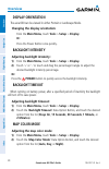
Garmin aera 660 pilot’s guide 190-02017-20 rev. A 24 overview overview navigation flight planning hazar d a voidance additional f eatur es appendices index display orientation the aera 660 can be viewed in either portrait or landscape mode. Changing the display orientation: from the main menu, touch...
Page 41: Overview
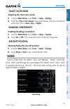
Garmin aera 660 pilot’s guide 190-02017-20 rev. A 25 overview overview navigation flight planning hazar d a voidance additional f eatur es appendices index chart color mode adjusting the chart color mode: 1) from the main menu, touch tools > setup > display. 2) touch the 'chart color mode' data opti...
Page 42: Overview
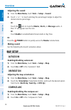
Garmin aera 660 pilot’s guide 190-02017-20 rev. A 26 overview overview navigation flight planning hazar d a voidance additional f eatur es appendices index adjusting the sound: 1) from the main menu, touch tools > setup > sound. 2) touch '+' or '-' or touch and drag the percentage triangle to adjust...
Page 43: Overview
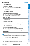
Garmin aera 660 pilot’s guide 190-02017-20 rev. A 27 overview overview navigation flight planning hazar d a voidance additional f eatur es appendices index north up above setting north up above: 1) from the main menu, touch tools > setup > map. 2) touch the 'north up above' data option button, and t...
Page 44: Overview
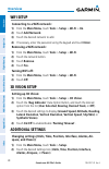
Garmin aera 660 pilot’s guide 190-02017-20 rev. A 28 overview overview navigation flight planning hazar d a voidance additional f eatur es appendices index wifi setup connecting to a wifi network: 1) from the main menu, touch tools > setup > wi-fi > on. 2) touch add network. 3) touch the desired net...
Page 45: Overview
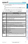
Garmin aera 660 pilot’s guide 190-02017-20 rev. A 29 overview overview navigation flight planning hazar d a voidance additional f eatur es appendices index 3) touch the desired setting to change. Touch the desired setting from the vertical list (if applicable). Or: use the keypad to enter numerical ...
Page 46: Overview
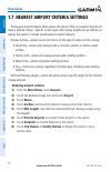
Garmin aera 660 pilot’s guide 190-02017-20 rev. A 30 overview overview navigation flight planning hazar d a voidance additional f eatur es appendices index 1.7 nearest airport criteria settings the nearest airports option menu allows the pilot to filter out airports that do not meet a defined criter...
Page 47: Overview
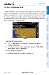
Garmin aera 660 pilot’s guide 190-02017-20 rev. A 31 overview overview navigation flight planning hazar d a voidance additional f eatur es appendices index 1.8 present position the present position function displays latitude, longitude, gps altitude, reference waypoint, type, distance, direction, an...
Page 48: Overview
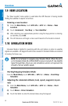
Garmin aera 660 pilot’s guide 190-02017-20 rev. A 32 overview overview navigation flight planning hazar d a voidance additional f eatur es appendices index 1.9 new location the ‘new location’ menu option is used when the gps receiver is having trouble finding the satellites it expects to be there. E...
Page 49: Overview
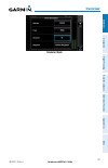
Garmin aera 660 pilot’s guide 190-02017-20 rev. A 33 overview overview navigation flight planning hazar d a voidance additional f eatur es appendices index simulator mode.
Page 50: Overview
Garmin aera 660 pilot’s guide 190-02017-20 rev. A 34 overview overview navigation flight planning hazar d a voidance additional f eatur es appendices index blank page.
Page 51: Navigation
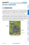
Garmin aera 660 pilot’s guide 190-02017-20 rev. A 35 navigation overview navigation flight planning hazar d a voidance additional f eatur es appendices index section 2 navigation 2.1 introduction the navigation map displays aviation data (e.G., airports, vors, airways, airspaces), geographic data (e...
Page 52: Navigation
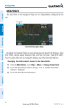
Garmin aera 660 pilot’s guide 190-02017-20 rev. A 36 navigation overview navigation flight planning hazar d a voidance additional f eatur es appendices index data fields the data fields on the navigation map can be independently configured by the user. Data fields (navigation map) data fields by def...
Page 53: Navigation
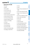
Garmin aera 660 pilot’s guide 190-02017-20 rev. A 37 navigation overview navigation flight planning hazar d a voidance additional f eatur es appendices index data field options •accuracy •altitude •bearing(brg) •coursetosteer(cts) •crosstrackerror(xtk) •desiredtrack(dtk) •distance(destination)(distd...
Page 54: Navigation
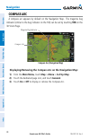
Garmin aera 660 pilot’s guide 190-02017-20 rev. A 38 navigation overview navigation flight planning hazar d a voidance additional f eatur es appendices index compass arc a compass arc appears by default on the navigation map. The magenta bug indicator (similar to the bug indicator on the hsi) can be...
Page 55: Navigation
Garmin aera 660 pilot’s guide 190-02017-20 rev. A 39 navigation overview navigation flight planning hazar d a voidance additional f eatur es appendices index 2.2 3d vision 3d vision provides a three-dimensional view of terrain features as seen from outside the aircraft. 3d vision imagery shows the r...
Page 56: Navigation
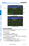
Garmin aera 660 pilot’s guide 190-02017-20 rev. A 40 navigation overview navigation flight planning hazar d a voidance additional f eatur es appendices index vertical speed ground speed hsi option menu 3d vision (tapes) altitude 3d vision (round gauges) 3d vision operation 3d vision is accessed from...
Page 57: Navigation
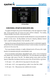
Garmin aera 660 pilot’s guide 190-02017-20 rev. A 41 navigation overview navigation flight planning hazar d a voidance additional f eatur es appendices index 3d vision menu horizontal situation indicator (hsi) the graphic hsi depicts the course to the destination or the next waypoint in a flight pla...
Page 58: Navigation
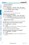
Garmin aera 660 pilot’s guide 190-02017-20 rev. A 42 navigation overview navigation flight planning hazar d a voidance additional f eatur es appendices index c hanging the cdi s cale changing the cdi scale: 1) from the main menu, touch 3d vision > menu > more options. 2) touch the 'cdi scale' data o...
Page 59: Navigation
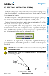
Garmin aera 660 pilot’s guide 190-02017-20 rev. A 43 navigation overview navigation flight planning hazar d a voidance additional f eatur es appendices index 2.3 vertical navigation (vnav) the vnav function provides settings for the vertical navigation. These settings create a three-dimensional prof...
Page 60: Navigation
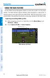
Garmin aera 660 pilot’s guide 190-02017-20 rev. A 44 navigation overview navigation flight planning hazar d a voidance additional f eatur es appendices index using the vnav feature use the vnav (vertical navigation) feature to ensure the aircraft is at the proper altitude. The vnav indicator appears...
Page 61: Navigation
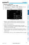
Garmin aera 660 pilot’s guide 190-02017-20 rev. A 45 navigation overview navigation flight planning hazar d a voidance additional f eatur es appendices index configuring a vnav profile: 1) from the main menu, touch tools > vnav 2) touch the desired fields ('waypoint', 'profile', 'altitude', etc) to ...
Page 62: Navigation
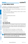
Garmin aera 660 pilot’s guide 190-02017-20 rev. A 46 navigation overview navigation flight planning hazar d a voidance additional f eatur es appendices index 2.4 map display setup map displays are used extensively in the aera to provide situational awareness in flight. Most aera maps can display the...
Page 63: Navigation
Garmin aera 660 pilot’s guide 190-02017-20 rev. A 47 navigation overview navigation flight planning hazar d a voidance additional f eatur es appendices index adjusting the map orientation: 1) from the main menu, touch map > menu > set up map. 2) if necessary, touch the dedicated page icon, and touch...
Page 64: Navigation
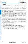
Garmin aera 660 pilot’s guide 190-02017-20 rev. A 48 navigation overview navigation flight planning hazar d a voidance additional f eatur es appendices index airways low altitude airways (or victor airways) primarily serve smaller piston-engine, propeller-driven airplanes on shorter routes and at lo...
Page 65: Navigation
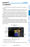
Garmin aera 660 pilot’s guide 190-02017-20 rev. A 49 navigation overview navigation flight planning hazar d a voidance additional f eatur es appendices index 2.5 waypoints the wpt info (waypoint information) function provides airport and waypoint information. Waypoints are predetermined geographical...
Page 66: Navigation
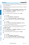
Garmin aera 660 pilot’s guide 190-02017-20 rev. A 50 navigation overview navigation flight planning hazar d a voidance additional f eatur es appendices index •runwaylightingtype:nolights,parttime,fulltime,unknown,orpclfreq(for pilot-controlled lighting) •comavailability:tx(transmitonly),rx(receiveon...
Page 67: Navigation
Garmin aera 660 pilot’s guide 190-02017-20 rev. A 51 navigation overview navigation flight planning hazar d a voidance additional f eatur es appendices index a) touch find. B) touch the recent, nearest airports, flight plan, or user tab. C) touch the desired waypoint from the list. 4) if duplicate e...
Page 68: Navigation
Garmin aera 660 pilot’s guide 190-02017-20 rev. A 52 navigation overview navigation flight planning hazar d a voidance additional f eatur es appendices index the frequencies box uses the descriptions and abbreviations listed in the follow- ing table: communication frequencies navigation frequencies ...
Page 69: Navigation
Garmin aera 660 pilot’s guide 190-02017-20 rev. A 53 navigation overview navigation flight planning hazar d a voidance additional f eatur es appendices index • vrp (visual reporting point) (atlantic unit only)—identifier, bearing, and distance. • usr wpt (user waypoints)—name, bearing, and distance....
Page 70: Navigation
Garmin aera 660 pilot’s guide 190-02017-20 rev. A 54 navigation overview navigation flight planning hazar d a voidance additional f eatur es appendices index nearest airport criteria the pilot can define the minimum runway length and surface type used when determining the 15 nearest airports to disp...
Page 71: Navigation
Garmin aera 660 pilot’s guide 190-02017-20 rev. A 55 navigation overview navigation flight planning hazar d a voidance additional f eatur es appendices index 1) from the main menu, touch the weather. 2) touch the dedicated page icon, and touch metar. 3) touch the desired metar flag. 4) touch the map...
Page 72: Navigation
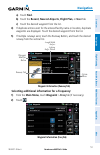
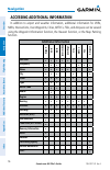
Garmin aera 660 pilot’s guide 190-02017-20 rev. A 56 navigation overview navigation flight planning hazar d a voidance additional f eatur es appendices index accessing additional information in addition to airport and weather information, additional information for vors, ndbs, intersections, user wa...
Page 73: Navigation
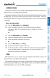
Garmin aera 660 pilot’s guide 190-02017-20 rev. A 57 navigation overview navigation flight planning hazar d a voidance additional f eatur es appendices index intersections intersection information can be viewed using the waypoint information function, the nearest function, or the map panning functio...
Page 74: Navigation
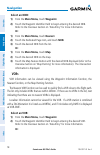
Garmin aera 660 pilot’s guide 190-02017-20 rev. A 58 navigation overview navigation flight planning hazar d a voidance additional f eatur es appendices index select an ndb: 1) from the main menu, touch waypoint. 2) touch the waypoint identifier field to begin entering the desired ndb. Refer to the o...
Page 75: Navigation
Garmin aera 660 pilot’s guide 190-02017-20 rev. A 59 navigation overview navigation flight planning hazar d a voidance additional f eatur es appendices index 1) from the main menu, touch nearest. 2) touch the dedicated page icon, and touch vor. 3) touch the desired vor from the list. Or: 1) from the...
Page 76: Navigation
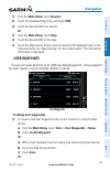
Garmin aera 660 pilot’s guide 190-02017-20 rev. A 60 navigation overview navigation flight planning hazar d a voidance additional f eatur es appendices index a) from the main menu, touch gps info > position tab > menu. B) touch mark waypoint. 2) enter the desired user waypoint name (up to 10 charact...
Page 77: Navigation
Garmin aera 660 pilot’s guide 190-02017-20 rev. A 61 navigation overview navigation flight planning hazar d a voidance additional f eatur es appendices index user waypoint location 7) if desired, touch the menu icon and touch 'reference waypoints' to enter a bearing and distance from another waypoin...
Page 78: Navigation
Garmin aera 660 pilot’s guide 190-02017-20 rev. A 62 navigation overview navigation flight planning hazar d a voidance additional f eatur es appendices index 4) touch the desired field to edit: a) touch the name button. B) enter the desired user waypoint name (up to 10 characters). Refer to the over...
Page 79: Navigation
Garmin aera 660 pilot’s guide 190-02017-20 rev. A 63 navigation overview navigation flight planning hazar d a voidance additional f eatur es appendices index c) touch the desired symbol to delete. The symbol will be highlighted blue. D) touch the ok icon. The confirmation window will appear. Or: a) ...
Page 80: Navigation
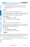
Garmin aera 660 pilot’s guide 190-02017-20 rev. A 64 navigation overview navigation flight planning hazar d a voidance additional f eatur es appendices index 2) touch the desired city symbol on the map. 3) touch the map feature button with the desired city displayed (refer to the overview section on...
Page 81: Navigation
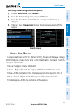
Garmin aera 660 pilot’s guide 190-02017-20 rev. A 65 navigation overview navigation flight planning hazar d a voidance additional f eatur es appendices index selecting and viewing nearest airspaces: 1) from the main menu, touch nearest . 2) touch the dedicated page icon, and touch airspace. 3) touch...
Page 82: Navigation
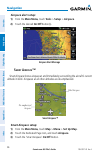
Garmin aera 660 pilot’s guide 190-02017-20 rev. A 66 navigation overview navigation flight planning hazar d a voidance additional f eatur es appendices index airspace alert setup: 1) from the main menu, touch tools > setup > airspace. 2) touch the desired on/off button(s). Airspace alert message s m...
Page 83: Navigation
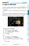
Garmin aera 660 pilot’s guide 190-02017-20 rev. A 67 navigation overview navigation flight planning hazar d a voidance additional f eatur es appendices index 2.6 direct-to navigation the direct-to method of navigation, initiated by pressing the direct to icon is quicker to use than a flight plan whe...
Page 84: Navigation
Garmin aera 660 pilot’s guide 190-02017-20 rev. A 68 navigation overview navigation flight planning hazar d a voidance additional f eatur es appendices index b) touch the recent, nearest airports, flight plan, or user tab. C) touch the desired waypoint. Or: a) touch find. B) touch the search name ta...
Page 85: Flight Planning
Garmin aera 660 pilot’s guide 190-02017-20 rev. A 69 flight planning overview navigation flight planning hazar d a voidance additional f eatur es appendices index section 3 flight planning 3.1 introduction flight planning on the aera consists of building a flight plan by entering waypoints one at a ...
Page 86: Flight Planning
Garmin aera 660 pilot’s guide 190-02017-20 rev. A 70 flight planning overview navigation flight planning hazar d a voidance additional f eatur es appendices index 2) touch the desired data field button at the top of the flight plan. 3) touch to select the desired data field from the list. The curren...
Page 87: Flight Planning
Garmin aera 660 pilot’s guide 190-02017-20 rev. A 71 flight planning overview navigation flight planning hazar d a voidance additional f eatur es appendices index creating an active flight plan: 1) from the main menu, touch active flight plan. 2) touch add waypoint. 3) enter a waypoint identifier us...
Page 88: Flight Planning
Garmin aera 660 pilot’s guide 190-02017-20 rev. A 72 flight planning overview navigation flight planning hazar d a voidance additional f eatur es appendices index c) touch the desired waypoint. Or: a) touch find. B) touch the search name tab. C) touch search by facility name. D) enter the desired fa...
Page 89: Flight Planning
Garmin aera 660 pilot’s guide 190-02017-20 rev. A 73 flight planning overview navigation flight planning hazar d a voidance additional f eatur es appendices index c) touch the desired waypoint. Or: a) touch find. B) touch the search name tab. C) touch search by facility name. D) enter the desired fa...
Page 90: Flight Planning
Garmin aera 660 pilot’s guide 190-02017-20 rev. A 74 flight planning overview navigation flight planning hazar d a voidance additional f eatur es appendices index 3.3 flight plan storage the aera can store up to 50 flight plans. The active flight plan is erased when another flight plan is activated....
Page 91: Flight Planning
Garmin aera 660 pilot’s guide 190-02017-20 rev. A 75 flight planning overview navigation flight planning hazar d a voidance additional f eatur es appendices index activating a stored flight plan: 1) from the main menu, touch flight plan list. 2) touch the desired saved flight plan. An option menu is...
Page 92: Flight Planning
Garmin aera 660 pilot’s guide 190-02017-20 rev. A 76 flight planning overview navigation flight planning hazar d a voidance additional f eatur es appendices index copying flight plans the aera allows copying a flight plan into a new flight plan memory slot, allowing editing, etc., without affecting ...
Page 93: Flight Planning
Garmin aera 660 pilot’s guide 190-02017-20 rev. A 77 flight planning overview navigation flight planning hazar d a voidance additional f eatur es appendices index deleting an individual waypoint from a saved flight plan: 1) from the main menu, touch flight plan list. 2) touch the desired saved fligh...
Page 94: Flight Planning
Garmin aera 660 pilot’s guide 190-02017-20 rev. A 78 flight planning overview navigation flight planning hazar d a voidance additional f eatur es appendices index select approach selecting an approach when selecting an approach, it replaces the destination airport with the sequence of waypoints for ...
Page 95: Flight Planning
Garmin aera 660 pilot’s guide 190-02017-20 rev. A 79 flight planning overview navigation flight planning hazar d a voidance additional f eatur es appendices index selecting an approach using the direct to function: 1) touch the direct to icon. 2) touch the menu icon. 3) touch select approach (only a...
Page 96: Flight Planning
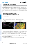
Garmin aera 660 pilot’s guide 190-02017-20 rev. A 80 flight planning overview navigation flight planning hazar d a voidance additional f eatur es appendices index activating vectors-to-final after an approach has been activated, the 'activate vectors-to-final' menu option is used when being vectored...
Page 97: Hazard Avoidance
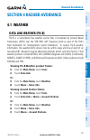
Garmin aera 660 pilot’s guide 190-02017-20 rev. A 81 hazard avoidance overview navigation flight planning hazar d a voidance additional f eatur es appendices index section 4 hazard avoidance 4.1 weather data link weather (fis-b) fis-b is a subscription-free weather service that is broadcast by groun...
Page 98: Hazard Avoidance
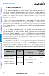
Garmin aera 660 pilot’s guide 190-02017-20 rev. A 82 hazard avoidance overview navigation flight planning hazar d a voidance additional f eatur es appendices index fis-b weather products fis-b weather broadcasts are updated regularly and may take approximately ten minutes to transmit all available w...
Page 99: Hazard Avoidance
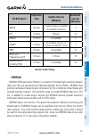
Garmin aera 660 pilot’s guide 190-02017-20 rev. A 83 hazard avoidance overview navigation flight planning hazar d a voidance additional f eatur es appendices index fis-b products expiration time update interval (minutes) broadcast interval (minutes) metar 8 hours 1 minute (where available), as avail...
Page 100: Hazard Avoidance
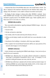
Garmin aera 660 pilot’s guide 190-02017-20 rev. A 84 hazard avoidance overview navigation flight planning hazar d a voidance additional f eatur es appendices index composite data from all the nexrad radar sites in the united states is shown. This data is composed of the maximum reflectivity from the...
Page 101: Hazard Avoidance
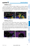
Garmin aera 660 pilot’s guide 190-02017-20 rev. A 85 hazard avoidance overview navigation flight planning hazar d a voidance additional f eatur es appendices index nexrad i ntensity colors are used to identify the different nexrad echo intensities (reflectivity) measured in dbz (decibels of z). “ref...
Page 102: Hazard Avoidance
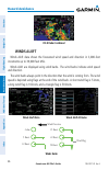
Garmin aera 660 pilot’s guide 190-02017-20 rev. A 86 hazard avoidance overview navigation flight planning hazar d a voidance additional f eatur es appendices index fis-b radar combined winds aloft winds aloft data shows the forecasted wind speed and direction in 3,000-foot increments up to 39,000 fe...
Page 103: Hazard Avoidance
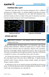
Garmin aera 660 pilot’s guide 190-02017-20 rev. A 87 hazard avoidance overview navigation flight planning hazar d a voidance additional f eatur es appendices index temperatures aloft temperature aloft data shows the forecasted temperatures aloft in 3,000-foot increments up to 39,000 feet msl. For al...
Page 104: Hazard Avoidance
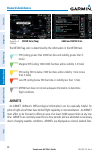
Garmin aera 660 pilot’s guide 190-02017-20 rev. A 88 hazard avoidance overview navigation flight planning hazar d a voidance additional f eatur es appendices index map feature button metar data (map) additional metar data the metar flag color is determined by the information in the metar text. Vfr (...
Page 105: Hazard Avoidance
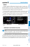
Garmin aera 660 pilot’s guide 190-02017-20 rev. A 89 hazard avoidance overview navigation flight planning hazar d a voidance additional f eatur es appendices index sigmets a sigmet (significant meteorological information) advises of weather that is potentially hazardous to all aircraft. In the conti...
Page 106: Hazard Avoidance
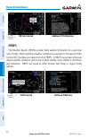
Garmin aera 660 pilot’s guide 190-02017-20 rev. A 90 hazard avoidance overview navigation flight planning hazar d a voidance additional f eatur es appendices index tfr data selected additional trf information map feature button pireps pilot weather reports (pireps) provide timely weather information...
Page 107: Hazard Avoidance
Garmin aera 660 pilot’s guide 190-02017-20 rev. A 91 hazard avoidance overview navigation flight planning hazar d a voidance additional f eatur es appendices index using fis-b weather products warning: do not use data link weather information for maneuvering in, near, or around areas of hazardous we...
Page 108: Hazard Avoidance
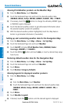
Garmin aera 660 pilot’s guide 190-02017-20 rev. A 92 hazard avoidance overview navigation flight planning hazar d a voidance additional f eatur es appendices index viewing fis-b weather products on the weather map: 1) from the main menu, touch weather. 2) touch the dedicated page icon and touch the ...
Page 109: Hazard Avoidance
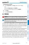
Garmin aera 660 pilot’s guide 190-02017-20 rev. A 93 hazard avoidance overview navigation flight planning hazar d a voidance additional f eatur es appendices index animating fis-b weather: 1) from the main menu, touch map (weather must be enabled). Or: a) from the main menu, touch weather. B) touch ...
Page 110: Hazard Avoidance
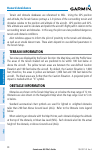
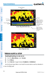
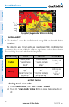
Garmin aera 660 pilot’s guide 190-02017-20 rev. A 94 hazard avoidance overview navigation flight planning hazar d a voidance additional f eatur es appendices index terrain and obstacle databases are referenced to msl. Using the gps position and altitude, the terrain feature portrays a 2-d picture of...
Page 111: Hazard Avoidance
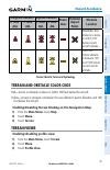
Garmin aera 660 pilot’s guide 190-02017-20 rev. A 95 hazard avoidance overview navigation flight planning hazar d a voidance additional f eatur es appendices index unlighted obstacle lighted obstacle power lines potential impact points obstacle location agl > 1000’ agl agl > 1000’ agl warning: red o...
Page 112: Hazard Avoidance
Garmin aera 660 pilot’s guide 190-02017-20 rev. A 96 hazard avoidance overview navigation flight planning hazar d a voidance additional f eatur es appendices index terrain profile view terrain legend terrain 'map with profile' view obstacle red terrain is above or within 100 ft below the aircraft. Y...
Page 113: Hazard Avoidance
Garmin aera 660 pilot’s guide 190-02017-20 rev. A 97 hazard avoidance overview navigation flight planning hazar d a voidance additional f eatur es appendices index •caution elevation—the aera will provide an alert if the terrain or obstacle is within the default caution elevation or user-defined cau...
Page 114: Hazard Avoidance
Garmin aera 660 pilot’s guide 190-02017-20 rev. A 98 hazard avoidance overview navigation flight planning hazar d a voidance additional f eatur es appendices index pop-up alert pop-up alert (navigation map with terrain shading) range rings aural alerts • “five hundred”—when the aircraft descends thr...
Page 115: Hazard Avoidance
Garmin aera 660 pilot’s guide 190-02017-20 rev. A 99 hazard avoidance overview navigation flight planning hazar d a voidance additional f eatur es appendices index 4.3 traffic traffic information service (tis-a) note: refer to appendix f for general information regarding tis-a. Refer to appendix d f...
Page 116: Hazard Avoidance
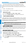
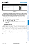
Garmin aera 660 pilot’s guide 190-02017-20 rev. A 100 hazard avoidance overview navigation flight planning hazar d a voidance additional f eatur es appendices index if the number of traffic advisories on the tis-a display decreases and then increases, a new audio alert is sounded. The tis-a audio al...
Page 117: Hazard Avoidance
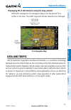
Garmin aera 660 pilot’s guide 190-02017-20 rev. A 101 hazard avoidance overview navigation flight planning hazar d a voidance additional f eatur es appendices index displaying tis-a information using the map pointer: with traffic displayed on the navigation map, touch the desired tis-a symbol on the...
Page 118: Hazard Avoidance
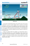
Garmin aera 660 pilot’s guide 190-02017-20 rev. A 102 hazard avoidance overview navigation flight planning hazar d a voidance additional f eatur es appendices index 18,000 ft 10,000 ft gps radar atc 1090 es uat radar composite ads-b ground station mode a/c 1090 es 1090 es uat uat uat ads-b system fo...
Page 119: Hazard Avoidance
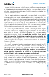
Garmin aera 660 pilot’s guide 190-02017-20 rev. A 103 hazard avoidance overview navigation flight planning hazar d a voidance additional f eatur es appendices index because 1090 es transponders and uats operate on different frequencies, aircraft not similarly equipped cannot transmit/receive data li...
Page 120: Hazard Avoidance
Garmin aera 660 pilot’s guide 190-02017-20 rev. A 104 hazard avoidance overview navigation flight planning hazar d a voidance additional f eatur es appendices index warning: do not rely solely upon the display of traffic information for collision avoidance maneuvering. The traffic display does not p...
Page 121: Hazard Avoidance
Garmin aera 660 pilot’s guide 190-02017-20 rev. A 105 hazard avoidance overview navigation flight planning hazar d a voidance additional f eatur es appendices index system status traffic icon no traffic data available traffic modes some weather/traffic devices also have a pressure altitude sensor to...
Page 122: Hazard Avoidance
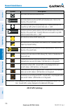
Garmin aera 660 pilot’s guide 190-02017-20 rev. A 106 hazard avoidance overview navigation flight planning hazar d a voidance additional f eatur es appendices index symbol description non-threat, non-directional airborne traffic non-threat directional airborne traffic with absolute vector. Points in...
Page 123: Hazard Avoidance
Garmin aera 660 pilot’s guide 190-02017-20 rev. A 107 hazard avoidance overview navigation flight planning hazar d a voidance additional f eatur es appendices index t raffic a dvisories (ta) tas are issued for traffic when they are predicted to be within a specified volume of airspace around the air...
Page 124: Hazard Avoidance
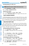
Garmin aera 660 pilot’s guide 190-02017-20 rev. A 108 hazard avoidance overview navigation flight planning hazar d a voidance additional f eatur es appendices index disabling/enabling the traffic alerts: note: traffic alerts are reset to ‘enabled’ on the next power cycle. 1) from the main menu,touch...
Page 125: Hazard Avoidance
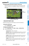
Garmin aera 660 pilot’s guide 190-02017-20 rev. A 109 hazard avoidance overview navigation flight planning hazar d a voidance additional f eatur es appendices index displaying traffic information using the map pointer: with traffic displayed on the navigation map, touch the desired traffic symbol on...
Page 126: Hazard Avoidance
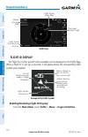
Garmin aera 660 pilot’s guide 190-02017-20 rev. A 110 hazard avoidance overview navigation flight planning hazar d a voidance additional f eatur es appendices index traffic page traffic display range rings altitude/ operating mode directional airborne traffic traffic system status receiving air-to-a...
Page 127: Hazard Avoidance
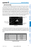
Garmin aera 660 pilot’s guide 190-02017-20 rev. A 111 hazard avoidance overview navigation flight planning hazar d a voidance additional f eatur es appendices index motion vectors there are two pilot-selectable and mutually exclusive types of motion vectors, absolute and targettrend, which are diffe...
Page 128: Hazard Avoidance
Garmin aera 660 pilot’s guide 190-02017-20 rev. A 112 hazard avoidance overview navigation flight planning hazar d a voidance additional f eatur es appendices index motion vector selection is made from the traffic page menu by enabling/disabling targettrend. Absolute vectors are selected by default ...
Page 129: Additional Features
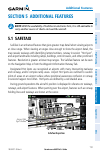
Garmin aera 660 pilot’s guide 190-02017-20 rev. A 113 additional features overview navigation flight planning hazar d a voidance additional f eatur es appendices index section 5 additional features note: with the availability of safetaxi in electronic form, it is still advisable to carry another sou...
Page 130: Additional Features
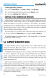
Garmin aera 660 pilot’s guide 190-02017-20 rev. A 114 additional features overview navigation flight planning hazar d a voidance additional f eatur es appendices index enabling/disabling safetaxi: 1) from the main menu, touch map > menu > set up map. 2) touch the dedicated page icon and touch the ai...
Page 131: Additional Features
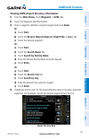
Garmin aera 660 pilot’s guide 190-02017-20 rev. A 115 additional features overview navigation flight planning hazar d a voidance additional f eatur es appendices index viewing aopa airport directory information: 1) from the main menu, touch waypoint > aopa tab. 2) touch the waypoint identifier butto...
Page 132: Additional Features
Garmin aera 660 pilot’s guide 190-02017-20 rev. A 116 additional features overview navigation flight planning hazar d a voidance additional f eatur es appendices index or: 1) from any map highlight an airport using the map pointer. 2) touch the map feature button. 3) touch the aopa tab (if necessary...
Page 133: Appendix A
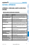
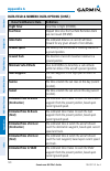
Garmin aera 660 pilot’s guide 190-02017-20 rev. A appendix a 117 overview navigation flight planning hazar d a voidance additional f eatur es appendices index section 6 appendices appendix a: messages, alerts & data field options miscellaneous message advisories message comments approaching target a...
Page 134: Appendix A
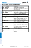
Garmin aera 660 pilot’s guide 190-02017-20 rev. A appendix a 118 overview navigation flight planning hazar d a voidance additional f eatur es appendices index miscellaneous message advisories (cont.) message comments route memory full no additional routes can be saved. Route truncated uploaded route...
Page 135: Appendix A
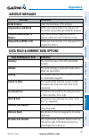
Garmin aera 660 pilot’s guide 190-02017-20 rev. A appendix a 119 overview navigation flight planning hazar d a voidance additional f eatur es appendices index airspace messages message comments inside airspace inside the boundaries of the airspace. Airspace near and ahead within two nautical miles o...
Page 136: Appendix A
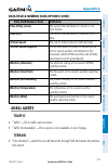
Garmin aera 660 pilot’s guide 190-02017-20 rev. A appendix a 120 overview navigation flight planning hazar d a voidance additional f eatur es appendices index data field & numeric data options (cont.) data field/numeric data definition flight timer total time in-flight (hh:mm). Fuel timer elapsed ti...
Page 137: Appendix A
Garmin aera 660 pilot’s guide 190-02017-20 rev. A appendix a 121 overview navigation flight planning hazar d a voidance additional f eatur es appendices index data field & numeric data options (cont.) data field/numeric data definition time of day (local) the current time and date in 12-hour or 24- ...
Page 138: Appendix A
Garmin aera 660 pilot’s guide 190-02017-20 rev. A appendix a 122 overview navigation flight planning hazar d a voidance additional f eatur es appendices index the following aural terrain alerts are issued when flight conditions meet parameters that are set within the software algorithms, and are dep...
Page 139: Appendix B
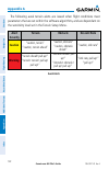
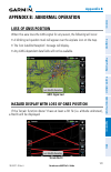
Garmin aera 660 pilot’s guide 190-02017-20 rev. A appendix b 123 overview navigation flight planning hazar d a voidance additional f eatur es appendices index appendix b: abnormal operation loss of gnss position when the aera loses the gnss signal for any reason, the following will occur: •a blinkin...
Page 140: Appendix B
Garmin aera 660 pilot’s guide 190-02017-20 rev. A appendix b 124 overview navigation flight planning hazar d a voidance additional f eatur es appendices index blank page.
Page 141: Appendix C
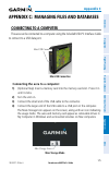
Garmin aera 660 pilot’s guide 190-02017-20 rev. A appendix c 125 overview navigation flight planning hazar d a voidance additional f eatur es appendices index appendix c: managing files and databases connecting to a computer the aera can be connected to a computer using the included usb-pc interface...
Page 142: Appendix C
Garmin aera 660 pilot’s guide 190-02017-20 rev. A appendix c 126 overview navigation flight planning hazar d a voidance additional f eatur es appendices index managing files note: the aera is not compatible with windows95 ® , 98, me, windows nt ® , and mac ® os 10.3 and earlier. Files can be stored ...
Page 143: Appendix C
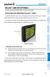
Garmin aera 660 pilot’s guide 190-02017-20 rev. A appendix c 127 overview navigation flight planning hazar d a voidance additional f eatur es appendices index microsd ™ card use (optional) the aera uses an optional microsd ™ card for storing data. Installing and removing microsd ™ cards install the ...
Page 144: Appendix C
Garmin aera 660 pilot’s guide 190-02017-20 rev. A appendix c 128 overview navigation flight planning hazar d a voidance additional f eatur es appendices index removing an microsd card: 1) push the card into the unit until it stops. 2) release the card. The card should eject for easy removal. 3) with...
Page 145: Appendix C
Garmin aera 660 pilot’s guide 190-02017-20 rev. A appendix c 129 overview navigation flight planning hazar d a voidance additional f eatur es appendices index airport directory databases the aopa airport directory provides data on airports and heliports throughout the u.S. And it is updated on a 56-...
Page 146: Appendix C
Garmin aera 660 pilot’s guide 190-02017-20 rev. A appendix c 130 overview navigation flight planning hazar d a voidance additional f eatur es appendices index •*vors—identifier,facilityname,city/state/country,location(latitude/longitude), frequency, service volume (high, low, terminal), and type (su...
Page 147: Appendix C
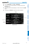
Garmin aera 660 pilot’s guide 190-02017-20 rev. A appendix c 131 overview navigation flight planning hazar d a voidance additional f eatur es appendices index 3) from the main menu, touch tools > downloads. 4) if necessary, touch the desired database to 'download' and touch the download button. 5) i...
Page 148: Appendix C
Garmin aera 660 pilot’s guide 190-02017-20 rev. A appendix c 132 overview navigation flight planning hazar d a voidance additional f eatur es appendices index blank page.
Page 149: Appendix D
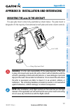
Garmin aera 660 pilot’s guide 190-02017-20 rev. A appendix d 133 overview navigation flight planning hazar d a voidance additional f eatur es appendices index appendix d: installation and interfacing mounting the aera in the aircraft the aera yoke mount comes fully assembled as shown below. The yoke...
Page 150: Appendix D
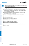
Garmin aera 660 pilot’s guide 190-02017-20 rev. A appendix d 134 overview navigation flight planning hazar d a voidance additional f eatur es appendices index note: readjust the position of the aera to provide the best view of the display screen as lighting conditions change. Attaching the yoke moun...
Page 151: Appendix D
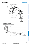
Garmin aera 660 pilot’s guide 190-02017-20 rev. A appendix d 135 overview navigation flight planning hazar d a voidance additional f eatur es appendices index aera cradle release button aera cradle adjustment knob yoke mount assembly connecting the cables: make all applicable cable connections. 3.5m...
Page 152: Appendix D
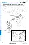
Garmin aera 660 pilot’s guide 190-02017-20 rev. A appendix d 136 overview navigation flight planning hazar d a voidance additional f eatur es appendices index reconfiguring the yoke mount for center column yokes: 1) loosen and remove the cradle adjustment knob, spacer, and rubber washer. 2) rotate t...
Page 153: Appendix D
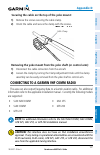
Garmin aera 660 pilot’s guide 190-02017-20 rev. A appendix d 137 overview navigation flight planning hazar d a voidance additional f eatur es appendices index securing the cable on the top of the yoke mount: 1) remove the screws securing the cable clamp. 2) orient the cable and secure the clamp with...
Page 154: Appendix D
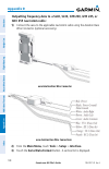
Garmin aera 660 pilot’s guide 190-02017-20 rev. A appendix d 138 overview navigation flight planning hazar d a voidance additional f eatur es appendices index outputting frequency data to a sl40, sl30, gtr 200, gtr 225, or gnc 255 nav/comm radio: 1) connect the aera to the applicable nav/comm radio ...
Page 155: Appendix D
Garmin aera 660 pilot’s guide 190-02017-20 rev. A appendix d 139 overview navigation flight planning hazar d a voidance additional f eatur es appendices index 4) touch ' aviation in/nmea & vhf out' or 'gtx tis-a in/nmea & vhf out'. These comm modes send both nmea data and vhf frequency information. ...
Page 156: Appendix D
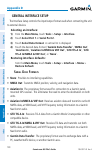
Garmin aera 660 pilot’s guide 190-02017-20 rev. A appendix d 140 overview navigation flight planning hazar d a voidance additional f eatur es appendices index general interface setup the interface setup controls the input/output format used when connecting the unit to external devices. Selecting an ...
Page 157: Appendix D
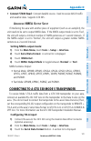
Garmin aera 660 pilot’s guide 190-02017-20 rev. A appendix d 141 overview navigation flight planning hazar d a voidance additional f eatur es appendices index • connext 57600 baud: connext datalink source. Used to receive ads-b traffic and weather data. Supports gtx 345. A dvanced nmea o utput s etu...
Page 158: Appendix D
Garmin aera 660 pilot’s guide 190-02017-20 rev. A appendix d 142 overview navigation flight planning hazar d a voidance additional f eatur es appendices index 4) touch 'gtx tis-a in' or 'gtx tis-a in/nmea & vhf out'. The tis-a status field indicates one of the following messages: • waiting for data—...
Page 159: Appendix D
Garmin aera 660 pilot’s guide 190-02017-20 rev. A appendix d 143 overview navigation flight planning hazar d a voidance additional f eatur es appendices index 3) touch serial port 1 or serial port 2. 4) touch the 'serial data format' data field button. A vertical list is displayed. 5) touch 'garmin ...
Page 160: Appendix D
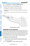
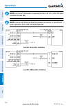
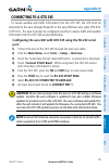
Garmin aera 660 pilot’s guide 190-02017-20 rev. A appendix d 144 overview navigation flight planning hazar d a voidance additional f eatur es appendices index note: external gps antenna not required on either gdl 39 or gdl 39r when connected to aera 660. Note: external uat antenna should be mounted ...
Page 161: Appendix D
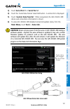
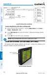
Garmin aera 660 pilot’s guide 190-02017-20 rev. A appendix d 145 overview navigation flight planning hazar d a voidance additional f eatur es appendices index connecting to a gtx 345 to receive weather and traffic information from the gtx 345, the gtx must be connected to the aera through bluetooth ...
Page 162: Appendix D
Garmin aera 660 pilot’s guide 190-02017-20 rev. A appendix d 146 overview navigation flight planning hazar d a voidance additional f eatur es appendices index aera/gtx 345 bare wire installation connecting/pairing gtx 345 via bluetooth: 1) ensure the gtx 345 is turned on. From the main menu, touch t...
Page 163: Appendix E
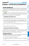
Garmin aera 660 pilot’s guide 190-02017-20 rev. A appendix e 147 overview navigation flight planning hazar d a voidance additional f eatur es appendices index appendix e: battery and care information battery information the aera contains a user-replaceable, lithium-ion battery. To maximize the lifet...
Page 164: Appendix E
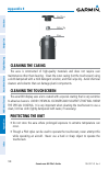
Garmin aera 660 pilot’s guide 190-02017-20 rev. A appendix e 148 overview navigation flight planning hazar d a voidance additional f eatur es appendices index end piece silver tip fuse cleaning the casing the aera is constructed of high-quality materials and does not require user maintenance other t...
Page 165: Appendix E
Garmin aera 660 pilot’s guide 190-02017-20 rev. A appendix e 149 overview navigation flight planning hazar d a voidance additional f eatur es appendices index avoiding theft •removetheunitfromsightwhennotinuse. •donotkeeptheunitintheglovecompartment. •registertheproductathttp://my.Garmin.Com..
Page 166: Appendix E
Garmin aera 660 pilot’s guide 190-02017-20 rev. A appendix e 150 overview navigation flight planning hazar d a voidance additional f eatur es appendices index blank page.
Page 167: Appendix F
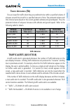
Garmin aera 660 pilot’s guide 190-02017-20 rev. A appendix f 151 overview navigation flight planning hazar d a voidance additional f eatur es appendices index appendix f: general tis-a information note: aircraft without an operational transponder are invisible to tis-a. Warning: do not rely solely u...
Page 168: Appendix F
Garmin aera 660 pilot’s guide 190-02017-20 rev. A appendix f 152 overview navigation flight planning hazar d a voidance additional f eatur es appendices index tis-a limitations tis-a relies on surveillance of the mode-s radar system, which is a “secondary surveillance” radar system similar to that u...
Page 169: Appendix F
Garmin aera 660 pilot’s guide 190-02017-20 rev. A appendix f 153 overview navigation flight planning hazar d a voidance additional f eatur es appendices index tis-a information is collected during a single radar sweep. Collected information is then sent through the mode s uplink on the next radar sw...
Page 170: Appendix F
Garmin aera 660 pilot’s guide 190-02017-20 rev. A appendix f 154 overview navigation flight planning hazar d a voidance additional f eatur es appendices index blank page.
Page 171: Appendix G
Garmin aera 660 pilot’s guide 190-02017-20 rev. A appendix g 155 overview navigation flight planning hazar d a voidance additional f eatur es appendices index appendix g: utilities flight log the flight log shows a list of any recorded flights, including date, route of flight, and flight time. The a...
Page 172: Appendix G
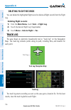
Garmin aera 660 pilot’s guide 190-02017-20 rev. A appendix g 156 overview navigation flight planning hazar d a voidance additional f eatur es appendices index deleting flight records youcandeletethehighlightedflightrecordordeleteallflightrecordsfromtheflight log. Deleting flight records: 1) from the...
Page 173: Appendix G
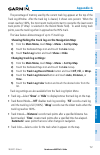
Garmin aera 660 pilot’s guide 190-02017-20 rev. A appendix g 157 overview navigation flight planning hazar d a voidance additional f eatur es appendices index the percentage of memory used by the current track log appears at the top of the track log window. After the track log is cleared, it shows z...
Page 174: Appendix G
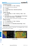
Garmin aera 660 pilot’s guide 190-02017-20 rev. A appendix g 158 overview navigation flight planning hazar d a voidance additional f eatur es appendices index clearing the track log: 1) from the main menu, touch tools > track log. 2) touch the desired track log (if applicable). 3) touch menu. 4) tou...
Page 175: Appendix G
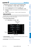
Garmin aera 660 pilot’s guide 190-02017-20 rev. A appendix g 159 overview navigation flight planning hazar d a voidance additional f eatur es appendices index changing the track vector settings on the navigation map: 1) from the main menu, touch map > menu > set up map. 2) touch the dedicated page i...
Page 176: Appendix G
Garmin aera 660 pilot’s guide 190-02017-20 rev. A appendix g 160 overview navigation flight planning hazar d a voidance additional f eatur es appendices index • calibrated airspeed— required entry for density altitude/true airspeed calculation. Enter the aircraft’s airspeed indicator value. • total ...
Page 177: Appendix G
Garmin aera 660 pilot’s guide 190-02017-20 rev. A appendix g 161 overview navigation flight planning hazar d a voidance additional f eatur es appendices index calculating winds aloft: 1) from the main menu, touch tools > e6b, calculate or enter the true airspeed into the ‘true airspeed’ field. 2) en...
Page 178: Appendix G
Garmin aera 660 pilot’s guide 190-02017-20 rev. A appendix g 162 overview navigation flight planning hazar d a voidance additional f eatur es appendices index entering an aircraft profile: 1) from the main menu, touch tools > profile 2) touch the aircraft identifier button and enter the aircraft ide...
Page 179: Appendix G
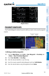
Garmin aera 660 pilot’s guide 190-02017-20 rev. A appendix g 163 overview navigation flight planning hazar d a voidance additional f eatur es appendices index weight & balance proximity waypoints the proximity waypoints allows the pilot to define an alarm circle around a waypoint location. Proximity...
Page 180: Appendix G
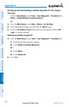
Garmin aera 660 pilot’s guide 190-02017-20 rev. A appendix g 164 overview navigation flight planning hazar d a voidance additional f eatur es appendices index setting up and customizing proximity waypoints for the naviga- tion map: from the main menu, touch tools > user waypoint > proximity tab > me...
Page 181: Appendix H
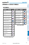
Garmin aera 660 pilot’s guide 190-02017-20 rev. A appendix h 165 overview navigation flight planning hazar d a voidance additional f eatur es appendices index appendix h: display symbols vfr symbols item symbol unknown non-towered, non-serviced towered, non-serviced non-towered, serviced towered, se...
Page 182: Appendix H
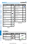
Garmin aera 660 pilot’s guide 190-02017-20 rev. A appendix h 166 overview navigation flight planning hazar d a voidance additional f eatur es appendices index item symbol intersection visual reporting point lom (compass locator at outer marker) ndb (non-directional radio beacon) vor vor/dme ils/dme ...
Page 183: Appendix H
Garmin aera 660 pilot’s guide 190-02017-20 rev. A appendix h 167 overview navigation flight planning hazar d a voidance additional f eatur es appendices index item symbol unknown vfr airport, non-serviced ifr airport, non-serviced vfr airport, serviced ifr airport, serviced vfr, soft surface, non- s...
Page 184: Appendix H
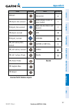
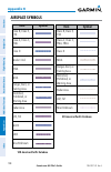
Garmin aera 660 pilot’s guide 190-02017-20 rev. A appendix h 168 overview navigation flight planning hazar d a voidance additional f eatur es appendices index airspace symbols item symbol class b, class e, cta class a, class c, tma class d mode c veil trsa moa danger, alert, or training area restric...
Page 185: Appendix H
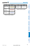
Garmin aera 660 pilot’s guide 190-02017-20 rev. A appendix h 169 overview navigation flight planning hazar d a voidance additional f eatur es appendices index item symbol danger or alert area restricted, prohibited, or warning area training area vfr atlantic database exceptions item symbol training ...
Page 186: Appendix H
Garmin aera 660 pilot’s guide 190-02017-20 rev. A appendix h 170 overview navigation flight planning hazar d a voidance additional f eatur es appendices index blank page.
Page 187: Appendix I
Garmin aera 660 pilot’s guide 190-02017-20 rev. A appendix i 171 overview navigation flight planning hazar d a voidance additional f eatur es appendices index appendix i: map datum and location formats map datums a datum is a mathematical model of the earth that approximates the shape of the earth a...
Page 188: Appendix I
Garmin aera 660 pilot’s guide 190-02017-20 rev. A appendix i 172 overview navigation flight planning hazar d a voidance additional f eatur es appendices index blank page.
Page 189: Appendix J
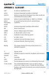
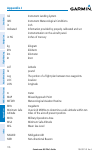
Garmin aera 660 pilot’s guide 190-02017-20 rev. A appendix j 173 overview navigation flight planning hazar d a voidance additional f eatur es appendices index appendix j: glossary adiz air defense identification zone ads-b automatic dependant surveillance -broadcast ads-b in ability to receive ads-b...
Page 190: Appendix J
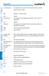
Garmin aera 660 pilot’s guide 190-02017-20 rev. A appendix j 174 overview navigation flight planning hazar d a voidance additional f eatur es appendices index crosstrack error the distance the aircraft is off a desired course in either direction, left or right. Dbz decibels ‘z’ (radar return) deg de...
Page 191: Appendix J
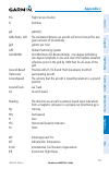
Garmin aera 660 pilot’s guide 190-02017-20 rev. A appendix j 175 overview navigation flight planning hazar d a voidance additional f eatur es appendices index fss flight service station ft foot/feet gal gallon(s) glide ratio, g/r the estimated distance an aircraft will move forward for any given amo...
Page 192: Appendix J
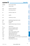
Garmin aera 660 pilot’s guide 190-02017-20 rev. A appendix j 176 overview navigation flight planning hazar d a voidance additional f eatur es appendices index ils instrument landing system imc instrument meteorological conditions in inch indicated information provided by properly calibrated and set ...
Page 193: Appendix J
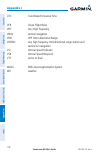
Garmin aera 660 pilot’s guide 190-02017-20 rev. A appendix j 177 overview navigation flight planning hazar d a voidance additional f eatur es appendices index nexrad next generation radar nm nautical mile(s) oat outside air temperature obs omni bearing selector psi pounds per square inch qty quantit...
Page 194: Appendix J
Garmin aera 660 pilot’s guide 190-02017-20 rev. A appendix j 178 overview navigation flight planning hazar d a voidance additional f eatur es appendices index utc coordinated universal time vfr visual flight rules vhf very high frequency vnav vertical navigation vor vhf omni-directional range vortac...
Page 195: Appendix K
Garmin aera 660 pilot’s guide 190-02017-20 rev. A appendix k 179 overview navigation flight planning hazar d a voidance additional f eatur es appendices index appendix k: license agreement and warranty contact garmin contact garmin if you have any questions while using your aera. In the usa contact ...
Page 196: Appendix K
Garmin aera 660 pilot’s guide 190-02017-20 rev. A appendix k 180 overview navigation flight planning hazar d a voidance additional f eatur es appendices index innoeventshallgarminbeliableforanyincidental,special,indirect,orconsequential damages,whetherresultingfromtheuse,misuse,orinabilitytousethisp...
Page 197: Appendix K
Garmin aera 660 pilot’s guide 190-02017-20 rev. A appendix k 181 overview navigation flight planning hazar d a voidance additional f eatur es appendices index ac-u-kwik license agreement ac-u-kwikanditsrelatedorganizations(hereinaftercollectively“ac-u-kwikorganizations”) expresslydisclaimallwarranti...
Page 198: Appendix K
Garmin aera 660 pilot’s guide 190-02017-20 rev. A appendix k 182 overview navigation flight planning hazar d a voidance additional f eatur es appendices index radiation exposure statement this equipment complies with fcc rf and ic rss-102 radiation exposure limits set forth for an uncontrolled envir...
Page 199: Index
Garmin aera 660 pilot’s guide 190-02017-20 rev. A index index-1 overview navigation flight planning hazar d a voidance additional f eatur es appendices index a abnormal operation 123 acquiring satellites 4 ac-u-kwik 114, 129 additional features 113 ads-b 110 aircraft profile 161 airmets 88 airspace ...
Page 200: Index
Garmin aera 660 pilot’s guide 190-02017-20 rev. A index index-2 overview navigation flight planning hazar d a voidance additional f eatur es appendices index activation 74 active 71 copying 76 creation 70 data fields 69 deleting 76 fuel flow 75 inverting 77 fss 64 fuel flow 75 fuse, changing 147 g g...
Page 201: Index
Garmin aera 660 pilot’s guide 190-02017-20 rev. A index index-3 overview navigation flight planning hazar d a voidance additional f eatur es appendices index p panning 7 pireps 90 power button 4 present position 31, 32 proximity waypoints 163 r red x 123 runways 50 s safetaxi 113 satellite informati...
Page 202: Index
Garmin aera 660 pilot’s guide 190-02017-20 rev. A index index-4 overview navigation flight planning hazar d a voidance additional f eatur es appendices index y yokemount134 z zooming 8.
Page 204
Garmin international, inc. 1200 east 151st street olathe, kansas 66062, u.S.A. Tel: 913.397.8200 fax: 913.397.8282 aircraft on ground (aog) hotline: 913.397.0836 aviation dealer technical support: 888.606.5482 garmin at, inc. 2345 turner road se salem, or 97302, u.S.A. Tel: 503.581.8101 fax 503.364....

