Summary of FF 650 GPS
Page 1
Ff 650 gps owner’s manual.
Page 2
© 2017 garmin ltd. Or its subsidiaries all rights reserved. Under the copyright laws, this manual may not be copied, in whole or in part, without the written consent of garmin. Garmin reserves the right to change or improve its products and to make changes in the content of this manual without oblig...
Page 3: Table of Contents
Table of contents introduction.....................................................................1 ff 650 gps dimensions............................................................ 1 device overview ......................................................................... 1 keys......................
Page 4
Unit settings ............................................................................. 15 communications settings ......................................................... 15 nmea 0183 settings ............................................................15 navigation settings .....................
Page 5: Introduction
Introduction warning see the important safety and product information guide in the product box for product warnings and other important information. Ff 650 gps dimensions À 176 mm (6.94 in.) Á 178 mm (7 in.) 190 mm (7.5 in.) Ã 81.8 mm (3.25 in.) device overview À power key Á device keys keys hold to...
Page 6: Home Screen
Adjusting the backlight 1 select settings > system > display > backlight . Tip: press > backlight from any screen to open the backlight settings. 2 adjust the backlight. Changing the color mode 1 select settings > system > display > color mode . Tip: press > color mode from any screen to access the ...
Page 7: Sonar
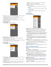
Traditional clearvü waypoint map ais radar highway default shortcuts shift zoom clearvüshift zoom split frequency depth data graph temperature data graph numbers compass trip speed data graph available shortcuts editing the page shortcuts before you can change a page in the shortcuts menu, you must ...
Page 8
Bottom depth water temperature gps speed device voltage time color bar depth line transducer type and frequency, zoom type, and color filter status depth indicator as the sonar data screen scrolls from right to left suspended targets (fish) a-scope bottom echo garmin clearvü sonar view note: to rece...
Page 9
À zoomed depth scale Á depth range adjusting the zoom you can adjust the zoom manually by specifying the span and a fixed starting depth. For example, when the depth is 15 m and the starting depth is 5 m, the device displays a magnified area from 5 to 20 m deep. You also can allow the device to adju...
Page 10
Sonar gain the gain setting controls the sensitivity of the sonar receiver to compensate for water depth and water clarity. Increasing the gain shows more detail, and decreasing the gain reduces screen clutter. Note: setting the gain on one sonar view applies the setting to all the views. Setting th...
Page 11: Waypoints and Marks
• to use a very fast scroll speed, select ultrascroll . The ultrascroll option quickly scrolls new sonar data, but with a reduced image quality. For most situations, the fast option provides a good balance between a quickly scrolling image and targets that are less distorted. Sonar appearance settin...
Page 12: Routes
Transfer a mark to another device, the mark is converted to a waypoint. You can save a maximum of 12,000 waypoints and marks. Creating a mark or waypoint on a sonar screen using your present location 1 pause the sonar. 2 select an option: • to create a mark at the cursor, select mark/wpt . • to crea...
Page 13: Track
2 pan the waypoint map to select the starting location of the route. 3 follow the onscreen instructions to add a turns. 4 select menu > navigate to . 5 select an option. Creating and navigating a route using the waypoint list 1 select user data > routes & auto guidance paths > new > route using wayp...
Page 14
When connected to an external ais device, the chartplotter can show some ais information about other vessels that are within range, equipped with a transponder, and are actively transmitting ais information. The information reported for each vessel includes the maritime mobile service identity (mmsi...
Page 15: Highway Page
Adjusting the vrm and ebl before you can adjust the vrm and ebl, you must show them showing the vrm and ebl , page 10 . You can adjust the diameter of the vrm and the angle of the ebl, which moves the intersection point of the vrm and the ebl. 1 from the ais radar screen, select menu > adjust vrm/eb...
Page 16: Device Configuration
1 select navigation info > other vessels > dsc list > add contact . 2 enter the maritime mobile service identity (mmsi) of the vessel. 3 enter the name of the vessel. Incoming distress calls if your compatible chartplotter and vhf radio are connected using nmea 0183, your chartplotter alerts you whe...
Page 17
◦ color mode ◦ configure colors ◦ beeper ◦ gps ◦ skyview ◦ gps mode ◦ sbas ◦ speed filter ◦ auto power ◦ off ◦ on ◦ language ◦ system information ◦ event log ◦ software information ◦ factory settings ◦ simulator • my vessel ◦ keel offset ◦ temp. Offset ◦ calibrate water speed • communications ◦ seri...
Page 18
System information : provides information about the device and the software version. Simulator : turns on the simulator and allows you to set the speed and simulated location. System information select settings > settings > system information . Event log : allows you to view a log of system events. ...
Page 19
Arrival : sets an alarm to sound when you are within a specified distance or time from a turn or a destination. Anchor drag : sets an alarm to sound when you exceed a specified drift distance while anchored. Off course : sets an alarm to sound when you are off course by a specified distance. System ...
Page 20: Appendix
System : enables nmea 0183 output sentences for system information. Garmin : enables nmea 0183 output sentences for garmin proprietary sentences. Posn precision : adjusts the number of digits to the right of the decimal point for transmission of nmea output. Xte precision : adjusts the number of dig...
Page 21
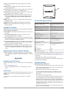
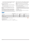
To check the voltage, measure the female power and ground sockets of the power cable for dc voltage. If the voltage is less than 10 vdc, the device will not turn on. My sonar does not work • push the transducer cable all the way into the back of the device. Even if the cable seems to be connected, y...
Page 22: Index
Index a ais 9 alarm 10 color scheme 11 display 10 group 10 measuring 11 range 10 range rings 11 sart 10 threats 10 waypoints 10, 11 alarms 15 anchor drag 14 arrival 14 collision 10 navigation 14 off course 14 sonar 15 anchor drag alarm 14 arrival alarm 14 b backlight 2 beeper 2 beidou 13 c clock 15 ...
Page 24: Support.Garmin.Com
Support.Garmin.Com 1800 235 822 +43 (0) 820 220230 + 32 2 672 52 54 0800 770 4960 1-866-429-9296 +385 1 5508 272 +385 1 5508 271 +420 221 985466 +420 221 985465 + 45 4810 5050 + 358 9 6937 9758 + 331 55 69 33 99 + 39 02 36 699699 (+52) 001-855-792-7671 0800 427 652 0800 0233937 +47 815 69 555 00800 ...


