Summary of tactix
Page 1
Tactix ™ owner’s manual september 2013 190-01652-00_0a printed in taiwan.
Page 2
All rights reserved. Under the copyright laws, this manual may not be copied, in whole or in part, without the written consent of garmin. Garmin reserves the right to change or improve its products and to make changes in the content of this manual without obligation to notify any person or organizat...
Page 3: Table of Contents
Table of contents introduction.................................................................... 1 getting started........................................................................... 1 charging the device .............................................................. 1 keys....................
Page 4
Updating the software ............................................................. 13 device care ............................................................................. 13 cleaning the device ............................................................ 13 specifications ........................
Page 5: Introduction
Introduction warning always consult your physician before you begin or modify any exercise program. See the important safety and product information guide in the product box for product warnings and other important information. Getting started when using your device the first time, you should comple...
Page 6
4 select . Note: your body temperature affects the temperature sensor. To get the most accurate temperature reading, remove the device from your wrist and wait 20–30 minutes. Tip: to purchase a tempe™ wireless temperature sensor, go to www.Garmin.Com . 5 select . Turning on a sensor mode the default...
Page 7
Creating a waypoint you can save your current location as a waypoint. 1 hold the action key. 2 select an option: • to save the waypoint without changes, select save. • to make changes to the waypoint, select edit, make changes to the waypoint, and select save. Finding a waypoint by name 1 select the...
Page 8: Navigation
2 select routes. 3 select a route. 4 select edit. 5 select a point. 6 select an option: • to view the point on the map, select map. • to change the order of the point on the route, select move up or move down. • to insert an additional point on the route, select insert. The additional point is inser...
Page 9
• select gps tools > geocaches. 6 select a destination. 7 select go. The device displays time to destination À , distance to destination Á , and estimated time of arrival . 8 select to view the compass page. The two pointer marks à serve as a bearing pointer. The top mark on the device points in the...
Page 10: Geocaches
2 select setup > sensors > mode > always on. 3 select repeatedly to return to the time of day page. 4 select repeatedly until the barometric data page appears. The current barometric pressure appears in large numbers, and the range of previous readings for the graph shown appears in small numbers at...
Page 11
Static: the wind speed and direction are assumed to be constant for the duration of the jump. The drop altitude must be at least 1,000 feet. Entering jump information 1 select the action key. 2 select jumpmaster. 3 select a jump type ( page 6 ). 4 complete one or more actions to enter your jump info...
Page 12: Customizing Your Device
Using the stopwatch 1 select the action key. 2 select clock > stopwatch. 3 select start. Adding a custom time zone 1 select the action key. 2 select clock > alt. Zones > add zone. 3 select a time zone. The custom time zone page is added to the current profile. Editing a custom time zone 1 select the...
Page 13
Setup item available settings and information system you can customize gps settings, arrow keys, and the device language ( page 9 ). Data pages you can customize data pages and data fields ( page 9 ). Sensors you can customize the compass ( page 9 ) and altimeter ( page 10 ) settings. Ant sensor you...
Page 14
Altimeter settings select setup > sensors > altimeter. Auto cal.: allows the altimeter to self-calibrate each time you turn on gps tracking. Baro. Plot: variable records changes in elevation while you are moving. Fixed assumes the device is stationary at a fixed elevation. Therefore, the barometric ...
Page 15: Fitness
Fitness customizing your running or cycling profile there are many ways to customize your device for ease of use while running or cycling. You can access the settings menu using the action key. • select setup > tracks > auto pause to turn on auto pause® ( page 10 ). • select setup > tracks > output ...
Page 16
2 wet both electrodes Á on the back of the strap to create a strong connection between your chest and the transmitter. 3 if the heart rate monitor has a contact patch , wet the contact patch. 4 wrap the strap around your chest, and connect the strap hook à to the loop. The garmin logo should be righ...
Page 17: Device Information
Regulation track (2 laps = 0.5 mi. Or 800 m) is more accurate than a treadmill. 1 select the action key. 2 select setup > ant sensor > foot pod > calibrate > distance. 3 select start to begin recording. 4 run or walk 0.5 mi. Or 800 m. 5 select stop. Calibrating your foot pod by gps before you can ca...
Page 18: Appendix
3 wait 30 seconds. 4 insert the new battery with the positive side facing up. Note: do not damage or lose the o-ring gasket. 5 replace the back cover and the four screws. Note: do not overtighten. After you replace the heart rate monitor battery, you may need to pair it with the device again. Caring...
Page 19
Avg hr (average heart rate): the average heart rate for the current activity. Avg hr % (average heart rate percentage): the average percentage of maximum heart rate for the current activity. Avg lap (average lap): the average lap time for the current activity. Avg pace (average pace): the average pa...
Page 20
Max temp (maximum temperature): the maximum temperature recorded in the last 24 hours. Min elevtn (minimum elevation): the lowest elevation reached since the last reset. Min temp (minimum temperature): the minimum temperature recorded in the last 24 hours. Mov'n avg (moving average): the average spe...
Page 21
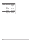
Heart rate zone calculations zone % of maximum heart rate perceived exertion benefits 1 50–60% relaxed, easy pace, rhythmic breathing beginning-level aerobic training, reduces stress 2 60–70% comfortable pace, slightly deeper breathing, conversation possible basic cardiovascular training, good recov...
Page 22: Index
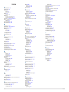
Index a accessories 14 adventures 4 alarms 8 clock 7 proximity 8 alerts 8 location 8 almanac hunting and fishing 8 sunrise and sunset 8 altimeter 1, 2, 5, 10, 14, 16 ant+ sensors 11 pairing 11 area calculation 8 auto pause 10, 11 b backlight 1, 10 barometer 1, 2, 5, 14, 16 basecamp 2, 14 battery 13 ...
Page 24: Www.Garmin.Com/support
Www.Garmin.Com/support 913-397-8200 1-800-800-1020 0808 238 0000 +44 870 850 1242 1-866-429-9296 +43 (0) 820 220 230 +32 2 672 52 54 +45 4810 5050 +358 9 6937 9758 + 331 55 69 33 99 +49 (0)180 6 427646 + 39 02 36 699699 0800 - 023 3937 035 - 539 3727 + 47 815 69 555 00800 4412 454 +44 2380 662 915 +...


