- DL manuals
- Icom
- Receiver
- FP-561
- Instruction Manual
Icom FP-561 Instruction Manual
Information provided by this
product includes navigation-aid
data.
Consult nautical charts in addi-
tion to the data when making a
decision on navigation.
MARINEPLOTTER/SOUNDER
fp-561
COMBINE
Electronic charts are not legal
replacements for paper charts.
Always carry and consult current
official charts frequently.
FP-561
MARINE PLOTTER/SOUNDER
INSTRUCTION MANUAL
Summary of FP-561
Page 1
Information provided by this product includes navigation-aid data. Consult nautical charts in addi- tion to the data when making a decision on navigation. Marineplotter/sounder fp-561 combine electronic charts are not legal replacements for paper charts. Always carry and consult current official cha...
Page 2: Cartgraphy Supplied By
Qty. Q self-tapping screws (m 6 × 30)········································4 w spring washers (m 6) ······················································4 e flat washers (m 6)···························································4 r connector covers···········································...
Page 3
Table of contents introduction . . . . . . . . . . . . . . . . . . . . . . . . . . . . . . . . . . . . . . . . . . . . . . . . . . . . . . . . . . . . . . . . . . . . . . . . . . . . . . . . .I supplied accessories . . . . . . . . . . . . . . . . . . . . . . . . . . . . . . . . . . . . . . . . . . ....
Page 4: Safety Notices
1 1 safety notices be sure to read the following safety notices to ensure safe use of the product. ¡ the safety notices are for preventing personal injury and property damage. ¡ observe the following safety notices to ensure safe and proper used of the product. ¡ after you finish reading this manual...
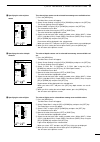
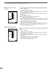
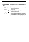
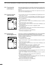
Page 5: Caution
2 1 safety notices each of the following caution notices indicates that neglecting the suggested procedure or practice may result in personal injury or property damage. Data card handling precautions: ¡ do not put data cards into such a pocket or poly bag that is electrically charged. ¡ do not leave...
Page 7
4 2 parts and functions function press to power on or off the product ( ☞ p. 5). Each time this key is pressed, the power is turned on and off alternately. Use to set the image sensitivity ( ☞ p. 52) on the fishfinder screen. Use to set the depth range ( ☞ p. 52) or depth shift ( ☞ p. 53), or to ent...
Page 8: Basic Operation
5 3-1 powering on or off the system after installing the system, be sure to perform initial setting according to the instructions in chapter 5 “initial setting after installation” ( ☞ p. 62 ff.). Q press the [power] key. The system will sound an electronic beep, display the opening screen for approx...
Page 9
6 4 available operation modes and screens 4-1 how to change operation modes three operation modes are available for this system: the plotter mode, sounder mode and combination mode. To change the operation mode, proceed as follows. Q when the system is in plotter mode: press the [sounder] key. The s...
Page 10
7 4 available operation modes and screens 4-2 menu operation menu screens allows you to select and execute various functions of the sys- tem or to change various settings. For available menu screens and the menu structure, see page 9. The following summarizes the menu operation flow. Q press the [me...
Page 12
9 4 available operation modes and screens route enter/edit mark enter/erase dgps positioning info clr ent set canc sel press the [menu] key. Sounder menu dsp speed 5 stop stc 1 i.R on off n.R 1 off frequency l h plotter menu trk erase heading on off route enter/edit→ mark enter/erase→ trk color whit...
Page 13: Plotter Mode
10 4 r plotter mode q table of contents !!!!!!!!!!!!!!!!!!!!!!!!!!!!!!!!!!!!!!!!!!!!!!!!!! Plotter mode !!!!!!!!!!!!!!!!!!!!!!!!!!!!!!!!!!!!!!!!!!!!!!!!!! (1) available screens and indications...............................................................................................................
Page 14
11 4 r plotter mode q table of contents (6) destination navigation setting ........................................................................................................................... 28 (6)-1 setting destination navigation······························································...
Page 15
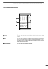
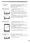
12 1 r plotter mode q available screens and indications (1)-1 how to access screens in plotter mode, the following two screens are available. Pressing the [plotter] key in plotter mode allows selection between the coast- line screen and the navigation monitor screen. This screen indicates various na...
Page 16
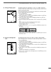
13 1 r plotter mode q available screens and indications this field shows the current scale to which the coast line image is displayed. The coastline image can be zoomed in or out to a total of 16 scales ( ☞ p. 17). This field shows the positioning device in use. This field shows the current ship pos...
Page 17
14 1 r plotter mode q available screens and indications m water temperature , speed . Azimuth ⁄0 monitor ⁄1 cursor position ⁄2 latitude/longitude lines ⁄3 alarm indication this field shows the current water temperature. If no water temperature sensor is installed, the field is blank. This field show...
Page 18
15 1 r plotter mode q available screens and indications (1)-3 navigation monitor screen z monitor x alarm indication c azimuth deviation v distance deviation b compass n ship position this field shows navigation data including the destination no., the destination azimuth, the distance to the destina...
Page 19
16 1 r plotter mode q available screens and indications z satellite x dop c dgps information this field shows and locates the navigational satellites that the system is being tracked. This field shows the geometrical arrangement of the navigational satellites and the ship in the form of dop (dilutio...
Page 20
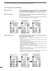
17 2 r plotter mode q coastline data manipulation Å 16 reduced scales ı ship-centering mode (2)-1 zooming in or out coastline images the coastline image on the screen can be zoomed in or out to 0.125/256 nm per dot to 4096/256 nm per dot ( / to ⁄5 ). See p. 30 for over zoom function. The zooming cen...
Page 22
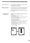
19 2 r plotter mode q coastline data manipulation (2)-4 measuring the distance and azimuth between two points Å measurement between the ship mark and the cursor position using the cross hair cursor permits you to measure the distance and azimuth between two points easily. The distance and azimuth th...
Page 23
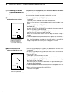
20 3 r plotter mode q route registration and edit (3)-1 registering and editing navigation routes you can register up to 20 navigation routes, each of which consists of up to 50 points. Q press the [menu] key. The main menu screen will appear. W select “plotter menu” using the [up] or [down] key and...
Page 25
22 3 r plotter mode q route registration and edit (3)-2 clearing a route the procedure of clearing a route is as follows. Q press the [menu] key. The main menu screen will appear. W select “plotter menu” using the [up] or [down] key and press the [set] key. The plotter menu screen will appear. E sel...
Page 26
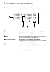
23 3 r plotter mode q route registration and edit (3)-3 character list z character list x spaces c cursor movement directions v end the character list appears on the route enter/edit screen during route no. Selection, and is used for comment entry. The character list is a list of characters used for...
Page 27
24 4 r plotter mode q mark manipulation (4)-1 registering marks Å registration of marks from the plotter menu screen navigational reference points, such as the destination point and turning points, can be indicated with marks. These marks will be helpful for desti- nation navigation and route naviga...
Page 28
25 4 r plotter mode q mark manipulation ı registration of the current ship position mark on the coastline screen to indicate the current ship position with a mark, proceed as follows. Q press the [mark] key. One of 12 marks will appear at the bottom of the screen. W select the desired mark using the...
Page 29
26 4 r plotter mode q mark manipulation (4)-2 clearing marks Å clearing marks on the coastline screen marks cannot be cleared during destination or route navigation. To clear registered marks separately, you must enter the coastline screen. To clear all registered mark at a time, you must enter the ...
Page 30
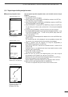
27 5 r plotter mode q route navigation setting (5)-1 setting route navigation route navigation means that the ship is navigated via a number of registered marks to the destination. Q make sure that the navigation route has already been registered ( ☞ p. 20) before commencing route navigation. Failur...
Page 31
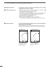
28 6 r plotter mode q destination navigation setting (6)-1 setting destination navigation Å setting destination navigation using existing registered marks destination navigation means that the ship is navigated from the current ship position to the specified destination (within one section only). De...
Page 32
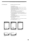
29 7 r plotter mode q track manipulation (7)-1 setting the track color (7)-2 changing the tracking interval there are seven user-selectable colors of the track. Set the track color as follows. Q press the [menu] key. The main menu screen will appear. W select “plotter menu” using the [up] or [down] ...
Page 33
30 7 r plotter mode q track manipulation to clear the track on the screen after navigation, proceed as follows. Note the following procedure loses any track data in the system. Make sure that deletion of track data will cause no problem before commencing the procedure. Q press the [menu] key. The ma...
Page 34
31 8 r plotter mode q data color setting (8)-1 setting colors of data on screen Å specifying the color of land ı specifying the color of sea data stored on a navionics ® electronic chart, including lights positions and depth contours, can be displayed selectively. The following explains how to speci...
Page 35
32 8 r plotter mode q data color setting Ç specifying the color of place- names Î specifying the color of depth contours ´ specifying the color of lights the color of place-names can be selected from among seven available colors. Q press the [menu] key. The main menu screen will appear. W select “sc...
Page 36
Ï specifying the color of map border ˝ specifying the display mode 33 8 r plotter mode q data color setting the color of map border can be selected from among seven available colors. Q press the [menu] key. The main menu screen will appear. W select “screen setting” using the [up] or [down] key and ...
Page 37
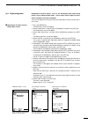
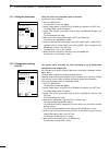
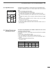
34 9 r plotter mode q positioning device (9) selection of positioning device there are two options in receiving the latitude and longitude data of the cur- rent ship position. Q press the [menu] key. The main menu screen will appear. W select “positioning menu” using the [up] or [down] key and press...
Page 38
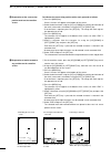
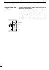
35 10 r plotter mode q correction of ship positioning error (10)-1 correcting a ship positioning error (10)-2 correction using the cross hair cursor (10)-3 correction with latitude/longitude entry if the current ship position on screen differs from that on the nautical chart in latitude and/or longi...
Page 39
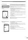
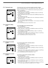
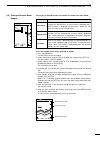
36 11 r plotter mode q averaging (11) averaging averaging is the process of averaging positioning data received by the sup- plied gps receiver for past several seconds so as to minimize meandering of the plotted track. This process makes the track smoother, but deteriorates the response of the scree...
Page 40
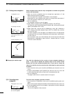
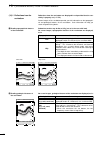
37 12 r plotter mode q dgps the dgps is a newly established system intended to improve the positioning precision of the gps. (optional rd-200 is needed to use the dgps). This chapter describes how to correct the positioning data using dgps data, select the beacon station, and set the baud rate. Usin...
Page 41
38 14 r plotter mode q dop as a positioning precision indicator to set the baud rate (transmission speed) of the beacon station, proceed as follows. Q press the [menu] key. The main menu screen will appear. W select “positioning menu” using the [up] or [down] key and press the [set] key. The positio...
Page 42
39 15 r plotter mode q alarm function (15)-1 available alarms as shown in the table below, there are three types of plotter-related alarms. The alarm zone can be set to a maximum of 9.99 nm (or 9.99 km or 9.99 ml) around the ship position in increments of 0.01 nm (or 0.01 km or 0.01 ml). The alarm z...
Page 43
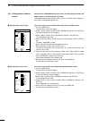
40 15 r plotter mode q alarm function (15)-2 setting the alarm zone to set the alarm zone, proceed as follows. Perform steps q to e when simply turning on or off the alarm function. Q press the [menu] key. The main menu screen will appear. W select “alarm menu” using the [up] or [down] key and press...
Page 44
41.
Page 45: Sounder Mode
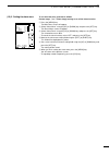
42 4 r sounder mode q table of contents !!!!!!!!!!!!!!!!!!!!!!!!!!!!!!!!!!!!!!!!!!!!!!!!!! Sounder mode !!!!!!!!!!!!!!!!!!!!!!!!!!!!!!!!!!!!!!!!!!!!!!!!!! (1) available screens and indications . . . . . . . . . . . . . . . . . . . . . . . . . . . . . . . . . . . . . . . . . . . . . . . . . . . . . ....
Page 46
43.
Page 47
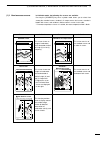
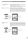
44 1 r sounder mode q available screens and indications in fishfinder mode, the following five screens are available. Pressing the [sounder] key once in plotter mode allows you to select from among the standard screen, standard + a scope screen, dual screen, standard + bottom lock screen, and standa...
Page 48
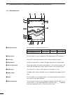
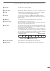
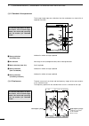
45 1 r sounder mode q available screens and indications (1)-1 standard screen this field shows the positioning device in use. This field shows the current ship position in latitude/longitude or time difference. In this field, a moving 30-second time mark is always indicated in yellow. The current sh...
Page 49
46 1 r sounder mode q available screens and indications ⁄0 ship speed ⁄1 operation mode ⁄2 bearing ⁄3 frequency ⁄4 [range] key ⁄5 sensitivity level bar ⁄6 color pattern ⁄7 plotter alarm indication ⁄8 fishfinder alarm this field shows the current ship speed. When the system operates in auto mode ( ☞ ...
Page 50
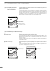
47 1 r sounder mode q available screens and indications l h ft 43.4 315 ° t 10.2kt 58 ° f gps 48 ° 21.417n 125 ° 26.643w low frequency image high frequency image (frequency specified on the sounder menu screen) 20 40 60 80 0 100 20 40 60 80 0 100 (1)-4 dual screen the dual screen consists of high an...
Page 51
48 1 r sounder mode q available screens and indications (1)-6 standard + marker zoom-in screen underwater area around this marker is zoomed in. This image covers the specified underwater area ( ☞ p. 55). This line represents the center of the marker zoom-in image and corresponds to the depth marker ...
Page 52
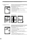
49 2 r sounder mode q selection of frequency (2) selection of frequency (3) stc; setting of immunity to air bubbles to select the sounder frequency between “high (h)” and “low (l)”, proceed as follows. (default; h) q press the [menu] key. The main menu screen will appear. W select “sounder menu” usi...
Page 53
50 4 r sounder mode q setting of display speed (4) setting of display speed (5) selection of background color the display speed can be adjusted to “1” thru “5” or “stop”. (default; 5) selecting a high display speed enlarges the image horizontally and will thus be helpful for analyzing the image. If ...
Page 54
51 6 r sounder mode q setting of interference rejection (6) setting of interference rejection the system has an interference rejection function that removes inductive interference derived by a generator on the ship or noise disturbance caused by a fishfinder of other ships. (default; on) to activate...
Page 55
52 8 r sounder mode q manual setting of sensitivity (8) manual setting of sensitivity to set the sensitivity to ultrasonic reflected from the sea bottom, proceed as follows. Q press the [gain] key. The level bar will appear on the screen and is indicating the current level. * the level bar is inoper...
Page 56
53 10 r sounder mode q setting of depth shift (10) setting of depth shift setting the depth shift allows you to specify a depth at which the upper edge of the screen image stands. To set the depth shift, proceed as follows. Q press the [range] key. “range” (“shift” or “auto”) will be indicated in th...
Page 57
54 12 r sounder mode q depth measurement (12) depth measurement (13) setting of zoom-in range on bottom lock screen the depth of the sea bottom or a shoal of fish can be measured precisely. The depth is indicated by a green line called the depth marker and a numerical value. To measure the depth, pr...
Page 58
55 14 r sounder mode q setting of marker zoom-in range the zoom-in range displayed on the standard + marker zoom-in screen can be selected from among four options. The zoom-in function provides zoom-in display around the variable range marker for detailed observation of underwater activity such as f...
Page 59
56 15 r sounder mode q setting of sounder alarm ranges to set the sounder alarm ranges, proceed as follows. Q press the [menu] key. The main menu screen will appear. W select “alarm menu” using the [up] or [down] key and press the [set] key. The alarm menu screen will appear. E select “depth (limit)...
Page 60
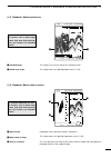
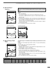
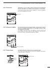
57 16 r sounder mode q how to read images (16)-1 reflections from the sea bottom Å reading topographical features of the sea bottom reflections from the sea bottom are displayed in red provided that the sen- sitivity is properly set ( ☞ p. 52). Screen images of the sea bottom provide you with inform...
Page 61
58 16 r sounder mode q how to read images (16)-2 reflection from a fish school Å reading the size of a fish school in general, reflections from a fish school form a light-colored downturn between the sea level and bottom on the screen. Information provided by the screen image of a fish school includ...
Page 62
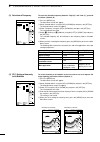
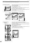
59 16 r sounder mode q how to read images (16)-3 secondary reflections from the sea bottom in shallow-depth areas, phantom contours of the sea bottom may often occur under the actual contour. These phantom contours of the sea bottom are caused by secondary reflections from the sea bottom (bounce of ...
Page 63
60 16 r sounder mode q how to read images (16)-6 influence of air bubbles if the ultrasonic beam passes through air bubbles, reflections from a shoal of fish or the sea bottom may deteriorate or be interrupted, resulting in voids occurring on the screen image. This symptom is apt to occur when a low...
Page 64: Combination Mode
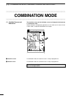
61 (1) r combination mode q available screens and indications !!!!!!!!!!!!!!!!!!!!!!!!!!!!!!!!!!!!!!!!!!!!!!!!!! Combination mode !!!!!!!!!!!!!!!!!!!!!!!!!!!!!!!!!!!!!!!!!!!!!!!!!! (1) available screens and indications the coastline screen and the fishfinder screen are displayed simultaneously in co...
Page 65
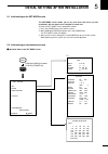
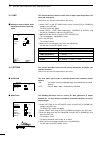
62 5 initial setting after installation 5-1 initial setting on the set mode screen the set mode screen allows you to set such items that, once set after installation, will not require to be changed in normal use. To enter the set mode screen, proceed as follows. Q press the [power] key to turn off t...
Page 68
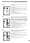
65 5 initial setting after installation this item allows you to make a selection between two options on graphic indication on the navigation monitor screen: • nor: normal indication • revs: reverse indication this item allows you to make a selection between two options on time indi- cation on the na...
Page 69
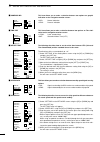
66 5 initial setting after installation this item allows you to make a selection between two versions of external nmea0183 supported by the system: • v1.5: version 1.5 • v2.2: version 2.2 this item allows you to make a selection between two reference points of the azimuth to the destination or next ...
Page 70
67 5 initial setting after installation 5-5 range selection this section describes how to register your most-used depth ranges among 31 depth ranges. Q select “range selection” on the set mode screen using the [up] or [down] key and press the [set] key. The depth range selection screen will appear. ...
Page 71: Installation Procedure
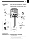
68 6 installation procedure 6-1 overall connection diagram install the system properly according to the instruction of this manual to ensure optimum performance and stable operation of the system prior to commencing installation work, make sure that the system package comes complete with the accesso...
Page 72
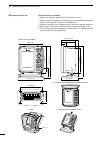
69 6 installation procedure 186 mm; 7 6 ⁄ 16 ″ 37.5 mm;1 15 ⁄ 32 ″ 103 mm;4 ″ 125.65 mm;4 15 ⁄ 16 ″ 196 mm; 7 23 ⁄ 32 ″ 125 mm;4 29 ⁄ 32 ″ 203 mm;8 ″ 75 mm; 31 ⁄ 32 ″ 234.5 mm;9 7 ⁄ 32 ″ 178 mm;7 ″ 234.5 mm;9 7 ⁄ 32 ″ 160 mm;6 5 ⁄ 16 ″ 91 mm;3 19 ⁄ 32 ″ tilting lever tilting removing the unit from t...
Page 73
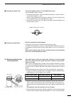
70 6 installation procedure this system operates from an 11 to 30 vdc power source. Connect the power cable as follows. Q connect the connectorless end of the cable to the battery as shown in the over- all connection diagram ( ☞ p. 68). * exercise care to avoid reverse connection in polarity. Revers...
Page 74
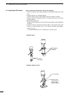
71 6 installation procedure 6-4 installing the gps antenna when installing the gps antenna, observe the following. Q install the antenna at the top of the highest and obstacle-free position of the ship. W install the antenna in a horizontal position. Install the antenna with a extention pipe and the...
Page 75
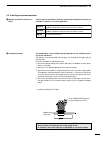
72 6 installation procedure 6-5 installing an optional transducer various types of transducers and ship speed/water temperature sensors are available as options to suit your application. The performance of the fishfinder greatly depends on the installation posi- tion of the transducer. Transducers a...
Page 76
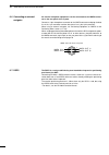
73 6 installation procedure 6-6 connecting an external navigator 6-7 dgps an external navigation equipments can be connected to the nmea connec- tor on the rear panel of the system. Connect a 4-pin microphone connector to the nmea connector and plug the data line in the 1-pin connector and the data ...
Page 77: Maintenance
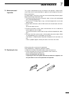
74 7 maintenance 7-1 maintenance and inspection 7-2 replacing the fuse this system is designed to be easy to maintain for the operator. Proper mainte- nance allows to the system to be kept in a optimum state and prevents the possi- bility of malfunctions. As a high voltage is used in the system, be ...
Page 78: Specifications
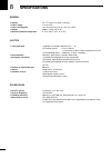
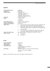
75 8 specifications general ¡ display : 5.6 ″ tft color lcd (320 × 234 dots) ¡ power supply : 11 to 33 vdc ¡ power consumption : less than 22 w (less than 1.8 a at 12 vdc) ¡ weight : approx. 2.2 kg; 4 lb 14 oz ¡ operating ambient temperature : 0 °c to +50°c, +32°f to +122°f plotter ¡ track indicatio...
Page 79
76 8 specifications sounder ¡ transmission frequency : 50/200 khz ¡ output power : 500 w (rms) ¡ available screens : (1) standard screen (2) standard + a scope screen (3) two-frequency screen (4) standard + bottom rock screen (5) standard + marker zoom-in screen ¡ image feed : 6 stages including hal...
Page 80
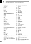
77 9 datum (geodetic reference) code ■ datum (geodetic reference) table 0 : wgs 84—default 1 : ethiopia, sudan 2 : burkina faso 3 : cameroon 4 : ethiopia 5 : mali 6 : senegal 7 : sudan 8 : somalia 9 : bahrain 10 : saudi arabia 11 : cocas islands 12 : antigua 13 : botswana, lesotho, malawi, swaziland...
Page 81
78 9 datum (geodetic reference) table 109 : alaska 110 : bahamas (except san salvador island) 111 : bahamas (san salvador island) 112 : canada (alberta, british, columbia) 113 : canada (manitoba, ontario) 114 : canada (new brunswick, newfoundland, nova scotia, quebec) 115 : canada (northwest territo...
Page 82
79.
Page 83
80
Page 84
6-9-16 kamihigashi, hirano-ku, osaka 547-0002, japan a-5595g-1ex- q printed in japan © 1999 icom inc..


