- DL manuals
- Locosys
- Car Navigation system
- BGT-11
- Owner's Manual
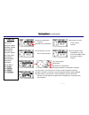
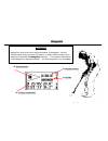
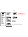
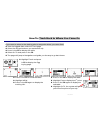
Locosys BGT-11 Owner's Manual - Page System Tree
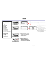
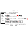
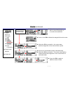
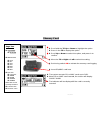
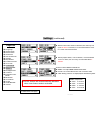
Page System Tree
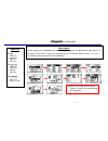
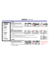
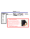
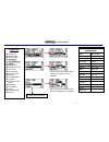
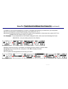
(continued)
Memory Card
Alert
MISC
NAVI Link
Route
Settings
z
Calendar
z
Buzzer
On/Off
z
Over Speed Alert
On/Off
Speed Settings
30-150KMH
z
Altitude Alert
On/Off
Altitude Setting
Above/Below
z
Target Alert
On/Off
Waypoint type
Distance
10m-1KM
z
NAVI LINK
Down/Upload
the data saved
on the built-in
flash memory,
including
waypoints,
routes, and
tracked log
z
Log Switch
On/Off
z
NMEA Items
z
GGA
z
GLL
z
GSA
z
GSV
z
RMC
z
VTG
z
ZDA
z
File Size
z
Card Size
z
128KB
z
512KB
z
1024KB
z
2048KB
When Card is
inserted
z
Format Card
z
Remove Card
z
List
z
New Route
z
Area Calculation
z
Go To
z
Edit
z
Delete
z
Copy
z
Reverse
z
Rename
z
All
Delete
z
Edit
z
Yes or No
z
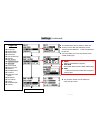
Language
z
Time Format
z
Date Format
z
Time Zone
z
Unit of Measure
z
Arrived
z
Map Datum
z
Position Format
z
User Grid
z
Power Mode
z
DGPS Source
z
Interface
z
Backlight Time
z
Contrast
z
External Power
Mode
z
User Name
z
Usage
z
Serial Number
z
Version
GT-11/BGT-11 Owner’s Manual Version 1.0
12
Summary of BGT-11
Page 1
G g t t - - 1 1 1 1 / / b b g g t t - - 1 1 1 1 the multifunctional gps handheld navigator and data logger © locosys technology inc. All rights res.
Page 2
Welcome congratulations for choosing gt-11/bgt-11 ! We hope you will agree it is an excellent navigator. We want you to have a very pleasant outdoor experience with gt-11/bgt-11 so please check the content in the package first. If you find any parts missing, please contact your locosys authorized de...
Page 3: From The Editor
From the editor one of my japanese friends once told me: “i can manage our language, which has hundreds of different characters; but i just can’t manage a language that has only 26 characters or letters.” “yes, indeed,” i answered, “there are thousands of different characters in my native language, ...
Page 4: Warning and Cautions
Warning and cautions taking your eyes off the road can cause accidents and serious damage or personal injury. Do not change any settings on gt-11/bgt-11 while driving or riding. Come to a complete stop or have your passenger make any changes. Do not secure gt-11/bgt-11 over airbag panels or in a pla...
Page 5: Table of Contents
Welcome from the editor warnings and cautions table of contents introduction to gt-11/bgt-11 controls power/esc button thumb stick operation fast mark before getting started status indicators introduction to the pages page system tree main menu satellite signal trip meter navigation track position m...
Page 6: Introduction to Gt-11/bgt-11
Introduction to gt-11/bgt-11 the gt-11/bgt-11 is a wonderfully compact, business card sized navigator, carefully designed to embody ergonomic principles. It will comfortably fit in the palm of your hand, mount on the handlebar of bike or motorcycle, and can even be worn on your wrist or arm. The sty...
Page 7: Introduction to Gt-11/bgt-11
Z power/esc button z thumb stick z led z internal buzzer z strap hole z mounting screw holes bottom z usb slot front back z built-in antenna z built-in rechargeable battery introduction to gt-11/bgt-11 (continued) z waterproof compartment z sd/mmc card slot z lcd gt-11/bgt-11 owner’s manual version ...
Page 8: Controls
Controls thumb stick (ts) operation z it’s a 5-way directional controller. Z move the ts up, down, left, or right to highlight the option. Z press in the ts to confirm, or execute the option. Z press power/esc button to escape the current page. Press in power/esc button z press this button and hold ...
Page 9: Before Getting Started
. Gt-11/bgt-11 owner’s manual version 1.0 9 5) mark and edit waypoints, and create a route (refer to mark, waypoint, and route pages for details) gt-11/bgt-11 can now tell you: z where you are z where you have been z where you are going z how did you made up your trip, and z many other interesting p...
Page 10: Status Indicators
Status indicators gt-11/bgt-11 owner’s manual version 1.0 10 z positioning indicators: positioning with 3d fixed positioning with 2d fixed acquiring signal bluetooth is working * z buzzer function indicator: enabled disabled z scroll bar z battery indicator z external power and other indicators: ext...
Page 11: Page System Tree
Page system tree z sat signal z sky view z fixed info satellite signal trip meter z time now z stop watch z trip max speed z trip avg speed z trip time z trip odometer z odometer z total time navigation z speed z avg speed z max speed z heading z bearing z odo meter z time pass z altitude z departur...
Page 12: Page System Tree
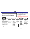
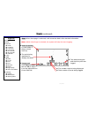
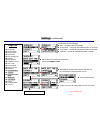
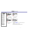
Page system tree (continued) memory card alert misc navi link route settings z calendar z buzzer on/off z over speed alert on/off speed settings 30-150kmh z altitude alert on/off altitude setting above/below z target alert on/off waypoint type distance 10m-1km z navi link down/upload the data saved ...
Page 13: Main Menu
Main menu z waypoints z routes z memory card z alert z navi link z settings z misc page tree z satellite signal z trip meter z navigation z track z position mark satellite signal and fixed info provides the information on your movement navigating along your routes the current and historical directio...
Page 14: Satellite Signal
Satellite signal there are three pages providing the detailed information related to gps signals. Page tree z sat signal z sky view z fixed info gps signal z satellite signal strength bars. The longer bar, the stronger the gps signal z the id of the gps being seen sky view z satellite position. The ...
Page 15: Trip Meter
Status indicators z 2d or 3d fixed z buzzer sound alert z sd/mmc card z external power z battery status the trip meter pages provide current speed, trip timer, average speed, odo meter, and more. All the meter pages have a similar format as follows: z page title z current speed z current time z trip...
Page 16: Trip Meter
Z average speed during the trip - derived from trip odom and trip time z press in the ts to pause, zero, or count z maximum speed during the trip since last trip reset all the meters can be reset. Trip meter (continued) z trip odo z total odo z total time speed z trip avg speed z trip time watch z t...
Page 17: Navigation
Navigation the navigation pages provide the direction you are moving, current time, speed, altitude, and other trip computer information. Page tree compass distance to next waypoint waypoint type current speed page title navigation features will be activated only when a route or waypoint has been se...
Page 18: Navigation
Navigation (continued) page tree z speed z avg speed z max speed z heading z bearing z odo meter z time pass z altitude z departure z arrival z status z to next z to dst z time now z sunrise z sunset z the current speed z the direction of your destination z accumulated mileage z the average speed of...
Page 19: Navigation
Navigation (continued) page tree z speed z name of destination waypoint z distance to destination z the time sun rises at the current location z avg speed z max speed z heading z bearing z the time the sun sets at the current location z odo meter z time pass z altitude z departure z arrival z status...
Page 20: Track
Track z the track data is logged on the built-in flash memory of gt-11/bgt-11 . Track pages provide two types of movement information: z up to 8192 points can be logged z the active movement of the trip (egg laying page) z to log the track data, you first need to set the interval. Z the historical m...
Page 21: Track (Egg Laying)
Track (egg laying) z north pointer z scale the scale can be adjusted by scrolling the ts up or down, from 15m to 260km z track points page tree z egg laying z mark z interval z clear z detail z view z ettings s z stop z compact z 1 second z 5 seconds z 10 seconds z 30 seconds z 1 minute z mark z go ...
Page 22: Track
Track (continued) page tree z egg laying z mark z interval z clear z view z settings z stop z compact z 1 second z 5 seconds z 10 seconds z 30 seconds z 1 minute z speed z wpt name z wpt symbol z while the ts is pressed in, the current location will be marked as a waypoint. Z refer to position mark ...
Page 23: Track
Track (continued) z speed z wpt name z wpt symbol z north up pointer in view mode, it always shows north up. Z the point being requested to display the detail. Z the date/month/year and time the point was logged. Z the number of point being displayed z total number of points being logged page tree v...
Page 24: Track
Track (continued) z pressing in the ts will mark the track point you have selected. The marked point will be automatically assigned a numerical waypoint name. You may edit it with new name and new type. Page tree z egg laying z mark z interval z clear z view z settings z stop z compact z 1 second z ...
Page 25: Track
Track (continued) page tree z pressing in the ts, the page will show number of the track point, altitude, heading, speed, and the coordinates of the point being selected. Z egg laying z mark z interval z pressing in the ts, the page will jump to the egg laying page and resume the track logging. Z th...
Page 26: Position Mark
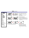
Position mark description you may mark the current location as a waypoint and then edit it for future reference. The same page may be accessible from track and route pages. Z pressing in the ts, the page will show the detail of current location, and automatically generate a waypoint name in numerica...
Page 27: Waypoint
Waypoint description waypoint is one of the most import elements of navigation. You will need to either mark a position of interest, or edit a known location as a waypoint to activate the navigation function. The location information in the waypoint is described below. All of the waypoints can be ed...
Page 28: Waypoint
Waypoint (continued) description page tree z when the waypoint has been used in a route, you can’t delete the waypoint. All the waypoints in database can be displayed by name in alphabetical order (list) or by types (type list). Then you may select go to, delete, edit or copy. Or, you can delete all...
Page 29: Waypoint
Waypoint (continued) go to page tree z list z type list z delete all z go to z delete z edit z copy z go to z delete z edit z copy z in use z yes or no select the waypoint to navigate z highlight the waypoint you want to navigate to. Z press in the ts, the page will jump to navigation page automatic...
Page 30: Waypoint
Waypoint (continued) page tree z list all z by type z delete all z go to z delete z edit z copy z go to z delete z edit z copy z in use z yes or no copy you can copy the waypoint in the database for future use. Z waypoint 001 has been copied always carry a first aid kit there are many bad things tha...
Page 31: Route
Route page tree z when selected, the page will display all the routes in the database, and, z list z the total number of waypoints in each route. Z go to z a total of 20 routes can be created. Z edit z new route z delete all z delete z copy z reverse z rename z area calculation z edit z when selecte...
Page 32: Route
Route (continued) z scroll with the ts to highlight the route and press in. The page will show related features for this route. Page tree z list z go to z press in the ts, the page will jump to navigation and navigate to the first waypoint in that route. Z edit when gt-11/bgt-11 is navigating, you c...
Page 33: Route
Route (continued) z select the waypoint you wish to insert and press in to confirm the selection. Z reverse is functioned similar to backtracking. Z when the ts is pressed in, the route name will be copied and all the waypoints in this route will be in reversed order. Page tree z list all z new rout...
Page 34: Memory Card
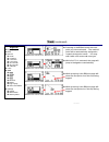
Memory card page tree z scroll with the ts up or down to highlight the option z log switch z press in the ts to display the option z nmea items z file size when the card is correctly inserted z format card z remove card z card size z 128kb z 512kb z 1024kb z 2048kb z gga z gll z gsa z gsv z rmc z vt...
Page 35: Memory Card
Memory card (continued) page tree z log switch z nmea items z file size when the card is correctly inserted z format card z remove card z card size z 128kb z 512kb z 1024kb z 2048kb z gga z gll z gsa z gsv z rmc z vtg z zda z on or off z marked items are being activated. Nmea-0183 sentences: gga: gl...
Page 36: Memory Card
Memory card (continued) page tree z log switch z nmea items z file size when the card is correctly inserted z format card z remove card z on or off z gga z gll z gsa z gsv z rmc z vtg z zda z card size z 128kb z 512kb z 1024kb z 2048kb z select proper size to log the track data. Z file sizes can be ...
Page 37: Alert
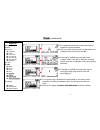
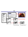
Z select to turn on the audio alert. Z led will be on automatically when anyone of the alerts is activated. Z select the speed or disable (off) the over speed alert. Alert description page tree gt-11/bgt-11 generates audio and visual signals through a buzzer and led. These signals can be used to pro...
Page 38: Alert
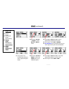
Alert (continued) z move the ts left or right to select below or above alerts z scroll up or down the ts to select approaching altitude for the alert z the range is from 0m to 15240m. Z gt-11/bgt-11 will automatically alert you when approaching the selected altitude. Page tree z buzzer on/off z over...
Page 39: Navi Link
Navi link navi link feature is to provide the connection between the unit and the host pc/notebook to download or upload the data. Z download data includes: way points, routes, and track points stored on the built-in flash memory. Z upload data includes: way points and routes z before downloading or...
Page 40: Settings
Three formats may be selected z date-month-year z month-date-year, or z year-month-date z select the time zone you are in. 25 cities or states are included in the table. Z if you can’t find the time zone you need in the table, select others and set the time difference. Z the selected option is shown...
Page 41: Settings
Metric (meter) or imperial (feet) measuring systems can be selected settings (continued) time zone in database gmt new delhi alaska day rome alaska std sydney alt std taipei ast day tokyo azores us ctz baku us esz bangkok us mt2 brazilia us pt2 dhakar wellington eniwetok *others hawaii hong kong isr...
Page 42: Settings
Settings (continued) z the default map datum setting is wgs-84. Page tree z there are over 180 map data that can be selected in the database. Refer to appendix 1 for the list. Z language z time format z date format z you may define your own map datum in the user grid page. Z time zone z unit of meas...
Page 43: Settings
Settings (continued) z when proper sbas, such as waas, or serial dgps source is fed in, the accuracy can be better than 3 meters . Z when low power mode is selected, the unit may run up to 32 hours . However, it is recommended to use it in a clear view environment. Continued to next page page tree z...
Page 44: Settings
Settings (continued) set the timer for the backlight. Z off – backlight will not illuminate. Page tree z 10 seconds – turned off automatically after 10 seconds. Z language z 30 seconds – turned off automatically after 30 seconds. Z time format z 1 minute – turned off automatically after 1 minute. Z ...
Page 45: Settings
Settings (continued) page tree z language z time format z date format z time zone z unit of measure z the usage status of route and waypoint. Z the series number of this product. Z arrived z map datum z position format z user grid z power mode z dgps source z interface z backlight time z contrast z ...
Page 46: Miscellanies
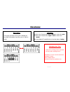
Miscellanies description operation z move the thumb stick up or down to select the year z move the thumb stick right or left to select the month this page provides a 120-year calendar for the date information from the year of 1940 to 2060 z press in the thumb stick to show the date of today managing...
Page 47
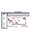
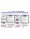
How to: track back to where you came on if you want to return to the starting point or waypoint where you came from: z view the logged data under the track page z select the first point where you started the trip z press in the ts to display the table z select go to and press in the ts z the page wi...
Page 48
How to: track back to where you came on (continued) in addition to using saved waypoints or routes to navigate back where you came from, you may either z search the waypoint under waypoint page, then select go to, or z execute the reverse function to reverse the order of the waypoints in that route,...
Page 49
How to: calculate the area (area calculation) area calculation is a useful feature when you wish to measure an area. There are two pages route or track in which you may have the access to this feature: route page it calculates the area based on the waypoints in a route. Z press in the ts to display ...
Page 50
How to: download and upload data the data stored on internal memory (the flash memory in the unit), including the routes, waypoints, logged tracking data, can be downloaded to a pc or notebook for post analysis or for other applications. The routes and waypoints edited on pc or notebook can also be ...
Page 51
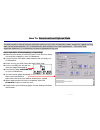
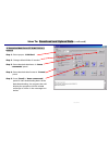
How to: download and upload data (continued) to download data from gt-11/bgt-11 to a host pc step 1: select proper “com port” step 2: change default folder if needed step 3: select desired data items in “items commands” panel step 4: select desired data format in “format” panel step 5: press [read] ...
Page 52
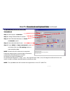
How to: download and upload data (continued) to ppload data from a host pc to the gt-11/bgt-11 step 1: select proper “com port” step 2: change default folder if needed step 3: select desired data items in “items commands” panel step 4: select desired data format step 5: press [write] in “items comma...
Page 53
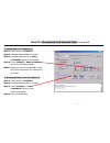
How to: download and upload data (continued) to delete data in gt-11/bgt-11 step 1: select proper “com port” step 2: change default folder if needed step 3: select the data items in “items commands” panel to be deleted step 4: press [delete] in “items commands” panel to start deleting data note: way...
Page 54
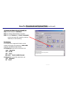
How to: download and upload data (continued) to restore all data in the gt-11/bgt-11 step 1: select proper “com port” step 2: change default folder if needed. Step 3: press [restore] in “clone commands” panel and select file (usually a backup data file) to start restoring file naming file names are ...
Page 55: How To: Update The Firmware
How to: update the firmware from time to time, there will be upgraded new firmware available for download at our web site. You may follow the steps described below to update your gt-11/bgt-11 . Z make sure that the driver of usb-to-serial comm port has been installed on your pc/notebook. Z connect t...
Page 56
Appendix 1 map datum list gt-11/bgt-11 owner’s manual version 1.0 56 no abbrev description 1 adinda adindan-mean for ethiopia, sudan 2 adindb adindan-burkina faso 3 adindc adindan-cameroon 4 adindd adindan-ethiopia 5 adinde adindan-mali 6 adindf adindan-senegal 7 adindg adindan-sudan 8 afgy afgooye-...
Page 57
24 asc45 astro beacon e 1945-iwo jima 25 asthi astro dos 71/4-st helena island 26 ast61 astro tern island (frig) 1961 tern island 27 ast52 astronomical station 1952 marcus island 28 aust66 australian geodetic 1966 australia & tasmania 29 aust84 australian geodetic 1984 australia & tasmania 30 ayabe ...
Page 58
50 eur-a european 1950 mean for austria, denmark, france, west germany, netherlands, switzerland 51 eur-b european 1950 mean for iraq, israel, jordan, lebanon, kuwait, saudi arabia, syria 52 eur-c european 1950 - cyprus 53 eur-d european 1950 - egypt 54 eur-e european 1950 england, channel islands, ...
Page 59
77 ind75 indian 1975 - thailand 78 ire65 ireland 1965 - ireland 79 ists68 ists 061 astro 1968 south georgia islands 80 ists69 ists 073 astro 1969 - diego garcia 81 ji61 johnston island 1961 - johnston island 82 kanda kandawala - sri lanka 83 krg49 kerguelen island 1949 kerguelen island 84 kert48 ker...
Page 60
103 nad27a north american 1927 mean for antigua, barbados, barbuda, caicos islands, cuba, dominican republic, grand cayman, jamaica, turks islands 104 nad27b north american 1927 mean for belize, costa rica, el salvador, guatemala, honduras, nicaragua 105 nad27c north american 1927 mean for canada 10...
Page 61
128 maui old hawaiian maui 129 oahu old hawaiian oahu 130 oman oman - oman 131 os36 ord. Survey great britain 1936 mean for england, isle of man, scotland, shetland islands, wales 132 os36b ord. Survey great britain 1936 - england 133 os36c ord. Survey great britain 1936 england, isle of man, wales ...
Page 62
154 reuni reunion - mascarene islands 155 rome40 rome 1940 - italy (sardinia) 156 santo65 santo (dos) 1965 espirito santo island 157 saobrz sao braz azores (sao miguel, santa maria islands) 158 sappr sapper hill 1943 - east falkland island 159 schwa schwarzeck – namibia 160 selva selvagem grande - s...
Page 63
180 tkykr tokyo - korea 181 tkyok tokyo - okinawa 182 trst68 tristan astro 1968 - tristan da cunha 183 vitil6 viti levu 1916 fiji (viti levu island) 184 wake60 wake - eniwetok 1960 - marshall islands 185 wake52 wake island astro 1952 - wake atoll 186 wgs72 wgs 1972 - global definition 187 wgs84 wgs ...
Page 64: Warranty And Repair
Warranty and repair warranty locosys technology inc. Warrants this product to be free from defect in material and workmanship for 12 months from the date of purchase. This warranty does not cover the damage due to the shipping of the product, external causes, including accident, abuse, misuse, probl...
Page 65: Warranty And Repair
Warranty and repair repapir locosys technology inc. Will repair the defective products covered under this limited warranty, if they are returned to locosys technology inc. If the product does prove defective, it will be repaired at no charge during the warranty period and at normal repair charge rat...
Page 66
Federal communications commission (fcc) statement 15.21 you are cautioned that changes or modifications not expressly approved by the part responsible for compliance could void the user’s authority to operate the equipment. 15.105(b) this equipment has been tested and found to comply with the limits...
Page 67
Federal communications commission (fcc) statement operation is subject to the following two conditions: 1) this device may not cause interference and 2) this device must accept any interference, including interference that may cause undesired operation of the device. Fcc rf radiation exposure statem...
Page 68
Authorized dealer revision history part number revision date note 1.00 2006/02/10 document number: gt-11/bgt-11 owner’s manual version 1.0 68 © locosys technology inc. All rights reservedd..


