- DL manuals
- Magellan
- GPS
- RoadMate 860T
- Reference Manual
Magellan RoadMate 860T Reference Manual
Summary of RoadMate 860T
Page 1
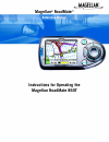
Magellan ® roadmate ™ reference manual instructions for operating the magellan roadmate 860t.
Page 2: Important Safety Warnings
(1) the magellan roadmate 860t is a vehicle-navigation aid designed to assist you in arriving at your selected destinations. When using the magellan roadmate, these safety rules must be followed to prevent accidents that can result in injury or death to yourself or others: • california law prohibits...
Page 3
(2) about the ac adapter • do not use the adapter in a high moisture environment. Never touch the adapter when your hands or feet are wet. • allow adequate ventilation around the adapter when using it to operate the device or charging the battery. Do not cover the ac adapter with paper or other obje...
Page 4
(3) instruction to the user this equipment has been tested and found to comply with the limits for a class b digital device, pursuant to part 15 of the fcc rules. These limits are designed to provide reasonable protection against harmful interference in a residential installation. This equipment gen...
Page 5: Table of Contents
Table of contents i magellan® roadmate™ ............................................................................................................................... (1) instructions for operating the magellan roadmate 860t .............................................................................
Page 6: Table of Contents
Table of contents ii numerical characters (“123” button) .......................................................................................................................................... 15 what is quickspell? ....................................................................................
Page 7: Table of Contents
Table of contents iii voice options ............................................................................................................................................................................ 63 menu colors ...............................................................................
Page 8: Table of Contents
Table of contents iv rename .................................................................................................................................................................................... 85 play mode .................................................................................
Page 9: Contact Information
(4) contact information if you need support for your magellan roadmate and you wish to contact thales, please use the following information to direct your questions/comments to the proper person. 1.1 technical support if you need technical assistance or “how-to” help, or if you have a technical ques...
Page 10: Chapter 1: Information
1 chapter 1: information 1.1 about satellite navigation global satellite navigation is an exciting technology, providing enhanced productivity and accuracy in a vast number of industries. It adds a new level of enjoyment and safety to a wide range of navigation, sports, and recreational activities. ...
Page 11: Chapter 1: Information
Chapter 1: information 2 1.3 a word on the safe usage of gps maps just like paper maps, maps on gps devices vary greatly in terms of information included and visual presentation. Whether topographical maps, roadmaps or marine charts, each map and the data it presents is designed for a specific purpo...
Page 12: Chapter 1: Information
Chapter 1: information 3 1.6 gps maps and your safety remember, your gps device is an aid to navigation. It must be used with common sense, and it is important that users interpret gps map data with a critical eye. Landscapes and roads change or may be impassable, trees and tall buildings can obscur...
Page 13: Chapter 2: Magellan Roadmate
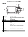
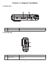
4 chapter 2: magellan roadmate 2.1 front view 1 suspend button press to enable “sleep” mode. 2 zoom in button while viewing the map, press to zoom in on the center of the display. The zoom in button can also be used with long lists to scroll one page at a time. 3 menu button press to view main menu....
Page 14: Chapter 2: Magellan Roadmate
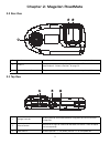
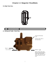
Chapter 2: magellan roadmate 5 2.2 rear view 2.3 top view 1 speaker used for audible maneuvering instructions and music playback. 2 antenna rotate up when in use to receive signals from the gps satellite network. See chapter 4 “antenna position” on page 13. 3 external antenna connection plug in an e...
Page 15: Chapter 2: Magellan Roadmate
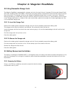
Chapter 2: magellan roadmate 6 2.4 bottom view 2.5 left side view 1 16-pin connection used for future expansion. 2 external power connection plug in the ac adapter or the 12 volt vehicle power adapter. 1 stereo headphone connection used to connect the stereo headphones. 2 usb connection plug the mag...
Page 16: Chapter 2: Magellan Roadmate
Chapter 2: magellan roadmate 7 2.6 right side view 2.7 enhanced cradle - back view 1 battery compartment cover rechargeable battery. External gps antenna input (external gps antenna sold separately) audio out (note: there are two audio out jacks, one on the receiver and one on the enhanced cradle. B...
Page 17: Chapter 2: Magellan Roadmate
Chapter 2: magellan roadmate 8 2.8 using removable storage cards the magellan roadmate is equipped with a storage card slot at the top of the unit (see page 5) that accepts secure digital (sd) cards and multimedia cards (mmc). These cards are used to backup navigation data and to transfer image file...
Page 18: Chapter 2: Magellan Roadmate
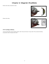
Chapter 2: magellan roadmate 9 remove the battery compartment cover. Remove the battery. 2.9.2 installing the battery insert the new battery with the battery diagram label side up and the pins facing inward. Then, replace the battery compartment cover and replace the screw..
Page 19
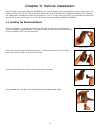
10 chapter 3: vehicle installation take care when mounting the magellan roadmate in your vehicle, whether using the windshield mount or other mount, that it does not obstruct the driver’s view of the road. Make sure that the placement of the magellan roadmate and cable does not interfere with the op...
Page 20
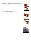
Chapter 3: vehicle installation 11 plug the data cable (tmc connector) from the traffickit module into the enhanced cradle connect the antenna cable to the traffickit module. Connect the power in cable from the traffickit module to the cigarette lighter adapter cable. Press the windshield mount to t...
Page 21
Chapter 3: vehicle installation 12 plug the cigarette lighter adapter into a 12vdc receptacle in the vehicle. Using the suction cups at the end of the fm antenna, stretch out the fm antenna and attach it to the windshield. Route the cabling and the traffickit module so that it is secure and out of t...
Page 22: Chapter 4: Antenna Position
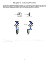
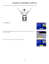
13 chapter 4: antenna position the antenna on the magellan roadmate 860t is designed in such a way as to receive the satellite signal at the front face of the antenna. It is important to angle the antenna so that the front face is mostly toward the sky. Ideally in most vehicles, the antenna should b...
Page 23
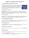
14 chapter 5: navigation basic operation 5.1 turning the magellan roadmate on out of the box slide the reset switch, located at the top of the unit (see “top view” on page 5) to position “1”. If power is connected properly or if the battery is charged sufficiently, the magellan screen will appear fo...
Page 24
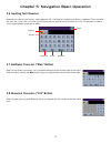
Chapter 5: navigation basic operation 15 5.6 inputting text characters whenever you need to input names, street addresses, etc., the magellan roadmate will display a keyboard. Touch the letter you want and, if you make a mistake, use the backspace key to go back one character at a time. The spacebar...
Page 25
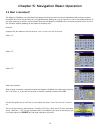
Chapter 5: navigation basic operation 16 5.9 what is quickspell? The magellan roadmate uses quickspell technology to provide you with the fastest method possible to enter characters. Quickspell eliminates the possibility of a misspelled word or looking for a city or street that is not in the loaded ...
Page 26
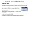
Chapter 5: navigation basic operation 17 5.10 multi-word indexing the magellan roadmate employs a search feature known as “multi-word indexing”. This feature enables you to search the database for possible matches based on the characters entered. The matches returned will start with the characters e...
Page 27: Chapter 6: Traveling
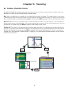
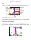
18 chapter 6: traveling 6.1 guidance information screens the magellan roadmate has three screens you can use to assist you in traveling to your destination: the map screen, the maneuver list screen, and the trueview 3d/split trueview screen. Map : when a new destination is selected and calculated, t...
Page 28: Chapter 6: Traveling
Chapter 6: traveling 19 6.2 map screen the map screen is the most commonly used screen in the magellan roadmate and provides you with detailed information about where you are and where you are going. † by touching the poi icon on the screen, you can get information and route to it. As you travel, th...
Page 29: Chapter 6: Traveling
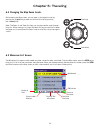
Chapter 6: traveling 20 6.4 changing the map zoom levels while viewing the map screen, you can zoom in (enlarge the map) by pressing the + (plus) key or zoom out (shrink the map) by pressing the - (minus) key. Note: the zoom in and zoom out keys can also be used the scroll through long lists. While ...
Page 30: Chapter 6: Traveling
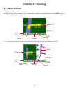
Chapter 6: traveling 21 6.6 trueview 3d screen the magellan roadmate uses trueview 3d technology to display a three-dimensional picture of the next maneuver. The trueview 3d screen can be viewed only after a route has been calculated. From the map screen, press the view key twice to view the truevie...
Page 31: Chapter 6: Traveling
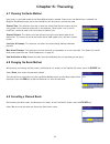
Chapter 6: traveling 22 6.7 choosing the route method every route is calculated based on the route method criteria selected. Every time a new destination is selected, the magellan roadmate prompts you for the method that will be used to calculate the route. Shortest time : this selection calculates ...
Page 32: Chapter 6: Traveling
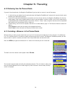
Chapter 6: traveling 23 6.10 detouring from the planned route if you exit the planned route, the magellan roadmate will get you back on course in one of three ways. 1. If, while driving, you detour from the planned route, the magellan roadmate will automatically recalculate the route based on your n...
Page 33: Chapter 6: Traveling
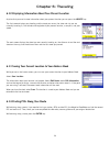
Chapter 6: traveling 24 6.12 displaying information about your present location anytime that you want to view information about your present location you can press the locate key. The first screen displays your heading and the street you are on, the state and city you are currently traveling in, the...
Page 34: Chapter 6: Traveling
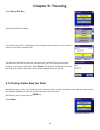
Chapter 6: traveling 25 select dining, atm, gas... . Select the desired poi category. A list of the nearest poi’s is displayed. Use the navigation key to scroll the list up or down (if necessary) and select the desired poi. The magellan roadmate will calculate a new route to the selected poi from yo...
Page 35: Chapter 6: Traveling
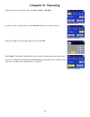
Chapter 6: traveling 26 select the distance of the detour. Select 3 miles , 5 miles , or 10 miles . Or, you can enter a custom distance. Select custom and select the custom distance. Enter the number of miles for your detour and then select ok . Select route . The magellan roadmate will recalculate ...
Page 36
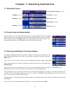
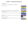
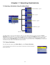
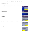
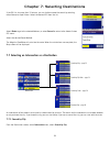
27 chapter 7: selecting destinations 7.1 destination screen 7.2 country selection (globe button) country selection is used to help speed up searching by narrowing down the database. Before entering a destination, make sure you select the country where your destination is located. To select the count...
Page 37
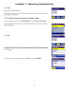
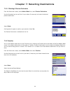
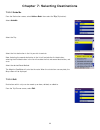
Chapter 7: selecting destinations 28 now, when you press the home button, you will be prompted to either route to or change the home address. 7.4 selecting a destination using select address a destination can be created by entering the street address that you want to go to. This address is not autom...
Page 38
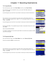
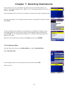
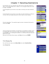
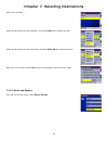
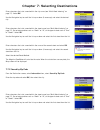
Chapter 7: selecting destinations 29 7.4.1 search by city from the destination screen, select select address and then, select search by city . Enter characters that start a word within the city name (see “multi-word indexing” on page 17). Select ok . Use the navigation key to scroll the list up or d...
Page 39
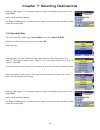
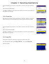
Chapter 7: selecting destinations 30 enter the street address. The acceptable range of numbers is displayed at the top of the screen. Select done . Select the desired route method. The magellan roadmate will calculate the route. When the calculations are complete, the map screen will be displayed. 7...
Page 40
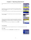
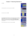
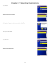
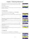
Chapter 7: selecting destinations 31 7.4.4 previous city from the destination screen, select select address then, select previous city . Select the city from the list. Enter characters that start a word within the street name (see “multi-word indexing” on page 17). Do not enter prefixes such as “nor...
Page 41
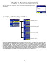
Chapter 7: selecting destinations 32 7.5 selecting a destination using the address book the address book can store up to 200 addresses. When you select address book you are given five options: previous destinations lets you select from a list of the last 50 destinations you routed to; list addresses...
Page 42
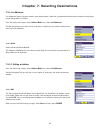
Chapter 7: selecting destinations 33 select route . Select the desired route method. The magellan roadmate will calculate the route. When the calculations are complete, the map screen will be displayed. 7.5.1.1 saving a previous destination to the address book from the destination screen, select add...
Page 43
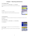
Chapter 7: selecting destinations 34 7.5.1.2 deleting a previous destination from the destination screen, select address book then, select previous destinations . Use the navigation key to scroll the list up or down (if necessary) and select the desired previous destination. Select delete . A dialog...
Page 44
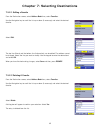
Chapter 7: selecting destinations 35 7.5.2.1 editing a favorite from the destination screen, select address book then, select favorites . Use the navigation key to scroll the list up or down (if necessary) and select the desired favorite. Select edit . The top line (name) and the bottom line (inform...
Page 45
Chapter 7: selecting destinations 36 7.5.3 list addresses list addresses shows all entries stored in your address book. It does not include previous destinations but does include those entries designated as favorites. From the destination screen, select address book then, select list addresses . Use...
Page 46
Chapter 7: selecting destinations 37 7.5.3.2 deleting an address from the destination screen, select address book then, select list addresses . Use the navigation key to scroll the list up or down (if necessary) and select the desired address. Select delete . A dialog box will appear to confirm your...
Page 47
Chapter 7: selecting destinations 38 enter characters that start a word within the street name (see “multi-word indexing” on page 17). Do not enter prefixes such as “north” or “n”, or the type of street such as “ave.” or “street”. Select ok . Use the navigation key to scroll the list up or down (if ...
Page 48
Chapter 7: selecting destinations 39 enter characters that start a word within the street name (see “multi-word indexing” on page 17). Do not enter prefixes such as “north” or “n”, or the type of street such as “ave.” or “street”. Select ok . Use the navigation key to scroll the list up or down (if ...
Page 49
Chapter 7: selecting destinations 40 enter characters that start a word within the street name (see “multi-word indexing” on page 17). Do not enter prefixes such as “north” or “n”, or the type of street such as “ave.” or “street”. Select ok . Use the navigation key to scroll the list up or down (if ...
Page 50
Chapter 7: selecting destinations 41 use the navigation key to scroll the list up or down (if necessary) and select the desired city. Enter characters that start a word within the street name (see “multi-word indexing” on page 17). Do not enter prefixes such as “north” or “n”, or the type of street ...
Page 51
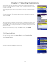
Chapter 7: selecting destinations 42 select new . Use the keypad to enter a name for the new trip and select ok . From the pop-up menu, select add . From the select trip planner address screen, select the method for adding a destination to your trip: map (map button) will add a destination by select...
Page 52
Chapter 7: selecting destinations 43 7.5.5.2 optimizing a trip with route optimization, you can sort the destinations in your trip from closest to farthest. From the trip planner screen, select edit . Select the trip to optimize. Select optimize . The destinations are sorted from closest to farthest...
Page 53
Chapter 7: selecting destinations 44 7.5.5.3 guide me from the destination screen, select address book . Then select the trip (trip button). Select guideme . Select the trip. Select the first destination in the list you wish to route to. Note: selecting the second destination in the list will exclud...
Page 54
Chapter 7: selecting destinations 45 select the trip to edit. Select the destination you wish to delete, and select delete from the pop-up menu. Select the destination you wish to change, and select move up from the pop-up menu. When you have finished, select save and you are returned to the trip pl...
Page 55
Chapter 7: selecting destinations 46 select delete . Select the trip you wish to delete. A dialog box will appear to confirm your selection. Select yes . The trip has been deleted. Select rename . Select the trip to be renamed..
Page 56
Chapter 7: selecting destinations 47 use the backspace key to delete the old name; then, enter the new name for the trip. When you have finished, select ok . The trip has been renamed. 7.6 selecting a point of interest as a destination points of interest (or pois) are commercial or recreational loca...
Page 57
Chapter 7: selecting destinations 48 enter the name of the poi. 7.6.1.1 nearest selecting nearest will list the pois matching the name you entered from closest to farthest from your current position. Select nearest . Use the navigation key to scroll the list up or down (if necessary) and select the ...
Page 58
Chapter 7: selecting destinations 49 7.6.1.3 select category selecting select category enables you to narrow the list of pois by selecting the category of the name you spelled. Select category . Use the navigation key to scroll the list up or down and select the desired poi category. Use the navigat...
Page 59
Chapter 7: selecting destinations 50 a list of all the poi’s in the selected category nearest to your current position is displayed. Select the poi from the list. Select the desired route method. The magellan roadmate will calculate the route. When the calculations are complete, the map screen will ...
Page 60
Chapter 7: selecting destinations 51 use the navigation key to scroll the list up or down (if necessary) and select the desired poi. Select the desired route method. The magellan roadmate will calculate the route. When the calculations are complete, the map screen will be displayed. 7.6.2.4 cuisine ...
Page 61
Chapter 7: selecting destinations 52 if the poi list has more than 15 returns, you can further narrow the search by selecting either nearest or spell name. Select the desired poi from the list. Select route to go to the selected address, or select cancel to return to the select custom poi menu. Sele...
Page 62
Chapter 7: selecting destinations 53 enter characters that start a word within the city name (see “multi-word indexing” on page 17). Select ok . Use the navigation key to scroll the list up or down (if necessary) and select the desired city. Enter characters that start a word within the street name ...
Page 63
Chapter 7: selecting destinations 54 enter characters that start a word within the name of the second street and select ok . Use the navigation key to scroll the list up or down (if necessary) and select the second street from the list. Select the desired route method. The magellan roadmate will cal...
Page 64
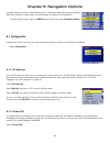
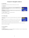
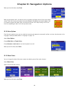
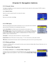
55 chapter 8: navigation options navigation options are only available when you are in navigation mode. When going to the main menu from the music player or from the photo viewer, this option will be grayed out. To access these features, press the menu key on the unit and select navigation options ....
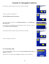
Page 65
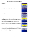
Chapter 8: navigation options 56 select a poi file . Use the navigation key to scroll the list up or down (if necessary) and select a poi file. With the file selected, you are returned to the custom pois menu. Select display categories . The categories you created are displayed in the same way as th...
Page 66
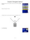
Chapter 8: navigation options 57 with the poi alerts set, you can now choose at what point you will be alerted. Select alert parameters . Select the poi category to customize. The detection angle is set to alert you when you are within so many degrees of the poi. Select detection angle ..
Page 67
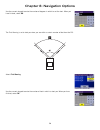
Chapter 8: navigation options 58 use the numeric keypad to enter the number of degrees in which to set the alert. When you have finished, select ok . The first warning is set to alert you when you are within a certain number of feet from the poi. Select first warning . Use the numeric keypad to ente...
Page 68
Chapter 8: navigation options 59 the last warning is set as a final alert when you are within a certain number of feet from the poi. Select last warning . Use the numeric keypad to enter the number of feet in which to alert you. When you have finished, select ok . When you have set the parameters as...
Page 69
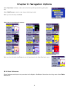
Chapter 8: navigation options 60 8.1.3 map options map options enable you to determine the behavior of the map while you are driving. Select map options . With scrolling enabled, the vehicle position icon will always remain in the same position with the map scrolling, or moving as while the vehicle ...
Page 70
Chapter 8: navigation options 61 select day screen to choose a color scheme for the map while you are driving during the day. Select night screen to select a color scheme for driving at night. When you have finished, select save . Select from nine available color schemes: when you have finished, sel...
Page 71
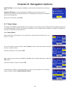
Chapter 8: navigation options 62 avoid toll roads instructs magellan roadmate to avoid known toll roads when calculating a route. Automatic re-route will cause the magellan roadmate to try up to three times to automatically re-route to the destination when it has detected that the vehicle has deterr...
Page 72
Chapter 8: navigation options 63 when you have finished, select save . When you encounter traffic, and the set time has elapsed, the detour icon will flash on the map screen. Touch the icon on the screen to have the magellan roadmate calculate the detour. You can choose to ignore the detour alert; a...
Page 73
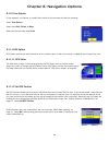
Chapter 8: navigation options 64 8.1.10 tone options as you approach a maneuver, an audible alert sounds to let you know to make the maneuver. Select tone options . Select either bell , chime , or beep . When you have finished, select save . 8.1.11 gps options gps options provide you with informatio...
Page 74
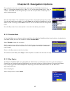
Chapter 8: navigation options 65 enter characters that start a word within the street name (see “multi-word indexing” on page 17). Do not enter prefixes such as “north” or “n”, or the type of street such as “ave.” or “street”. Select ok . Use the navigation key to scroll the list up or down (if nece...
Page 75
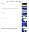
Chapter 8: navigation options 66 select code . Use the keypad to enter the unlock code. When you have finished, select ok . Select unlock . The database is unlocked. Select ok. Select europe and then select switch . Select yes . After the unit has powered down, turn the unit back on and the new map ...
Page 76
Chapter 8: navigation options 67 8.1.14 automatic volume the magellan roadmate can be set to automatically increase the volume when the vehicle exceeds 45 mph in order to compensate for road noise. Select automatic volume . Select the number increment by which to increase the volume. Select enable ....
Page 77
Chapter 8: navigation options 68 a dialog box will appear asking you to confirm your selection. Select yes . The files are copied to the storage card. 8.1.16.2 restore from mass storage card to restore the files to the hard disk, select backup and restore then, select restore from mass storage card ...
Page 78
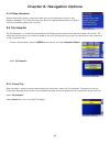
Chapter 8: navigation options 69 8.1.18 map information product information displays information about the map and database installed in your magellan roadmate. This information aids our technical support representative in finding a solution to whatever problem you may have. 8.2 trip computer the tr...
Page 79
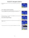
Chapter 8: navigation options 70 the trip computer is always in a “running” state. The information for the current trip is displayed. 8.2.1.1 stopping or starting the trip computer at any time the trip computer can be stopped and started. If the trip computer is currently running, select stop . The ...
Page 80
Chapter 8: navigation options 71 8.2.1.3 resetting the trip computer before starting a new trip that you want to record, you need to reset the trip computer first. Select reset and the information will be set to zero. The trip computer will remain in a “running” state. 8.2.1.4 viewing a saved trip r...
Page 81: Chapter 9: System Settings
72 chapter 9: system settings the system settings menu contains system wide customization features which include: brightness, power management, password, and language. To access these features, press the menu key on the unit and select system settings . 9.1 brightness to change how light the screen ...
Page 82: Chapter 9: System Settings
Chapter 9: system settings 73 9.3.2 remove password select password and use the keyboard to enter the password. When you have finished, select ok . Then, from the set new password screen, select ok . 9.4 language to change the language for the menu text and voice prompts for navigation, select langu...
Page 83: Chapter 10: System Status
74 chapter 10: system status the system status menu give you further options to check the performance of your magellan roadmate. 10.1 product information select product information to show the current application software versions. Also, the current hardware and firmware versions will be displayed. ...
Page 84: Chapter 11: Help
75 chapter 11: help the help feature provides you with an interactive tutorial on the features and functions of the magellan roadmate along with contact information should you need assistance. 11.1 quick tips quick tips for new users provides information in the following categories on basic usage an...
Page 85
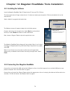
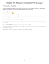
76 chapter 12: magellan roadmate tools installation 12.1 installing the software insert the magellan roadmate tools pc application cd into your pc’s cd drive. The setup application will begin automatically. If it does not, browse your computer’s cd drive and double-click on the setup.Exe file. Selec...
Page 86
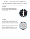
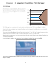
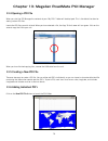
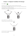
77 chapter 13: magellan roadmate poi manager the magellan roadmate poi manager enables you to transfer custom points of interest files from your computer to your magellan roadmate. Before we add any custom poi’s to the unit, you should understand how the poi manager plots pois. 13.1 latitude latitud...
Page 87
Chapter 13: magellan roadmate poi manager 78 13.3 altitude each location can also have an altitude. Altitude is expressed by how far the point is above or below the level of the ocean, or sea level. For example, los angeles, california is about 300 feet above sea level. Death valley, california is a...
Page 88
Chapter 13: magellan roadmate poi manager 79 13.4 opening a poi file when you start the poi manager the contents of your “my poi’s” folder will be displayed. This is the default location for storing custom poi files. Locate the poi files you wish to load. When you have selected a file, the copy to u...
Page 89
Chapter 13: magellan roadmate poi manager 80 click on the add button . Enter the name, the latitude, and the longitude. The altitude and description fields are optional. Select the category field and select new . A dialog box will appear to create a new poi category. Enter the name and assign an ima...
Page 90
Chapter 13: magellan roadmate poi manager 81 13.7 importing a data file the poi manager software supports ascii file format (.Asc,.Csv,.Txt); gps exchange file format (.Gps,.Xml); magellan waypoint file format (.Wpt,.Rte); and garmin pcx5 waypoint file format (.Wpt,.Rte). Click on the open button . ...
Page 91
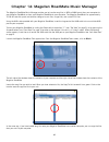
82 chapter 14: magellan roadmate music manager the magellan roadmate music manager enables you to transfer song files in mp3 or wma format from your computer to your magellan roadmate, or from your magellan roadmate to your computer. The magellan roadmate has approximately 10 gb of hard disk space a...
Page 92: Chapter 15: Music Player
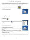
83 chapter 15: music player the magellan roadmate music player enables you to play music files in mp3, or wma format, stored on the hard disk of your magellan roadmate. If you have not already done so, you must install the magellan roadmate tools application (page 76) and transfer files onto your un...
Page 93: Chapter 15: Music Player
Chapter 15: music player 84 select playlist the playlist menu will appear. To exit from the playlist menu, select esc . 15.2.1 play to hear a previously created playlist, select play . Use the up or down arrow to select the desired playlist. Select ok . The songs will begin playing automatically in ...
Page 94: Chapter 15: Music Player
Chapter 15: music player 85 15.2.5 rename if you want to change the name of a playlist, select rename . Select the playlist you wish to rename and then, select ok . Use the backspace key ( finished, select ok . 15.3 play mode while in single song play, select play mode for song play options. Repeat ...
Page 95: Chapter 15: Music Player
Chapter 15: music player 86 15.5 equalizer the equalizer provides advanced sound options so you can customize the quality of the playback. The equalizer will only be available for mp3 format sound files. Select an equalizer preset from the following preconfigured options: default (flat), jazz, class...
Page 96
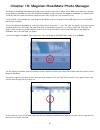
87 chapter 16: magellan roadmate photo manager the magellan roadmate photo manager enables you to transfer image files in either jpg or bmp format from your computer to your magellan roadmate, or from your magellan roadmate to your computer. The magellan roadmate has approximately 10 gb of hard disk...
Page 97: Chapter 17: Photo Viewer
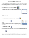
88 chapter 17: photo viewer the magellan roadmate photo viewer enables you to view image files in jpg and bmp format, stored on the hard disk of your magellan roadmate or an optional storage card. In order to transfer files from your pc to the magellan roadmate, you must install the magellan roadmat...
Page 98: Chapter 17: Photo Viewer
Chapter 17: photo viewer 89 17.1.3 slideshow press the slideshow button to cycle through all the photos in the pictures folder automatically. 17.1.4 pan if you enlarge an image beyond the screen boundaries, press the pan button to enable image scrolling. While enabled, you can drag the image in any ...
Page 99: Chapter 17: Photo Viewer
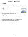
Chapter 17: photo viewer 90 17.2.4 properties to view information on the selected file or folder, press properties . A thumbnail of the image will be displayed along with the width and height in pixels, the size, and the format (image type). When viewing the properties for folders, width, height, an...
Page 100: Appendix
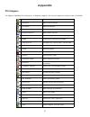
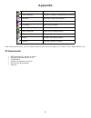
91 appendix poi categories the magellan roadmate poi database has 37 different categories. The icons will appear on the map screen (if enabled): restaurant fast food, diners, and food marts bank/atm most financial services gas station most fuel services roadside assistance towing companies hospital/...
Page 101: Appendix
Appendix 92 when selecting restaurants, you can further narrow the search by cuisine type such as french, italian, greek, mexican, etc. Pc requirements • ibm compatible pc, pentium or higher • microsoft ® windows® 2000 or xp • 128 mb ram • cd drive for software installation • dvd drive for map upgra...
Page 102: Appendix
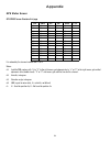
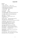
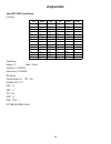
Appendix 93 gps status screen gps status screen structure-first page it is ordered by the channel number from 1 to 12. Where: d1: satellite prn number, with “e” or “e” to the right means got ephemeris data, “v” or “v” to the right means got verified ephemeris data (double check). “e” or “v” also mea...
Page 103: Appendix
Appendix 94 bad fix code 0 pvt_ok :good fix 2 illegal_alt: illegal altitude 17.5km 4 position_jump: too big position jump between two epoch (300 miles) 5 illegal_velocity_or_alt: max velocity 951mile 7 too_big_acceleration max 15m around 1.5g 8 too_small_altitude -10000 m 9 too_big_altitude 17,500 m...
Page 104: Appendix
Appendix 95 gps status screen structure - second page heading xxx (degree) speeding xx.X (meter per second) current lat: ddd.Ddddd w/e (current latitude, degree) current long: ddd.Ddddd n/s (current longitude, degree) current altitude xxxx (altitude in mean sea level meter) ttff xxxxs (time-to-first...
Page 105: Appendix
Appendix 96 typical gps status screen display first page second page heading 0 speed 0.0 m/s current lat: 34.10939 n current long:117.82599 w gps version: current altitude 2 55 ttff 116s #satellite (u/t) 11/12 pdop 2 .3 vdop 1.7 ttff 0.0 hdop 1.3 foms p/v/h 2 utc time 08/16/2004 2 2:56:53 ch prn az ...
Page 106: Appendix
Appendix 97 frequently asked questions why is my street not showing up on the map? The magellan roadmate uses the most current available map data. Chances are, your street is in a new housing development or the street is new. Map updates are made available about twice per year. I know there is a gas...

