- DL manuals
- Magellan
- Receiver
- Trailblazer XL
- Reference Manual
Magellan Trailblazer XL Reference Manual
Summary of Trailblazer XL
Page 1
Magellan gps satellite navigator reference guide trailblazer xl.
Page 2
Magellan systems corporation dept. 3-a 960 overland court san dimas, ca 91773 welcome from the magellan crew. With the purchase of a magellan trailblazer xl gps satellite receiver, you have joined the thousands of people who enjoy using gps in their profes- sional and recreational activities. Since ...
Page 3
Certificate of registration — trailblazer xl ❑ mr. ❑ mrs. ❑ ms. ❑ miss serial number last name mi first name street address city state zip code purchased from date of purchase * * * to help us serve you better, please complete the following * * * how do you plan to use your gps satellite navigator? ...
Page 4: Magellan Systems Corporation
Place postage here magellan systems corporation 960 overland court san dimas, california 91773 registration card.
Page 5: Quick Start
Location 1 screen quick start this brief section provides the key presses required to access some features and to perform some basic operations. Quick start does not replace other instructions con- tained in this guide. To get the fullest use out of your receiver and to interpret the displays, read ...
Page 6
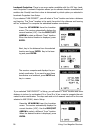
The receiver is now ready to get a location fix. Get a location fix: you must be outside to get a location fix. Rotate the antenna so it is vertical, and hold the receiver at a comfortable angle. The receiver automatically displays the last-known coordinates an power-on while it looks for satellites...
Page 7
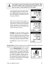
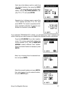
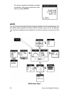
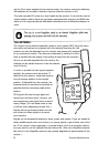
The pointer screen shows the destination (the icon) and your heading (the arrow). The icon's location varies in relation to your heading. Keep the icon and the arrow aligned to stay an course. Save the location fix as a landmark: once the receiver has a fix and the first location fix has been saved ...
Page 8: Attachments
Table of contents using your magellan receiver ..... 1 general information, 1 ; setup, 5 ; setup/aux flow charts, 5 ; loc, 16; location flow charts, 17; goto, 28; goto flow charts, 28; quick find index, 40. Gps navigation ................................ 42 navigation screens, 43; coordinate systems...
Page 9
Use good judgement this product is an excellent navigation aid, but does not replace the need for careful orienteering and good judgement. Never rely solely on one device for navigating. Use care the global positioning system (gps) is operated by the u.S. Government, which is solely responsible for ...
Page 10: General Information
Your magellan gps receiver has the advanced navigation features that experienced navigators expect, yet is easy enough for the novice navigator to use. This chapter is broken into four sections. The first section describes the conventions used in this guide. The others describe the features accessed...
Page 11
Using the arrow keys. The arrow icons in the lower corner of the screen indicate that additional screens are available. To resch these screens, just press one of the indicated arrows. Try pressing the setup key. This accesses the time display. Notice that the current date and time is followed by a s...
Page 12
If the right/left arrow is inverted, the highlight bar will move from right to left. When the edit arrow icons appear on a screen that is not a menu, the arrows will enter data and move the cursor. Use the up/down arrow to step through letters and numbers or numbers only at the cursor location. The ...
Page 13
Low geometric quality. Appears when the geometric quality (gq) of a position fix is below a set value and the accuracy of the position fix is question- able. Location information displayed may not be accurate enough to be used for navigation. Old data. The old data icon (" hour glass") appears when ...
Page 14: Setup
Using your magellan receiver 5 setup the setup function allow you to control how the trailblazer xl displays information. You may select, for example, which coordinate system will be used, or whether eleva- tion is shown in meters or feet. Setup also includes the initialize feature. You should use t...
Page 15
Press setup. The receiver displays the time screen, which displays the current date and time. Both the setup and aux menus are ac- cessed from this display. The time displayed by the trailblazer xl is received from the satellites, then converted to your local dock. Since each satellite carries an at...
Page 16
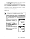
The following sample uses the coordinates for los angeles, california (34.03n lati- tude and 118.14w longitude). Do not use these coordinates unless you are within 300 miles of los angeles. Use the coordinates for a city within 300 miles of your location. Highlight "initialize" and press enter. The ...
Page 17
The receiver now prompts you for the eleva- tion. You do not have to enter this informa- tion right now. Press enter to use the de- fault elevation of 0 feet. Key in your local time in a 12-hour (am/pm) clock. Take extra care to enter the time correctly, including the am/pm designation. Entry is the...
Page 18
Highlight "coord. System" and press en- ter. Select "location 1" or "location 2." (the system selected for location 1 is also used for all landmark coordinate displays.) press enter. Select the desired coordinate system and press enter. If you select lat/lon, you will be asked to select deg/min or d...
Page 19
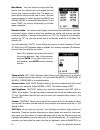
Map datum. You may need to change the map datum that the receiver will use to agree with the datum your maps and charts use. The datum re- quired will be printed on the map or chart. The most common datums in north america are nad27 and wgs84; wgs84 is the default map datum. If you select "user", th...
Page 20
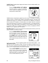
Nearest (nearest to furthest from your present location). This selection will not affect the landmark search display. The default sort is alphabetical. Utm grid plot. This feature adds a utm grid overlay to the plotter screen when utm coordinates have been selected for the location 1 screen. Select ...
Page 21
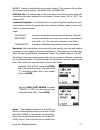
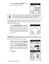
12 using your magellan receiver softlock tm . Softlock prevents the receiver from being turned on unless a specific key sequence is pressed during power-up. Lt is used to prevent the receiver from being turned on while it is being store or transported to prevent unnecessary use of the batteries. Whe...
Page 22
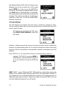
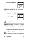
Highlight "dgps" and press enter. A check appears, indicating that the function is on. To turn dgps off, press the enter key again. The trailblazer xl can accept broadcast differential corrections only when it is con- nected to a compatible differential radio beacon receiver and dgps is turned on. S...
Page 23
Highlight "last loc" and press enter. Use the up/down arrow to select a save rate. To turn last loc off, select "off." a check appears next to "last loc" in the menu when any setting other than "off" is selected. Default is 10 minutes. Sampling. Sampling turns the receiver on every so often to compu...
Page 24
Velocity average. As you use your receiver, you may notice fluctuations in the veloc- ity (speed) displays. Like elevation, velocity is susceptible to selective availability. Ve- locity averaging minimizes this effect by displaying an averaged speed measurement. There are three settings to choose fr...
Page 25: Loc
Highlight "erase lloc." and press enter. Next, press clear to continue erasing, or press any function key to exit without erasing the buffer. Erase track. Track is the actual course you have travelled, which is not always the same as the course you planned to travel. As you use the receiver, you may...
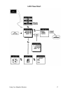
Page 26: Loc Flow Chart
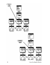
Loc flow chart using your magellan receiver 17.
Page 27
Using your magellan receiver 18.
Page 28
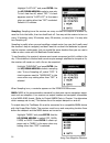
Within a few minutes, the bar graph is re- placed with the local time. This indicates that your receiver is obtaining gps information and has computed your present location. Ev- erything you do from now on is based on the location information received. Receiver status. The receiver status screen is ...
Page 29
Satellite status. Satellite status displays the locations of each available satellite, rela- tive to your location. Press the down arrow. Left arrow from the location 1 screen. The satellites whose numbers are highlighted are the ones being used for location fixes. Satellite location is described by...
Page 30
Use the right/left arrow to scroll through the fixes in the buffer. When the buffer is filled, incoming last loc fixes replace the oldest fixes in the buffer. Last location pointer. The last location pointer indicates where the last loc fix is in relation to the present location. Press the down arro...
Page 31
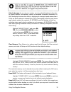
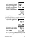
You may personalize the landmark name by selecting an icon and name that describes the location being saved. (this will allow you to identify a specific landmark more easily later.) to select an icon and enter a name, press en- ter. Use the up/down arrow to select a enter the landmark name (up to 5 ...
Page 32
You may enter a message or description that will be saved with the landmark. The message can be displayed when the landmark is viewed from the landmark menu and from the navi- gation screens when the landmark is used in a route. Use the right/left arrow to highlight "yes" and press enter. Key in up ...
Page 33
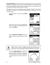
Use the arrow keys to move the highlight bar through the menu. To view landmark coordi- nates, press enter. Press the right/left arrow. The receiver steps through the stored landmark coordi- nates. Press the down arrow to display the landmark pointer. This screen is the same as the last location poi...
Page 34
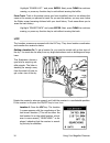
Press the down arrow again to view the landmark's message. If no message was saved, you may press clear to enter one now. Use the right/left arrow to select the "from" location and press enter. The re- ceiver computes the number of inches (or cen- timeters) n or s and e or w from the land- mark to t...
Page 35
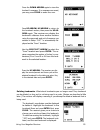
Landmark projection. There is one more option available with the loc key: land- mark projection. Landmark projection allows you to estimate location coordinates of another site. Exactly how this is done is determined by which option you selected in landmark projection from setup. If you selected "lm...
Page 36
Next, key in the distance north or south from the selected location, then press the right arrow to move the cursor to the hemi- sphere. Use the up/down arrow to dis- play "n" or "s" and press enter. Repeat to key in distance east or west of the "from" location and select "e" or "w", then press enter...
Page 37: Goto
The receiver computes and displays projected coordinates, which can be saved as a land- mark by pressing enter. Goto flow chart 28 using your magellan receiver goto the goto screens include all of the navigation displays and the route features. You can display some navigation information without hav...
Page 38
A route is a planned course of travel that is often broken into smaller "mini-routes" called legs. If you've ever gone on a car trip with planned stops along the way, you have travelled on a multileg route. (each of the stops was the end of a leg.) the trailblazer xl has several types of routes. You...
Page 39
Using your magellan receiver 30
Page 40
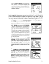
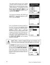
Press the right arrow. This is the naviga- tion screen. This screen displays the destination's bearing, distance to the desti- nation, heading, speed, and a cdi (course deviation indicator). Press clear. Use the left/right arrows to change the first line. You may select vmg, vmg/spd bar, xte, hdg, e...
Page 41
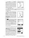
Press left arrow, then the down ar- row twice to reach the plotter screen. The plotter screen displays your planned course (the route) and the course you actually trav- elled (the track), which may not always match. This allows you to follow your movement in relation to the course. The plotter also ...
Page 42
Using your magellan receiver 33 press the up/down arrows to change the orientation of the plotter from north up to heading up. Press clear to exit the edit mode, then press the up arrow to return to the plotter. Press the right arrow. This is the distance screen. Lt works just like the odometer in y...
Page 43
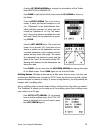
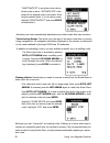
The up/down arrows to select an empty route and press enter. Two choices are displayed; set route and backtrack. Leave the highlight an set route and press enter. First, you will select the starting location for the route. The receiver automatically displays the current location as the from location...
Page 44
Press enter. The receiver automatically uses the destination of the first leg as the start of the second leg. Once the first leg is established, you will select only the destination of the fol- lowing legs. Use the right/left arrow to display the destination for leg 2 and press enter. Continue to ad...
Page 45
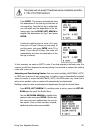
" deactivate rt" is an option when the se- lected route is active. "activate rte" is dis- played if the selected route is not active. Since we just created route 1, it is an active route; highlight "deactivate rt" and press enter to deactivate it. Activating one route automatically deactivates any o...
Page 46
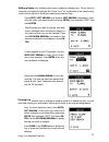
Editing a route. Any multileg route can be edited by adding a leg. This is done by inserting a landmark between the "from" and "to" landmarks of an existing leg, which has the effect of dividing an existing leg into two legs. Press goto, left arrow (and another left arrow if necessary). High- light ...
Page 47
38 using your magellan receiver reversing a route. Reverse route allows you to take an existing route and reverse the order of the landmarks used to create it. For example, if you were to set a route that went from point a to point b and ended at point c, reverse route would change the route to go f...
Page 48
Using your magellan receiver 39 the last location used to create the backtrack route are saved as temporary land- marks. You'll see them in the landmark menu indicated with the a icon. These land- marks will be saved until the existing backtrack route is replaced with a new one. Mob. Mob is the man ...
Page 49
Quick find 40 using your magellan receiver general information ....................................................................................... 1 reference guide conventions ......................................................................... 1 using the arrow keys .........................
Page 50
Loc ........................................................................................................................................ 16 flow charts ............................................................................................................ 17 getting a location fix ............
Page 51
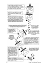
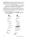
Now that you know what the receiver's features are, how do you make them work for you? Suppose you were on a fishing trip in the area shown below. You want to go from the camp site to the island in the middle of the bay. Before you start, turn the receiver on and let it get a location fix. Once you ...
Page 52
For your first a multileg route to go from the skiff to the dock, then to the camp. You could set a backtrack route by selecting any route in the menu, then selecting backtrack. If both the receiver and the last location buffer were on, the receiver can generate a route that "backtracks" the route y...
Page 53
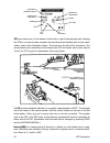
Cdi icon cdi centerline destination landmark name bearing to destination heading cdi distance to destination speed cdi scale south is 180°. 44 gps navigation xte (cross track error) is the distance to the left or right of the planned path. Keeping the xte to a minimum helps maintain the most direct ...
Page 54
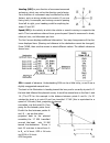
Heading (hdg) is your direction of movement measured as bearing, which may not be the direction you're facing. Your direction of movement may be affected by other factors, such as strong winds and currents. If you are facing north, for example, and a strong current is passing from left to right, you...
Page 55
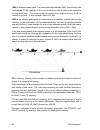
Courseline ste is steering. Steering is the correction in heading that must be made to return to course. Lt is expressed as bearing. Ttg is time to go. Eta is estimated time of arrival. These are the only measurements that output a time value. Ttg is the time remaining to reach the next destination ...
Page 56
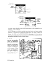
Destination landmark name bearing indicator heading indicator direction to steer destination landmark name destination icon south marker time to go bearing of destination heading indicator west marker distance to destination the road screen is a pic- torial cdi. The destination (using the destinatio...
Page 57
If you are on course, the person icon is on the center line. If you are to the left of course, the icon is to the left of the center line. The grids on either side of the road move toward the bottom of the display in relation to your soa. If soa is a negative value or if you are stationary, the grid...
Page 58
34°06'35"n 117°49'34"w utm 11 4 23 818 e 37 74 624 n gps navigation 49 specifically, a location is so many degrees north or south of the equator (up to the poles, which are 90°n and 90°s; the equator is 0° latitude), and so many degrees east or west of the prime merid- ian, which is 0° longitude. (t...
Page 59
Osgb coordinate system osgb coordinates are similar to utms, but they describe only great britain. They are generally used with the gbr36 datum, which also describes great britain. This coor- dinate system cannot be used in any other part of the world. The trailblazer xl auto- matically selects the ...
Page 60
Lt is possible to use rechargeable batteries, but there are a couple of things you should be aware of when using them. Commercially available nicad batteries typically have poor power performance after repeated use, and rechargeable alkaline batteries main- tain only 50% of the useful life of standa...
Page 61
Ing kit. (even when operating from external power, the receiver must have batteries; the batteries will be used to maintain memory when the receiver is off.) the cable converts dc power to a level usable by the receiver. Lt can also be used to output location data to electronic navigation equipment ...
Page 62: Troubleshooting
Troubleshooting receiver is not producing a fix frozen display, keypad does not respond or use the four-finger reset (setup, loc, clear, and enter, pressed together). No power check how the batteries were inserted into the tray; are they oriented correctly? The batteries may also have run down compl...
Page 63: Specifications
Location fix fluctuates nmea device is not responding dashes appear in nav displays small changes in the location coordinates and elevation are normal. They are caused by several variables, including the geometric quality of the fix and the effects of sa. Geometric quality is a measurement of the pr...
Page 64
Nmea data messages. Nmea data is output at 4800 baud, 8, n, 1, checksum off. These settings are acceptable to most equipment and software applications. There are several nmea output message sets, each with a slightly different application. Check the documentation for your external equipment to selec...
Page 65
Nmea message definitions apa cross track error, direction to steer, status of gps, route status, destina- tion landmark name, and bearing from origin to destination (old format). Apb revised autopilot message contains all of the above plus: heading to steer toward destination, bearing from the prese...
Page 66
1 status: v = loran-c blink or snr warning a = general warning flag for other navigation systems when a reliable fix is not available. 2 status: v = loran-c cycle lock warning flag a = ok or not used 3 magnitude of xte 4 direction to steer (l, r) 5 xte units, nautical miles 6 status: a = arrival cir...
Page 67
0 = fix not available or invalid 1 = gps fix 2 = differential gps fix 7 number of satellites in use 8 horizontal dilution of precision 9 antenna altitude above/below mean sea level 10 units of antenna altitude 11 geoidal separation - difference between the wgs-84 earth ellipsoid and mean sea level (...
Page 68
10 range naut. Miles, present fix to destination landmark great circle. [if range exceeds 999.9 nm, display 999.9.] 11 bearign, true, great circle, present fix to dest. Landmark 12 closign velocity to destination, knots 13 arrival (or'ed arrival circle and crossing of line which is perpendicular to ...
Page 69
Packing list the following items should be in your package: gps trailblazer xl reference guide field guide carrying case if any of these items is missing, please contact your local magellan dealer or distributor. Optional accessories in addition to the items provided with the receiver, optional acce...
Page 70
What is gps? Gps is a constellation of navigation satellites that orbit the earth. The precise time and position information transmitted by these satellites is used by a gps receiver to trian- gulate a location fix. The system is now officially declared "initial operational", and provides continuous...
Page 71
Both almanac and ephemeris data are required for a gps receiver to locate and ac- quire satellites quickly and compute a location fix. More information for information relating to the operation of your magellan gps receiver, call magellan at (909) 394-5000 and ask for customer service. 62 global pos...
Page 72
General information on the global positioning system and satellite status is available from the civil gps information center (gpsic) in virginia. Lt is operated by the united states coast guard for the department of transportation, and was established to provide information and to serve as a point o...
Page 73
Azimuth the height above the horizon of a satellite or other object. Bearing direction, as measured in degrees from north in a clockwise direc- tion. The receiver uses either true north or magnetic north, as selected from the setup menu. Cdi course deviation indicator. A graphic representation of cr...
Page 74
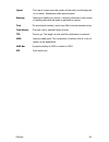
Glossary 65 speed the rate of motion over the surface of the earth (not through the air or water). Sometimes called ground speed. Steering setting and holding to a course. A steering correction is the change in heading that must be made to get back an course. Track the actual path travelled, which m...
Page 75
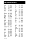
Australia & 5w pacific adelaide 34°55 s 138°35 e alice springs 23°42 s 133°53 e apia 13°48 s 171°45 w auckland 36°55 s 174°47 e bourail 21°34 s 165°29 e brisbane 27°28 5 153°02 e canberra 35°17 s 149°08 e tokyo tonhil ulaanbaatar Ürümqi wuhan xi'an yumen cis 35°40 n 139°45 e 46°19 n 93°54 e 47°54 n ...
Page 76
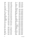
Bamako banghazi bangui beira cairo capetown dakar fes freetown harare kabwe kampala kano khartoum kinshasa kisangani lagos las palmas de gc lindi lobito lome lubumbashi lüderitz lusambo maputo maseru mbale mogadishu monrovia mwanza, zaire n' djamena nairobi namibe nouakchott ouagadougou pointe noire...
Page 77
Managua manaus merida, venezuala miami milwaukee minneapolis montevideo, uru. Nakina nashville, tn new york norfolk, vi oklahoma city omaha panama city peace river peoria, il phoenix pittsburgh port-au-prince portland, or porto velho quebec rapid city sd recife reno rio de janeiro salt lake city san...
Page 78
Datums defined in the trailblazer xl are accessed with the following abbreviations. Wgs84 ..................................... Wgs84 indian (india, nepal) .................... India north american 1927 ........... Nad27 iran, european 1950 ................... Iran north american 1983 ........... Na...
Page 79
Magellan systems corporation limited warranty all magellan gps receivers are navigational aids, and are not intended to replace other methods of navigation. Purchaser is advised to perform careful position charting and use good judgement. Read the user guide carefully before using this product. 1. M...
Page 80
• modifications to the receiver which may be required due to any change in the global positioning system (gps). [note: all magellan gps receivers use gps to obtain position, velocity, and time information. Gps is operated by the u.S. Government, which is solely responsible for its accuracy and maint...
Page 81
Serial no. Date purchased place of purchase no part of this handbook may be reproduced or transmitted in any form or by any m eans, electronic or mechanical, including photocopying and recording, for any purpose other than the purchaser's personal use without the written permission of magellan syste...
Page 82
960 overland court, san dimas, ca 91773 (909) 394-5000 22-60026-000


