- DL manuals
- Magellan
- GPS
- Trailblazer
- Reference Manual
Magellan Trailblazer Reference Manual
Summary of Trailblazer
Page 1
Magellan gps satellite navigator reference guide.
Page 2
Welcome from the magellan crew. With the purchase of a magellan gps satellite receiver, you have joined the thousands of people who enjoy using gps in their professional and recre- ational activities. Since we introduced our first product more than five years ago, magellan has established a reputati...
Page 3: First-Time Gps Users
First-time gps users ........................... 1 navigation, 1; latitude/longitude, 1 ; using position fixes, 2; navigating with waypoints, 3; setting a route, 5; navigating with a route, 5; entering a waypoint, 6; utm coordinates, 6; applications, 8. General usage ........................... 9 po...
Page 4
Use good judgement this product is an excellent navigation aid, but does not replace the need for careful orienteering and good judgement. Never rely solely an one device for navigating. Use care the global positioning system (gps) is operated by the u.S. Government, which is solely responsible for ...
Page 5: First-Time Gps Users
1 first-time gps users this section is to help readers who are new to navigation or to electronic navigation equipment. Lt explains terms that are commonly used by naviga- tors worldwide and some basic concepts of navigation, such as position fixes and coordinates. Navigation navigation is getting f...
Page 6
This is much like de- scribing a position in a city by the street inter- section, but "fifth and main" can describe more than one location, since these are com- monly used designa- tions. Lat/lon uses numbers and hemi- sphere to describe each position in a unique way. Using lat/lon co- ordinates, no...
Page 7
"camp." as you walk to your skiff at the dock, the receiver continues to obtain position fixes; these are "updates" to the first fix obtained. Once at the dock, you save the current position fix as waypoint "dock." instead of travelling directly across the lake to the inlet on the other side, you ma...
Page 8
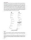
The first thing you have to do is to return to your skiff, which you do by getting a current position fix, then setting a direct-to course. A direct-to course is a straight line from your current position to the waypoint you select. Here, the direct-to course is to waypoint "in- let". The direct-to ...
Page 9
Setting a route with stored waypoints to navigate safely from the inlet to the dock, you set a route from inlet to buoy, then to dock. A route is required to help you avoid the shallow area or any rocks that you may not see when visibility is poor. A route is a planned course from one place to anoth...
Page 10
The magellan gps receiver displays xte graphically on a course deviation indicator, or cdi. The cdi displays the courseline at the center of a scale, and your current position relative to the courseline is shown as a symbol. When you are to the left of the courseline, the symbol is to the left of th...
Page 11
A utm position is described by three elements; the zone it is in, the easting, and the northing. Eastings and northings measure how far into a zone a position is in meters. Eastings are an east/west measurement, and correspond roughly to longitude. Northings are a north/south measurement, and corre-...
Page 12
Applications in addition to the use described in the preceding example, the magellan gps receiver is ideally suited to a wide variety of outdoor activities, including: backpacking — you have the freedom to explore places that are off the beaten path or snow-covered areas with the security of knowing...
Page 13
Power the receiver is powered by three aa batteries. Lt can also be powered from an external dc power source by using the optional magellan power/data cable. Batteries. We suggest using aa alkaline batteries to power the receiver. (magellan systems recommends eveready energizer tm batteries.) alkali...
Page 14
External power. The receiver can be connected to an external dc power supply with the optional power/data cable. The cable converts dc power to a level usable by the receiver, and can also be used to output positioning data for use by electronic navigation equipment that conforms to nmea stan- dards...
Page 15
11 initialization initialization is the preparation you do before the receiver is used for the first time or after memory loss. Lt should also be done when the receiver is moved 300 miles or more from its last position fix. You can enter only the initial position and the current date and time, or yo...
Page 16
Initial position. By entering an initial position you are informing the receiver of approximately where it is; you should know this position within 300 miles (approximately 480 km). If you do not know your coordinates, refer to the city reference chart to key in the coordinates of the nearest city. ...
Page 17
6. Next, the receiver displays prompts for current time input. Key in the local time on an am/pm clock and press enter. The magellan gps receiver can display time on a 24-hour local clock, a 12- hour local clock (am/pm), or ut. Ut, or universal time coordinated, is the time that is current at the pr...
Page 18
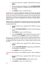
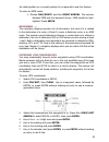
2. Press the up/down arrow to toggle between lat/lon and utm. (default is lat/lon displayed as degrees/minutes.) press enter. 3. If lat/lon was selected, the receiver shows the two available display options. Press the up/down arrow to select de- grees/minutes or degrees/minutes/seconds. 4. Press ent...
Page 19
The magellan gps receiver can display position fixes in twelve of the most commonly used datums. (default is wgs84.) using an incorrect datum may cause the receiver to display position coordinates that differ from those on the map. Whenever possible, set the receiver to use the datum that was used t...
Page 20
1. From the setup menu, highlight "map datum" and press enter. 2. The first four datums are displayed. Press the down arrow to scroll through the 12 datums until the desired one is highlighted. 3. Press enter to return to the setup menu. Elevation mode. This setting determines whether the receiver w...
Page 21
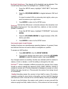
Backlight brightness. The intensity of the backlight can be adjusted. This is most easily done when the backlight is on. (default is high.) 1. From the setup menu, highlight "light brt." and press enter. 2. Press the up/down arrow to toggle between low and high. Lt is best to select low on extremely...
Page 22
Of the sky to locate and acquire sufficient satellites, the receiver will be unable to obtain a position fix. The receiver should also be set to either 2d or 3d operation (not auto) for the best results. If 2d is selected, be sure the elevation at initial position is correct. When sampling is set, a...
Page 23
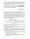
In order to support this equipment, the receiver must operate continuously. This can be a very heavy drain on the receiver's batteries; if supporting an nmea device, consider operating from external power. Velocity averaging. As you use the receiver, you may notice that the velocity measurements flu...
Page 24
20
Page 25
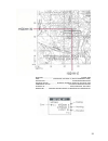
Spheroid ................................................................................................ Clarke 1866 grid ................................ 1,000 meter, utm zone 11 (black numbered lines) projection ..................................................................... Transverse merc...
Page 26
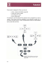
This tutorial is designed to show you how to • enter, rename and delete waypoints • create and reverse routes • set a direct-to route • set an mob route lt is easiest to use this tutorial if the receiver has no waypoints or route in memory. The receiver should be initialized or have obtained a posit...
Page 27
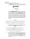
Waypoints waypoints are accessed with the pos/wpt key. 1. Press pos/wpt, followed by clear. The receiver displays "define waypoint" and the cursor is active an the first line. 2. Press the right/left arrows to see how the cursor moves. Press the up arrow to scroll through the characters (letters and...
Page 28
5. Enter the coordinates for longitude. The longitude for seattle is 1 22°18.50 w. Key in 122 18 5. If necessary, move the cursor to the hemisphere space and press the up/down arrow to select w. Press enter to move to the next line. 6. Enter the elevation. Elevation is the height above or below mean...
Page 29
To create a route: 1. Press nav/route, then the left arrow. 2. The route menu is displayed. Since there are no routes in the receiver's memory, only two options are displayed, "set route" and "backtrack." use the up/down arrow to high light "set route" and press enter. 3. The receiver displays a fro...
Page 30
Arrow to highlight "reverse route." (since a route has been entered, both "reverse route" and "clear route" are now options.) press enter, and the route is autotmatically reversed. Reading the pointer display the receiver has three different navigation displays. Navigation (the central display of th...
Page 31
27.
Page 32
Backtrack backtrack is similar to direct-to, but is better suited to longer distances. Before leaving your camp, clear all of the last fixes in the buffer. As you travel, the receiver will automatically save one position fix every 10 minutes to the buffer (if the receiver is on). Lf you prefer, set ...
Page 33
An initial position or a current position fix is required to use this feature. To enter an mob route: 1. Press nav/route and the right arrow. The receiver displays mob and the waypoint library. Mob should be high- lighted. Press enter. Remember - the navigation displays provide a lot of information,...
Page 34
What is gps? Gps is a constellation of navigation satellites that orbit the earth. The precise time and position information transmitted by these satellites is used by a gps receiver to triangulate a position fix. The system is expected to be completed during 1994, and will provide continuous, 24-ho...
Page 35
Both almanac and ephemeris data are required for a gps receiver to locate and acquire satellites quickly and compute a position fix. Accuracy gps positioning with an sps receiver that is intended for general use will produce accuracies of 25 meters or better. In fact, sps receivers have proven to be...
Page 36
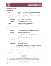
Technical notes specifications size 6.125" x 3.5" x 1.25", not including antenna (15.6 cm x 8.9 cm x 3.2 cm) weight 1 4 ounces (0.397 kg), with batteries installed temperature: operating 14°f to 140°f (-10°c to 60°c) storage -40°f to 167°f (-40°c to 75°c) case waterproof (non-submersible) antenna de...
Page 37
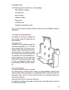
Packing list the following items should be in your package: gps satellite navigator carrying case lanyard strap reference guide field guide warranty card magellan initialization map if any of these items is missing, please contact your local magellan dealer or distributor. Optional accessories in ad...
Page 38
Frozen display, remove the batteries and wait for the receiver to keypad does not turn off. (if operating from external power, respond disconnect power before removing the batteries.) or use the four-finger reset (aux, nav, clear, and enter, pressed together). No power check how the batteries were i...
Page 39
Position fix fluctuates 35 small changes in the position coordinates and elevation are normal. They are caused by several variables, including the geometric quality of the fix and the effects of sa. (geometric quality is a measurement of the probable accuracy of a fix).
Page 40
Serial no. Date purchased place of purchase no part of this handbook may be reproduced or transmitted in any form or by any means, electronic or mechanical, including photocopying and recording, for any purpose other than the purchaser's personal use without the written permission of magellan system...
Page 41
960 overland court, san dimas, ca 91773 (909) 394-5000 22-60005-012.


