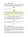
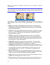
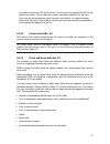
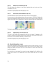
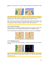
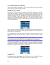
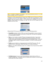
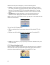
- DL manuals
- Xroad
- GPS
- V4100
- Software User Manual
Xroad V4100 Software User Manual
Summary of V4100
Page 1
Software user manual carpoint co., ltd. English june, 2007.
Page 2: Copyright Note
2 copyright note the product and the information contained herein may be changed at any time without prior notification. This manual nor any parts thereof may not be reproduced or transmitted in any form either electronically or mechanically, including photocopying and recording, without the express...
Page 3
3 thank you for choosing xroad as your door-to-door in-car navigator. Read the quick start guide first and start using xroad right away. This document is the detailed description of the software. Although xroad can easily be discovered by experience, it is still recommended that you read through thi...
Page 4: Table of Contents
4 table of contents 1 warnings and safety information......................................................................... 9 2 general information........................................................................................... 10 3 operating xroad (controls)..............................
Page 5
5 4.4.4 time synchronization .......................................................................... 28 4.5 screens with map ...................................................................................... 28 4.5.1 turn preview (no. 1) ..........................................................
Page 6
6 4.8.2 tmc control centre ............................................................................. 54 4.8.2.1 selected fm radio station................................................................ 54 4.8.2.2 exclude selected station..............................................................
Page 7
7 5.4.4.2 motorways....................................................................................... 68 5.4.4.3 ferries ............................................................................................. 68 5.4.4.4 u-turns ................................................................
Page 8
8 7 troubleshooting guide....................................................................................... 90 8 glossary............................................................................................................ 92 9 end user license agreement ....................................
Page 9
9 1 warnings and safety information xroad is a navigation system that helps you find your way to your selected destination. It will determine your exact location with the help of the built-in gps device. The position information obtained from the gps receiver will not be transmitted anywhere, so oth...
Page 10: 2 General Information
10 2 general information xroad is a navigation system optimized for in-car use. It provides door-to-door navigation for both single and multi-point routes using adaptable route parameters. Xroad is capable of planning routes throughout the whole installed map set. Unlike some other products, xroad d...
Page 11
11 3 operating xroad (controls) xroad is designed for easy operation. All controls are operable by fingertips. Wherever possible, pushbuttons and lists are provided to make accessing functions or changing settings as easy as possible. 3.1 hardware buttons there are only a few hardware buttons on you...
Page 12
12 3.2 screen buttons and controls the primary input channel of xroad is the touch screen. If you read on, you will realize that most parts of the screen are not only used to display information but also to initiate functions by tapping. Below you will find a list of the most frequently used control...
Page 13
13 3.2.4 switches when a function can only have two values (mainly enabled and disabled), a switch is used. Unlike with list selectors, the horizontal line contains the name of the function and not the actual status. There is a lamp on the left to show whether the function is active or not. When the...
Page 14
14 use backspace (arrow pointing left) to delete the last letter you have entered if you have made a mistake, tap space to enter more words, and hit done to finish entering the text. This type of keyboard has large, finger-friendly buttons. Note: if you have chosen a program language that uses latin...
Page 15
15 although qwerty-type keyboards also contain number keys, when entering a house number, the program offers the more convenient numeric keypad..
Page 16
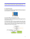
16 4 discovering the program through the screens the best way to discover xroad is to explore each screen in detail, and to find out how to move from one to another. Read this chapter for a guided tour. 4.1 main menu xroad starts by displaying the main menu. This is the root of the screen hierarchy,...
Page 17
17 no. Content 7 exit: button to exit xroad** (navigation stops) 8 current position 9 current date and time 10 cockpit: button to open cockpit screen 11 map: button to open map screen ** same as removing the sd card 4.2 about screen tap about on the main menu screen to open this screen. The about sc...
Page 18
18 it is easy to change between 2d and 3d modes. You have two options. You can use the tilt up and down buttons (page 31) to tilt the map seamlessly between 2d and all 3d angles, or you can use the switch in the quick menu (page 42) to quickly switch between the two modes. Note: you may find that 2d...
Page 19
19 note: if you need to zoom out briefly to locate your position on the map, use the overview mode instead of zooming out and back in. The overview mode is a 2d north-up view that can be started by tapping the compass button on the right (page 33). Note: xroad has a special smart zoom function for n...
Page 20
20 note: the colors mentioned and screenshots included in this manual refer to the default daytime and night color schemes. They may not look the same in the schemes you have chosen. Tip: if you use xroad after sunrise or before sunset, look for the sun in the sky in the map background using a flat ...
Page 21
21 current view of the map. It is important, as the driver must be able to read the map at a glance. Tip: if you do not want to be bothered by street names during navigation, turn them off in map options (page 64). Tip: major roads usually have alternative names (numbering) besides the primary name....
Page 22
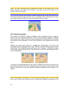
22 the location received from the gps receiver is shown as a blue dot on the map. This can help you locate your position if the gps accuracy is poor, and the lock-on-road system puts you on the wrong street. It is also the location saved in the track log (page 47). Note: the lock-on-road feature can...
Page 23
23 the color of the pin is automatically selected by xroad. Different colors help you identify a pin in the history list (page 85) later. There they are shown together with their address and gps coordinates. Tip: there is a quick way to save the current gps position as a pin. Press the record button...
Page 24
24 if two points are too close to each other so that icons overlap, a multi-poi icon is shown instead of individual ones. Zoom in more to see them separately. (should the two pois have the same icon, this icon will be displayed instead of the multi-poi icon.) note: when navigating, poi icons can be ...
Page 25
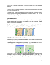
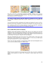
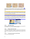
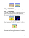
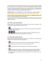
25 4.3.11.2 animated turn guidance animated arrows represent all route events other than the above-mentioned special points. These arrows show the direction in which you need to continue your journey. 4.3.11.3 the active leg of the route the active leg is the section of the route you are currently d...
Page 26
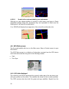
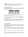
26 4.3.11.5 roads in the route excluded by your preferences although you can choose whether to include or avoid some road types in route parameter settings (page 68), sometimes they are impossible to avoid near the starting point, via points or the destination. If so, xroad will display those segmen...
Page 27
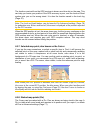
27 grey satellites are only received, while green ones are used by the gps to calculate your current location. On the right you can see the satellite signal strength bars. Grey bars are for the grey and black bars are for the green satellites. To identify satellites use their numbers also shown in t...
Page 28
28 • green means 3d reception. The gps receiver has enough satellites to calculate altitude. Position is generally correct (yet it can still be inaccurate due to different environmental factors). Xroad is ready for navigation. 4.4.4 time synchronization in the top right corner of the screen you have...
Page 29
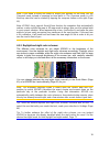
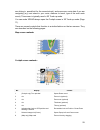
29 are driving in, speed limit for the current street), and some more route data if you are navigating (e.G. Next street in your route, distance to travel, type of the next route event). This screen is typically used in 3d track-up mode. You can make xroad always open the cockpit screen in 3d track-...
Page 30
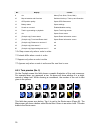
30 no. Display control 9 n/a menu (find, quick, route, main) 10 map orientation and overview switches north-up, track-up and overview 11 gps position quality opens gps data screen 12 battery status opens settings 13 sound on or muted enables/disables muting 14 track log recording or playback opens t...
Page 31
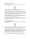
31 4.5.2 zoom in and out (no. 2 & 3) these semi-transparent buttons are only displayed if "zoom & tilt" is enabled in the quick menu (page 43). Zoom will change the scale of the map. Zoom out shows a larger part of the map, while zoom in shows a smaller part of the map in more detail. The automatic ...
Page 32
32 4.5.4 follow mode - lock to gps position and heading (no. 6) this semi-transparent icon is displayed if gps position is available, and the map has been moved. It also appears when you scale or tilt the map while smart zoom is enabled. This semi-transparent icon is displayed if gps position is ava...
Page 33
33 you can use it in both 2d and 3d modes to scale the map. Drag and pull it right to zoom in, or left to zoom out. 4.5.7 menu (no. 9) this button opens the menu with the find engine, the quick menu, the route menu and the exit button that takes you to the main menu screen. The menu will be describe...
Page 34
34 tap the icon again to return to track-up (automatic rotation) mode. 4.5.9 gps position quality (no. 11) similarly to the icon found on the gps data screen (page 27), the map screens also inform you about the gps signal: • the black satellite dish with the red exclamation mark shows there is no co...
Page 35
35 4.5.11 sound muting (no. 13) by tapping this button you can quickly mute all sounds of the pna. This will not modify the volume level and the enabled or disabled status of the voice guidance or the key sounds (all to be set on the sound settings screen: page 65), just mutes the sound output. When...
Page 36
36 when you open the menu manually, it will stay on until you close it or switch to another screen. Tip: if you want to see the map around the cursor, close the cursor menu and reopen it. When this menu is opened manually, the map is always moved to have the cursor in the centre. The content of the ...
Page 37
37 you want to add a new poi at the cursor, you can do so by tapping add poi in the bottom left corner. You can also add a new road safety camera if you tap add cam, and set the parameters (type, direction, and speed). If a camera already exists near the cursor, this button is inactive, and you can ...
Page 38
38 4.5.16 distance to next turn (no. 18) this field shows the distance to go before reaching the next route event (turn, roundabout, exit, etc.) this field is only displayed when navigating a route. 4.5.17 next street / next settlement (no. 19) this field shows the road or street that comes next in ...
Page 39
39 4.6.1 route data displayed (for destination and via points) in the top section of the screen you see information about the current route. These fields are continuously updated while you keep this screen open. When you open the screen, all fields contain information on reaching your final destinat...
Page 40
40 4.6.1.2 distance left this value can also be displayed in one of the route data fields on the cockpit screen as ‘distance to destination’. This is the distance you need to travel on the route before reaching your final destination. If via points exist, tap and tap again any of the fields to see t...
Page 41
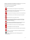
41 warnings, so icons always show information for the whole route, even if the data fields display values from your current position to a via point only. Click on any of the icons to show its description. A few samples of the available icons: • this icon shows that you need to pay toll on the recomm...
Page 42
42 4.6.3 fit to screen tap this button to display an overview of the whole recommended route. You will jump to the map screen with a 2d north-up view so that you can check where the route takes you. 4.6.4 parameters this button opens the route parameter settings screen (page 66) otherwise opened fro...
Page 43
43 switched on by tilting down in 2d mode. Map view modes are described here: page 17. Note: when you reach 2d view by tilting the map, smart zoom will tilt the map as you press the follow button or it disappears after the timeout (set in advanced settings) expires. Use the 3d map toggle to permanen...
Page 44
44 4.7.2.4 manage poi (points of interest) here you can set all the parameters of pois that you have created and the visibility of the built-in pois that come with the map. Manage built-in poi visibility the maps in xroad come with a huge number of pois. Displaying all of them would make the maps to...
Page 45
45 note: the group unnamed only appears if you have previously saved a poi item without creating a new poi group for it. Tapping any of the group names will open a list of pois saved in that group. This list is similar to the list of poi results in find. The pois are ordered based on their distance ...
Page 46
46 when the list of my pois is displayed, you have the following options: • search: you can shorten the list of matching poi items by filtering. Just like in find, enter a few letters of the desired poi name. When the number of matching items can fit in one page, xroad will automatically display the...
Page 47
47 tip: tapping one of the blue information icons behind the poi names shows the details of the appropriate poi item. 4.7.2.6 manage track logs using xroad it is also possible to save the track logs of your journeys. This screen lets you manage all your track logs. When it comes up, it shows a list ...
Page 48
48 icon (page 35) is shown on the map screens to let you know that a recording is in progress. Tapping that icon opens this track log screen. • stop recording: if recording is in progress, this buttons stops it. • info: this button opens a screen that shows the track log details, and lets you: • cha...
Page 49
49 recalculate this function repeats the route calculation based on the same settings as used to calculate previously. This possibility is typically used when automatic off-route recalculation is disabled. However you may consider using it when you travel on a road parallel to that recommended by th...
Page 50
50 4.7.3.2 delete tap delete to erase the active route along with all its route points (start, via points and destination). If you later decide that you need the same route again, you will have to rebuild it from scratch. Xroad will warn you before deleting route data. This function has a special ro...
Page 51
51 tap this button to see the highlighted list item on the map. This will help you identify route events in the list. Avoid tap this button to show a list of possibilities for modifying the route. They let you recalculate the route avoiding the highlighted event and sometimes also some of the subseq...
Page 52
52 this mode is mainly useful for demonstrating xroad, or to learn the way it works before you start your first journey. Tap anywhere on the screen to stop the simulation. 4.7.3.5 edit tap edit to see the list of all points used in the route. The first item in the list is the departure point of the ...
Page 53
53 4.7.4 main button the main button at the bottom right corner leads to the main menu screen described here: page 16. 4.8 tmc (traffic message channel) xroad can provide you with even better routes if traffic message channel (tmc) information is available. The tmc is a specific application of the f...
Page 54
54 tap the arrows to turn the page, and see traffic difficulties farther away from your current position, or press settings to configure the tmc subsystem. This opens a new window. 4.8.2 tmc control centre this screen shows the selected tmc source and allows you to change the tmc settings. 4.8.2.1 s...
Page 55
55 4.8.2.4 sort events by distance / type the list of traffic events can be ordered by their distance from the current position, or by their type. Tap this button to toggle between the two possibilities. 4.8.2.5 use traffic information this button is enabled by default, which means that tmc messages...
Page 56
56 4.9.1 camera types there are four types of speed cameras: 4.9.1.1 fixed cameras some cameras stand by the roadside, looking in one direction, measuring one or both directions of the traffic. They measure your current speed. For these cameras you can specify the controlled traffic direction and th...
Page 57
57 4.9.1.4 section control cameras these cameras work in pairs, and do not measure your current speed but your average speed between the two cameras. Both will identify your car, and record the exact time you pass them. The difference between the two points of time will be used to calculate your ave...
Page 58
58 4.9.3 speed limit checked as additional information, the speed limit checked by the camera is given for fixed, built-in and section control cameras. When you manually save a camera location from the cursor menu (page 35), the speed limit of the road (if available) is used by default, but you can ...
Page 59: 5 Settings
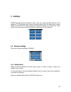
59 5 settings xroad provides several settings in order to let you customize the functions of the program. The settings screen can be accessed directly from the main menu screen (page 16) and from the map screens by using the battery icon (page 34), while some of its sub-screens are accessible from o...
Page 60
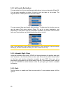
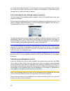
60 5.1.2 set favorite destinations you can select two of your most frequent destinations to be your favorites (page 89). You can start navigating to either of them by only two taps on the screen. The original names of these points are home and work. You can rename them and specify their locations. T...
Page 61
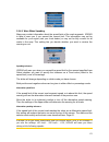
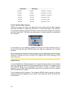
61 5.1.4.1 warn when speeding maps may contain information about the speed limits of the road segments. Xroad is able to warn you if you exceed the current limit. This information may not be available for your region (ask your local dealer) or may not be fully correct for all roads in the map. This ...
Page 62
62 speed limit warning at 40 km/h 50 km/h (=40 km/h + 10 km/h) 60 km/h 70 km/h (=60 km/h + 10 km/h) 90 km/h 100 km/h (=90 km/h + 10 km/h) 100 km/h 105 km/h (=100 km/h + 5%) 120 km/h 126 km/h (=120 km/h + 5%) 160 km/h 168 km/h (=160 km/h + 5%) 5.1.4.2 enable safety cameras xroad can warn you when you...
Page 63
63 5.1.5 route recalculation once a route is planned, this setting will tell xroad what to do when you deviate from that route. 5.1.5.1 automatic the route will be recalculated automatically a few seconds after you go astray. 5.1.5.2 ask first xroad can also ask your preference each time you leave t...
Page 64
64 5.2.1 daylight / night color profile xroad comes with different color schemes for both daylight and night use. There is always one selected daytime scheme and one selected night-time scheme. Xroad uses these when switching from day to night and back. Tap the appropriate button and select a new sc...
Page 65
65 5.3 sound settings settings on this page determine the way xroad sounds. Note: the mute function (page 35) accessible from the map screens overrides the settings on this screen. When xroad is muted, all sounds disappear. These settings will not be changed; only the output will be muted temporaril...
Page 66
66 5.3.4 dynamic volume when driving at high speed, the noise in the car may be too loud to clearly understand the voice guidance messages and to perceive the key sounds. Using dynamic volume you can instruct xroad to increase the volume when your speed exceeds a certain minimum, and reach its highe...
Page 67
67 5.4.2 route here you can choose from three different route types. 5.4.2.1 short choosing short will result in a route that has the smallest total distance of all possible routes between the given points. This is usually preferred by pedestrians, cyclists or slow vehicles. 5.4.2.2 fast choosing fa...
Page 68
68 5.4.4 road types to include/exclude to let the route fit your needs you can also set which road types are to be considered for or to be excluded from the route if possible. Note: excluding a road type is a preference. It does not necessarily mean total prohibition. If your destination can only be...
Page 69
69 5.4.4.6 toll roads toll roads are included in your routes by default. If you wish to travel more to avoid paying a toll, disabling them will make xroad plan the best toll-free route for you. Note: you have a few more ways to influence routing and route recalculation in advanced settings route opt...
Page 70
70 5.6 advanced settings these screens let you set a large number of different advanced settings and initiate some special functions. These settings and functions are divided into groups. Tap on any button to set the corresponding parameters. They all open new windows where you can make your desired...
Page 71
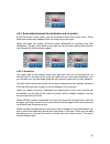
71 5.6.1.2 3d in cockpit mode (and track-up orientation) the normal use of the cockpit mode is cruising or navigating, when the road lying in front of the driver is the most important part of the map. It is usually done in a 3d view with the current direction towards the top of the map. By default x...
Page 72
72 5.6.2.1 power management at the top of the screen you can set how the backlight will behave when the screen has not been touched for a while. Backlight always on you can choose to have the lights always on. Smart powersave you can also initiate this special feature of xroad. When running on batte...
Page 73
73 5.6.3.1 smart zoom settings you can set how close smart zoom can zoom in when approaching the next turn (zoom-in limit), and the maximum zoom level to zoom out when the next turn is further away (zoom-out limit). The default values are set to be optimal in most cases. 5.6.3.2 enable overview mode...
Page 74
74 if you move the map, all parts of smart zoom become deactivated, and the view freezes. Tapping the follow button makes xroad follow your position again (lock- to-position) and also re-enables smart zoom. You can make xroad push the follow button for you automatically after a few seconds of inacti...
Page 75
75 5.6.4.1 off-route sensitivity and recalculation delay depending on the quality of your gps device, the gps antenna location in the car and the environment you are driving in, route recalculation can behave differently. Xroad may think you have departed the proposed route and perform a recalculati...
Page 76
76 5.6.4.4 carpool lanes (for the usa map only) you can instruct xroad to use carpool lanes when planning routes. These lanes are currently available in the usa only. This control only appears on the screen when the usa map is available in the product. 5.6.4.5 keep position on road (lock-on-road) xr...
Page 77
77 will then restart, and all your previous pois, track logs, settings, city and find history lists will also appear on the new pna . 5.6.5.2 restore data if you have accidentally deleted things, or you have created a number of temporary items and you do not wish to delete them one by one, you can t...
Page 78: 6 Find
78 6 find one of the most frequently used functions of xroad is selecting the destination. Once you have the destination, you can start navigating. Getting to this point should be as fast as possible. Xroad provides you with a versatile search engine designed to find your chosen destination after on...
Page 79
79 tip: if you want the selected point shown in the centre of the map, close and reopen the menu or wait until it closes and open it again. By opening the cursor menu manually, the map will be moved to have the selected location in the centre. 6.3 using the find menu the find menu is accessible by t...
Page 80
80 you enter the module at level 3. From this point you can go forward (down) to give the name of the street, then the house number or intersection, or backward (up) to change the city, state or country to search. 6.3.1.1 selecting the city, state and country to search in the first screen of the add...
Page 81
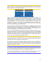
81 note: in netherlands, if you enter the whole postcode (6 digits), you do not need to select the street. You will proceed to the house number input screen. Just enter the house number to specify the exact address. You can accomplish this by using an alphabetic input screen (either an abc- or a qwe...
Page 82
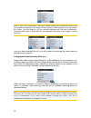
82 note: if any of the settlements listed has named suburbs or numbered districts that also appear separately in the map, a show districts button will appear in the bottom left corner. Tap this button to list the suburbs together with the main settlements. Now the button turns to hide districts, and...
Page 83
83 changing the country if your destination is in another country, tap the change country button in the top right corner of the state selection screen (australia, usa, etc.), or the city selection screen, and select the country from the list. 6.3.1.2 selecting a street or the centre of the settlemen...
Page 84
84 tip: you can search for both the type and the name of a road. If you have the same name appear as street, avenue, boulevard, road, place and court, you can get the result faster by giving the first letter of this, too. For example searching for ‘pi a’ will result in pine avenue skipping all pine ...
Page 85
85 street (displayed in the top centre of the screen). The crossing of the two streets will be the selected point. 6.3.1.5 an example for a full address search this is an example for the most complex address search, finding an address from abroad. In this example your current position is not in fran...
Page 86
86 just pick any of the recent locations as your destination. Here you have no possibility to reorder the list or filter it by name, but the next and previous buttons let you browse through the complete list to find your preferred point. Tip: if you will need a location later but you do not want to ...
Page 87
87 once you have entered both numbers, press done to make the selection. Tip: the quickest way to tell the coordinates of a point is to select it by tapping on the map or by using find, and then come to this page and read the coordinates. Tip: if you need to reformat coordinates to the format select...
Page 88
88 • cursor: the search will be carried out around the previously selected map point. • destination: the search will be carried out around the destination of your current route. The current selection is always shown in the green field at the top of the page. Note: the default reference point for poi...
Page 89
89 tapping the arrow in the top left corner returns to the search results. Tip: if you want to find the nearest pois, or if you are close to one of them but do not know exactly where it is or what its name is, tap the all button on the very first screen of poi search, and get a list of the nearest p...
Page 90: 7 Troubleshooting Guide
90 7 troubleshooting guide thank you again for purchasing our product. We hope you will enjoy every minute of using it. However you may face difficulties before you get really accustomed to xroad. In such cases, please, refer to this table of frequently encountered problematic situations. I cannot f...
Page 91
91 creating a multi-point route i have tapped the ‘route to’ button once for each destination but only the last one appears in the list, all previous points have disappeared. The ‘route to’ button is for starting a new route only. For a single route you tap this when the destination is selected. Mul...
Page 92: 8 Glossary
92 8 glossary the manual may contain many technical terms. Please look below for an explanation if you are unfamiliar with some of them. 2d/3d gps reception: the gps receiver uses satellite signals to calculate its (your) position. Depending on the current positions of the ever moving satellites in ...
Page 93
93 automatic day/night colors: based on the time and position given by the gps device, xroad is able to calculate when the sun rises and sets at your current location on this particular day. Using that information xroad can change between the day and the night color schemes a few minutes before sunr...
Page 94
94 position. Then the follow button appears on the screen. Tapping it will re-enable lock-to-position. See also page 32. Map orientation: xroad is able to rotate the map for your convenience. If you choose track-up mode, the map will be rotated to look in the direction of your heading. Selecting nor...
Page 95
95 9 end user license agreement 1. The contracting parties 1.1. Contracting parties to present agreement are, on the one hand: carpoint and nav n go kft (51 gabor aron, h-1026 budapest, hungary; hungarian reg.No.: 03-09-111944) as licensor and the legal user (as defined in section 2) of the object o...
Page 96
96 3.2. Present agreement is issued in english and in hungarian. In case of dispute the hungarian text shall prevail. 4. The object of the agreement 4.1. The object of present agreement shall be the navigation guidance software product of licensor (hereinafter referred to as software product). 4.2. ...
Page 97
97 copy of the software product has become unsuitable for proper and legal use without any doubt, such state thereof being supported by acceptable proof. 7. Limitations of use 7.1. The user is not entitled 7.1.1. To multiply the software product (to make a copy thereof); 7.1.2. To lease, rent, lend,...
Page 98
98 8.5. The licensor shall hereby also draw the attention of the user with great emphasis to the fact that while utilising the software product in any form of transportation, observing the traffic regulations and rules (e.G. Use of obligatory and/or reasonable and suitable security measures, proper ...


