- DL manuals
- Garmin
- GPS
- eTrex 10
- Owner's Manual
Garmin eTrex 10 Owner's Manual
Summary of eTrex 10
Page 1
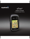
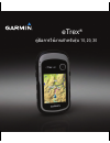
Etrex ® owner’s manual for use with models 10, 20, 30
Page 2
© 2012 garmin ltd. Or its subsidiaries all rights reserved. Under the copyright laws, this manual may not be copied, in whole or in part, without the written consent of garmin. Garmin reserves the right to change or improve its products and to make changes in the content of this manual without oblig...
Page 3: Table of Contents
Owner’s manual for use with models 10, 20, 30 1 table of contents en table of contents getting started ...................3 device overview ......................... 3 using the etrex keys ................... 4 battery information ..................... 5 turning the device on or off ........ 6 satel...
Page 4
2 owner’s manual for use with models 10, 20, 30 table of contents en system settings ........................ 28 display settings ........................ 28 setting the device tones ........... 29 map settings ............................. 29 tracks settings .......................... 30 changing t...
Page 5: Getting Started
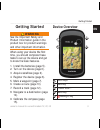
Owner’s manual for use with models 10, 20, 30 3 getting started en getting started warning see the important safety and product information guide in the product box for product warnings and other important information. When using your device the first time, you should complete these tasks to set up ...
Page 6: Using The Etrex Keys
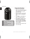
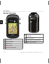
4 owner’s manual for use with models 10, 20, 30 getting started en ➏ ➒ ➑ ➐ ➏ mini-usb port (under weather cap) ➐ battery cover ➑ battery cover locking ring ➒ mounting spine using the etrex keys • move the thumb stick up, down, left, and right to highlight menu selections or to move around the map. •...
Page 7: Battery Information
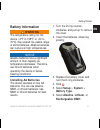
Owner’s manual for use with models 10, 20, 30 5 getting started en battery information warning the temperature rating for the device (-4°f to 158°f, or -20 to 70°c) may exceed the usable range of some batteries. Alkaline batteries can rupture at high temperatures. Notice alkaline batteries lose a si...
Page 8: Turning The Device On Or
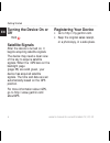
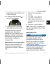
6 owner’s manual for use with models 10, 20, 30 getting started en turning the device on or off hold . Satellite signals after the device is turned on, it begins acquiring satellite signals. The device may need a clear view of the sky to acquire satellite signals. When the gps bars on the backlight ...
Page 9: Waypoints, Routes,
Owner’s manual for use with models 10, 20, 30 7 waypoints, routes, and tracks en waypoints, routes, and tracks waypoints waypoints are locations you record and store in the device. Creating a waypoint you can save your current location as a waypoint. 1. Select mark waypoint. 2. Select an option: • t...
Page 10: Increasing The Accuracy of A
8 owner’s manual for use with models 10, 20, 30 waypoints, routes, and tracks en increasing the accuracy of a waypoint location waypoint averaging allows you to increase the accuracy of a waypoint location by collecting multiple samples of the waypoint location. 1. Select waypoint averaging. 2. Sele...
Page 11: Where To? Menu
Owner’s manual for use with models 10, 20, 30 9 waypoints, routes, and tracks en where to? Menu you can use the where to? Menu to find a destination to navigate to. Not all where to? Categories are available in all areas and maps. Additional maps you can use additional maps on the etrex 20 and etrex...
Page 12: Finding An Address
10 owner’s manual for use with models 10, 20, 30 waypoints, routes, and tracks en finding an address you can use optional city navigator maps to search for addresses. 1. Select where to? > addresses. 2. If necessary, enter the country or state. 3. Enter the city or postal code. Note: not all map dat...
Page 13: Editing A Route
Owner’s manual for use with models 10, 20, 30 11 waypoints, routes, and tracks en editing a route 1. Select route planner. 2. Select a route. 3. Select edit route. 4. Select a point. 5. Select an option: • to view the point on the map, select review. • to change the order of the point on the route, ...
Page 14: Tracks
12 owner’s manual for use with models 10, 20, 30 waypoints, routes, and tracks en tracks a track is a recording of your path. The track log contains information about points along the recorded path, including time, location, and elevation for each point. Recording track logs 1. Select setup > tracks...
Page 15: Saving The Current Track
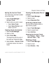
Owner’s manual for use with models 10, 20, 30 13 waypoints, routes, and tracks en saving the current track the track being recorded is called the current track. 1. Select track manager > current track. 2. Select what you want to save: • select save track. • select save portion, and select a portion....
Page 16: Navigation
14 owner’s manual for use with models 10, 20, 30 navigation en navigation you can navigate a route, a track, to a waypoint, to a geocache, or to any saved location in the device. You can use the map (page 14) or compass (page 15) to navigate to your destination. Navigating to a destination you can n...
Page 17: Navigating A Driving Route
Owner’s manual for use with models 10, 20, 30 15 navigation en • select a location on the map, and the bar at the top of the screen shows information about the selected location. Navigating a driving route driving route navigation is only available on the etrex 20 and etrex 30. Before you can use th...
Page 18: Calibrate Compass > Start.
16 owner’s manual for use with models 10, 20, 30 navigation en you should calibrate the compass after moving long distances, experiencing temperature changes, or changing the batteries. 1. Select compass > menu > calibrate compass > start. 2. Follow the on-screen instructions. Navigating with the be...
Page 19: Navigating With The Course
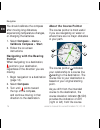
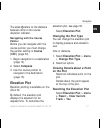
Owner’s manual for use with models 10, 20, 30 17 navigation en the scale ➍ refers to the distance between dots on the course deviation indicator. Navigating with the course pointer before you can navigate with the course pointer, you must change the pointer setting to course (cdi) (page 32). 1. Begi...
Page 20: Calibrating The Barometric
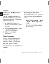
18 owner’s manual for use with models 10, 20, 30 navigation en calibrating the barometric altimeter you can manually calibrate the barometric altimeter if you know the correct elevation or the correct barometric pressure. 1. Go to a location where the elevation or barometric pressure is known. 2. Se...
Page 21: Geocaches
Owner’s manual for use with models 10, 20, 30 19 geocaches en geocaches a geocache is like a hidden treasure. Geocaching is when you hunt for hidden treasures using gps coordinates posted online by those hiding the geocache. Downloading geocaches 1. Connect your device to a computer (page 42). 2. Go...
Page 22: Back.
20 owner’s manual for use with models 10, 20, 30 geocaches en 1. Select setup > geocaches > filter setup > create filter. 2. Select items to filter. 3. Select an option: • to apply the filter to the geocache list, select search. • to save the filter, select back. After it is saved, the filter is aut...
Page 23: Add Comment, Enter A
Owner’s manual for use with models 10, 20, 30 21 geocaches en • to enter a comment about looking for the cache or the cache itself, select add comment, enter a comment, and select done. Chirp ™ chirp programming and searching is available on the etrex 30. A chirp is a small garmin accessory that you...
Page 24: Applications
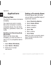
22 owner’s manual for use with models 10, 20, 30 applications en applications sharing data the etrex 30 can share information wirelessly. Your device can send or receive data when connected to another compatible device. You can share waypoints, geocaches, routes, and tracks. Sending and receiving da...
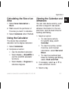
Page 25: Calculating The Size of An
Owner’s manual for use with models 10, 20, 30 23 applications en calculating the size of an area 1. Select area calculation > start. 2. Walk around the perimeter of the area you want to calculate. 3. Select calculate when finished. Using the calculator the device has a standard calculator and a degr...
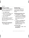
Page 26: Setting An Alarm
24 owner’s manual for use with models 10, 20, 30 applications en setting an alarm if you are not currently using the device, you can set the device to turn on at a specific time. 1. Select alarm clock. 2. Select the clock numbers to set the time, and select done. 3. Select turn alarm on. 4. Select a...
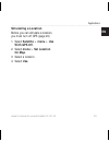
Page 27: Simulating A Location
Owner’s manual for use with models 10, 20, 30 25 applications en simulating a location before you can simulate a location, you must turn off gps (page 24). 1. Select satellite > menu > use with gps off. 2. Select menu > set location on map. 3. Select a location. 4. Select use..
Page 28: Customizing Your
26 owner’s manual for use with models 10, 20, 30 customizing your device en customizing your device customizing the main menu select menu > change item order to change the item order on the main menu. Customizing specific pages data fields display information about your location or other specified d...
Page 29: Customizing Dashboards
Owner’s manual for use with models 10, 20, 30 27 customizing your device en customizing dashboards 1. Open the page for which you want to customize the dashboard. 2. Select an option: • from the map, select menu > setup map > data fields > dashboard. • from the compass or trip computer, select menu ...
Page 30: Editing A Profile Name
28 owner’s manual for use with models 10, 20, 30 customizing your device en editing a profile name 1. Select setup > profiles. 2. Select a profile. 3. Select edit name. 4. Enter the new name. 5. Select done. Deleting a profile 1. Select setup > profiles. 2. Select a profile. 3. Select delete > yes. ...
Page 31: ◦ Mode—Sets A Light
Owner’s manual for use with models 10, 20, 30 29 customizing your device en ◦ mode—sets a light background (day), a dark background (night), or automatically switches between the two based on the sunrise time and the sunset time for your current location (auto). ◦ day background color— sets the back...
Page 32: Map. When Off Is Selected,
30 owner’s manual for use with models 10, 20, 30 customizing your device en • guidance text—allows you to select when to show guidance text on the map. • data fields—selects the number and size of the data fields to display on the map. • advanced map setup—sets the zoom levels, the text size, and th...
Page 33: Changing The Units of
Owner’s manual for use with models 10, 20, 30 31 customizing your device en frequentlycreates a more- detailed track, but fills the track log faster. • auto archive—selects an automatic archive method to organize your tracks. Tracks are saved and cleared automatically based on the user setting. • co...
Page 34: • Map Datum—Sets The
32 owner’s manual for use with models 10, 20, 30 customizing your device en • map datum—sets the coordinate system on which the map is structured. • map spheroid—shows the coordinate system the device is using. The default coordinate system is wgs 84. Heading settings this function is available on t...
Page 35: • Barometer Mode
Owner’s manual for use with models 10, 20, 30 33 customizing your device en • barometer mode ◦ variable elevation—allows the barometer to measure changes in elevation while you are moving. ◦ fixed elevation—assumes the device is stationary at a fixed elevation. Therefore, the barometric pressure sho...
Page 36: • Chirp
34 owner’s manual for use with models 10, 20, 30 customizing your device en • found geocaches—allows you to edit the number of geocaches found. This number automatically increases as you log a find (page 20). • filter setup— page 19. • chirp ™ searching—page 21. • program chirp ™ —programs the chirp...
Page 37: ◦ Manual—Allows You to
Owner’s manual for use with models 10, 20, 30 35 customizing your device en • lock on road—locks the position icon, which represents your position on the map, onto the nearest road. • off road transitions— available only for some activities. ◦ auto—automatically routes you to the next point. ◦ manua...
Page 38: • Marine Alarm Setup
36 owner’s manual for use with models 10, 20, 30 customizing your device en navigation aids on the map. • marine alarm setup ◦ anchor drag alarm—alarm sounds when you exceed a specified drift distance while anchored. ◦ off course alarm—alarm sounds when you are off course by a specified distance. ◦ ...
Page 39: Restoring Specific Page
Owner’s manual for use with models 10, 20, 30 37 customizing your device en restoring specific page settings you can restore the settings for the map, compass, and trip computer. 1. Open the page for which you will restore the settings. 2. Select menu > restore defaults. Restoring all default settin...
Page 40: Device Information
38 owner’s manual for use with models 10, 20, 30 device information en device information adjusting the screen note: the backlight brightness may be limited when the remaining capacity in the batteries is low. Extensive use of screen backlighting can significantly reduce battery life. 1. While the d...
Page 41: Specifications
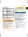
Owner’s manual for use with models 10, 20, 30 39 device information en specifications water resistance rugged plastic, waterproof to iec 60529 ipx7 battery type 2 aa batteries, (alkaline, nimh, lithium, or precharged nimh) battery life up to 25 hours operating temperature range from -4°f to 158°f (-...
Page 42: Long-Term Storage
40 owner’s manual for use with models 10, 20, 30 device information en long-term storage when you do not plan to use the device for several months, remove the batteries. Stored data is not lost when batteries are removed. Caring for the device notice avoid chemical cleaners and solvents which can da...
Page 43: Data Management
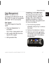
Owner’s manual for use with models 10, 20, 30 41 device information en data management note: the device is not compatible with windows ® 95, 98, me, or nt. It is also not compatible with mac ® os 10.3 and earlier. File types the device supports these file types. • files from basecamp ™ or homeport ™...
Page 44: Connecting The Device to A
42 owner’s manual for use with models 10, 20, 30 device information en 4. Place the microsd card ➋ in the device with the gold contacts facing down. 5. Close the card holder. 6. Slide the card holder toward the top of the device to lock it. 7. Replace the batteries (page 5). 8. Replace the battery c...
Page 45: 5. Select Edit > Paste.
Owner’s manual for use with models 10, 20, 30 43 device information en 4. Open the “garmin” or memory card drive/volume. 5. Select edit > paste. Tip: you must put geocache files in the garmin\gpx folder. Deleting files notice if you do not know the purpose of a file, do not delete it. Your device me...
Page 46: Appendix
44 owner’s manual for use with models 10, 20, 30 appendix en appendix optional accessories optional accessories, such as mounts, maps, fitness accessories, and replacement parts, are available at http://buy.Garmin.Com or from your garmin dealer. Optional maps you can purchase additional maps, such a...
Page 47: Tips For Pairing Ant+
Owner’s manual for use with models 10, 20, 30 45 appendix en tips for pairing ant+ accessories with your garmin device • verify that the ant+ accessory is compatible with your garmin device. • before you pair the ant+ accessory with your garmin device, move (33 ft. Or 10 m) away from other ant+ acce...
Page 48
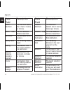
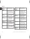
46 owner’s manual for use with models 10, 20, 30 appendix en data field description ascent - maximum the maximum ascent rate in feet or meters per minute. Ascent - total the total elevation distance ascended. Barometer the calibrated current pressure. Battery level the remaining battery power. Beari...
Page 49
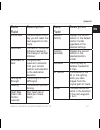
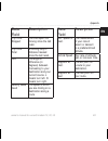
Owner’s manual for use with models 10, 20, 30 47 appendix en data field description eta at next the estimated time of day you will reach the next waypoint on the route. Glide ratio the ratio of horizontal distance traveled to the change in vertical distance. Glide ratio to dest. The glide ratio requ...
Page 50
48 owner’s manual for use with models 10, 20, 30 appendix en data field description speed the current rate of speed at which you are moving since last reset. Speed - maximum the maximum speed reached since last reset. Speed - moving avg. The average speed of the device while moving since last reset....
Page 51
Owner’s manual for use with models 10, 20, 30 49 appendix en data field description trip time - stopped the time spent not moving since the last reset. Trip time - total a running tally of distance traveled since the last reset. Turn the angle of difference (in degrees) between the bearing to your d...
Page 52: Troubleshooting
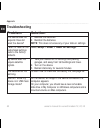
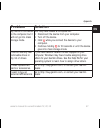
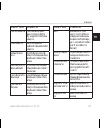
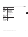
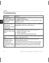
50 owner’s manual for use with models 10, 20, 30 appendix en troubleshooting problem solution the device does not respond. How do i reset the device? 1. Remove the batteries. 2. Reinstall the batteries. Note: this does not erase any of your data or settings. I want to reset all the customized settin...
Page 53: Problem
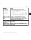
Owner’s manual for use with models 10, 20, 30 51 appendix en problem solution my device is connected to the computer, but it will not go into mass storage mode. You may have loaded a corrupted file. 1. Disconnect the device from your computer. 2. Turn off the device. 3. Hold while you connect the de...
Page 55
Etrex ® คู่มือการใช้งานสำาหรับรุ่น 10, 20, 30
Page 56
© 2012 garmin ltd. หรือบริษัทสาขา สงวนลิขสิทธิ์ ภายใต้กฎหมายลิขสิทธิ์ ไม่อนุญาตให้ทำาสำาเนาคู่มือฉบับนี้ ไม่ว่า จะเป็นบางส่วนหรือทั้งหมด โดยไม่ได้รับความยินยอมเป็นลายลักษณ์อักษรจาก garmin บริษัท garmin ขอสงวนสิทธิ์ในการเปลี่ยนแปลงหรือแก้ไขผลิตภัณฑ์ของ บริษัท และเปลี่ยนแปลงเนื้อหาของคู่มือฉบับนี้ โดย...
Page 57: สารบัญ
คู่มือการใช้งานสำาหรับรุ่น 10, 20, 30 55 th สารบัญ สารบัญ เริ่มต้นการใช้งาน .................57 ภาพรวมอุปกรณ์ .......................... 57 การใช้ปุ่มของ etrex ..................... 58 ข้อมูลแบตเตอรี่ ........................... 59 การเปิดหรือปิดอุปกรณ์ ................. 60 สัญญาณดาวเทียม .............
Page 58
56 คู่มือการใช้งานสำาหรับรุ่น 10, 20, 30 th สารบัญ การตั้งค่าระบบ ............................ 81 การตั้งค่าการแสดงผล................... 81 การตั้งค่าโทนเสียงของอุปกรณ์ ....... 82 การตั้งค่าแผนที่ ........................... 82 การตั้งค่า tracks ......................... 83 การเปลี่ยนหน่วยวัด .........
Page 59: คำาเตือน
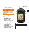
คู่มือการใช้งานสำาหรับรุ่น 10, 20, 30 57 th เริ่มต้นการใช้งาน เริ่มต้นการใช้งาน คำาเตือน ดูคู่มือ ความปลอดภัยที่สำาคัญและ ข้อมูลผลิตภัณฑ ์ ในกล่องผลิตภัณฑ์ สำาหรับคำาเตือนของผลิตภัณฑ์และ ข้อมูลสำาคัญอื่น ๆ เมื่อใช้อุปกรณ์เป็นครั้งแรก คุณควรทำา ขั้นตอนเหล่านี้เพื่อตั้งค่าอุปกรณ์ และ เพื่อเรียนรู้คุณส...
Page 60
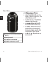
58 คู่มือการใช้งานสำาหรับรุ่น 10, 20, 30 th เริ่มต้นการใช้งาน ➏ ➒ ➑ ➐ ➏ พอร์ต mini-usb (ใต้ฝาป้องกันสภาพ อากาศ) ➐ ฝาครอบแบตเตอรี่ ➑ แหวนล็อกฝาครอบแบตเตอรี่ ➒ แกนยึดด้านหลังสำาหรับการติดตั้ง การใช้ปุ่มของ etrex • เลื่อน thumb stick ขึ้น ลง ซ้าย และขวา เพื่อเน้นการเลือกเมนู หรือ เคลื่อนไปรอบๆ แผนที่ •...
Page 61: คำาเตือน
คู่มือการใช้งานสำาหรับรุ่น 10, 20, 30 59 th เริ่มต้นการใช้งาน ข้อมูลแบตเตอรี่ คำาเตือน ระดับอุณหภูมิสำาหรับอุปกรณ์ (-4°f ถึง 158°f, หรือ -20 ถึง 70°c) อาจ เกินช่วงการใช้งานของแบตเตอรี่บาง ชนิด แบตเตอรี่ alkaline อาจแตกออกที่ อุณหภูมิสูงได้ หมายเหต ุ แบตเตอรี่ alkaline จะสูญเสียความ จุไฟฟ้าในปริมาณมา...
Page 62: และ Tracks
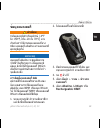
60 คู่มือการใช้งานสำาหรับรุ่น 10, 20, 30 th waypoints เส้นทาง และ tracks การเปิดหรือปิดอุปกรณ์ กด ค้างไว้ สัญญาณดาวเทียม หลังจากเปิดอุปกรณ์ ก็จะเริ่มรับ สัญญาณดาวเทียม โดยอาจต้องเห็น ท้องฟ้า เพื่อให้อุปกรณ์รับสัญญาณ ดาวเทียมได้ เมื่อแถบ gps บนหน้า backlight (หน้า 90) ขึ้นเป็นสีเขียว ทึบ แสดงว่าอุปกร...
Page 63: การหา Waypoint
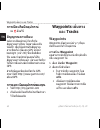
คู่มือการใช้งานสำาหรับรุ่น 10, 20, 30 61 th waypoints เส้นทาง และ tracks การหา waypoint 1. เลือก ค้นหาตำาแหน่ง > waypoints 2. เลือกหนึ่ง waypoint การแก้ไข waypoint ก่อนที่จะสามารถแก้ไข waypoint คุณ ต้องสร้าง waypoint ขึ้นมาก่อน 1. เลือก จัดการ waypoint 2. เลือกหนึ่งจุด waypoint 3. เลือกรายการที่ต้อง...
Page 64: Waypoint
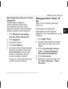
62 คู่มือการใช้งานสำาหรับรุ่น 10, 20, 30 th waypoints เส้นทาง และ tracks การใช้ sight ‘n go มี sight ‘n go บน etrex 30 คุณสามารถชี้อุปกรณ์ไปที่วัตถุที่อยู่ไกล ออกไป ล็อคทิศทาง และนำาทางไปยัง วัตถุนั้นได้ 1. เลือก sight ‘n go 2. ชี้อุปกรณ์ไปยังหนึ่งวัตถุหรือใน ทิศทางของหนึ่งตำาแหน่ง 3. เลือก ล็อคทิศท...
Page 65: สะกด
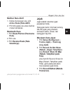
คู่มือการใช้งานสำาหรับรุ่น 10, 20, 30 63 th waypoints เส้นทาง และ tracks การค้นหาตำาแหน่งโดยใช้ชื่อ ขึ้นอยู่กับแผนที่ที่ถูกติดตั้งบนอุปกรณ์ ของคุณ คุณสามารถค้นหาเมือง จุดทาง ภูมิศาสตร์ และจุดสนใจ (pois) อื่น ๆ ได้ เช่น ร้านอาหาร โรงแรม และบริการ สำาหรับรถยนต์ 1. เลือก ค้นหาตำาแหน่ง 2. เลือกหนึ่งหมวด...
Page 66
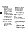
64 คู่มือการใช้งานสำาหรับรุ่น 10, 20, 30 th waypoints เส้นทาง และ tracks การสร้างเส้นทาง 1. เลือก วางแผนเส้นทาง > สร้าง เส้นทาง > เลือกจุดเรีมต้น 2. เลือกหนึ่งหมวดหมู่ 3. เลือกจุดแรกในเส้นทาง 4. เลือก ใช้ > เลือกจุดต่อไป 5. ทำาขั้นตอน 2–4 ซ้ำาจนกระทั่งเส้น ทางเสร็จสมบูรณ์ 6. เลือก back เพื่อบันทึกเส...
Page 67: Tracks
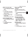
คู่มือการใช้งานสำาหรับรุ่น 10, 20, 30 65 th waypoints เส้นทาง และ tracks การดูเส้นทางบนแผนที่ 1. เลือก วางแผนเส้นทาง 2. เลือกหนึ่งเส้นทาง 3. เลือก ดูแผนที่ การลบเส้นทาง 1. เลือก วางแผนเส้นทาง 2. เลือกหนึ่งเส้นทาง 3. เลือก ลบเส้นทาง การดูเส้นทางที่ใช้งาน 1. ในระหว่างการนำาทางบนเส้นทาง ให้ เลือก เส้นท...
Page 68: ปัจจุบัน
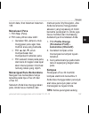
66 คู่มือการใช้งานสำาหรับรุ่น 10, 20, 30 th waypoints เส้นทาง และ tracks • เลือก ระยะทาง เพื่อบันทึก tracks ตามระยะทางที่ถูกระบุ • เลือก เวลา เพื่อบันทึก tracks ตามเวลาที่ถูกระบุ 5. เลือก ช่วง 6. ทำาต่อจนจบขั้นตอน: • เลือกหนึ่งตัวเลือกเพื่อบันทึก tracks บ่อยขึ้นหรือน้อยลง หมายเหตุ: การใช้ช่วง บ่อย ท...
Page 69: การนำาทาง
คู่มือการใช้งานสำาหรับรุ่น 10, 20, 30 67 th การนำาทาง การดูผังความสูงของหนึ่ง track 1. เลือก จัดการ track 2. เลือกหนึ่ง track 3. เลือก profile ผังความสูง การจัดเก็บ track ที่ถูกบันทึกไว้ แล้วแบบถาวร คุณสามารถจัดเก็บ tracks ที่ถูกบันทึก แล้วไว้อย่างถาวรได้ เพื่อลดขนาดเนื้อที่ หน่วยความจำา 1. เลือก จั...
Page 70: นำาทาง
68 คู่มือการใช้งานสำาหรับรุ่น 10, 20, 30 th การนำาทาง การหยุดการนำาทาง เลือก ค้นหาตำาแหน่ง > หยุด นำาทาง แผนที่ แสดงตำาแหน่งของคุณบนแผนที่ ในขณะที่คุณเดินทาง จะเคลื่อนที่ไป ด้วย เมื่อคุณกำาลังนำาทางไปยังจุดหมาย เส้นทางของคุณถูกแสดงด้วยเส้นสีม่วง บนแผนที่ ดูการปรับ dashboard แผนที่และ data fields ที่...
Page 71: เข็มทิศ
คู่มือการใช้งานสำาหรับรุ่น 10, 20, 30 69 th การนำาทาง เข็มทิศ etrex 30 มีเข็มทิศอิเล็กทรอนิกส์แบบ 3 แกน คุณสามารถใช้ลูกศรชี้ทิศทาง หรือลูก ศรชี้เส้นทาง เพื่อนำาทางไปยังจุดหมาย ได้ เคล็ดลับ: เมื่ออุปกรณ์กำาลังใช้ profile รถยนต์ เข็มทิศจะแสดงทิศทางการมุ่ง หน้าของ gps ไม่ใช่ทิศทางของแม่ เหล็ก การปรับตั...
Page 72
70 คู่มือการใช้งานสำาหรับรุ่น 10, 20, 30 th การนำาทาง ของคุณ ➋ ➊ ➍ ➌ ลูกศรชี้เส้นทาง ➊ แสดงความสัมพันธ์ ของคุณกับเส้นทาง ➋ ที่จะนำาไปสู่จุด หมาย เส้นทางไปยังจุดหมายของคุณ ขึ้นอยู่กับจุดเริ่มต้นดั้งเดิมของคุณ เมื่อคุณเบี่ยงเบนออกจากเส้นทาง ที่วางแผนไว้ไปสู่จุดหมาย ตัวบ่งชี้ ความคลาดเคลื่อนของเส้นทาง ...
Page 73: แผนภูมิ
คู่มือการใช้งานสำาหรับรุ่น 10, 20, 30 71 th การนำาทาง การเปลี่ยนประเภทของผัง คุณสามารถเปลี่ยนประเภทของการวาด ผังความสูงให้แสดงแรงกดบนพื้นผิวกับ ระดับความสูงตามเวลาหรือระยะทางได้ 1. เลือก profile ผังความสูง > menu > เปลี่ยนประเภทแผนภูมิ 2. เลือกหนึ่งตัวเลือก การดูรายละเอียดเกี่ยวกับจุดบน แผนภูมิ เลือ...
Page 74: ใหม่ > ใช่
72 คู่มือการใช้งานสำาหรับรุ่น 10, 20, 30 th geocaches การตั้งค่าข้อมูลการเดินทางใหม่ เพื่อให้ได้ข้อมูลที่แม่นยำา ให้ตั้งค่า ข้อมูลการเดินทางใหม่ก่อนเริ่มการเดิน ทาง เลือก trip computer > menu > ตั้งใหม่ > ตั้งข้อมูลเดินทาง ใหม่ > ใช่ ค่าทั้งหมดของ trip computer จะ ถูกปรับให้เป็นศูนย์ geocaches geoca...
Page 75: Geocache
คู่มือการใช้งานสำาหรับรุ่น 10, 20, 30 73 th geocaches การกรองรายการ geocache คุณสามารถกรองรายการ geocache ได้ตามปัจจัยที่กำาหนด เช่น ระดับของ ความยาก 1. เลือก geocaches > menu > ใช้ filter > quick filter 2. เลือกรายการเพื่อกรอง 3. เลือกหนึ่งตัวเลือก: • เลือก ค้นหา เพื่อใช้ตัวกรอง รายการ geocache • เ...
Page 76: Chirp
74 คู่มือการใช้งานสำาหรับรุ่น 10, 20, 30 th geocaches การนำาทางไปยัง geocache 1. เลือก geocaches 2. เลือกหนึ่ง geocache 3. เลือก นำาทาง 4. นำาทางโดยใช้แผนที่ (หน้า 68) หรือเข็มทิศ (หน้า 69) การบันทึกความพยายาม หลังจากที่คุณพยายามค้นหา geocache คุณสามารถบันทึกผลการค้นหาไว้ได้ 1. เลือก geocaches > men...
Page 77: ใช้งาน
คู่มือการใช้งานสำาหรับรุ่น 10, 20, 30 75 th โปรแกรมประยุกต์ การเปิดใช้การค้นหา chirp 1. เลือก ตั้งค่า > geocaches 2. เลือก กำาลังค้นหา chirp™ > เปิด ใช้งาน การค้นหา geocache ด้วย chirp 1. เลือก geocaches > menu > แสดงรายละเอียดของ chirp™ 2. เริ่มการนำาทางไปยัง geocache (หน้า 74) เมื่อคุณอยู่ภายในระย...
Page 78
76 คู่มือการใช้งานสำาหรับรุ่น 10, 20, 30 th โปรแกรมประยุกต์ การตั้งค่าการเตือนใกล้เคียง การเตือนใกล้เคียงจะเตือนให้คุณทราบ เมื่อคุณเข้าใกล้ระยะที่ถูกกำาหนดไว้ล่วง หน้าของตำาแหน่งนั้น ๆ 1. เลือก เตือนใกล้เคียง 2. เลือก สร้างสัญญาณเตือน 3. เลือกหนึ่งหมวดหมู่ 4. เลือกหนึ่งตำาแหน่ง 5. เลือก ใช้ 6. ป้อนร...
Page 79
คู่มือการใช้งานสำาหรับรุ่น 10, 20, 30 77 th โปรแกรมประยุกต์ การดูปฏิทินและ almanacs คุณสามารถดูกิจกรรมของอุปกรณ์ได้ เช่น เมื่อมีการบันทึก waypoint, ดู ข้อมูล almanac สำาหรับพระอาทิตย์และ พระจันทร์, และเวลาที่ดีที่สุดสำาหรับการ ล่าสัตว์และการตกปลา 1. เลือกหนึ่งตัวเลือก: • เลือก ปฏิทิน เพื่อดูกิจกรรมข...
Page 80: การปิด Gps
78 คู่มือการใช้งานสำาหรับรุ่น 10, 20, 30 th โปรแกรมประยุกต์ การเปิดนาฬิกาจับเวลา เลือก นาฬิกาจับเวลา หน้าดาวเทียม หน้าดาวเทียมแสดงตำาแหน่งปัจจุบัน ของคุณ ความแม่นยำาของ gps ตำาแหน่งดาวเทียม และความแรงของ สัญญาณ การเปลี่ยนภาพดาวเทียม 1. เลือก ดาวเทียม > menu 2. หากจำาเป็น ให้เลือก หันทิศรถวิ่ง เพื่อเ...
Page 81: ของคุณ
คู่มือการใช้งานสำาหรับรุ่น 10, 20, 30 79 th การตั้งค่าอุปกรณ์ ของคุณ การตั้งค่าอุปกรณ์ ของคุณ การตั้งค่าเมนูหลัก เลือก menu > เปลี่ยนลำาดับ รายการ เพื่อเปลี่ยนลำาดับรายการ บนเมนูหลัก การตั้งค่าหน้าเฉพาะต่าง ๆ data fields แสดงข้อมูลเกี่ยวกับ ตำาแหน่งของคุณหรือข้อมูลเฉพาะอื่น ๆ dashboards เป็นการรวมกล...
Page 82: Dashboard
80 คู่มือการใช้งานสำาหรับรุ่น 10, 20, 30 th การตั้งค่าอุปกรณ์ ของคุณ การปรับ dashboards 1. เปิดหน้าที่คุณต้องการปรับ dashboard 2. เลือกหนึ่งตัวเลือก: • จากแผนที่ให้เลือก menu > ตั้งค่าแผนที่> data fields > dashboard • จากเข็มทิศหรือ trip computer เลือก menu > เปลี่ยน dashboard 3. เลือกหนึ่ง dashboar...
Page 83: การลบ Profile
คู่มือการใช้งานสำาหรับรุ่น 10, 20, 30 81 th การตั้งค่าอุปกรณ์ ของคุณ การแก้ไขชื่อ profile 1. เลือก ตั้งค่า > profiles 2. เลือกหนึ่ง profile 3. เลือก แก้ไขชื่อ 4. ป้อนชื่อใหม่ 5. เลือก เสร็จ การลบ profile 1. เลือก ตั้งค่า > profiles 2. เลือกหนึ่ง profile 3. เลือก ลบ การตั้งค่าระบบ เลือก ตั้งค่า > ระบ...
Page 84: อุปกรณ์
82 คู่มือการใช้งานสำาหรับรุ่น 10, 20, 30 th การตั้งค่าอุปกรณ์ ของคุณ มืด (กลางคืน) หรือสับเปลี่ยน ระหว่างทั้งสองระบบโดย อัตโนมัติ ตามเวลาที่พระอาทิตย์ ขึ้นและเวลาที่พระอาทิตย์ตก สำาหรับตำาแหน่งปัจจุบันของคุณ (อัตโนมัติ) ◦ แบบสีกลางวัน — ตั้งค่าสี สำาหรับโหมดกลางวัน ◦ แบบสีกลางคืน — ตั้งค่าสี สำาหรับ...
Page 85
คู่มือการใช้งานสำาหรับรุ่น 10, 20, 30 83 th การตั้งค่าอุปกรณ์ ของคุณ ระดับการซูมที่เหมาะสมโดย อัตโนมัติ เพื่อการใช้แผนที่อย่าง มีประสิทธิภาพที่สุด เมื่อเลือก ปิด คุณต้องซูมเข้าหรือออกด้วย ตนเอง ◦ ระดับการซูม—เลือกระดับการ ซูมสำาหรับรายการต่างๆ บน แผนที่ ◦ ขนาดตัวอักษร—เลือกขนาดตัว อักษรสำาหรับรายการ...
Page 86
84 คู่มือการใช้งานสำาหรับรุ่น 10, 20, 30 th การตั้งค่าอุปกรณ์ ของคุณ ค่าของผู้ใช้ • สี (etrex 20/30)—เปลี่ยนสีของ เส้น track บนแผนที่ การเปลี่ยนหน่วยวัด คุณสามารถปรับหน่วยวัดสำาหรับระยะ ทางและความเร็ว ความสูง และแรงกด บนพื้นผิวได้ 1. เลือก ตั้งค่า > หน่วย 2. เลือกประเภทของหน่วยวัด 3. เลือกหน่วยวัดสำ...
Page 87
คู่มือการใช้งานสำาหรับรุ่น 10, 20, 30 85 th การตั้งค่าอุปกรณ์ ของคุณ ตามโครงสร้างของแผนที่ • map spheroid—แสดงระบบพิกัด ที่อุปกรณ์กำาลังใช้อยู่ ระบบพิกัด มาตรฐานคือ wgs 84 การตั้งทิศทางที่มุ่งหน้าไป ฟังก์ชั่นนี้มีอยู่บน etrex 30 เลือก ตั้งค่า > ทิศทางที่มุ่งไป • แสดงผล—ตั้งประเภทของทิศทาง การมุ่งหน้...
Page 88: Geocache Style
86 คู่มือการใช้งานสำาหรับรุ่น 10, 20, 30 th การตั้งค่าอุปกรณ์ ของคุณ อากาศเท่านั้น • trending ของความกดอากาศ ◦ จัดเก็บเมื่อเปิดเครื่อง— บันทึก ข้อมูลความกดอากาศเฉพาะเมื่อ เปิดอุปกรณ์อยู่เท่านั้น คุณสมบัติ นี้มีประโยชน์เมื่อคุณกำาลังเฝ้า ดูแนวโน้มการเปลี่ยนความกด อากาศ ◦ จัดเก็บ—บันทึกข้อมูลความกด อา...
Page 89
คู่มือการใช้งานสำาหรับรุ่น 10, 20, 30 87 th การตั้งค่าอุปกรณ์ ของคุณ การตั้งค่าการนำาทาง อุปกรณ์จะคำานวณเส้นทางที่เหมาะสม กับประเภทของกิจกรรมที่คุณกำาลังทำา ที่สุด การตั้งค่าการนำาทางจะแตกต่างกันไป ตามกิจกรรมที่เลือก เลือก ตั้งค่า > การนำาทาง • วิธีการนำาทาง— ให้คุณเลือกวิธี การนำาทางสำาหรับการคำานว...
Page 90: Marine Alarm
88 คู่มือการใช้งานสำาหรับรุ่น 10, 20, 30 th การตั้งค่าอุปกรณ์ ของคุณ การตั้งค่าแผนที่ทางทะเล ฟังก์ชั่นนี้มีอยู่บน etrex 20 และ etrex 30 เลือก ตั้งค่า > ทะเล • โหมดแผนภูมิทางทะเล— ให้คุณ เลือกแผนภูมิการเดินเรือหรือแผนภูมิ การตกปลา: ◦ การเดินเรือ—แสดงคุณสมบัติ แผนที่หลายแบบในสีต่างกัน เพื่อให้สามารถอ่...
Page 91: ฟิตเนส
คู่มือการใช้งานสำาหรับรุ่น 10, 20, 30 89 th การตั้งค่าอุปกรณ์ ของคุณ ฟิตเนส สำาหรับข้อมูลเพิ่มเติมเกี่ยวกับอุปกรณ์ เสริมทางฟิตเนส ดูที่หน้า 96 การตั้งข้อมูลใหม่ คุณสามารถตั้งข้อมูลการเดินทาง, ลบ waypoints ทั้งหมด, ลบ track ปัจจุบัน, หรือใช้ค่าโรงงานใหม่ได้ 1. เลือก ตั้งค่า > ตั้งค่าใหม่ 2. เลือกรายก...
Page 92: การลบหน้า
90 คู่มือการใช้งานสำาหรับรุ่น 10, 20, 30 th ข้อมูลอุปกรณ การเปลี่ยนลำาดับหน้า ก่อนที่จะสามารถเปลี่ยนลำาดับหน้าได้ คุณต้องทำาการเพิ่มหน้าเข้าตามลำาดับ ก่อน (หน้า 90) 1. เลือก ตั้งค่า > ลำาดับหน้า 2. เลือกหนึ่งหน้า 3. เลือก เลื่อน 4. เลือกตำาแหน่งของหน้าใหม่ การเพิ่มหน้า 1. เลือก ตั้งค่า > ลำาดับหน้า ...
Page 93: Backlight ใน
คู่มือการใช้งานสำาหรับรุ่น 10, 20, 30 91 th ข้อมูลอุปกรณ เลือก ตั้งค่า > แสดง > ปิด backlight ใน การอัพเดทซอฟต์แวร์ ก่อนที่คุณจะสามารถอัพเดทซอฟต์แวร์ ได้ คุณต้องเชื่อมต่ออุปกรณ์เข้ากับ คอมพิวเตอร์ (หน้า 94) 1. ไปที่ http://www.Garmin.Com/ products/webupdater 2. ทำาตามขั้นตอนบนหน้าจอ หมายเหตุ: การอัพ...
Page 94
92 คู่มือการใช้งานสำาหรับรุ่น 10, 20, 30 th ข้อมูลอุปกรณ ข้อควรระวัง ติดต่อแผนกกำาจัดของเสียในท้องถิ่น ของคุณ เพื่อทำาการรีไซเคิลแบตเตอรี่ อย่างถูกต้อง หมายเหตุ แบตเตอรี่ alkaline จะสูญเสียความจุ ไฟฟ้าในปริมาณมาก เมื่ออุณหภูมิลดลง ดังนั้นให้ใช้แบตเตอรี่ lithium เมื่อใช้ งานอุปกรณ์ในสภาพแวดล้อมที่เย็...
Page 95
คู่มือการใช้งานสำาหรับรุ่น 10, 20, 30 93 th ข้อมูลอุปกรณ 3. เช็ดจอให้แห้งทั่วกัน การแช่น้ำา หมายเหตุ อุปกรณ์นี้กันน้ำาตามมาตรฐาน iec 60529 ipx7 สามารถทนการแช่น้ำาที่ ความลึก 1 เมตรได้เป็นเวลานาน 30 นาที อย่างไรก็ตาม การปล่อยจมอยู่ใน น้ำาเป็นเวลานานสามารถทำาให้เกิดความ เสียหายต่ออุปกรณ์ได้ เมื่อนำาขึ...
Page 96
94 คู่มือการใช้งานสำาหรับรุ่น 10, 20, 30 th ข้อมูลอุปกรณ การติดตั้ง microsd การ์ด etrex 20 และ etrex 30 สามารถใช้ microsd การ์ดสำาหรับเก็บข้อมูลเพิ่ม เติมได้ และแผนที่บางพื้นที่ยังมีติดตั้ง ล่วงหน้าบนการ์ดหน่วยความจำา สำาหรับ ข้อมูลเพิ่มเติมไปที่ http://buy.Garmin. Com 1. หมุนแหวนรูปตัว d ทวนเข็มนาฬ...
Page 97: การลบไฟล์
คู่มือการใช้งานสำาหรับรุ่น 10, 20, 30 95 th ข้อมูลอุปกรณ ➊ ➋ 3. เสียบปลายด้านเล็กของสายเคเบิล usb เข้าไปในพอร์ต mini-usb อุปกรณ์ของคุณและการ์ดหน่วยความ จำา (อุปกรณ์เสริม) จะปรากฏเป็นไดรฟ์ที่ สามารถถอดออกได้ใน my computer บน windows คอมพิวเตอร์ และปรากฏ เป็น mounted volumes บน mac คอมพิวเตอร์ การถ่าย...
Page 98: ภาคผนวก
96 คู่มือการใช้งานสำาหรับรุ่น 10, 20, 30 th ภาคผนวก 4. กดปุ่ม delete บนแป้นพิมพ์ของคุณ การถอดสายเคเบิล usb 1. ทำาต่อจนจบขั้นตอน: • สำาหรับ windows คอมพิวเตอร์ ให้คลิกไอคอน eject ใน system tray ของคุณ • สำาหรับ mac คอมพิวเตอร์ ให้ ลากไอคอน volume ไปยังถัง ขยะ (trash) 2. ถอดอุปกรณ์ออกจากคอมพิวเตอร์ ขอ...
Page 99
คู่มือการใช้งานสำาหรับรุ่น 10, 20, 30 97 th ภาคผนวก ฟิตเนส รวมถึงเครื่องตรวจวัดอัตรา การเต้นของหัวใจ หรือเซนเซอร์วัด จังหวะการปั่นจักรยานกับอุปกรณ์ของ คุณ อุปกรณ์เสริมเหล่านี้ใช้เทคโนโลยี ไร้สาย ant+™ ในการส่งข้อมูลไปยัง อุปกรณ์ การใช้อุปกรณ์เลือกเสริมด้านฟิตเนส 1. ตั้งอุปกรณ์ให้อยู่ในภายในช่วง (10 ...
Page 100
98 คู่มือการใช้งานสำาหรับรุ่น 10, 20, 30 th ภาคผนวก อุปกรณ์เสริมอื่น ๆ ได้ ตัวเลือก data field data fields บางอย่างอาจมีไม่ครบใน ทุกรุ่น data field คำาอธิบาย ความแม่นยำา ของ gps ความผิดพลาดคลาด เคลื่อน สำาหรับตำาแหน่ง ที่ถูกต้องของคุณ ตัวอย่างเช่น ตำาแหน่ง gps ของคุณมีความ แม่นยำาภายในระยะ +/- 12 ฟุ...
Page 101
คู่มือการใช้งานสำาหรับรุ่น 10, 20, 30 99 th ภาคผนวก data field คำาอธิบาย ระยะทางไปถึง จุดหมาย ระยะทางไปยังจุดหมาย ปลายทางสุดท้ายของ คุณ ระยะทางไปถึง จุดต่อไป ระยะทางที่เหลือไป ยัง waypoint ถัดไปบน เส้นทาง ความสูง ความสูงของตำาแหน่ง ปัจจุบันของคุณ เหนือ หรือต่ำากว่าระดับน้ำาทะเล ค่ามากสุดของ ความสูง ...
Page 102
100 คู่มือการใช้งานสำาหรับรุ่น 10, 20, 30 th ภาคผนวก data field คำาอธิบาย ตำาแหน่ง (ที่ถูก เลือก) แสดงตำาแหน่งปัจจุบัน ในรูปแบบตำาแหน่งที่ถูก เลือก เครื่องวัดระยะ ทาง การบันทึกระยะทางที่ เดินทางไปแบบต่อเนื่อง สำาหรับการเดินทาง ทั้งหมด ออกนอกเส้น ทาง ระยะทางไปทางซ้าย หรือขวา ซึ่งคุณหันเห จากเส้นทางเด...
Page 103
คู่มือการใช้งานสำาหรับรุ่น 10, 20, 30 101 th ภาคผนวก data field คำาอธิบาย เวลาถึงจุดต่อไป เวลาโดยประมาณที่ ต้องการจนกระทั่งไป ถึง waypoint ถัดไปบน เส้นทาง ไปยังเส้นทาง ทิศทางที่คุณต้อง เคลื่อนที่ เพื่อกลับไปยัง เส้นทาง เครื่องวัดระยะ ทาง การบันทึกระยะทางที่ เดินทางไปแบบต่อเนื่อง นับตั้งแต่การตั้งค่า...
Page 104: ปัญหา
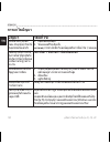
102 คู่มือการใช้งานสำาหรับรุ่น 10, 20, 30 th ภาคผนวก การแก้ไขปัญหา ปัญหา วิธีแก้ไข อุปกรณ์ไม่มีการตอบ สนอง ฉันจะตั้งค่าใหม่ให้ กับอุปกรณ์ได้อย่างไร 1. ถอดแบตเตอรี่ออก 2. ใส่แบตเตอรี่ใหม่อีกครั้ง หมายเหต ุ:การทำาเช่นนี้จะไม่ลบข้อมูลหรือการตั้งค่าใด ๆ ของคุณ ฉันต้องการตั้งค่าใหม่ให้ กับการตั้งค่าที่ถู...
Page 105: ปัญหา
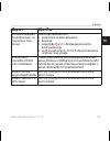
คู่มือการใช้งานสำาหรับรุ่น 10, 20, 30 103 th ภาคผนวก ปัญหา วิธีแก้ไข อุปกรณ์ของฉันเชื่อมต่อ กับคอมพิวเตอร์แล้ว แต่ ไม่เข้าสู่โหมด mass storage คุณอาจโหลดไฟล์ที่เสียหายมา 1. ถอดอุปกรณ์จากคอมพิวเตอร์ของคุณ 2. ปิดอุปกรณ์ 3. กดปุ่่มเปิดปิด ค้างไว้ เมื่อเชื่อมต่ออุปกรณ์เข้ากับ คอมพิวเตอร์ของคุณ 4. กด ค้า...
Page 107
Etrex ® petunjuk teknis penggunaan untuk model 10, 20, 30
Page 108
© 2012 garmin ltd. Atau anak perusahaannya semua hak dilindungi undang-undang. Berdasarkan undang-undang hak cipta, petunjuk teknis ini tidak boleh disalin, seluruhnya atau sebagian, tanpa izin tertulis dari garmin. Garmin berhak mengubah atau menyempurnakan produknya dan membuat perubahan pada isi ...
Page 109: Daftar Isi
Petunjuk teknis penggunaan untuk model 10, 20, 30 107 id daftar isi daftar isi untuk memulai ...............109 device overview ......................109 menggunakan tombol etrex ......111 informasi baterai ......................111 mengaktifkan atau menonaktifkan perangkat ............................
Page 110
108 petunjuk teknis penggunaan untuk model 10, 20, 30 id daftar isi profil .......................................136 pengaturan sistem ...................137 pengaturan layar .....................137 pengaturan nada perangkat ......139 pengaturan peta .......................139 pengaturan jejak ......
Page 111: Untuk Memulai
Petunjuk teknis penggunaan untuk model 10, 20, 30 109 id untuk memulai untuk memulai peringatan lihat panduan informasi penting tentang keselamatan dan produk dalam kemasan produk untuk mengetahui peringatan dan informasi penting lainnya terkait produk. Bila menggunakan perangkat untuk pertama kalin...
Page 112: Device Overview
110 petunjuk teknis penggunaan untuk model 10, 20, 30 id untuk memulai device overview ➊ ➎ ➍ ➌ ➋ ➊ tombol zoom ➋ tombol kembali ➌ thumb stick™ ➍ tombol menu ➎ /tombol lampu latar ➏ ➒ ➑ ➐ ➏ port mini-usb (di bawah tutup pelindung) ➐ penutup baterai ➑ ring pengunci penutup baterai ➒ bagian pemasangan.
Page 113: Menggunakan Tombol
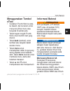
Petunjuk teknis penggunaan untuk model 10, 20, 30 111 id untuk memulai menggunakan tombol etrex • gerakkan thumb stick ke atas, ke bawah, dan ke kanan untuk menyorot pilihan menu atau bergerak di sekitar peta. • tekan bagian tengah thumb stick untuk memilih item yang disorot. • tekan back (kembali) ...
Page 114: Setup (Konfigurasi) >
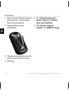
112 petunjuk teknis penggunaan untuk model 10, 20, 30 id untuk memulai 1. Putar d-ring berlawanan dengan arah jarum jam, dan lepaskan atau buka penutupnya. 2. Pasang baterai sesuai polaritasnya. 3. Pasang penutup baterainya, dan putar d-ring searah jarum jam. 4. Tahan . 5. Pilih setup (konfigurasi) ...
Page 115: Mengaktifkan Atau
Petunjuk teknis penggunaan untuk model 10, 20, 30 113 id untuk memulai mengaktifkan atau menonaktifkan perangkat tahan . Sinyal satelit setelah perangkat diaktifkan, maka akan segera mendapat sinyal satelit. Perangkat ini memerlukan pandangan yang jelas ke arah langit untuk mendapatkan sinyal sateli...
Page 116: Waypoint, Rute, Dan
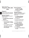
114 petunjuk teknis penggunaan untuk model 10, 20, 30 id waypoint, rute, dan jalur waypoint, rute, dan jalur waypoint waypoint adalah lokasi yang anda rekam dan tersimpan di perangkat. Membuat waypoint anda bisa menyimpan lokasi aktif sebagai waypoint. 1. Pilih mark waypoint (membuat waypoint). 2. T...
Page 117: Meningkatkan Akurasi Lokasi
Petunjuk teknis penggunaan untuk model 10, 20, 30 115 id waypoint, rute, dan jalur meningkatkan akurasi lokasi waypoint perata-rataan waypoint memungkinkan anda untuk meningkatkan akurasi lokasi waypoint dengan mengumpulkan banyak sampel lokasi waypoint. 1. Pilih waypoint averaging (perata-rataan wa...
Page 118: Menu Mau Kemana?
116 petunjuk teknis penggunaan untuk model 10, 20, 30 id waypoint, rute, dan jalur menu mau kemana? Anda bisa menggunakan menu mau kemana? Untuk mencari destinasi dan bernavigasi. Tidak semua kategori mau kemana? Tersedia di semua area dan peta. Peta tambahan anda dapat menggunakan peta tambahan pad...
Page 119: Mencari Alamat
Petunjuk teknis penggunaan untuk model 10, 20, 30 117 id waypoint, rute, dan jalur mencari alamat anda dapat menggunakan peta navigator kota tambahan untuk mencari alamat. 1. Pilih where to? (mau kemana?). > addresses (alamat). 2. Jika perlu, masukkan negara atau negara bagian. 3. Masukkan kota atau...
Page 120: Done (Selesai).
118 petunjuk teknis penggunaan untuk model 10, 20, 30 id waypoint, rute, dan jalur 5. Pilih done (selesai). Mengedit rute 1. Pilih route planner (perencana rute) 2. Pilih rute. 3. Pilih edit route (edit rute). 4. Pilih satu titik. 5. Tentukan pilihan: • untuk melihat titik pada peta, pilih review (t...
Page 121: Melihat Rute Aktif
Petunjuk teknis penggunaan untuk model 10, 20, 30 119 id waypoint, rute, dan jalur melihat rute aktif 1. Ketika menavigasi rute, pilih active route (rute aktif). 2. Pilih titik pada rute untuk melihat rincian tambahan. Membalik rute 1. Pilih route planner (perencana rute). 2. Pilih rute. 3. Pilih re...
Page 122: Secara Optimal, Pilih Auto
120 petunjuk teknis penggunaan untuk model 10, 20, 30 id waypoint, rute, dan jalur 4. Tentukan pilihan: • untuk merekam jejak pada waktu yang berbeda untuk memberi gambaran jejakr secara optimal, pilih auto (otomatis). • untuk merekam jejak pada jarak tertentu, pilih distance (jarak). • untuk mereka...
Page 123: Melihat Informasi Jejak
Petunjuk teknis penggunaan untuk model 10, 20, 30 121 id waypoint, rute, dan jalur melihat informasi jejak 1. Pilih track manager (pengelola jalur). 2. Pilih jalur. 3. Pilih view map (lihat peta). Awal dan akhir jalur ditandai dengan bendera. 4. Pilih menu > review track (tinjau jejak). Informasi te...
Page 124: Navigasi
122 petunjuk teknis penggunaan untuk model 10, 20, 30 id navigasi navigasi anda bisa menavigasi rute, jejak, ke titik waypoint, ke geocache, atau lokasi yang tersimpan di dalam perangkat. Anda bisa menggunakan peta (halaman 122) atau kompas (halaman 123) untuk menavigasi ke tempat tujuan anda. Menav...
Page 125: Menelusuri Peta
Petunjuk teknis penggunaan untuk model 10, 20, 30 123 id navigasi kolom data, lihat halaman halaman 135. Menelusuri peta 1. Pilih map (peta). 2. Pilih satu pilihan atau lebih: • gunakan stik jempol untuk menggeser peta agar bisa melihat area yang berbeda. • pilih ▲ dan ▼ untuk memperbesar dan memper...
Page 126: Mengkalibrasi Kompas
124 petunjuk teknis penggunaan untuk model 10, 20, 30 id navigasi menggunakan profil otomotif, kompas akan menampilkan arah gps, bukan arah magnetik. Mengkalibrasi kompas pemberitahuan kalibrasikan kompas elektronik di luar ruangan. Untuk meningkatkan akurasi arah, jauhi objek yang dapat mempengaruh...
Page 127: Menavigasi Dengan Penunjuk
Petunjuk teknis penggunaan untuk model 10, 20, 30 125 id navigasi ➋ ➊ ➍ ➌ penunjuk jalan ➊ menunjukkan hubungan anda dengan garis jalan ➋ yang menuju destinasi. Garis jalan ke tujuan anda didasarkan pada titik tolak awal anda. Ketika anda bergerak dari jalan yang dimaksud menuju ke tujuan, indikator...
Page 128: Pilih Elevation Plot (Plot
126 petunjuk teknis penggunaan untuk model 10, 20, 30 id navigasi pilih elevation plot (plot ketinggian). Mengubah jenis plot anda dapat mengubah plot ketinggian untuk menampilkan tekanan dan ketinggian berdasarkan waktu atau jarak. 1. Pilih elevation plot (plot ketinggian) > menu > change plot type...
Page 129: Komputer Perjalanan
Petunjuk teknis penggunaan untuk model 10, 20, 30 127 id cache geografis komputer perjalanan komputer perjalanan menampilkan kecepatan saat ini, kecepatan rata-rata, kecepatan maksimum, pengukur jarak perjalanan, dan statistik bermanfaat lainnya. Untuk menyesuaikan komputer perjalanan, lihat halaman...
Page 130: Menyaring Daftar Cache
128 petunjuk teknis penggunaan untuk model 10, 20, 30 id cache geografis 5. Ikuti petunjuk pada layar untuk mencari dan mengunduh cache geografis ke perangkat. Menyaring daftar cache geografis anda bisa menyaring daftar cache geografis berdasarkan faktor-faktor tertentu seperti tingkat kesulitan. 1....
Page 131: (Mencari).
Petunjuk teknis penggunaan untuk model 10, 20, 30 129 id cache geografis • untuk menerapkan penyaringan pada daftar cache geografis, pilih search (mencari). • untuk menyimpan penyaringan, pilih back (kembali). Setelah disimpan, penyaringan akan diberi nama secara otomatis. Anda dapat mengakses penya...
Page 132: Pilih Find Next Closest
130 petunjuk teknis penggunaan untuk model 10, 20, 30 id cache geografis • untuk memulai navigasi ke cache geografis terdekat, pilih find next closest (cari yang terdekat berikutnya). • untuk mengakhiri pendataan, pilih done (selesai). • untuk memasukkan komentar tentang pencarian cache atau cache i...
Page 133: Setup (Konfigurasi) >
Petunjuk teknis penggunaan untuk model 10, 20, 30 131 id aplikasi mengaktifkan pencarian chirp 1. Pilih setup (konfigurasi) > geocaches (cache geografis). 2. Pilih chirp™ searching (pencarian chirp™) > on (aktif). Mencari cache geografis dengan chirp 1. Pilih geocaches (cache geografis) > menu > sho...
Page 134: Mengatur Alarm
132 petunjuk teknis penggunaan untuk model 10, 20, 30 id aplikasi 3. Ikuti petunjuk yang muncul di layar. Mengatur alarm dekatnya alarm dekatnya akan memperingatkan anda ketika berada dalam jarak tertentu dari suatu lokasi. 1. Pilih proximity alarms (alarm dekatnya). 2. Pilih create new (buat alarm)...
Page 135: (Derajat) Untuk Menghitung
Petunjuk teknis penggunaan untuk model 10, 20, 30 133 id aplikasi • • pilih menu > degrees (derajat) untuk menghitung derajat. Melihat kalender dan almanak anda dapat melihat aktivitas perangkat, seperti kapan waypoint disimpan, informasi almanak matahari dan bulan, dan waktu terbaik untuk berburu m...
Page 136: Membuka Stopwatch
134 petunjuk teknis penggunaan untuk model 10, 20, 30 id aplikasi jika perangkat tidak aktif pada waktu alarm, perangkat akan aktif dan membunyikan alarm. Membuka stopwatch pilih stopwatch halaman satelit halaman satelit menunjukkan lokasi anda saat itu, akurasi gps, lokasi satelit, dan kekuatan sin...
Page 137: Cmenyesuaikan
Petunjuk teknis penggunaan untuk model 10, 20, 30 135 id cmenyesuaikan perangkat cmenyesuaikan perangkat menyesuaikan menu utama pilih menu > change item order (ubah urutan item) untuk mengubah urutan item pada menu utama. Menyesuaikan halaman khusus kolom-kolom data menampilkan informasi tentang lo...
Page 138: Menyesuaikan Dasbor
136 petunjuk teknis penggunaan untuk model 10, 20, 30 id cmenyesuaikan perangkat menyesuaikan dasbor 1. Buka halaman yang dasbornya ingin anda sesuaikan. 2. Tentukan pilihan: • dari peta, pilih menu > konfigurasi peta > kolom data > dasbor. • dari kompas atau komputer perjalanan, pilih menu > ubah d...
Page 139: Create New Profile (Buat
Petunjuk teknis penggunaan untuk model 10, 20, 30 137 id cmenyesuaikan perangkat 4. Pilih create new profile (buat profil) > ok. Mengedit nama profil 1. Pilih setup (konfigurasi) > profiles (profil). 2. Pilih profil. 3. Pilih edit name (edit nama). 4. Masukkan nama baru. 5. Pilih done (selesai). Men...
Page 140: Colors (Warna) (Etrex
138 petunjuk teknis penggunaan untuk model 10, 20, 30 id cmenyesuaikan perangkat pengaturan lampu latar, lihat halaman 40. • colors (warna) (etrex 20/30)—mengatur warna yang ditampilkan pada mode malam dan siang. ◦ mode—mengatur latar belakang cerah (siang), latar belakang gelap (malam), atau berpin...
Page 141: Pengaturan Nada
Petunjuk teknis penggunaan untuk model 10, 20, 30 139 id cmenyesuaikan perangkat pengaturan nada perangkat anda dapat menyesuaikan nada untuk pesan, tombol, peringatan belokan, dan alarm. 1. Pilih setup (konfigurasi) > tones (nada). 2. Pilih nada untuk tiap jenis yang bisa didengar. Pengaturan peta ...
Page 142: Text Size (Ukuran Teks)—
140 petunjuk teknis penggunaan untuk model 10, 20, 30 id cmenyesuaikan perangkat manual. ◦ zoom levels (tingkat zoom)— memilih tingkat zoom untuk item-item peta. ◦ text size (ukuran teks)— memilih ukuran teks untuk item- item peta. ◦ detail (rincian)—memilih banyaknya rincian yang ditampilkan di pet...
Page 143: • Auto Archive (Arsip
Petunjuk teknis penggunaan untuk model 10, 20, 30 141 id cmenyesuaikan perangkat • auto archive (arsip otomatis)—memilih metode arsip otomatis untuk menata jejak. Jejak disimpan dan dihapus secara otomatis berdasarkan pengaturan pengguna. • color (warna) (etrex 20/30)— mengubah warna garis jejak di ...
Page 144: Setup (Konfigurasi) >
142 petunjuk teknis penggunaan untuk model 10, 20, 30 id cmenyesuaikan perangkat pilih setup (konfigurasi) > position format (format posisi). • position format (format posisi)—mengatur format posisi untuk menampilkan data lokasi tertentu. • map datum (datum peta)— mengatur sistem koordinat untuk str...
Page 145: Pengaturan Altimeter
Petunjuk teknis penggunaan untuk model 10, 20, 30 143 id cmenyesuaikan perangkat kompas. • kalibrasi kompas—halaman 124. Pengaturan altimeter fungsi ini tersedia pada tipe etrex 30. Pilih setup (konfigurasi) > altimeter (altimeter). • auto calibration (kalibrasi otomatis)—altimeter akan dikalibrasi ...
Page 146: Pengaturan Cache
144 petunjuk teknis penggunaan untuk model 10, 20, 30 id cmenyesuaikan perangkat dinonaktifkan. • jenis lokasi ◦ elevation/time (ketinggian/ waktu)—merekam perubahan ketinggian selama jangka waktu tertentu. ◦ elevation/distance (ketinggian/ jarak)—merekam perubahan ketinggian pada jarak tertentu. ◦ ...
Page 147: Program)—Memprogram
Petunjuk teknis penggunaan untuk model 10, 20, 30 145 id cmenyesuaikan perangkat program)—memprogram aksesori chirp. Lihat chirp owner’s manual di http://www. Garmin.Com. Pengaturan perutean perangkat ini menghitung rute yang dioptimalisasi untuk jenis kegiatan yang sedang anda kerjakan. Pengaturan ...
Page 148: Manual (Manual)—
146 petunjuk teknis penggunaan untuk model 10, 20, 30 id cmenyesuaikan perangkat titik berikutnya secara otomatis. ◦ manual (manual)— memungkinkan anda memilih titik berikutnya pada rute. ◦ distance (jarak)—merutekan ke titik berikutnya pada rute bila berada dalam jarak tertentu dari titik saat itu....
Page 149: • Appearance
Petunjuk teknis penggunaan untuk model 10, 20, 30 147 id cmenyesuaikan perangkat untuk penggunaan optimal saat memancing. • appearance (penampilan)—memungkinkan anda mengatur kemunculan alat bantu laut di peta. • konfigurasi alarm laut ◦ anchor drag alarm (alarm tarik jangkar)—alarm berbunyi jika an...
Page 150: Setup (Konfigurasi) >
148 petunjuk teknis penggunaan untuk model 10, 20, 30 id cmenyesuaikan perangkat 1. Pilih setup (konfigurasi) > reset (atur ulang) 2. Pilih item yang akan diatur ulang. Mengembalikan pengaturan ke standar pabrik 1. Pilih setup (konfigurasi). 2. Pilih item yang akan diatur ulang. 3. Pilih menu > rest...
Page 151: Mengubah Urutan
Petunjuk teknis penggunaan untuk model 10, 20, 30 149 id cmenyesuaikan perangkat mengubah urutan halaman sebelum mengubah urutan halaman, anda harus menambah halaman ke dalam urutan (halaman 149). 1. Pilih setup (konfigurasi) > page sequence (urutan halaman). 2. Pilih halaman. 3. Pilih move (pindahk...
Page 152: Informasi Perangkat
150 petunjuk teknis penggunaan untuk model 10, 20, 30 id informasi perangkat informasi perangkat menyesuaikan layar catatan: kecerahan lampu latar mungkin terbatas ketika kapasitas baterai yang tersisa rendah. Penggunaan lampu latar layar secara terus-menerus dapat mengurangi masa pakai baterai seca...
Page 153: Melihat Informasi
Petunjuk teknis penggunaan untuk model 10, 20, 30 151 id informasi perangkat atau pengaturan anda. Melihat informasi perangkat anda dapat melihat id unit, versi perangkat lunak, dan perjanjian lisensi. Pilih setup (konfigurasi) > about (tentang). Spesifikasi kedap air plastik kasar, tahan air menuru...
Page 154: Memaksimalkan Masa Pakai
152 petunjuk teknis penggunaan untuk model 10, 20, 30 id informasi perangkat kondisi di bawah titik beku. Memaksimalkan masa pakai baterai anda dapat melakukan berbagai hal untuk meningkatkan masa pakai baterai. • nonaktikan lampu latar sekiranya tidak diperlukan. • kurangi kecerahan lampu latar (ha...
Page 155: Perendaman Dalam Air
Petunjuk teknis penggunaan untuk model 10, 20, 30 153 id informasi perangkat perendaman dalam air pemberitahuan perangkat ini tahan air menurut iec standard 60529 ipx7. Perangkat ini bisa tahan terendam air kedalaman 1 meter selama 30 menit. Namun kalau terendamnya lebih lama dapat menyebabkan kerus...
Page 156: Memasang Kartu Microsd
154 petunjuk teknis penggunaan untuk model 10, 20, 30 id informasi perangkat memasang kartu microsd tipe etrex 20 dan etrex 30 dapat menggunakan kartu microsd sebagai alat penyimpanan tambahan. Beberapa peta juga sudah diisikan sebelumnya pada kartu memori. Kunjungi http://buy. Garmin.Com untuk kete...
Page 157: Mentransfer File Ke Komputer
Petunjuk teknis penggunaan untuk model 10, 20, 30 155 id informasi perangkat 1. Sambungkan kabel usb ke port usb di komputer. 2. Lepaskan tutup pelindung ➊ dari port mini-usb ➋ . ➊ ➋ 3. Pasang konektor kecil pada kabel usb ke port mini-usb. Perangkat dan kartu microsd (opsional) akan ditampilkan seb...
Page 158: Delete (Hapus)
156 petunjuk teknis penggunaan untuk model 10, 20, 30 id lampiran 154). 1. Buka drive atau perangkat penyimpanan “garmin”. 2. Jika perlu, buka folder atau perangkat penyimpanan. 3. Pilih file. 4. Tekan tombol delete (hapus) pada keyboard. Melepaskan sambungan kabel usb 1. Lakukan salah satu tindakan...
Page 159: Menggunakan Aksesori Fitnes
Petunjuk teknis penggunaan untuk model 10, 20, 30 157 id lampiran anda dapat menggunakan aksesori fitnes tambahan, termasuk pemantau detak jantung atau sensor siklus bersepeda di perangkat. Aksesori ini menggunakan teknologi nirkabel ant+™ untuk mengirim data ke perangkat. Menggunakan aksesori fitne...
Page 160: Pilihan Kolom Data
158 petunjuk teknis penggunaan untuk model 10, 20, 30 id lampiran kali diaktifkan. Proses ini berlangsung secara otomatis saat anda mengaktifkan perangkat garmin dan hanya memerlukan waktu beberapa detik bila aksesori diaktifkan dan berfungsi dengan baik. • setelah dipasangkan, perangkat garmin anda...
Page 161: Kolom
Petunjuk teknis penggunaan untuk model 10, 20, 30 159 id lampiran kolom data keterangan bearing (arah) arah dari lokasi anda saat itu ke tujuan. Cadence (siklus) (diperlukan aksesori siklus) perputaran poros roda atau langkah per menit. Course (rute) arah dari lokasi awal anda ke tujuan. Descent - a...
Page 162: Kolom
160 petunjuk teknis penggunaan untuk model 10, 20, 30 id lampiran kolom data keterangan eta at destination (eta di destinasi) perkiraan waktu tiba di tujuan akhir. Eta at next (eta di berikutnya) perkiraan waktu tiba di waypoint berikutnya pada rute. Glide ratio (rasio meluncur) rasio jarak horizont...
Page 163: Kolom
Petunjuk teknis penggunaan untuk model 10, 20, 30 161 id lampiran kolom data keterangan off course (keluar rute) jarak penyimpangan ke kiri atau kanan dari jalur awal perjalanan. Pointer (penunjuk) kolom data tanda panah yang menunjuk ke arah waypoint atau belokan berikutnya. Speed (kecepatan) kecep...
Page 164: Kolom
162 petunjuk teknis penggunaan untuk model 10, 20, 30 id lampiran kolom data keterangan time to next (waktu ke berikutnya) perkiraan waktu yang diperlukan untuk mencapai waypoint berikutnya pada rute. To course (ke rute) arah yang harus anda ambil untuk kembali ke rute. Trip odometer (odometer perja...
Page 165: Kolom
Petunjuk teknis penggunaan untuk model 10, 20, 30 163 id lampiran kolom data keterangan vertical speed (kecepatan vertikal) kecepatan keberhasilan atau ketidakberhasilan mencapai ketinggian seiring waktu. Waypoint at dest. (titik acuan di destinasi) titik terakhir pada rute ke tujuan anda. Waypoint ...
Page 166: Troubleshooting
164 petunjuk teknis penggunaan untuk model 10, 20, 30 id lampiran troubleshooting masalah solusi perangkat tidak merespon. Bagaimana cara mengatur ulang perangkat? 1. Keluarkan baterai. 2. Pasang kembali baterai. Catatan : langkah ini tidak akan menghapus data atau pengaturan anda. Saya ingin mengat...
Page 167: Masalah
Petunjuk teknis penggunaan untuk model 10, 20, 30 165 id lampiran masalah solusi perangkat saya tersambung ke komputer, namun tidak dapat mengakses mode penyimpanan massal. Anda mungkin memasukkan file yang rusak. 1. Lepaskan sambungan perangkat dari komputer. 2. Nonaktifkan perangkat. 3. Tahan keti...
Page 168
© 2012 garmin ltd. Or its subsidiaries garmin international, inc. 1200 east 151 st street, olathe, kansas 66062, usa garmin (europe) ltd. Liberty house, hounsdown business park, southampton, hampshire, so40 9lr uk garmin corporation no. 68, zhangshu 2 nd road, xizhi dist., new taipei city, 221, taiw...

