- DL manuals
- Garmin
- Monitor
- GMX 200
- Pilot's Manual & Reference
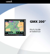
Garmin GMX 200 Pilot's Manual & Reference
Summary of GMX 200
Page 1
Gmx 200 tm pilot’s guide & reference.
Page 2
© 2006-2007 garmin ltd. Or its subsidiaries garmin international, inc. Garmin at 1200 east 151 st street, olathe, kansas 66062, u.S.A. 2345 turner rd., se salem, or 97302 tel. 913/397.8200 or 800/800.1020 tel. 503/581.8101 or 800/525.6726 fax 913/397.8282 fax. 503/364.2138 garmin at, inc., 2345 turn...
Page 3: Introduction
190-00607-02 rev c introduction introduction history of revisions date software manual version revision may 2006 2.0 190-00607-02 rev 1 june 2006 2.01-2.02 190-00607-02 rev a november 2006 2.03 190-00607-02 rev b july 2007 2.12 190-00607-02 rev c ordering information to receive additional copies of ...
Page 4
190-00607-02 rev c introduction end user license agreement (“eula”) you have acquired a device (gmx 200) which includes software licensed by garmin international, inc. Or its subsidiaries (garmin) from one or more software licen- sors garmin’s software suppliers. Such software products, as well as a...
Page 5
190-00607-02 rev c introduction > internet gaming/update features. If the software provides, and you choose to utilize, the internet gaming or update features within the software, it is necessary to use certain computer system, hardware, and software information to implement the features. By using t...
Page 6
V 190-00607-02 rev c introduction welcome… welcome to a new era of aviation navigation. Once again, garmin has set new standards in features and ease of use for the general aviation public. The gmx 200 multi-function display provides a focal point for integrating many of your navigation needs in an ...
Page 7
V 190-00607-02 rev c introduction about this manual this manual may be used as a summary, a refer- ence, and a learning tool. Information is provided about all of the functions available to the gmx 200. Your specific installation may not include all of these functions. Take a few moments to familiar...
Page 8: Table of Contents
V 190-00607-02 rev c introduction table of contents table of contents introduction .............................................................. I history of revisions ................................................................ I ordering information ..............................................
Page 9
V 190-00607-02 rev c introduction hot spots ............................................................................ 27 ifr option page 1................................................................ 28 flight plan ........................................................................... 28 ...
Page 10
V 190-00607-02 rev c introduction table of contents internal gmx 200-based terrain .......................................... 50 obstructions........................................................................ 50 terrain option page ............................................................. 5...
Page 11
X 190-00607-02 rev c introduction selecting the airport ...................................................... 81 loading the approach chart .......................................... 82 viewing the chart as an overlay.......................................... 83 display of coverage area ..............
Page 12
X 190-00607-02 rev c introduction hardware information ................................................. 115 port status ................................................................... 115 data link status ......................................................... 115 system test pages..............
Page 13: Getting Started
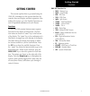
1 190-00607-02 rev c getting started getting started this section explains how to get started using the gmx 200. Information in this section describes the controls, data card, display, and basic operation. After reading this section, go to the detailed operation sec- tion for expanded explanations f...
Page 14
2 190-00607-02 rev c getting started the messagelog displays information from the gmx 200 or reported to the gmx 200 by its external sen- sors. A flashing msg annunciator notifies you of a new message that should be viewed. The custommap function allows you to completely customize the displayed map ...
Page 15
190-00607-02 rev c getting started display the gmx 200 display provides text and graphic information to give a “picture” of your flight and surround- ings. The display brightness may be set manually or allowed to automatically adjust to ambient light conditions. At the bottom of the display, labels ...
Page 16
190-00607-02 rev c getting started controls power on the power switch is located in the upper right corner of the gmx 200. Press the “+” rocker switch to turn the power on. The gmx 200 will progress through a series of startup screens. The final startup screen shows system information and the result...
Page 17
190-00607-02 rev c getting started display menu/ent the menu/ent key is located on the bottom right corner of the gmx 200. Press the menu/ent key to show a menu of options to modify the display of the current function. Press the menu/ent key to hide the menu. If no action is taken, the menu will aut...
Page 18
6 190-00607-02 rev c getting started annunciations advisory flags, data flags, and messages appear on the display to give information about the status of the gmx 200 or to provide operating information. Advisory flags annunciations will appear on the upper left side of the display to provide advisor...
Page 19
7 190-00607-02 rev c getting started annunciations data flag descrpton no vald poston nformaton s avalable from the source. Do not expect a vald poston representaton on the maps. No vald route (flght plan) s avalable from the external navgaton source. Route (flght plan) nformaton wll not be shown on...
Page 20
190-00607-02 rev c getting started data flags basic operation use the following items to get a basic feel for the operation of the gmx 200. The basic steps for using any of the separate functions of the gmx 200 are: • turn the power on. • adjust the brightness or leave in automatic mode. • check tha...
Page 21
9 190-00607-02 rev c getting started start up and baro correction confirm current baro correction when the altitude source is an altitude encoder, a window that displays the current barometric value will appear after you press the first “smart” key, and then every 30 minutes. This window will not ap...
Page 22
10 190-00607-02 rev c getting started function selection advisory hot key the “advisory hot key” feature allows advisory conditions to be quickly viewed with minimal effort by the pilot. This feature is comprised of three compo- nents: 1. A whte advsory flag on the left sde of the screen ndcates an ...
Page 23
11 190-00607-02 rev c getting started advisory hot key thumbnail feature the thumbnail feature provides a small map depiction that is overlaid in the upper left corner of the gmx 200 display. It provides for enhanced traffic and terrain situational awareness when not specifi- cally viewing traffic o...
Page 24
12 190-00607-02 rev c getting started thumbnail and tis traffic information services (tis) there are two versions of tis: tis-a and tis-b. Both are described below. In the tis-a system, ground radar sensors col- lect target information. The ground radar sensor then determines the targets in the vici...
Page 25: Summary
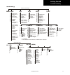
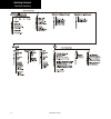
1 190-00607-02 rev c getting started flight plan map orient invert nav data load chart airports vors ndbs intersections airspace low airways high airways water roads boundaries airport chart obstructions traffic strikes * cities nexrad* metars* lightning* cell move* * terrain * * p re ss m en u ite ...
Page 26
14 190-00607-02 rev c getting started function summary.
Page 27: Detailed Operation
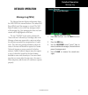
1 190-00607-02 rev c detailed operation detailed operation message log (msg) the message function displays information about the gmx 200 or the external sensors. The amber msg flag will flash until the message is viewed. The msg flag will remain in view while any messages remain in the message log. ...
Page 28: Custom Map (Map)
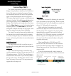
16 190-00607-02 rev c detailed operation custom map custom map (map) the custom map function provides a graphic display of map features in relation to the aircraft loca- tion to help improve situational awareness. Review the limitations section in the front of this guide that apply to using data dis...
Page 29
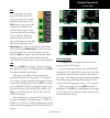
17 190-00607-02 rev c detailed operation pan the pan keys are used to move the display around so you can see beyond the initial boundaries of the screen. The pan function key is one of the “smart” keys available at the bottom of the screen. Pressing the rotary knob will also activate the pan functio...
Page 30
1 190-00607-02 rev c detailed operation custom map custom map menu option page 1 the first option page of the custom map function lets you select options for the choices of flight plan, map orientation, invert, nav data, and load chart. The last option selection takes you to the next page of options...
Page 31
19 190-00607-02 rev c detailed operation custom map full nav data information shown partial nav data information shown minimum nav data information shown load chart (optional) when load chart is selected with no destination airport entered in a flight plan, the nearest 15 airports are displayed. If ...
Page 32
20 190-00607-02 rev c detailed operation custom map page with ndbs, intersections, and airspace selected with menu items (page 2) when safetaxi airport diagrams are available, they are displayed when airports with labels and airports without labels are drawn and when the zoom scale is 15 nm or lower...
Page 33
21 190-00607-02 rev c detailed operation custom map vors the vors option allows you to choose the type of vor information displayed on the map screen. You may select the display of vor icon and identifier, icon only, or no information by each subsequent press of the vor menuitem key. Vor information...
Page 34
22 190-00607-02 rev c detailed operation custom map ils/localizer depiction when either an ils or localizer is tuned on the sl30, the gmx 200 will display the currently tuned approach on the appropriate airport runway. The sl30 nav function provides an overall graphic view of the selected airport an...
Page 35
2 190-00607-02 rev c detailed operation custom map not drawn on the display. Press the next page menuitem key to display the next page of menu items. Custom map menu option page 3 the third option page of the custom map function lets you select options for the choices of low airways, high airways, w...
Page 36
2 190-00607-02 rev c detailed operation custom map custom map menu option page 4 the fourth option page of the custom map func- tion lets you select options for choices of boundaries, nexrad, metars, lightning, and cell movement. Custom map page with boundaries, nexrad, metars, lightning, and cell m...
Page 37
2 190-00607-02 rev c detailed operation custom map airport chart (chartview) airport surface charts provide a graphical presen- tation of the airport surface area (runways, taxiways, buildings, towers, and other objects), within the immediate airport vicinity. The airport chart items are not availab...
Page 38
26 190-00607-02 rev c detailed operation custom map obstructions obstructions, such as towers and other man-made objects, are part of the gmx 200 updateable database. Obstructions over 250 feet high are shown on the maps with tower symbols. The symbol is color coded to sig- nify the relative altitud...
Page 39
27 190-00607-02 rev c detailed operation ifr en route (ifr) chart function the ifr en route chart function shows an ifr en route style map for the display. The ifr display shows navigational aid information and the flight plan course line. The “smart” keys on the bottom of the screen control zooming...
Page 40
2 190-00607-02 rev c detailed operation ifr en route chart ifr option page 1 the first option page of the ifr chart function lets you select options for the choices of flight plan, map orientation, invert display, nav data, and labels. The last option selection takes you to the next page of options....
Page 41
29 190-00607-02 rev c detailed operation ifr en route chart note: the barometer setting is not displayed if the taws sensor is connected to the gmx 200 or if gps altitude is used. Label the label key turns the labels for each item on or off for easy decluttering. When labels are turned off, only the...
Page 42
0 190-00607-02 rev c detailed operation ifr en route chart load chart once the airport is selected, the individual approach chart to be overlaid can be loaded from a list of geo-referenced approach charts available for that airport. Not all approach charts can be overlaid in this fashion and only ge...
Page 43: Vfr Chart (Vfr) Function
1 190-00607-02 rev c detailed operation vfr chart (vfr) function the vfr chart function shows a vfr sectional style map for the display. Topographic features are shown. The vfr display shows navigational aid infor- mation and the flight plan course line. The “smart” keys on the bottom of the screen ...
Page 44
2 190-00607-02 rev c detailed operation flight plan the flight plan option controls the display of the flight plan course line. Pressing the menuitem key next to the flight plan option toggles between showing and not showing the flight plan route line. If the flight plan provided by the navigator to...
Page 45
190-00607-02 rev c detailed operation split screen (split) function the split screen capability allows you to display up to two enabled functions side by side. Press the menuitemkey next to the desired map to highlight the selection. When two functions are displayed, you must first deselect a highli...
Page 46
190-00607-02 rev c detailed operation tas/tcad traffic tas / tcad traffic (traf) function the gmx 200 i/o traffic model supports interfaces to third party traffic sensors. The traffic function, when interfaced to a tas sensor (such as, honeywell ihas), or the ryan tcad is capable of displaying traff...
Page 47
190-00607-02 rev c detailed operation tas/tcad traffic level will be adjusted to 5 nm, unless taws alert mode is active. The alert hot key or traffic alert pop- up mode option is selectable in the traffic menu and only occurs when the display is set to some function other than traffic. Traffic alert...
Page 48
6 190-00607-02 rev c detailed operation tas/tcad traffic tcad 9900b menu options altitude option (relative/pressure) the altitude option lets you select between relative and pressure altitude in hundreds of feet. The altitude option choice is shown in the upper left corner of the screen. Relative al...
Page 49
7 190-00607-02 rev c detailed operation ads-b traffic (traf) function the ads-b traffic function allows you to view other traffic in the area, when installed with a uat data link radio. This screen can also show your flight plan. Traffic is shown in relationship to your aircraft. “smart” keys allow ...
Page 50
190-00607-02 rev c detailed operation ads-b traffic ads-b equipment may be certified as an air-to-air system for enhancing situational awareness and as a surveillance source for air traffic services. Refer to the aircraft’s flight manual supplement for the specific aircraft installation. Ads-b enabl...
Page 51
9 190-00607-02 rev c detailed operation ads-b traffic a small up or down arrow next to the identifier indicates that the traffic is climbing or descending at a rate of at least 500 feet per minute. The end of the vector line that extends beyond the point of the traffic arrow indicates where it will ...
Page 52
0 190-00607-02 rev c detailed operation ads-b traffic tis-b limitations 1. Tis-b is not intended to be used as a collision avoidance system and does not relieve the pilot’s responsibility to “see and avoid” other aircraft. Tis-b shall not be used for avoidance maneuvers during times when there is no...
Page 53
1 190-00607-02 rev c detailed operation ads-b traffic degraded target degraded targets are shown with the “bullet” symbol. A degraded target has limited positional accuracy and can either be an uplinked tis-b target, or an ads-b target who’s gps position has degraded. When a degraded target is selec...
Page 54
2 190-00607-02 rev c detailed operation ads-b traffic id, arcraft type, poston between target and ownshp, dstance, speed, and alttude. Poston s noted n clock numerals as relatve to drec- ton of travel for each arcraft. For nstance, a poston noted as 11/2 means that the traffic s at your arcraft (own...
Page 55
190-00607-02 rev c detailed operation ads-b traffic set 1200 pressing the set1200 key sets the ads-b code to 1200. This code entered into the gmx 200 does not control the code on mode a, c, or s transponders. Services the services option allows emergency/service codes to be sent over the data-link r...
Page 56
190-00607-02 rev c detailed operation ads-b traffic altitude, are shown. In ±2000 foot mode, only targets that are within 2000 feet above or below the ownship altitude are shown. Altitude option (relative/absolute) the altitude option lets you select between relative and absolute pressure altitude i...
Page 57
190-00607-02 rev c detailed operation tis-a traffic (traf) function the gmx 200 i/o supports the traffic information services – addressed (tis-a) function when interfaced to a third party tis-a sensor. The traffic function, when interfaced to the garmin gtx 330 is capable of displaying traffic targe...
Page 58
6 190-00607-02 rev c detailed operation tis-a traffic traffic depiction it is important to note that not all traffic may be displayed and that tis-a is only an aide to visual acquisition. Tis-a is there to assist you to visually acquire other aircraft around you and does not provide any information ...
Page 59
7 190-00607-02 rev c detailed operation tis-a traffic operate/standby the gmx 200, when installed with a control wire to the gtx 330, controls the tis-a sensor operating mode. The tis-a sensor defaults to “operate” when turned on. Symbology • tis-a targets are categorized as either “proxi- mate traf...
Page 60: Flight Plan (Fpl) Function
190-00607-02 rev c detailed operation flight plan (fpl) function use the flight plan function to view details about your flight plan route. Press the up/down arrow “smart” keys to step through the waypoints in your flight plan. Press the info key to view information about the waypoint. The flight pl...
Page 61
9 190-00607-02 rev c detailed operation flight plan flight plan information (uao selected) 2. Press the up or down functon smart keys to move up and down the flght plan lst n the current flght plan wndow. The detals for the selected waypont are shown n the waypont info wndow on the rght sde of the s...
Page 62: Terrain (Ter) Function
0 190-00607-02 rev c detailed operation terrain (ter) function the terrain function shows a map of the terrain in the area relative to your airplane’s position and altitude. The gmx 200 has a standard internally based terrain function. The gmx 200 also supports an exter- nal taws sensor. When the ex...
Page 63
1 190-00607-02 rev c detailed operation terrain custom map and in the terrain function. Use the in and out keys at the bottom of the screen to zoom in and zoom out. The zoom scale is shown in the lower left corner of the screen. Use the baro+ and baro- keys at the bottom of the screen to make minor ...
Page 64
2 190-00607-02 rev c detailed operation when baro +/baro – are highlighted, you may then use the knob to adjust the barometric setting with the rotary knob. Ter data flag the ter flag will appear if no terrain data is avail- able for the advisory coverage area. External taws-based terrain display th...
Page 65: Function
190-00607-02 rev c detailed operation uat flight information service (fis) function the fis function is a graphic weather display capable of displaying graphical weather information on uat equipped installations. Graphical data is overlaid on the map indicating the rainfall detected by ground based ...
Page 66
190-00607-02 rev c detailed operation uat - fis text display fis text messages are available on the text display and include metars and tafs. Messages are com- posed of four parts: message type, location, time, and message body. Uat fis text weather info with gdl 90 uat fis text weather message time...
Page 67: Service (Fis) Function
190-00607-02 rev c detailed operation gdl 69/69a flight information service (fis) function the fis function is capable of displaying graphical weather information through the xm satellite radio service when activated in the optional installation of the gdl 69/69a. A variety of graphical data can be ...
Page 68
6 190-00607-02 rev c detailed operation altitude. Press the tfrlbl key to toggle the tfr identifier labels on and off. Tfrs are drawn on the fis page when provided by the fis sensor and can not be enabled or disabled. Tfr text information is described on page 66. Tfr outline with tfr number and uppe...
Page 69
7 190-00607-02 rev c detailed operation gdl 69/69a - fis nexrad color legend current the current sub-function provides an overlay of the currently selected weather information. The three pages of menu item selections allow you to modify the display of nexrad, radar coverage, metars, lightning, thun-...
Page 70
190-00607-02 rev c detailed operation gdl 69/69a - fis winds aloft are not available and will be noted as “n/a” in their data fields, as opposed to when data is not received from the gdl 69/69a, the data fields are shown as dashes “---”. Nexrad animation detail showing image age when nexrad animatio...
Page 71
9 190-00607-02 rev c detailed operation gdl 69/69a - fis gdl 69/69a fis current menu page 2 the second menu option page of the current fis function lets you select options for the choices of: cloud tops, echo tops, winds aloft, winds aloft altitude, and tfr labels. Gdl 69/69a fis current menu page 2...
Page 72
60 190-00607-02 rev c detailed operation echo tops echo tops indicate the location, elevation, and direction the highest radar echo. This is typically asso- ciated with storms. This may not indicate the top of a storm or clouds, only the highest radar return echo. The information is derived from nex...
Page 73
61 190-00607-02 rev c detailed operation tfr label press menu/ent key and then press the tfrlbl key to toggle the tfr identifier labels on and off. The tfr identifier labels note the tfr number and upper altitude near the tfr outline. Press the nextpage key to display the next page of menu items. Gd...
Page 74
62 190-00607-02 rev c detailed operation gdl 69/69a - fis nexrad legend metar legend cloud tops legend echo tops legend airmet/sigmet legend city forecast legend county warnings legend freezing levels legend winds aloft legend map detail press menu/ent key and then press the mapdetail key to choose ...
Page 75
6 190-00607-02 rev c detailed operation gdl 69/69a - fis product times product times are shown on the lower portion of the display and cannot be hidden. The times for each of the enabled products (up to four at a time) are displayed. The time format shows day of month and then hours and minutes in z...
Page 76
6 190-00607-02 rev c detailed operation gdl 69/69a - fis xm fis forecast menu item page 1 1. Press the fn key and then the fis functon key when dsplayed. 2. Press the fourth functon smart key on the rght to select the forecast (fcst) sub-functon. . The menu/ent key brngs up menu tems for more sub-fu...
Page 77
6 190-00607-02 rev c detailed operation gdl 69/69a - fis xm fis forecast surface analysis city when enabled, the city forecast shows current or forecast conditions in available cities. Forecasts are available for intervals of 12, 24, 36, and 48 hours. This menu item key enables or disables this prod...
Page 78
66 190-00607-02 rev c detailed operation gdl 69/69a - fis gdl 69/69a fis forecast menu page 2 the second menu option page of the forecast (fcst) fis function lets you select options for the choices of: freezing levels, county warnings, cyclones, tfr labels, and label. Xm fis forecast menu item page ...
Page 79
67 190-00607-02 rev c detailed operation gdl 69/69a - fis xm fis forecast menu item page 3 flight plan press menu/ent key and then press the flight plan key to toggle the flight plan course line on and off. The magenta line is the active leg. If the flight plan provided by the navigator to the gmx 2...
Page 80
6 190-00607-02 rev c detailed operation gdl 69/69a - fis text the text sub-function displays text messages of the available weather information. Use the function smart keys at the bottom of the display to select the message that you would like to view from the list in the fis category window. The te...
Page 81
69 190-00607-02 rev c detailed operation gdl 69/69a - fis sorting metar, taf, and tfr text messages displayed text products can be sorted by distance from your present position (nearest pos), distance from destination (nearest dest), or alphabetically (alpha). Sorting text messages (nearest position...
Page 82
70 190-00607-02 rev c detailed operation gdl 69/69a - fis 6. The menu/ent key brngs up the menu tems. Press view, f necessary, to dsplay the full screen fis message. Status the status sub-function displays information about the available xm products, receiver performance, and subscription level. Xm ...
Page 83
71 190-00607-02 rev c detailed operation xm fis diagnostics 1. Whle n the status page, press menu/ent. 2. Press the products key to toggle to the dag- nostcs dsplay. The dagnostcs page nforma- ton s dsplayed. . Press the start diag key to actvate gdl 69/69a dagnostcs. Note: after diagnostics have be...
Page 84
72 190-00607-02 rev c detailed operation equipped gdl 69/69a and are needed in the activa- tion process. The id(s) is attached to this instruction sheet and printed on a label on the back of the unit. The ids can also be retrieved through the gmx 200 in the activation page of the status sub-function...
Page 85
7 190-00607-02 rev c detailed operation lightning strikes (lt) function the lightning strike function allows you to view lightning strikes that are reported by an l3 wx500 stormscope weather mapping sensor. The “t” marks are used as reference marks to aid in locating strikes in reference to your pos...
Page 86
7 190-00607-02 rev c detailed operation strike individual strikes are noted. Cell only lightning strikes associated with a group, or cell, of strikes are displayed. Heading stabilization the heading stabilization function of the wx500 can be turned on or off with this selection. System data press th...
Page 87
7 190-00607-02 rev c detailed operation noise monitor the noise monitor feature is a function of the wx500. For details about using this feature refer to the wx500 owner’s documents. The noise monitor displays reports of electrical noise, whether they are from lightning or other noise sources within...
Page 88
76 190-00607-02 rev c detailed operation flitechart (chart) function (optional) the optional gmx 200 flitechart feature pro- vides the capability to view garmin electronic charts. Depending on the charts available in the database, the following chart types may be viewed: approach charts, airport sur...
Page 89
77 190-00607-02 rev c detailed operation flitechart - chart flitechart example: 1. Press fn and then chart. 2. Press menu/ent. Menu items for the flitechart function . Press the search id menu item key and select the arport id. Use the two keys on the left, or the rotary knob, to choose the letters ...
Page 90
7 190-00607-02 rev c detailed operation 6. Vew the chart. Adjust the zoom level usng the in or out keys, or the rotary knob. Press the pan key and use the movement menu item keys on the rght sde of the dsplay. Menu items 1. Press fn and then chart. 2. Press menu/ent and then the menu item key for th...
Page 91
79 190-00607-02 rev c detailed operation select airport the select airport operation allows the airport of interest to be selected from a pop-up list. Up to 25 airports may be listed. The airports presented in the list are determined based on the destination waypoint as the first entry, and a neares...
Page 92
0 190-00607-02 rev c detailed operation chartview - chart chartview (chart) function (optional) the optional gmx 200 chartview feature provides the capability to view jeppesen sanderson inc. Elec- tronic charts. Two basic types of charts can be viewed: approach charts and airport surface charts. App...
Page 93
1 190-00607-02 rev c detailed operation • pressing the info key while a chart is loaded or being viewed will bring up the header, profile, and minimums associated with the chart. Chart data source the same set of charts that are available in elec- tronic form from the jeppesen jeppview™ product are ...
Page 94
2 190-00607-02 rev c detailed operation selected on the external gps navigator, with additional airports listed based on a nearest to destination search. Airports and approach charts that are not geo-refer- enced will not be shown for selection on this menu. Note: prior to loading an approach chart,...
Page 95
190-00607-02 rev c detailed operation selecting an airport in the ifr function . Hghlght the desred approach wth the arrow keys and then press the load key. Selecting an approach chart in the ifr function . Adjust the zoom level usng the in or out keys. Viewing the chart as an overlay display of cov...
Page 96
190-00607-02 rev c detailed operation selecting info for a chart in the ifr function chartview function the chartview function is accessed by pressing the fn function key and selecting the chartview (chart) function. The chartview function incorporates five menu items that control two basic operatio...
Page 97
190-00607-02 rev c detailed operation selecting the airport for a chart in the chartview function . Vew the chart. Adjust the zoom level usng the in or out keys. Press the pan key and use the movement menu item keys on the rght sde of the dsplay. Use the info key to step through the dfferent detals ...
Page 98
6 190-00607-02 rev c detailed operation select airport the select airport operation allows the airport of interest to be selected from a pop-up list. The airports presented in the list are determined based on the des- tination waypoint as the first entry, and a nearest type search for the remaining ...
Page 99
7 190-00607-02 rev c detailed operation airport surface charts airport surface charts provide a graphical presen- tation of the airport surface area (runways, taxiways, buildings, towers, and other objects), within the immediate airport vicinity. Selecting a surface chart from either the custom map ...
Page 100
190-00607-02 rev c detailed operation the approach chart is unloaded and the airport surface chart is displayed. While on the ground, airport surface charts will take priority over any loaded approach chart. Operational considerations when to load a chart an approach chart can be loaded at any point...
Page 101
9 190-00607-02 rev c detailed operation these areas are called “hot spots” and are identified by circular or elliptical lines. Although these areas are highlighted as places where extra caution is war- ranted and advised, they do not relieve the pilot of the responsibility to “see and avoid” other t...
Page 102: Radar (Radar) Function
90 190-00607-02 rev c detailed operation radar (radar) function the gmx 200 i/o radar product supports an interface for the garmin gwx 68, allied signal/ bendix-king art2000/2100, and rs 181a/rs 811a weather radars. The gwx 68, rs 181a/rs 811a, and art2000 weather radars are seamlessly integrated wi...
Page 103
91 190-00607-02 rev c detailed operation radar is required by the transmitter within the radar head assembly. Pressing the stby/on key while in standby mode turns on the radar in the weather mode. While in the on mode in both map and weather modes, the green rdr annunciator is on solid indicating th...
Page 104
92 190-00607-02 rev c detailed operation horizontal mode the horizontal mode (horiz) commands the radar head to scan in the horizontal plane at a pilot selectable tilt angle. In this mode, the current tilt angle is shown on the lower half of the display. Radar horizontal view vertical mode (gwx 68 a...
Page 105
9 190-00607-02 rev c detailed operation radar unit gwx 68 art2000 rs 181a/rs 811a bearing (°) l - r l - r na gain control available in map mode with the gwx 68, art2000, and rs 181a/rs 811a; and also in wx mode with the gwx 68. In the gwx 68, the gain settings are set separately for the map and wx m...
Page 106
9 190-00607-02 rev c detailed operation radar setup page conversely, if vertical scanning is occurring, a cursor line can be activated to pre-select a specific tilt to a weather cell of interest. Once selected, changing the scan mode to horizontal will automatically set the tilt angle of the horizon...
Page 107
9 190-00607-02 rev c detailed operation radar page with target alert active target alerting is enabled by pressing the menu/ ent key when the radar is in test or on modes. Press the menu/ent key and then the trgt alert key to enable and disable target alerting. Radar setup page with target alert rad...
Page 108
96 190-00607-02 rev c detailed operation fault message description action ele electrcal fault wth the radar hardware or the arcraft power bus. Power off the radar. The radar needs servce. 00 hz a prevously avalable analog 00 hz reference sgnal s no longer detected. Analog alttude nformaton wll not b...
Page 109
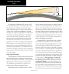
97 190-00607-02 rev c detailed operation radar radar beam from 12 inch antenna garmin gwx 68 radar description the garmin gwx 68 airborne color weather radar is a four color digital pulsed radar with 6.5 kilowatts of power. It combines excellent range and adjustable scanning profiles with a high-def...
Page 110
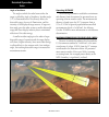
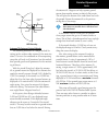
9 190-00607-02 rev c detailed operation nm radar beam in relation to the curvature of the earth radar it is important to understand the concept of the antenna beam illumination. The radar beam is much like the beam of a spotlight. The farther the beam travels, the wider it gets. The radar is only ca...
Page 111
99 190-00607-02 rev c detailed operation radar unless another cell or a ground target can be seen beyond the heavy cell. Radar signal reflectivity precipitation precipitation or objects more dense than water, such as earth or solid structures, will be detected by the weather radar. The weather radar...
Page 112
100 190-00607-02 rev c detailed operation angle of incidence the angle at which the radar beam strikes the target is called the angle of incidence. Incident angle (“a”) is illustrated below. This directly affects the detectable range, the area of illumination, and the intensity of the displayed targ...
Page 113
101 190-00607-02 rev c detailed operation radar mpel boundary radome center line of aircraft 10.83 ft for 12” ant antenna mpel boundary antenna tilt setup at cruise altitude the following discussion is a simple method for setting up the weather radar antenna tilt for most situ- ations. It is not to ...
Page 114
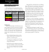
102 190-00607-02 rev c detailed operation weather mapping and interpretation weather display interpretation when evaluating various target returns on the weather radar display, the colors denote approximate rainfall intensity and rates as shown in the table below. Weather mode color approximate inte...
Page 115
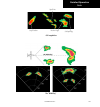
10 190-00607-02 rev c detailed operation steep gradient squall line hook or finger scalloped edge cell irregularities the “blind alley” radar.
Page 116
10 190-00607-02 rev c detailed operation tornadoes there is no conclusive radar target return charac- teristics which will identify a tornado, however, torna- does may be present if the following characteristics are observed: • a narrow, finger-like portion, as shown on the previous page, extends an...
Page 117
10 190-00607-02 rev c detailed operation xm satellite radio (xm) function audio entertainment is available through the xm satellite radio service when activated in the optional installation of the gdl 69a. The gmx 200 serves as the display and control head for your remotely mounted gdl 69a. Xm satel...
Page 118
106 190-00607-02 rev c detailed operation xm satellite radio menu page 1 the first menu item page of the xm radio function lets you select the options for viewing the radio id, saving a channel preset, going to the last channel, or selecting preset channels 1 and 2. The last option takes you to the ...
Page 119
107 190-00607-02 rev c detailed operation xm satellite radio save preset the save preset menu item allows you to store the displayed channel into a selected preset position for easy later recall. Saving xm audio radio channel presets 1. In the xm rado functon, press the menu/ent key. 2. Press the sa...
Page 120
10 190-00607-02 rev c detailed operation xm satellite radio volume the volume control allows you to set the audio volume level, as well as mute the audio. Xm audio radio volume controls 1. In the xm rado functon, press the + or - keys to ncrease or decrease the audo volume. Mute 1. In the xm rado fu...
Page 121
109 190-00607-02 rev c detailed operation xm satellite radio categories categories of channels, such as jazz, rock, or news, can be selected to list the available channels for a type of music or other contents. Xm audio radio categories 1. In the xm rado functon, press the cat func- ton smart key on...
Page 122
110 190-00607-02 rev c detailed operation xm satellite radio activating xm satellite radio services before audio entertainment can be used, the unit must be activated by xm satellite radio and services are subscribed to xm satellite radio. Please note that the gdl 69 is a weather data link. The gdl ...
Page 123
111 190-00607-02 rev c detailed operation xm advisory messages message condition description check antenna antenna not connected the xm antenna(s) or antenna cable are dsconnected from the rado. Updatng updatng encrypton code the encrypton code has been changed over the ar by xm and the rado has not...
Page 124: System (Sys) Function
112 190-00607-02 rev c detailed operation system (sys) function the system function allows you to set general nav preferences, obtain version information, and perform tests on the operation of your gmx 200. Press the fn key and then press the sys key to reach the system functions. System nav pages p...
Page 125
11 190-00607-02 rev c detailed operation initial en route zoom scale, initial ground zoom scale, and transition speed system nav setup menu items (page 2) a zoom scale auto-transition point is supported that helps to reduce the pilot workload by automating the selection of the zoom scale based on th...
Page 126
11 190-00607-02 rev c detailed operation system autoload electronic charts this is only available when installed with a gps navigator that supports the mapmx communication protocol (e.G., gns 480 series). This feature must be disabled when the gmx 200 is connected to a gps navigator that does not su...
Page 127
11 190-00607-02 rev c detailed operation system feature information the feature info page shows the installed addi- tional features and if they are unlocked for use. System info - feature page hardware information the hardware info page shows the port and data link status. System info - hardware pag...
Page 128
116 190-00607-02 rev c detailed operation system test pattern 1 the test pattern option displays a number of patterns and colors to test the gmx 200 display. Use this option to verify proper operation of the display or when contacting customer service. System test pattern 1 red, green, blue, white, ...
Page 129: Troubleshooting
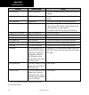
117 190-00607-02 rev c detailed operation troubleshooting this section contains information to troubleshoot the gmx 200 when improper operation is observed. The fol- lowing table lists possible problems you could encounter. Examine the possible causes of the problem and take the action listed to cor...
Page 130
11 190-00607-02 rev c appendix problem possible cause action rte (route) flag poston source route ensure that the external poston source has an actve route engaged. Lt (lghtnng) flag wx00 nstallaton have dealer/nstaller check for proper nstallaton of the wx00. Ter (terran) flag alttude source have d...
Page 131: Gdl 69/69A Fis Legends
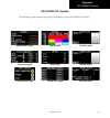
119 190-00607-02 rev c appendix gdl 69/69a fis legends the following legends describe the graphical information on the gdl 69/69a fis displays. Airmet/sigmet legend city forecast legend county warnings legend freezing levels legend nexrad legend metar legend cloud tops legend echo tops legend winds ...
Page 132
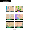
120 190-00607-02 rev c appendix gdl 69/69a fis screens sample gdl 69/69a fis displays the following displays provide examples of information shown in the gdl 69/69a fis function. Xm fis echo tops xm fis metars xm fis with nexrad weather and legend xm fis radar coverage xm fis winds aloft xm fis city...
Page 133: Specifications
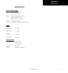
121 190-00607-02 rev c appendix specifications specifications physical specifications size: 6.27” w x 5.04” h x 8.0” d (15.9 x 12.7 x 20.3 cm) weight: 4.30 lbs (1.95 kg) standard unit only 4.60 lbs (2.1 kg) i/o unit only 0.73 lbs (0.33 kg) mounting tube display: 6.5 in. Diagonal (16.5 cm) 65,535-col...
Page 134: Care Information
122 190-00607-02 rev c appendix care information cleaning the unit your gmx 200 has a durable display with spe- cialized coatings. Reasonable care must be taken to maintain its performance and life. To remove stains, smudges, fingerprints, and so forth, we recommend these cleaning methods. If the fi...
Page 135: Glossary
12 190-00607-02 rev c appendix flitechart— the feature provides the capability to view garmin electronic charts. Depending on the charts available in the database, the following chart types may be viewed: approach charts, airport surface charts, sids, stars, airspace charts alternate mini- mums, and...
Page 136: Abbreviations
12 190-00607-02 rev c appendix abbreviations the following is a list of abbreviations and acronyms used on the gmx 200 and their meanings: abv— above ads-b— automatic dependent surveillance - broadcast alt— altitude artcc— air route traffic control center arwy— airway atc— air traffic control baro— ...
Page 137
12 190-00607-02 rev c appendix kg— kilograms khz— kilohertz km— kilometers kph— kilometers per hour kt— knots lat/lon—latitude/longitude lb— pounds link— data link lt— lightning °m— degrees magnetic m— meters mb— millibars (of pressure) metar— meteorological aviation report mhz— megahertz mi— statut...
Page 138
126 190-00607-02 rev c appendix taws— terrain awareness and warning system tcad — traffic/collision avoidance device tcas— traffic alert/collision avoidance system ter— terrain tfr— temporary flight rules tis-a— traffic information services - addressed tis-b— traffic information service - broadcast ...
Page 139: Contacting The Factory
127 190-00607-02 rev c appendix software license agreement by using the gmx 200, you agree to be bound by the terms and conditions of the following software license agreement. Please read this agreement carefully. Garmin grants you a limited license to use the software embedded in this device (the “...
Page 140: Limited Warranty
12 190-00607-02 rev c appendix limited warranty this garmin product is warranted to be free from defects in materials or workmanship for 24 months from the date of purchase. Within this period, garmin will at its sole option, repair or replace any compo- nents that fail in normal use. Such repairs o...
Page 141: Index
129 190-00607-02 rev c index index symbols 00 hz 96 a abbrevatons 12 absolute 2 accessores v actvate xm rado 110 actvaton 71 ads-b v, 1, 6, 9, 11, 26, 7, 2, 11, 12 advsory flags 6 advsory hot key 10 afc 96 arcraft symbol 112 airmet 62, 6, 6, 119 arport chart 76, 12 arports 17, 19, , , 79, 1, 6 arpor...
Page 142
10 190-00607-02 rev c index contactng the factory , 117, 122, 127 contact customer servce , , 72, 110, 122, 127 contact xm rado 110 controls county 66 county warnngs 62, 6, 66, 119 course 1, 22, 27, 1, , 1, 7, 61, 67, 7, 12 coverage current weather 7 cursor pre-select 9 custom map v, 2, , 9, 16, 29,...
Page 143
11 190-00607-02 rev c index icng 6 ident 7, , , 11, 12 ifr 27, 6, 0, 1, 2,, 6, 7, , 9 ihas 1, ils 7, 21, 22, 12 info 17,, 11 intal zoom level 16, 11 intersecton 22 invert 2, 2, l label 29, 2, , 61, 66 landng scenaro 9 last channel 106, 107 lat/lon format 112 lat/lon lnes 112 legend 61, 67, 119 lcens...
Page 144
12 190-00607-02 rev c index r radar 7, 9, , 9, 6, , 6, 60, 6, 90, 11 radar alert 9, 11 radar coverage , 6 radar range control 92 radar setup page 9 radar test 91 rado id 71, 106, 110 ran , 6 ram 96 range rng , 11 rdr 7, 91, 9, 11, 12 recever performance 70 reflectvty 6, 12 regstraton v, 127 relatve ...
Page 145
1 190-00607-02 rev c index tcas 11,,, 126 techncal support 127 temp 96 ter 1, 7, 9, 10, 0, 2, 11, 126 terran v, 1, 2, 6, 9, 11, 1, 2, 0, 1, 11, 126 test 2, , , 7, 7, 91, 112, 11, 117 test pattern 116 text 2,, 9, 1, 16, , 6,,, , 6, 6, 69,, 111 tfr , 6, 69, 126 tfr label 61 thumbnal 11, 26, , 6 thumbn...
Page 146
1 190-00607-02 rev c index this page intentionally left blank..
Page 148
© 2006-2007 garmin ltd. Or its subsidiaries garmin international, inc. 1200 east 151 st street, olathe, kansas 66062, u.S.A. Garmin (europe) ltd. Liberty house, hounsdown business park, southhampton, so40 9rb, u.K. Garmin corporation no. 68, jangshu 2 nd road, shijr, taipei county, taiwan www.Garmin...

