- DL manuals
- Garmin
- GPS
- GPS 150
- Pilot's Manual
Garmin GPS 150 Pilot's Manual
Summary of GPS 150
Page 1
Gps 150 pilot ’ s guide owner’s manual & reference tm ▲ gps 150 off brt nrst set rte wpt nav ▲ ▲ ▲ ▲ ▲ d crsr stat clr ▲ ▲ ▲ ▲ ▲ ▲ 150man rev e 7/24/98 3:09 pm page i.
Page 2
150man rev e 7/24/98 3:09 pm page ii.
Page 3: Introduction
I introduction foreword garmin™, gps 150™, autolocate™, multitrac8™ and autostore™ are trademarks of garmin corporation and may only be used with permission. All rights reserved. Software version 3.00 or above © 1997 garmin corporation 1200 e. 151st street, olathe, ks usa 66062 garmin (europe) ltd u...
Page 4: Caution
Caution the gps system is operated by the united states government, which is solely responsible for its accuracy and maintenance. The system is subject to changes which could affect the accuracy and performance of all gps equipment. Although the garmin gps 150 is a precision electronic navigation ai...
Page 5: Accessories & Packing List
Accessories & packing list congratulations on choosing the finest, most full-featured panel-mount vfr gps available. The gps 150 represents garmin’s commitment to provide an accurate, easy-to-use gps for all of your aviation needs. Before installing and getting started with your unit, please check t...
Page 6: Introduction
Designed for accurate performance and intuitive operation, the gps 150 is a powerful navigation device that allows you to navigate easily, no matter where your destination may take you. Precision performance • multitrac8™ receiver tracks and uses up to 8 satellites for fast, accurate positioning and...
Page 7: Introduction
Section 1 section 2 section 3 section 4 section 5 part one: introduction foreword . . . . . . . . . . . . . . . . . . . . . . . . . . . . . . . . . . . . . . . . . . . . . . . . . .I cautions . . . . . . . . . . . . . . . . . . . . . . . . . . . . . . . . . . . . . . . . . . . . . . . . . .Ii access...
Page 8: Introduction
Appendix a: navdata® and user data card use . . . . . . . . . . . . . . . . .67 appendix b: installation, removal and maintenance of the gps 150 . . .69 appendix c: gps 150 abbreviations and messages . . . . . . . . . . . . . . . .71 appendix d: specifications . . . . . . . . . . . . . . . . . . . ....
Page 9: Introduction
Vii introduction key and knob functions key and knob functions b the power/brightness knob controls unit power and screen brightness. D the direct-to key performs an instant direct-to, allows you to enter a waypoint, and sets a direct course to the destination. T the nearest key is used to obtain in...
Page 10: Introduction
N the navigation key is used to view navigation and position information. Planning operations are also performed using the n key. (see section 1 for more information on navigation and planning operations). C the cursor key is used to activate/deactivate the cursor. An active cursor is indicated by f...
Page 11: Getting Started
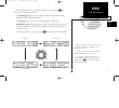
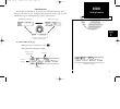
Operating mode page welcome page the garmin gps 150 is a powerful navigational tool that provides pilots with accurate navigational data and provides a host of database information at their fingertips. The next few pages are designed to familiarize you with the operation of the gps 150, including po...
Page 12: Getting Started
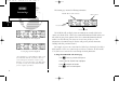
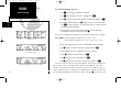
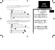
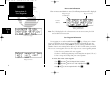
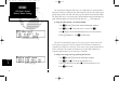
Database page operating mode page initial position reference page with airport identifier and position. To enter simulator mode from the operating mode page: 1. Rotate the outer knob ( o ) one stop to the left or right to highlight the operating mode. 2. Rotate the inner knob ( k ) to display ‘simul...
Page 13: Getting Started
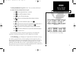
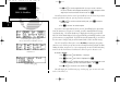
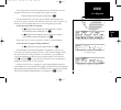
Position page waypoint confirmation page cdi page this will display the waypoint confirmation page which, for an airport, contains identifier, altitude, fuel services available, position, approach information and radar services. 1. Press e to confirm the waypoint information. 2. Press e again to acc...
Page 14: Getting Started
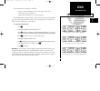
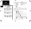
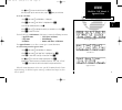
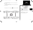
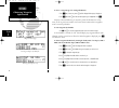
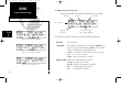
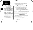
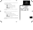
The cdi page after the waypoint has been confirmed. Entering the direct-to waypoint identifier. The cdi page after a ground speed has been set. To perform a direct-to at any time: 1. Press d . (for our simulated trip we will go to kdlo, delano municipal). 2. Rotate k until ‘ k’ is displayed. 3. Rota...
Page 15: Getting Started
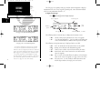
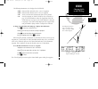
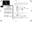
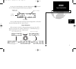
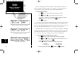
The cdi page with ‘brg’ and ‘trk’ displayed. The cdi page with ‘trn’ and ‘trk’ displayed. The cdi page contains three fields which may be configured to display other information. The ‘dis’ field can be configured to display any of the following: • dis – distance to destination waypoint • str – steer...
Page 16: Reference
The abbreviations used in the diagram on the right are: brg : bearing dis : distance dtk : desired track gs : ground speed str : steer direction & distance trk : track angle wpt : waypoint the gps 150 is a precision navigational device that provides speed, course and track information to the pilot a...
Page 17: Section 1
Section 1 navigating with the gps 150 prior to using your gps 150 for the first time in flight, we recommend that you taxi to a location that is well away from buildings and other aircraft. The first time you use the gps 150 it will automatically collect satellite data, and should not be interrupted...
Page 18: Reference
The position page will be displayed when the gps 150 has locked on to satellites and is ready for navigation. Note that if you begin using the gps 150 in any way before it has obtained a fix, it will not automatically display the position page, but will inform you when the gps 150 is displaying curr...
Page 19: Reference
The gps 150 displays all navigation data on pages accessed using the n key. The gps 150 contains four nav pages: the position page displays current position and altitude information and also provides reference waypoint information. The cdi page indicates the speed, steering and distance information....
Page 20: Reference
Position page with esa displayed. The position page contains the following information: the msa/esa field can display either the minimum safe altitude (msa) or the enroute safe altitude (esa). Msa is the recommended minimum altitude within a ten mile radius of your present position. Esa is the recom...
Page 21: Reference
The proximity field can display the following: • range, bearing and identifier of the nearest airport, vor, ndb, intersection, or user waypoint, or; • range and bearing from a user entered waypoint. This will display any waypoint’s distance and bearing on the bottom of the position page. This is esp...
Page 22: Reference
Cdi page with cts and eta displayed. The cdi page is the primary nav page used for enroute navigation. It displays information such as the active waypoint, ground speed, course deviation indicator (cdi), steering information, distance, etc. To display the cdi page: 1. Press n and rotate o until the ...
Page 23: Reference
The following information can be displayed in the ete field: • eta – estimated time of arrival (at the ‘active to’ waypoint). • ete – estimated time enroute (to the ‘active to’ waypoint). • trk – track, or the direction of movement relative to the ground. • vn – vertical navigation, or vnav. If vnav...
Page 24: Reference
In addition to the position and cdi pages, the n key features two menu pages to perform many planning and navigation functions. Nav menu 1 contains options to perform the following functions: • trip planning • density altitude/true air speed calc. • fuel planning • winds aloft calculations • vnav pl...
Page 25: Reference
The density altitude/true air speed function is also accessed from nav menu 1. To calculate the density altitude and true air speed: 1. Press n and rotate o until nav menu 1 is displayed. 2. Press c and rotate o to highlight the ‘dalt/tas?’. 3. Press e to access the density altitude page. 4. Use k a...
Page 26: Reference
To perform fuel planning operations: 1. Press n and rotate o until nav menu 1 is displayed. 2. Press c and rotate o until ‘fuel plan?’ is highlighted. Press e . 3. Rotate k to select either ‘wpt’ for direct navigation or the desired route number. Press e . 4. For waypoint-waypoint navigation, use k ...
Page 27: Reference
The gps 150 will also perform winds aloft calculations to inform you of the true direction and speed of the wind. The gps 150 will also display whether you are flying with a headwind or tailwind, and its speed. To calculate winds aloft: 1. Press n and rotate o until nav menu 1 is displayed. 2. Press...
Page 28: Reference
7. Use k and o to enter the waypoint identifier. If you are on a route or a direct-to, the ‘active to’ identifier will be displayed automatically. This may be changed to another waypoint, but it must be contained in the active route. Press e . You will now notice that the vertical speed field has be...
Page 29: Reference
5. Use k and o to enter the checklist item. Press e . 6. You may repeat step 5 to enter more items, or press c when you are finished. To execute a checklist: 1. Press n and rotate o until nav menu 1 is displayed. 2. Press c and rotate o until ‘chklist?’ is highlighted. Press e . 3. Scroll through av...
Page 30: Reference
The gps 150 keeps track of both utc time (greenwich mean time, or zulu time, calculated from the satellites) and local time. The gps 150 will allow you to set the local time and date for your reference so you do not have to do a utc to local time conversion manually. The times displayed elsewhere on...
Page 31: Reference
The gps planning function allows you to make sure there are no gps coverage outages for any location or waypoint, any day of the year. Now that the gps constellation is complete and has been declared operational by the u.S. Department of defense, it is unlikely that instances of poor coverage will o...
Page 32: Reference
The scheduler function will display reminder messages after a certain elapsed time such as change oil, switch fuel tanks, overhaul, etc. For example, if you enter ‘change oil’ to be displayed in 30 hours, the message ‘change oil’ will be displayed after the gps 150 has been on in normal operating mo...
Page 33: Section 2
Section 2 waypoint and database information the database in your gps 150 is contained on a navdata® card providing information for either the americas, international or worldwide coverage. The americas database covers north, central and south america. The international database covers europe, asia a...
Page 34: Reference
• intersections - identifier, country, position (lat/lon), nearest vor. • fss - identifier, reference vor, frequency and usage. • minimum safe altitude - minimum altitude you can fly and remain (msa) above obstructions in the region. Enroute safe altitude (esa) is the minimum safe altitude along a r...
Page 35: Reference
The user waypoint catalog page lists all of the user entered waypoints in alphabetical order. The waypoints comment catalog page lists all of the waypoints which have user entered comments. The waypoint pages may be accessed by pressing w and rotating the outer knob ( o ). 25 reference wpt key overv...
Page 36: Reference
To choose a waypoint type (for viewing information): 1. Press w and, if necessary, rotate o until the waypoint menu page is displayed. 2. Press c and rotate o until the desired waypoint type is highlighted. Press e . Airports, vors and ndbs may be entered by either the identifier, the facility name,...
Page 37: Reference
As soon as the desired identifier or location is displayed, press c . This will leave the following waypoint identification page displayed: if the city and/or facility name is too long to fit on the displayed line, it will scroll to show more information when the cursor is removed. Airport informati...
Page 38: Reference
To display the airport position page: 1. Rotate o until the airport position page is displayed (with the cursor not flashing). The fields on the airport position page display the following information: elevation - in feet or meters. Usage/fuel - if the airport is for military use, it will display ‘ ...
Page 39: Reference
Controlled airspace - displays controlled airspace type and if radar is available. Or radar information • class b • class c • cta - icao control area • tma - icao terminal control area • radar - indicates radar is present the gps 150 database also contains most communication frequencies used at the ...
Page 40: Reference
If the frequency is receive only, the frequency type will be followed by ‘rx’. If the frequency is transmit only, it will be followed by ‘tx’. If the displayed frequency has sector and/or altitude restrictions, they will also be displayed. Sector restrictions define a range of radials from the appli...
Page 41: Reference
The following runway information can be displayed on the runway information page: runway surfaces: runway lighting: hard - hard (concrete, asphalt, etc.) pt lights - part time lights turf - turf (grass) ft lights - full time lights seal - sealed surface pc - pilot controlled grav - gravel surface (w...
Page 42: Reference
To view the vor position page: 1. Make sure the cursor is not flashing. If it is, press c . 2. Rotate o until the vor position page is displayed. ‘ dme ’ or ‘ tacan ’ is displayed on the bottom line of the vor position page if there is a dme or tacan facility also located with the vor. The ‘ wx bdcs...
Page 43: Reference
Ndb information after entering the ndb identifier, city, or name, the ndb identification page will be displayed. Like vors, the gps 150 displays ndb information on three pages: the ndb identification page, the ndb position page, and the comments page. To view the ndb position page: 1. Make sure the ...
Page 44: Reference
Intersection information when an intersection identifier is entered, the following information will be displayed: note: the vor displayed is the calculated nearest vor, not necessarily the vor used to define the intersection. User waypoint information user waypoints are created or modified using the...
Page 45: Reference
If the waypoint is new, you will be prompted to select the method to enter the waypoint into the database. If the waypoint exists, skip the next step. 4. Select the method to enter the waypoint using o and press e . You will automatically be placed on either the latitude and longitude (if you select...
Page 46: Reference
User waypoints may also be created using autostore™. This will save your current position as a user waypoint and can instantly be added to any route. To autostore your current position as a waypoint: 1. Press n and rotate o until the position page is displayed. Press e . This will display the autost...
Page 47: Reference
3. Use k and o to enter the comment. 4. Press e to accept, and repeat, if desired, to enter information on another line. 5. Press c to complete. Proximity waypoints the gps 150 will allow you to enter up to 9 proximity waypoints, which will display an alert message when you come within a user entere...
Page 48: Reference
To delete a waypoint from the proximity waypoints page: 1. Rotate k to display the waypoint you would like to remove. 2. Press c , if necessary, to obtain a cursor. 3. Rotate o to highlight the waypoint you would like to remove. 4. Press \ to erase the name and then e to delete. If you enter the pro...
Page 49: Reference
To edit a waypoint: 1. Press e while the waypoint is highlighted to obtain the waypoint position page. Edit the waypoint as described on pages 34 & 35. To activate a user waypoint (perform a direct-to) from the list: 1. Press d while the waypoint is highlighted. To delete a waypoint from the list (c...
Page 50: Reference
Duplicate identifiers for waypoints sometimes exist when identifier names have been used in more than one location. For example, the identifier ma is used in nine- teen different locations throughout the world (fewer are contained on the americas or international databases). When you enter an identi...
Page 51: Section 3
Active leg eos ktul sgf kstl 'active from' waypoint 'active to' waypoint map section 3 routes all routes are created, edited, activated and copied using the r key. Routes are a series of waypoints flown in order to arrive at the desired destination. The gps 150 contains two route pages, the active r...
Page 52: Reference
To add waypoints to the active route (while on the active route page): 1. Make sure the cursor is not flashing. If it is, press c . 2. Rotate k to display the waypoint you would like to insert the new waypoint before. 3. Press c . 4. Rotate o to highlight the waypoint you would like to insert the ne...
Page 53: Reference
Rotate k to scroll through the available routes. You may perform the following functions on any of the routes in the route action field: • activate - activate the route for navigation • reverse - activate a route in reverse order • edit - create a new route, or edit existing routes • delete - delete...
Page 54: Reference
To edit a route (add or delete waypoints): 1. Press r and rotate o , if necessary, to display the route catalog page. 2. Rotate k until the route you would like to edit is displayed. 3. Press c , then e when ‘edit?’ is highlighted. This will display the route review page. To add a waypoint: 1. Rotat...
Page 55: Reference
To copy a route: 1. Press r and rotate o , if necessary, to display the route catalog page. 2. Rotate k until the route you would like to copy to is displayed. (the route must be empty.) 3. Press c and rotate k to display ‘copy?’. Press e . 4. Use k to select the route you would like to copy from. T...
Page 56: Reference
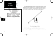
The following diagram displays how the cpa function works. The route is from kdal to klit, and the user desires to create a waypoint on the route in reference to txk. The gps 150 calculates the closest point the route comes to txk, which the unit calls txk0. The unit will display txk0’s range and be...
Page 57: Reference
The gps 150 will also guide you on search and rescue operations, navigating in a ladder pattern to maximize coverage and minimize navigational planning. This is done in reference to two waypoints, called the anchor waypoints. The first leg of the route will be a line connecting the anchor waypoints....
Page 58: Reference
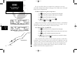
Airplane begin waypoint offset distance destination waypoint the gps 150 will also allow you to add one line of comments to each route, which will be displayed on the route catalog page. This excludes route 0, which will display the offset navigation field. To add user comments to any route (except ...
Page 59: Section 4
Section 4 nearest waypoints the gps 150 will locate and display the nine nearest airports, vors, ndbs, intersections and user waypoints within 200 nautical miles of your current position. In addition, it will also display the two nearest flight service station (fss) points of com- munication, and an...
Page 60: Reference
The sua alert page will inform you if any restricted or controlled airspace is near or in your flight path, according to the following conditions: • if your projected course will take you inside an sua within the next 10 minutes, the message ‘ sua ahead ’ will be displayed. • if you are within two n...
Page 61: Reference
The following sua types can appear in the sua type field: message airspace type alrt - alert caut - caution cl b - class b cl c - class c cta - icao control area dngr - danger moa - military operations area proh - prohibited rstc - restricted tma - icao terminal control area trng - training trsa - t...
Page 62: Reference
All sua alerts (except for prohibited areas) may be turned on or off to avoid unnecessary alerts. Alerts for prohibited areas will always be displayed. An altitude buffer also may be set to extend the vertical profile of your aircraft to provide earlier warnings when climbing or descending. For exam...
Page 63: Section 5
Section 5 unit settings and satellite status the gps 150 will allow you to customize many settings to your preferences. Also, it will provide information on the satellites it is currently tracking, which is helpful in alerting you to possible problems with antenna installation, or receiver problems....
Page 64: Reference
The course deviance indicator (cdi) may be set to deflect full scale at either 5 distance units (mi, nm, km) or 1.25 distance units. This setting will cause the cdi to deflect appro- priately when you have cross track error. This page also contains the arrival alarm settings. The arrival alarm can b...
Page 65: Reference
If you turn automatic leg sequencing off, you must manually advance the route you are navigating to the next waypoint. To manually sequence the active route legs: 1. Press r and rotate o until the active route page is displayed. 2. Rotate k until the next desired destination waypoint is displayed. 3...
Page 66: Reference
The next settings page contains the magnetic variation options. The gps 150 offers three magnetic variation settings. True, automatic, or user defined magnetic corrections will be applied to all track, course and heading information. To set the magnetic variation: 1. Press s and rotate o until the m...
Page 67: Reference
In the event of power failure, the gps 150 can automatically turn off the display while using battery power, if desired. This will greatly increase the gps 150’s battery life while navigating without aircraft power. During the time the display is off, the gps 150 will continue to navigate and track ...
Page 68: Reference
The gps 150 will display all distance, position, speed, fuel type, fuel quantity, altitude, pressure and temperature fields in several different measuring systems. To change the measurement units: 1. Press s and rotate o until the navigational units page is displayed. 2. Press c and rotate o to high...
Page 69: Reference
The gps 150 will allow you turn the sua alert messages on or off. This will not affect the airspace being listed on the sua alert page, it will simply turn off the alert messages when you are approaching or near an sua. You can turn off alerts for the following airspaces: class b / cta : icao contro...
Page 70: Reference
The gps 150 contains over 100 map datums for you to use when navigating with the gps 150. By default, your gps 150 calculates positions using the wgs-84 map datum. If you are using charts based on another datum, you must set the gps 150 to use that datum if you are using the coordinates provided on ...
Page 71: Reference
The gps 150 features two rs-232 data ports which can be configured to accept input from altitude serializers, fuel flow systems, fuel/air data computers or output aviation data to moving maps, fuel flow sensors, or the garmin pc 150 software kit. Channel 1 input selections correspond to the followin...
Page 72: Reference
To change the input/output settings (channel 1 or channel 2): 1. Press s and rotate o until the i/o channel 1 (or 2) page is displayed. 2. Press c and rotate o to select the field you would like to change. 3. Rotate k to select the proper setting. 4. Rotate o to highlight another, or c to complete. ...
Page 73: Reference
The gps 150 can also interface to another gps 150 to transfer user waypoints, settings and other user information between units. These operations are performed from the data transfer page. To receive user data from another gps 150: 1. Press s and rotate o until the data transfer page is displayed. 2...
Page 74: Reference
The gps 150 is designed to allow the user to obtain satellite information at any time to monitor signal strengths and relative accuracy of the position information the receiver is calculating. This is especially helpful when you might be experiencing a problem with low signal levels due to poor cove...
Page 75: Reference
The receiver status field can display the following messages: search sky - the gps 150 is searching the sky for visible satellites. You will be informed with the message ‘searching the sky’. Acquiring - the gps 150 is acquiring satellites for navigation. 2d nav - the gps 150 is in 2d navigation mode...
Page 76: Reference
The gps 150 will also display information regarding each satellite in view. To view individual satellite information: 1. Press a (while the u is not flashing). 2. Press c to obtain a cursor. 3. Rotate o to highlight the satellite you wish to view. 4. Press e . The satellite detail page will display ...
Page 77: Appendix A
Appendix a navdata ® and user data installation and operation the navdata card supplied with your gps 150 can be installed or removed only when the gps 150 is turned off. Insert the card with the thumb tab at the top, and the beveled corner on the bottom right. The user data card can be used to make...
Page 78: Appendix A
To restore user data from a user data card to the gps 150: 1. Install the user data card while the unit is off. 2. Turn the gps 150 on by rotating b clockwise. 3. Rotate o to highlight ‘restore user data?’ and press e . The gps 150 will ask you which type of data to replace. You may choose checklist...
Page 79: Appendix B
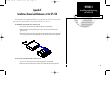
Appendix b installation, removal and maintenance of the gps 150 the aviation rack is designed to allow easy removal of the gps 150. This enables you to use the unit at home to create routes, interface to a pc, etc. To install the gps 150 into the aviation rack: 1. Insert a 3/32” allen wrench in the ...
Page 80: Maintenance
Maintenance the gps 150 is built to exacting standards and does not require user maintenance. Should the faceplate and lens require cleaning, use a soft cloth and non-abrasive cleaner. The user data is maintained by an internal battery with a projected life of 3 to 5 years. If the gps 150 detects a ...
Page 81: Appendix C
Appendix c gps 150 messages and abbreviations the gps 150 uses the message page to communicate important information to you. Some messages are advisory in nature, others are warnings that may require your intervention. This appendix provides a complete list of gps 150 messages and their meanings. Al...
Page 82: Appendix C
Checklist is full - the selected checklist is full. No new items can be added until existing items are deleted. Collecting data - the gps 150 is collecting orbital data while searching the sky. The antenna should have a good view of the sky and the gps 150 should be allowed to finish data collection...
Page 83: Appendix C
Invalid sar route - the selected route does not contain exactly two waypoints and cannot be used for sar operations. Leg not smoothed - the upcoming leg is too short for smooth waypoint transi- tions. Expect a rapid change in the cdi. Memory battery low - the battery that sustains user memory is low...
Page 84: Appendix C
Proximity wpt locked - at least one proximity waypoint is locked because the way- point has been removed from the jeppesen navdata®, the data card is missing, or the data card has failed. Proximity wpt moved - one or more proximity waypoints were moved at least 0.33 arc minutes due to a database cha...
Page 85: Appendix C
Route wpt moved - one or more route waypoints were moved at least 0.33 arc minutes due to a database change. Searching the sky - the gps 150 is in the search-the-sky mode. Allow the unit to complete data collection before turning it off. Start altitude chng - the altitude change entered on the vnav ...
Page 86: Appendix C
76 appendix c gps 150 abbreviations this section of appendix c provides a complete list of gps 150 abbreviations and their meanings. Alt- altitude app- approach apr- approach apt- airport waypoint arv- arrival atf- aerodrome traffic frequency ats- automatic terminal information service (atis) avgs- ...
Page 87: Appendix C
77 appendix c gps 150 abbreviations jet a- jet fuel - type a jet b- jet fuel - type b kh- kilometers per hour km- kilometers kt- knots lb- pounds lcl- local len- length lfob - leftover fuel on board lflow- left fuel flow loc- localizer lt- liters mag var -magnetic variation mb- millibars of pressure...
Page 88: Appendix C
78 appendix c gps 150 abbreviations rx- receive only sar- search and rescue sec- seconds seq- sequence sgl- signal slct- select srfc- surface str- steer to tacan- tactical air navigational aid tas- true airspeed tat - total air temperature temp- temperature tma- icao terminal control area trk- track...
Page 89: Appendix D
79 appendix d specifications ** subject to accuracy degradation to 100m 2drms under the us dod-imposed selective availability program. Appendix c specifications physical size: 6.25”w x 5.8”d x 2”h (159mm x 147mm x 51mm) weight: 34 ounces (0.96kg) rack size: 6.32”w x 5.64”d x 2”h (161mm x 143mm x 51m...
Page 90
80 150man rev e 7/24/98 3:11 pm page 80
Page 91: Appendix E
Appendix e map datums 81 appendix e map datums adindan ethiopia, mali, senegal, sudan afgooye somalia ain el abd 1970 bahrain island, saudi arabia anna 1 astro 1965 cocos islands arc 1950 botswana, lesotho, malawi, swaziland, zaire, zambia, zimbabwe arc 1960 kenya, tanzania ascension is 1958 ascensi...
Page 92: Appendix E
82 appendix e map datums (cont.) luzon philippines philippines (excluding mindanao isl.) mahe 1971 mahe island marco astro salvage islands massawa eritrea (ethiopia) merchich morocco midway astro 1961 midway island minna nigeria nad27 alaska north american 1927- alaska nad27 bahamas bahamas (excludi...
Page 93: Appendix F
83 appendix f index appendix f index a abbreviations 76-78 ac adaptor 68 accesory list iii activating user waypoints 39 activating a route 43 activating a route in reverse 43 active from waypoint 41 active route page 41 active to waypoint 41 adding waypoints to a route 42,44 airport information 23,2...
Page 94: Appendix F
84 appendix f index e editing routes 44 editing user waypoints 34-36 ent key viii entering waypoints 26 enroute safe altitude (esa) 10 epe 64 f foreword i fuel planning 15-16 fuel types 28 flight service stations (fsss) 24,52 g going to the nearest airport 5 gps planning 21 ground speed (setting) 4 ...
Page 95: Appendix F
85 appendix f index p packing list iii parallel track 48 pc 150 setup 62 position page 3,9,10 power/brightness knob vii power on (normal) 7 power on (simulator) 1 proximity field 11 proximity waypoints 24,37-38 r radar information 29 receiver status 7,8,64-65 receiving data from another gps 150 63 r...
Page 96: Appendix F
86 appendix f index v vertical navigation (vnav) 17-18 vors 23,31-32 w waypoint confirmation page 3 waypoint identification page 27 waypoint information 23 waypoint key vii,25 waypoint menu 24 waypoints with comments 25,39 weather broadcast indication 32,33 winds aloft 17 150man rev e 7/24/98 3:11 p...
Page 97
150man rev e 7/24/98 3:11 pm page 87.
Page 98
© 1997 garmin corporation 1200 e. 151st street, olathe, ks usa 66062 garmin (europe) ltd. Unit 5, the quadrangle, abbey park industrial estate, romsey, u.K. So51 9aq part no. 190-00048-00 rev. E ® 150man rev e 7/24/98 3:11 pm page 88.


