- DL manuals
- NorthStar
- GPS
- 957
- Operator's Manual
NorthStar 957 Operator's Manual
Summary of 957
Page 1
Northstar 957 gps/waas chart navigator operator’s manual.
Page 3: Limited Warranty Policy
Limited warranty policy northstar technologies, inc. Warrants the northstar 957 to be free from defects in mate- rials and workmanship for a period of two (2) years. This warranty applies to the original purchaser and to any subsequent owner during the warranty period, which begins on the date of sh...
Page 4
Caution! Northstar products are designed to be very useful navigation tools, but they are not substitutes for good seamanship. The prudent navigator should never rely on any single device as the sole source of navigation guidance. Exercise caution and good judgment when underway. Caution! The electr...
Page 5: Contents
957 operator’s manual rev. B page i contents getting started . . . . . . . . . . . . . . . . . . . . . . . . . . . . . . . . . . . . . . . . . . . . . . . . . . . . . . . . . . . . . . . . . 1 welcome to the 957 . . . . . . . . . . . . . . . . . . . . . . . . . . . . . . . . . . . . . . . . . . . . ...
Page 6
Page ii 957 operator’s manual rev. B rotating the chart . . . . . . . . . . . . . . . . . . . . . . . . . . . . . . . . . . . . . . . . . . . . . . . . . . . . . . . . . . . . . 42 setting up the chart screen . . . . . . . . . . . . . . . . . . . . . . . . . . . . . . . . . . . . . . . . . . . . . ....
Page 7
Page iii 957 operator’s manual rev. B using the nav log . . . . . . . . . . . . . . . . . . . . . . . . . . . . . . . . . . . . . . . . . . . . . . . . . . . . . . . . . . . .113 introducing the nav log . . . . . . . . . . . . . . . . . . . . . . . . . . . . . . . . . . . . . . . . . . . . . . . . ....
Page 8
Page iv 957 operator’s manual rev. B.
Page 9: Getting Started
957 operator’s manual, rev. B page 1 1 getting started welcome to the 957 . . . . . . . . . . . . . . . . . . . . . . . . . 2 using this manual . . . . . . . . . . . . . . . . . . . . . . . . . . . 2 obtaining technical support . . . . . . . . . . . . . . . . . 3 turning the 957 on and off . . . . ....
Page 10: Welcome To The 957
Page 2 957 operator’s manual, rev. B chapter 1 - getting started welcome to the 957 congratulations on your purchase of the northstar 957! The 957 is a full-featured color gps/vector charting system, which is extremely easy to use, but meets your marine navigation needs in a comprehensive, logical m...
Page 11: Conventions
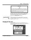
Chapter 1 - getting started 957 operator’s manual, rev. B page 3 conventions this manual uses certain conventions to provide a consistent way to recognize specific information, as follows: • is the universal caution symbol for caution and warning information related to your personal safety or possib...
Page 12: Hearing From You
Page 4 957 operator’s manual, rev. B chapter 1 - getting started hearing from you your feedback is important and helps northstar ensure that this manual is a valuable resource for all 957 users. Send your questions, comments, or suggestions about this manual to: manuals@northstarcmc.Com service and ...
Page 13: Turning The 957 On And Off
Chapter 1 - getting started 957 operator’s manual, rev. B page 5 repair or replace, free of charge, any part found to be defective due to faulty materials or workmanship, if the 957 has been properly installed and hasn’t been abused. The only cost to the owner will be the one-way shipping charges an...
Page 14: Checking Gps and
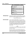
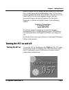
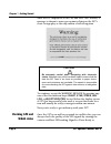
Page 6 957 operator’s manual, rev. B chapter 1 - getting started after the 957 displays its start-up and self-test screens, a message is shown to warn you against relying on the 957’s chart cartography as the only means of safe navigation. To continue, accept the warning message by pressing any one ...
Page 15: Turning The 957 Off
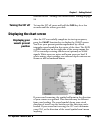
Chapter 1 - getting started 957 operator’s manual, rev. B page 7 described in see ”viewing gps satellite status” starting on page 54. Turning the 957 off to turn the 957 off, press and hold the pwr key for a few seconds until the screen goes dark. Displaying the chart screen displaying your vessel’s...
Page 16: Rotating The Chart
Page 8 957 operator’s manual, rev. B chapter 1 - getting started the scale of your first view is about 128 nautical miles (nm) from edge to edge—and is shown in the lower right corner of the screen. To see more details about your position, press the in key. To see more area and less detail, press th...
Page 17: Using Chart Data
Chapter 1 - getting started 957 operator’s manual, rev. B page 9 the necessary satellite information. This situation usually occurs in a 957 that’s been shipped more than several hundred miles from northstar, and often just the first time the 957 is turned on. This first time, the 957 takes two to f...
Page 18: Inserting A Chart
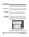
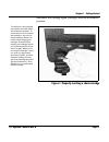
Page 10 957 operator’s manual, rev. B chapter 1 - getting started obtaining navionics charts, contact your authorized northstar dealer. Inserting a chart cartridge the cartridge slot is located at the lower left-hand corner of the 957. You can see if a cartridge is inside by opening the cartridge ac...
Page 19
Chapter 1 - getting started 957 operator’s manual, rev. B page 11 then move the cartridge again, it may get stuck in an awkward position. Figure 1: properly inserting a chart cartridge the navionics chart cartridge must remain free from debris and moisture at all times. To ensure that you do not exp...
Page 20
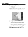
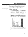
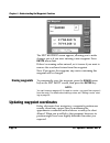
Page 12 957 operator’s manual, rev. B chapter 1 - getting started displaying detailed position information you can display detailed position information on two screens: • the chart screen • the gps position screen to display position information on the chart screen, press the more info menu key to d...
Page 21: Displaying The Fishfinder
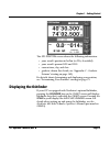
Chapter 1 - getting started 957 operator’s manual, rev. B page 13 the gps position screen shows the following information: • your vessel’s position in lat/lon (or tds, if enabled) • your vessel’s present sog and cog • current time, day, and date • geodetic datum (for details, see ”appendix c - geode...
Page 22: Displaying A Video Image
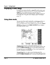
Page 14 957 operator’s manual, rev. B chapter 1 - getting started displaying a video image if your 957 is connected with a compatible video source, you can display the image onto most 957 screens by pressing the video key. For an introduction to this function, see ”introducing the 957’s special func...
Page 23
Chapter 1 - getting started 957 operator’s manual, rev. B page 15 the keypad to enter the desired speed, then press the enter key to start going to the demo cursor location. To go back to the chart screen (but stay in demo mode), press the return key twice. The word demo always appears on the chart ...
Page 24
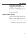
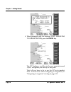
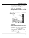
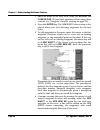
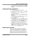
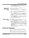
Page 16 957 operator’s manual, rev. B chapter 1 - getting started 4. When prompted with the message start navigating to cursor position, press the enter key. The 957 displays a track line to the new waypoint named -quik-, and guides you directly to this point. That’s all you have to do to use the 95...
Page 25: Introducing The 957
957 operator’s manual, rev. B page 17 2 introducing the 957 introducing the controls . . . . . . . . . . . . . . . . . . . . 18 introducing the display screen . . . . . . . . . . . . . . 19 introducing the 957’s special functions . . . . . 22 maintaining the 957 . . . . . . . . . . . . . . . . . . ....
Page 26: Introducing The Controls
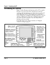
Page 18 957 operator’s manual, rev. B chapter 2 - introducing the 957 introducing the controls figure 2 below illustrates the functions of the 957’s controls. Feel free to try any of the 957’s controls! You can’t hurt anything, and can only learn more about how to use the 957 more efficiently. The 9...
Page 27: Overhead View
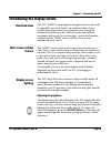
Chapter 2 - introducing the 957 957 operator’s manual, rev. B page 19 introducing the display screen overhead view the 957’s chart screen displays navigation data in an easily recognizable, practical format: an overhead view of your vessel’s present position (or any position you choose) in relation ...
Page 28: Chart Plotter
Page 20 957 operator’s manual, rev. B chapter 2 - introducing the 957 chart plotter function the 957 plots your position on the chart screen. Nearby land masses, depth contours, nav aids, waypoints, avoidance areas, and a lat/lon grid may be displayed, along with your vessel’s image. When you’re usi...
Page 29
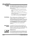
Chapter 2 - introducing the 957 957 operator’s manual, rev. B page 21 star function key (twice if the echo sounder is enabled). Messages you haven’t seen already display the word new in the upper right corner. To turn off the flashing icon and remove the message, press the clear alarm menu key. Info...
Page 30: Using The Alarms
Page 22 957 operator’s manual, rev. B chapter 2 - introducing the 957 question windows a question window appears when the 957 needs a response from you. You must respond to any question window by pressing the enter key to answer yes, or the clear key to answer no. Most of the other keys, including t...
Page 31: Using Tidetrack™
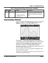
Chapter 2 - introducing the 957 957 operator’s manual, rev. B page 23 using tidetrack™ the 957’s tide track screen displays a 24-hour tide graph for any of over 3,000 noaa tide stations covering the entire u.S. Coastline, including alaska and hawaii, plus much of the eastern and western canadian coa...
Page 32: Cleaning The Display
Page 24 957 operator’s manual, rev. B chapter 2 - introducing the 957 • don’t open the 957’s case—there aren’t any user-serviceable parts inside cleaning the display screen be careful when cleaning the glass window covering the display screen. Although the window is scratch-resistant, you may damage...
Page 33: Using The Controls
957 operator’s manual, rev. B page 25 3 using the controls using the pwr key . . . . . . . . . . . . . . . . . . . . . . . . . 26 using the five function keys . . . . . . . . . . . . . . . . 26 using the cursor pad . . . . . . . . . . . . . . . . . . . . . 28 using the save key . . . . . . . . . . ....
Page 34: Using The Pwr Key
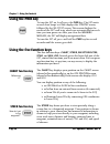
Page 26 957 operator’s manual, rev. B chapter 3 - using the controls using the pwr key to turn the 957 on, briefly press the pwr key. The 957 emits several short beeps as it first displays the startup screen, followed by the self-test screen. This screen displays the results of the 957’s self-tests,...
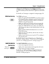
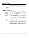
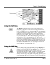
Page 35: Star Function Key
Chapter 3 - using the controls 957 operator’s manual, rev. B page 27 there are two versions of the steer display: traditional steering and 3d steer. Press the steer function key once to see the version you last used. Press it again to see the other one. For details, see ”steering to a waypoint” star...
Page 36: Nav Log Function
Page 28 957 operator’s manual, rev. B chapter 3 - using the controls nav log function key the nav log key displays a list of the waypoints you’ve passed, lets you change those ahead of you, reverse the direction of your trip, and stop or restart navigation. For details, see ”using the nav log” start...
Page 37: Using The Save Key
Chapter 3 - using the controls 957 operator’s manual, rev. B page 29 using the save key the save key instantly saves your vessel’s position as a waypoint—at any time, on any screen, during any function. Press the save key to store your position. This new waypoint is automatically given a name, such ...
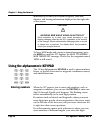
Page 38: Entering Numbers
Page 30 957 operator’s manual, rev. B chapter 3 - using the controls immediately become your current waypoint, with new distance and bearing information displayed on the right side of the screen. To leave mob mode and return to normal navigation, press the mob key until the 957 displays the back to ...
Page 39: Entering Letters and
Chapter 3 - using the controls 957 operator’s manual, rev. B page 31 calculator-style from the right side of the data area. If you make a mistake, press the clear key to clear the entire number and re-enter it, or press the cursor pad left to re-enter particular digits one at a time. Entering letter...
Page 40: Using The Brightness Key
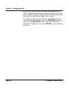
Page 32 957 operator’s manual, rev. B chapter 3 - using the controls using the brightness key to get the best picture for the current conditions, the 957’s screen may require minor adjusting for different viewing angles, temperature conditions, etc. Press the brightness key (the unlabelled double ar...
Page 41: Using The Chart Screen
957 operator’s manual, rev. B page 33 4 using the chart screen understanding electronic charts . . . . . . . . . . . . 34 understanding nav aids . . . . . . . . . . . . . . . . . . . . 35 zooming in and out . . . . . . . . . . . . . . . . . . . . . . . . . 37 controlling the cursor on the chart scre...
Page 42: Chart Boundary
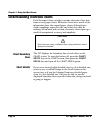
Page 34 957 operator’s manual, rev. B chapter 4 - using the chart screen understanding electronic charts each navionics chart cartridge contains electronic chart data from several paper charts. Electronic charts have much of the information from the original paper charts, although spot depth soundin...
Page 43: Understanding Nav Aids
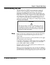
Chapter 4 - using the chart screen 957 operator’s manual, rev. B page 35 understanding nav aids the nav aids on the chart screen represent a variety of standard “aids to navigation” used on coastal and inland waterways throughout the united states. Nav aids are displayed on the chart screen as color...
Page 44: Landmarks
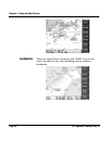
Page 36 957 operator’s manual, rev. B chapter 4 - using the chart screen landmarks there are other objects shown on the chart screen that aren’t classified as nav aids, including various onshore landmarks..
Page 45: Zooming In and Out
Chapter 4 - using the chart screen 957 operator’s manual, rev. B page 37 zooming in and out to get a closer look at the chart area around your vessel or around the cursor, press the in key to zoom in. To see a wider area, press the out key to zoom out. Each press of the in or out key approximately h...
Page 46
Page 38 957 operator’s manual, rev. B chapter 4 - using the chart screen as a reminder that no charted hazards or nav aids are shown, the 957 displays the words no chart multiple times across the screen. Even without any chart data displayed, you can still use the 957 as a precision plotter controll...
Page 47
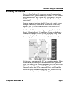
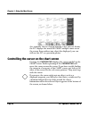
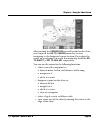
Chapter 4 - using the chart screen 957 operator’s manual, rev. B page 39 after pressing the cursor pad to scroll around on the chart, you can press the go to cursor menu key to start navigating to the designated cursor location. If you place the cursor on a waypoint or nav aid, this menu key would b...
Page 48: Vessel Mode
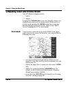
Page 40 957 operator’s manual, rev. B chapter 4 - using the chart screen comparing vessel and browse modes the 957 offers two display modes: • vessel • browse pressing the cursor pad at any time instantly changes the display from vessel mode to browse mode. When you’re in browse mode, pressing the v...
Page 49: Browse Mode
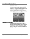
Chapter 4 - using the chart screen 957 operator’s manual, rev. B page 41 • restart your course line from your present position to your intended waypoint (restart key); for details, see ”restarting navigation” starting on page 116 • display or change the setup functions for the chart screen (chart se...
Page 50: Rotating The Chart
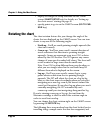
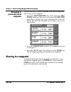
Page 42 957 operator’s manual, rev. B chapter 4 - using the chart screen • display or change the setup functions for the chart screen (chart setup key); for details, see ”setting up the chart screen” starting on page 45 • specify points to go to on the chart screen (go to cur- sor key) rotating the ...
Page 51
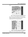
Chapter 4 - using the chart screen 957 operator’s manual, rev. B page 43 you rotate the chart from north-up to course-up and then to leg-up. Figure 1: north-up chart angle (first leg going northwest) figure 1 shows the vessel heading northwest on the first leg from the first waypoint to the second o...
Page 52: Using Chart Rotation
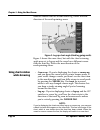
Page 44 957 operator’s manual, rev. B chapter 4 - using the chart screen different course than the second route leg. Notice the new direction of the north-pointing arrow. Figure 3: leg-up chart angle (third leg going south) figure 3 shows the same chart, but with the chart’s viewing angle now set to...
Page 53: Choosing The Chart
Chapter 4 - using the chart screen 957 operator’s manual, rev. B page 45 the edges of other charts in the 957’s built-in world atlas are shown, in addition to those in your local cartridge. These edges are shown as black or red dashed lines. The lat/lon grid is labelled only when the chart is north-...
Page 54: Lat/lon Grid
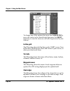
Page 46 957 operator’s manual, rev. B chapter 4 - using the chart screen to change any of the options, first press the cursor pad to move the cursor to the desired item, then press the on/off menu key to turn the item on or off (off is represented by two dashes) lat/lon grid the on setting shows lat...
Page 55: Depth
Chapter 4 - using the chart screen 957 operator’s manual, rev. B page 47 depth the on setting shows depth contour lines for low, mid, and deep water areas, for any or all of the three depth levels. Track line the on setting shows your vessel’s track points (the course you’ve already traveled). For m...
Page 56
Page 48 957 operator’s manual, rev. B chapter 4 - using the chart screen you can choose among the following options for point storage, and the corresponding track length: • every 1 second for 60 minutes total • every 2 seconds for 120 minutes total • every 4 seconds for 4 hours total • every 8 secon...
Page 57
Chapter 4 - using the chart screen 957 operator’s manual, rev. B page 49 press the enter key when you’re done, or clear to restore the field to its original value. To clear the track history displayed on the chart screen, press the erase track menu key and the enter key. Press the return menu key tw...
Page 58
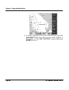
Page 50 957 operator’s manual, rev. B chapter 4 - using the chart screen 4. To make a waypoint at the next cursor location, press the add waypt menu key, then enter its name, symbol, or description on the new waypoint screen and press enter to save it..
Page 59: Determining Your Position
957 operator’s manual, rev. B page 51 5 determining your position displaying position, heading, and speed . . . . 52 using gps . . . . . . . . . . . . . . . . . . . . . . . . . . . . . . . . . . 52 using dgps . . . . . . . . . . . . . . . . . . . . . . . . . . . . . . . . . 55 using loran . . . . . ...
Page 60: Using Gps
Page 52 957 operator’s manual, rev. B chapter 5 - determining your position displaying position, heading, and speed the 957 uses a high-performance gps receiver as its primary source of position data, augmented by either the waas satellite system, or radiobeacon differential, or both. Depending on t...
Page 61
Chapter 5 - determining your position 957 operator’s manual, rev. B page 53 you’ll see your lat/lon on the gps position screen. If gps data isn’t available, you’ll see dashes instead of numbers. You can display lat/lon as either degrees, minutes, and seconds, or as degrees, minutes, and thousandths ...
Page 62: Viewing Gps
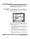
Page 54 957 operator’s manual, rev. B chapter 5 - determining your position viewing gps satellite status to display more information about signals received from the gps satellites, press the sat info menu key on the gps position screen. The gps satellites screen is displayed showing the received sig...
Page 63: Using Dgps
Chapter 5 - determining your position 957 operator’s manual, rev. B page 55 • accuracy: the estimated accuracy--in feet--of the gps system to be expected at the current time. Your position readings should be more accurate than this estimate 95 percent of the time. • hdop: this is a technical measure...
Page 64: Displaying Dgps
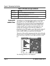
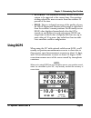
Page 56 957 operator’s manual, rev. B chapter 5 - determining your position when the dgps indicator is displayed, it means the 957 is using this higher level of accuracy. When you require this additional accuracy, be sure to check often to see that either the dgps or waas indicators are present. Dis...
Page 65
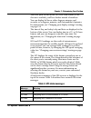
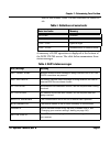
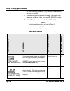
Chapter 5 - determining your position 957 operator’s manual, rev. B page 57 low for best results. Table 3 below describes the noise lev- els. A summary of dgps operations is displayed at the bottom of the dgps status screen. The table below summarizes these status messages. Table 3: definitions of n...
Page 66: Using Loran
Page 58 957 operator’s manual, rev. B chapter 5 - determining your position using loran this section explains how you can use the 957 to navigate using displayed loran coordinates if the 957 is connected to an loran receiver (such as the northstar 800). If you don’t plan to use loran, you can skip t...
Page 67: Checking Gps Status
Chapter 5 - determining your position 957 operator’s manual, rev. B page 59 press the l/l tds menu key several times to display either the particular pair of tds you want to use, or the loran-derived latitude/longitude. Note: if you want the 957 to display loran position coordinates from a connected...
Page 68: Viewing Loran
Page 60 957 operator’s manual, rev. B chapter 5 - determining your position longitude position fixes, the gri must correctly match the gri being used by your loran receiver. Viewing loran warnings three possible loran warning indicators obtained from any northstar 800 series loran receiver are displ...
Page 69: Selecting and
Chapter 5 - determining your position 957 operator’s manual, rev. B page 61 tds. The accuracy from this conversion is generally better than 500 to 1500 feet. This feature is called phantom loran, which helps you move from using loran to using gps. Phantom loran lets you display your position as tds,...
Page 70: Viewing Phantom
Page 62 957 operator’s manual, rev. B chapter 5 - determining your position viewing phantom loran tds press the l/l tds menu key several times to display either the particular pair of tds you want to use, or the gps-derived latitude/longitude. Setting phantom loran gri press the set gri menu key to ...
Page 71
957 operator’s manual, rev. B page 63 6 understanding the waypoints function introducing waypoints . . . . . . . . . . . . . . . . . . . . . 64 displaying waypoints . . . . . . . . . . . . . . . . . . . . . . . 64 displaying waypoint coordinates . . . . . . . . . . . 66 creating new waypoints . . . ...
Page 72: Introducing Waypoints
Page 64 957 operator’s manual, rev. B chapter 6 - understanding the waypoints function introducing waypoints the term waypoint refers to a point (a location) that you’ve entered into the 957’s memory. The waypoint appears on the chart with the symbol you’ve chosen. In contrast, the term nav aid refe...
Page 73
Chapter 6 - understanding the waypoints function 957 operator’s manual, rev. B page 65 the order shown above. Press the cursor pad to move up or down the list. (if your 957 is new, these lists will be empty.) waypoints chart screen: waypoints are displayed on the chart waypoints (local) screen: up t...
Page 74: On The Chart Screen
Page 66 957 operator’s manual, rev. B chapter 6 - understanding the waypoints function on the chart screen the waypoints chart screen displays all the waypoints in the area around the cursor, as you move the cursor around the chart. If necessary, press the in and out keys to see the waypoints. Note:...
Page 75: Creating New Waypoints
Chapter 6 - understanding the waypoints function 957 operator’s manual, rev. B page 67 the small letter “s” to the right of the waypoint name tells you that the displayed coordinates, either lat/lon or tds, were the ones used to originally store the waypoint. Creating new waypoints there are two eas...
Page 76: Entering Waypoints
Page 68 957 operator’s manual, rev. B chapter 6 - understanding the waypoints function entering waypoints graphically (on the chart screen) to enter waypoints on the chart screen: 1. Press the waypts/routes key. 2. Press the waypoints menu key. You may have to press the next view menu key to display...
Page 77
Chapter 6 - understanding the waypoints function 957 operator’s manual, rev. B page 69 5. Enter a name for the waypoint and, if you want, a description, as previously described. 6. Choose a symbol for the waypoint by pressing the symbol menu key to find a symbol you want (see ”assigning a symbol” st...
Page 78: Entering Waypoints
Page 70 957 operator’s manual, rev. B chapter 6 - understanding the waypoints function 8. Press the enter key to store the new waypoint and return to the graphical waypoints screen. Entering waypoints numerically (on the list screen) to enter waypoints numerically: 1. Press the waypts/routes key. 2....
Page 79
Chapter 6 - understanding the waypoints function 957 operator’s manual, rev. B page 71 3. Press the add key to display the new waypoint screen. 4. Enter a waypoint name and optional description. 5. Choose a symbol for the waypoint by pressing the symbol menu key to find the symbol you want. 6. Enter...
Page 80
Page 72 957 operator’s manual, rev. B chapter 6 - understanding the waypoints function 7. Press the enter key to permanently store the new waypoint, which you can edit or delete at any time. Note: don’t enter a number into the warn radius box unless you want to make this waypoint an avoidance point,...
Page 81
Chapter 6 - understanding the waypoints function 957 operator’s manual, rev. B page 73 note: the waypoint is treated as an avoidance point only if you specify a warn- ing radius larger than zero. In other words, just assigning a waypoint with the slashed circle symbol doesn’t mean the 957 will treat...
Page 82: Setting The
Page 74 957 operator’s manual, rev. B chapter 6 - understanding the waypoints function 3. Move the cursor to the warn radius box at the bottom of the screen, and enter the warning radius—up to 4.9 nm. 4. Press the enter key. Setting the avoidance-area alarm if you’ve made a waypoint into an avoidanc...
Page 83: Editing Waypoints
Chapter 6 - understanding the waypoints function 957 operator’s manual, rev. B page 75 editing waypoints you can change any information about an existing waypoint (except for the type of coordinates used to save it) or erase it entirely by using the 957’s waypoint editing function. Changing waypoint...
Page 84: Erasing Waypoints
Page 76 957 operator’s manual, rev. B chapter 6 - understanding the waypoints function the edit waypoint screen appears, allowing you to make changes just as if you were entering a new waypoint. Press enter when done. If there’s a warning radius entered, set it to zero if you want to remove the avoi...
Page 85: Updating From The
Chapter 6 - understanding the waypoints function 957 operator’s manual, rev. B page 77 with the 957’s coordinates’ update feature, when you get to the actual spot location of the waypoint, you can update the waypoint by setting its coordinates to your present position. You can do this on the waypoin...
Page 86: Connecting The Two
Page 78 957 operator’s manual, rev. B chapter 6 - understanding the waypoints function installed. To obtain any necessary upgrades, please see your authorized northstar dealer. You can import and export waypoints and routes between the following northstar units: • two 957’s • a 957 and a 952, or 951...
Page 87
Chapter 6 - understanding the waypoints function 957 operator’s manual, rev. B page 79 to that point are in the receiving unit (be aware that a particular route may not comprise all of its waypoints due to the transfer interruption). Press the start key again to re-start the entire transfer process ...
Page 88
Page 80 957 operator’s manual, rev. B chapter 6 - understanding the waypoints function 4. Press the import menu key to display the import data screen. The status bar in the center of the screen displays the message ready to transfer to show that the transfer is ready to start. 5. Before transferring...
Page 89: Moving Waypoints
Chapter 6 - understanding the waypoints function 957 operator’s manual, rev. B page 81 waypts or routes to transfer and the status-bar message no transfer done. • if the master unit is completely full of waypoints and routes with no more room available, the master unit displays the dialog-box messag...
Page 90
Page 82 957 operator’s manual, rev. B chapter 6 - understanding the waypoints function 3. Press the import/export menu key to display the import/export screen. 4. Press the export menu key to display the export data screen. The status bar in the center of the screen displays the message ready to tra...
Page 91
Chapter 6 - understanding the waypoints function 957 operator’s manual, rev. B page 83 6. To move waypoints and routes from this unit into the other unit, press the start key. The status bar displays the message transferring and updates every second with the number of waypoints and routes sent compa...
Page 92
Page 84 957 operator’s manual, rev. B chapter 6 - understanding the waypoints function transfer software and instructions, and cable ordering information, contact your authorized northstar dealer..
Page 93
957 operator’s manual, rev. B page 85 7 understanding the routes function introducing routes . . . . . . . . . . . . . . . . . . . . . . . . . . 86 creating routes from the chart . . . . . . . . . . . . . . 87 creating routes from a waypoints list . . . . . . . 89 saving a route as you travel . . . ...
Page 94: Introducing Routes
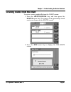
Page 86 957 operator’s manual, rev. B chapter 7 - understanding the routes function introducing routes a route is a series of two or more waypoints that form a connected path. You can create routes as you travel, or by placing new or existing waypoints into whatever order you want. Routes can be use...
Page 95
Chapter 7 - understanding the routes function 957 operator’s manual, rev. B page 87 creating routes from the chart to create a route graphically from the chart screen: 1. Press the waypts/routes key, and then press the routes menu key. The names of any previously stored routes are shown on the route...
Page 96
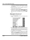
Page 88 957 operator’s manual, rev. B chapter 7 - understanding the routes function 3. Enter the name of the new route using the keypad and cursor pad. (if you have questions about using these controls, see ”using the controls” starting on page 25.) 4. Press the enter key. The new route chart screen...
Page 97
Chapter 7 - understanding the routes function 957 operator’s manual, rev. B page 89 7. When you’re done, to go back to the new route screen to see all of the route’s waypoints, press the return menu key, or to display the chart screen, press the chart key . Creating routes from a waypoints list to c...
Page 98
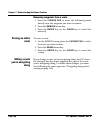
Page 90 957 operator’s manual, rev. B chapter 7 - understanding the routes function to begin saving a route as you travel: 1. Press the waypts/routes key, and then press the routes menu key to display the routes screen: 2. Press the save menu key to begin saving a route auto- matically. The save rou...
Page 99
Chapter 7 - understanding the routes function 957 operator’s manual, rev. B page 91 4. As you pass the location of each new waypoint, press the save key. The vessel’s location will be saved as a way- point, and the waypoint will automatically be added to the route being saved. The waypoint is stored...
Page 100: Editing A Route
Page 92 957 operator’s manual, rev. B chapter 7 - understanding the routes function editing a route you can edit an existing route on either the chart screen or on a waypoints list. On the chart screen, you can perform the following functions: • change the route name • add new or existing waypoints ...
Page 101
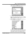
Chapter 7 - understanding the routes function 957 operator’s manual, rev. B page 93 2. Press the cursor pad to select the route you want to change, then press the edit menu key. The name of the route is displayed on the edit route screen. 3. If you want to change the route’s name, do so now. If the ...
Page 102
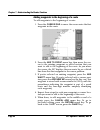
Page 94 957 operator’s manual, rev. B chapter 7 - understanding the routes function adding waypoints to the beginning of a route to add waypoints to the beginning of a route: 1. Press the cursor pad to move the cursor onto the first waypoint in the route. 2. Press the add to front menu key, then mov...
Page 103
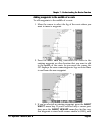
Chapter 7 - understanding the routes function 957 operator’s manual, rev. B page 95 adding waypoints to the middle of a route to add waypoints to the middle of a route: 1. Move the cursor to select the leg of the route where you want to insert a waypoint. 2. Press the split leg key, then move the cu...
Page 104
Page 96 957 operator’s manual, rev. B chapter 7 - understanding the routes function the parentheses indicating the waypoint is part of a saved route and the four-digit number uniquely identifying each waypoint). 4. Repeat these steps for each new waypoint or cursor loca- tion you want to insert in t...
Page 105
Chapter 7 - understanding the routes function 957 operator’s manual, rev. B page 97 route and the four-digit number uniquely identifying each waypoint). 4. Repeat these steps for each new waypoint or cursor loca- tion you want to add to the end of the route. 5. When done, to add waypoints to the beg...
Page 106: Editing A Route
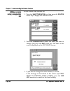
Page 98 957 operator’s manual, rev. B chapter 7 - understanding the routes function editing a route using a waypoints list to edit a route from a routes list: 1. Press the waypts/routes key, then press the routes menu key to display the routes screen. 2. Press the cursor pad to select the route you ...
Page 107
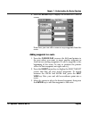
Chapter 7 - understanding the routes function 957 operator’s manual, rev. B page 99 4. Press the enter key to display the second edit route screen. From here you can add or remove any waypoints from the route. Adding waypoints to a route 1. Press the cursor pad to move the left-hand pointer to the s...
Page 108: Erasing An Entire
Page 100 957 operator’s manual, rev. B chapter 7 - understanding the routes function removing waypoints from a route 1. Press the cursor pad to move the left-hand pointer directly onto the waypoint you want to remove. 2. Press the remove menu key. 3. Press the enter key (or the clear key to cancel t...
Page 109
957 operator’s manual, rev. B page 101 8 understanding waypoint/route navigation navigating to waypoints . . . . . . . . . . . . . . . . . . . 102 steering to a waypoint . . . . . . . . . . . . . . . . . . . . 104 navigating along routes . . . . . . . . . . . . . . . . . . . 108 restarting the cours...
Page 110: Navigating To Waypoints
Page 102 957 operator’s manual, rev. B chapter 8 - understanding waypoint/route navigation navigating to waypoints there are several ways you can navigate to waypoints: • choose a cursor location or select an existing waypoint — you can do both of these right on the chart screen • enter position coo...
Page 111
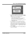
Chapter 8 - understanding waypoint/route navigation 957 operator’s manual, rev. B page 103 2. To display the coordinates you want to enter (as lat/lon, distance and bearing, or loran tds), press the coord type menu key to cycle through the choices: • lat/lon for any location worldwide • distance and...
Page 112: Navigating To
Page 104 957 operator’s manual, rev. B chapter 8 - understanding waypoint/route navigation navigating to previously stored waypoints this lets you select a stored waypoint from a list of waypoints, and then go to the waypoint: 1. Press the waypts/routes key, then press the way- points menu key. You ...
Page 113: Choosing A Steering
Chapter 8 - understanding waypoint/route navigation 957 operator’s manual, rev. B page 105 choosing a steering screen both screens help guide you precisely along a course line, which might follow a harbor channel or a line between shoals and sandbars. Both screens graphically show your cross-track d...
Page 114: Understanding The
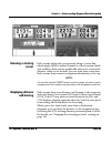
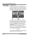
Page 106 957 operator’s manual, rev. B chapter 8 - understanding waypoint/route navigation understanding the cross-track display on the steering screen the steering screen uses a traditional display that shows cross-track distance as how far your vessel symbol is from the center line of the display ...
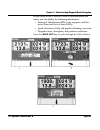
Page 115
Chapter 8 - understanding waypoint/route navigation 957 operator’s manual, rev. B page 107 in the center of the steering screen is an information box where you can display the following information: • estimated time enroute (ete) to the waypoint, and esti- mated time and date of arrival (eta) • spee...
Page 116: On The 3D Steer Screen
Page 108 957 operator’s manual, rev. B chapter 8 - understanding waypoint/route navigation on the 3d steer screen the 3d steer screen is similar to the steering screen, but displays a three-dimensional view of your vessel with the current waypoint, the course line to the waypoint, and the locations ...
Page 117: Selecting The
Chapter 8 - understanding waypoint/route navigation 957 operator’s manual, rev. B page 109 from here, you can perform the following functions: • select a starting waypoint or leg • reverse the route • start following the route selecting the starting point initially, the nearest waypoint is selected ...
Page 118: Restarting The Course Line
Page 110 957 operator’s manual, rev. B chapter 8 - understanding waypoint/route navigation onto the leg, then press the follow leg menu key, then press the enter key. In this case, your cross-track error starts at a number that’s your distance from that leg. The leg you’re currently navigating along...
Page 119
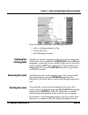
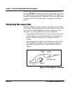
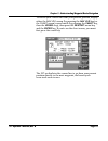
Chapter 8 - understanding waypoint/route navigation 957 operator’s manual, rev. B page 111 to restart your course line from your present position, display either the nav log screen (by pressing the nav log key) or the chart screen’s vessel mode (by pressing the chart key, then the vessel key), then ...
Page 120
Page 112 957 operator’s manual, rev. B chapter 8 - understanding waypoint/route navigation.
Page 121: Using The Nav Log
957 operator’s manual, rev. B page 113 9 using the nav log introducing the nav log . . . . . . . . . . . . . . . . . . . . 114 changing your trip . . . . . . . . . . . . . . . . . . . . . . . . 115 stopping and restarting navigation . . . . . . . . 116 t his chapter explains the 957’s nav log functi...
Page 122: Introducing The Nav Log
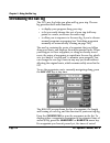
Page 114 957 operator’s manual, rev. B chapter 9 - using the nav log introducing the nav log the 957’s nav log helps you plan and log your trip. The nav log provides three main functions: • to display your progress along your trip • to let you easily change the rest of your trip (add way- points to ...
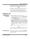
Page 123: Changing Your Trip
Chapter 9 - using the nav log 957 operator’s manual, rev. B page 115 shown are estimates based on your current speed. For waypoints you’vealready passed, actual times of arrival are shown. The 957 updates this information as you travel. Note: estimated times are just estimates, which may be inaccura...
Page 124: Stopping
Page 116 957 operator’s manual, rev. B chapter 9 - using the nav log stopping and restarting navigation stopping navigation whenever you press the nav log’s stop menu key, the 957 stops navigating, and won’t display distance and bearing to waypoints or eta or ete. Restarting navigation you can resta...
Page 125: Using Special Functions
957 operator’s manual, rev. B page 117 10 using special functions understanding alarms . . . . . . . . . . . . . . . . . . . . . 118 understanding tidetrack™ . . . . . . . . . . . . . . . . 131 using the video display option . . . . . . . . . . . . . 133 t his chapter describes the 957’s special fun...
Page 126: Understanding Alarms
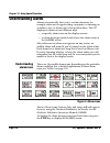
Page 118 957 operator’s manual, rev. B chapter 10 - using special functions understanding alarms alarms automatically alert you to certain situations, for example, when you’re approaching a waypoint, or entering an avoidance area, or when you’ve lost position fixes. The 957 displays its alarms in tw...
Page 127: Displaying Alarm
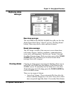
Chapter 10 - using special functions 957 operator’s manual, rev. B page 119 displaying alarm messages new alarm messages the word new in the recent alarms box tells you that the alarm shown hasn’t been “cleared” yet (see “clearing alarms” below). There may also be other uncleared alarms. Recent alar...
Page 128: Table 6: 957 Alarms
Page 120 957 operator’s manual, rev. B chapter 10 - using special functions are auto-clearing; however, they can also be manually cleared, if desired. • alarms that require manual clearing - these will stay onscreen until you clear them on the alarms screen. All of the 957’s alarms are described in ...
Page 129
Chapter 10 - using special functions 957 operator’s manual, rev. B page 121 you’ve entered avoid zone vessel has entered the warning radius of an avoidance waypoint. This alarm is shown only if you’ve turned it on at the alarms screen. Does not time out. Y now navigating to waypt: ‘name’ vessel has ...
Page 130
Page 122 957 operator’s manual, rev. B chapter 10 - using special functions cross-track limits exceeded vessel has exceeded the off-course limit set in the cross track alarm. This alarm is shown only if you’ve turned it on at the alarms screen. Does not time out. N !!Demo mode is on!! You’ve powered...
Page 131
Chapter 10 - using special functions 957 operator’s manual, rev. B page 123 big jump in gps position your displayed gps position suddenly “jumps” an unreasonable amount based on the vessel’s speed. Does not time out. Y no gps position fix gps position fix is unavailable and gps or phantom loran is t...
Page 132
Page 124 957 operator’s manual, rev. B chapter 10 - using special functions no loran position fix position fix from an external loran receiver is unavailable and external loran is the chosen position source. This alarm is delayed for three minutes at power-up. Does not time out. N loran communicatio...
Page 133
Chapter 10 - using special functions 957 operator’s manual, rev. B page 125 poor loran signals blink, cycle or low snr detected in the external loran used as the position source. Does not time out. N fishfinder alarms (only shown on the 957 if fishfinder is enabled) bottom collision! Fishfinder dete...
Page 134: Changing Alarm
Page 126 957 operator’s manual, rev. B chapter 10 - using special functions changing alarm settings you can manually adjust four of the 957’s alarms: • anchor alarm • cross track • arrive radius • dgps alarm you can also turn the alarm audio on or off for all of the 957’s alarms . Alarm audio you ca...
Page 135: Anchor Alarm
Chapter 10 - using special functions 957 operator’s manual, rev. B page 127 1. Press the cursor pad to select alarm audio, then press the edit alarm menu key. 2. Press the cursor pad to display off or on, then press the enter key. Anchor alarm the anchor alarm will signal if your vessel moves a cert...
Page 136: Arrive Radius
Page 128 957 operator’s manual, rev. B chapter 10 - using special functions to set the cross-track alarm: 1. Press the cursor pad to highlight cross track, then press the edit alarm menu key. 2. Press the cursor pad to turn the alarm to on. 3. To set the cross-track distance limit, press the cursor ...
Page 137: Setting Alarms To
Chapter 10 - using special functions 957 operator’s manual, rev. B page 129 to turn on the dgps alarm, press the cursor pad to highlight dgps alarm, then press the edit alarm menu key. Press the cursor pad to turn the alarm to on, then press the enter key. Setting alarms to honk you can set the 957 ...
Page 138: Honking For All Alarms
Page 130 957 operator’s manual, rev. B chapter 10 - using special functions the clear alarm key. You may also want to set the anchor alarm back to the off setting. Honking for all alarms instead of setting all alarms to only beep, you can set all alarms to honk. This honking starts simultaneously wi...
Page 139: Understanding Tidetrack
Chapter 10 - using special functions 957 operator’s manual, rev. B page 131 understanding tidetrack ™ the 957 calculates tide information for any of over 3,540 nos/ noaa tide stations. To display this information, press the star key until you see the tide track screen. The entire u.S. Coastline--inc...
Page 140: Choosing A Nearby
Page 132 957 operator’s manual, rev. B chapter 10 - using special functions the center of the screen shows a graphic representation of the tide height for the entire day. Maximum and minimum heights are shown as dashed horizontal lines labeled with the height in feet. Mean lower low water (mllw) is ...
Page 141: Choosing A Tide
Chapter 10 - using special functions 957 operator’s manual, rev. B page 133 3. Press the cursor pad to select the desired station, then press the enter key twice to display the tides for that station on the tide track screen. Choosing a tide station from the chart you can choose a tide station by mo...
Page 142: Turning The Video
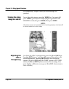
Page 134 957 operator’s manual, rev. B chapter 10 - using special functions will temporarily disappear until you acknowledge the question. Turning the video image on and off to see the video image, press the video key. To turn it off, press video again. If you’re displaying the optional echo sounder...
Page 143: Changing The
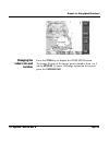
Chapter 10 - using special functions 957 operator’s manual, rev. B page 135 changing the video‘s size and location press the star key to display the video setup screen. To change the size of the image, press a number from 1 to 9 on the keypad. To move the image around on the screen, press the cursor...
Page 144
Page 136 957 operator’s manual, rev. B chapter 10 - using special functions.
Page 145: Setting Up Your 957
957 operator’s manual, rev. B page 137 11 setting up your 957 changing your display settings . . . . . . . . . . . . 138 changing your navigation settings . . . . . . . . . 141 changing your receiver settings . . . . . . . . . . . 146 changing your port settings . . . . . . . . . . . . . . . 151 set...
Page 146: Changing The
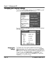
Page 138 957 operator’s manual, rev. B chapter 11 - setting up your 957 changing your display settings to access the 957’s display options, press the star key until you see the options/service info screen. Press the display options menu key to access the display options screen. Changing the settings...
Page 147: Choosing Rhumb
Chapter 11 - setting up your 957 957 operator’s manual, rev. B page 139 choosing rhumb line or great circle calculations you can set the 957 to calculate the distance and initial bearing to your intended destination along either a great circle route or a rhumb line. The shortest distance between any...
Page 148: Choosing A 12- Or
Page 140 957 operator’s manual, rev. B chapter 11 - setting up your 957 choosing a 12- or 24-hour clock you can set the time of day to either a 12- or 24-hour format. The option you select here affects all of the 957’s time-related displays, including high and low tides, sunrise/sunset, and eta. Cho...
Page 149
Chapter 11 - setting up your 957 957 operator’s manual, rev. B page 141 2. Enter the access code from your northstar owner’s card, then press the enter key. The first character block of the owner’s message flashes. 3. Enter the message (up to two lines) you want to see when you power-up the 957, the...
Page 150: Changing The
Page 142 957 operator’s manual, rev. B chapter 11 - setting up your 957 press the navigation options menu key to access the navigation options screen. Changing the settings to change any of the options (fully described in the following pages), select it by pressing the cursor pad to move the arrow a...
Page 151: Choosing Magnetic
Chapter 11 - setting up your 957 957 operator’s manual, rev. B page 143 note: this option also includes a setting for demo mode. For instructions on demo mode, see ”using demo mode” starting on page 14. Choosing magnetic variation compasses naturally point to the magnetic north pole, which is severa...
Page 152: Choosing A
Page 144 957 operator’s manual, rev. B chapter 11 - setting up your 957 you may want to switch waypoints manually if you’re maneuvering around a waypoint in search of a lobster trap, or trying to find a buoy in a thick fog. Manual switching lets you keep a constant display of distance and bearing in...
Page 153: Choosing The
Chapter 11 - setting up your 957 957 operator’s manual, rev. B page 145 choosing the cross-track scale you can set the cross-track full scale option to suit your particular needs—whether you’re navigating out in open water or trying to maneuver in a tight channel. Cross-track scale is the total left...
Page 154
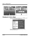
Page 146 957 operator’s manual, rev. B chapter 11 - setting up your 957 changing your receiver settings to access the 957’s receiver options, press the star key until you see the options/service info screen. Press the receiver options menu key to access the receiver options screen..
Page 155: Changing The
Chapter 11 - setting up your 957 957 operator’s manual, rev. B page 147 changing the settings to change any of the options (fully described in the following pages), select it by pressing the cursor pad to move the arrow at the left of the screen, then press the edit menu key. The selected option beg...
Page 156: Choosing Beacon
Page 148 957 operator’s manual, rev. B chapter 11 - setting up your 957 choosing beacon frequency and baud rate differential corrections are invaluable for navigating in narrow or congested areas, such as ports and waterways, or whenever you require extreme accuracy in order to locate a precise area...
Page 157: Manual Mode
Chapter 11 - setting up your 957 957 operator’s manual, rev. B page 149 manual mode although the need is rare, you can manually override automatic mode at any time by issuing tuning commands using the 957’s keypad. In manual mode, the differential receiver outputs its corrections only from the selec...
Page 158: Choosing A Dgps
Page 150 957 operator’s manual, rev. B chapter 11 - setting up your 957 • radiobeacon - the 957 will use radiobeacon differential if it’s connected to an optional external radiobeacon receiver • waas - the 957 will use waas differential corrections choosing a dgps corrections time-out the dgps data ...
Page 159: Changing Your Port Settings
Chapter 11 - setting up your 957 957 operator’s manual, rev. B page 151 changing your port settings you can interface the 957 directly to a variety of external equipment, such as the northstar 490 “black box” for fishfinding, autopilots, depth sounders, pc’s, and so on. The 957’s ports meet the spec...
Page 160
Page 152 957 operator’s manual, rev. B chapter 11 - setting up your 957 installing software updates you can install current software updates by obtaining a navionics-style software update cartridge from northstar or your local authorized northstar dealer. 1. Press the star key to display the options...
Page 161: 957 Serial Number
Chapter 11 - setting up your 957 957 operator’s manual, rev. B page 153 957 serial number the serial number is located in the serial number field (and on the back of the 957). 957 software version the current version of the 957’s operating software is located in the software version field. Beacon re...
Page 162: Using The
Page 154 957 operator’s manual, rev. B chapter 11 - setting up your 957 when you’re done, press and hold the cursor pad up or down until the 957 displays the more options/service info screen again. Using the ignore-door feature to help protect the nav-chart cartridge (as well as the 957’s internal c...
Page 163: Using The Lcd Test
Chapter 11 - setting up your 957 957 operator’s manual, rev. B page 155 the bypass stays in effect until you disable it or shut the 957 off. The next time you turn the 957 on, the ignore door command won’t be in effect; you must re-invoke it by re-pressing the ignore door menu key. Using the lcd tes...
Page 164
Page 156 957 operator’s manual, rev. B chapter 11 - setting up your 957 in the center of the screen, the current time expressed as “gmt” (greenwich mean time) is displayed. Note that the day of the week in greenwich, england may be different from the day in your local time zone (right screen, above)...
Page 165: Introducing Gps And Waas
957 operator’s manual, rev. B page 157 appendix a - understanding gps and waas introducing gps and waas what is gps? The nation’s global positioning system (gps) was developed by the united states department of defense, and comprises 21 active satellites (with three additional spares) that encircle ...
Page 166: What Is Differential
Page 158 957 operator’s manual, rev. B using dgps over non-sa gps is still clear and desirable for the safety of marine navigation. That is, mariners who need better than 100 meters will probably also need better than 30 meters. What is differential gps (dgps) the majority of mariners use gps in con...
Page 167: What Is Loran?
957 operator’s manual, rev. B page 159 these corrections are then broadcast to dgps receivers, which then convert this data into extremely precise position, heading, and speed information. Referred to as “beacons,” the transmitters are situated at various locations along the u.S. Coastline and great...
Page 168
Page 160 957 operator’s manual, rev. B loran, however, isn’t as proficient as gps in absolute accuracy, or when visiting a spot for the first time. Loran transmits at a relatively low frequency (100 khz—similar to that of an am radio). Your ability to get an accurate position fix is directly related...
Page 169
957 operator’s manual, rev. B page 161 with good dgps corrections, your 957 should provide better than four-meter accuracy (repeatable and absolute) 95 percent of the time. Sog readings should be accurate to 0.1 knot. You can connect your 957 to your loran receiver (as long as the loran has the appr...
Page 170
Page 162 957 operator’s manual, rev. B.
Page 171: Gps And Waas
957 operator’s manual, rev. B page 163 appendix b - system features gps and waas • self-contained 12-channel l1 gps/waas pod antenna-receiver • 2-channel waas reception • waas accuracy • accurate, worldwide position data in any weather, 24 hours a day • fast signal acquisition • fast-reacting, accur...
Page 172: Position Data
Page 164 957 operator’s manual, rev. B > your vessel’s intended course line > avoidance areas position data • latitude/longitude (158 datums) from gps with one-sec- ond updates • phantom loran-c tds calculated from gps • real-time gps/dgps status screens • loran-c tds from an external source (two-se...
Page 173: Waypoint
957 operator’s manual, rev. B page 165 > on a local avoidance list (in order of distance from your present position) • update waypoint coordinates to vessel’s position • edit/erase waypoints or routes directly on the chart screen or on list screens • plan-route function • plot any route with automat...
Page 174: Other Functions
Page 166 957 operator’s manual, rev. B other functions • anchor watch • avoidance-area alarm • gps clock • tidetrack™ (tide-prediction software integrated with the display at any u.S. And canadian noaa tide station for today or any other date up to the year 2010) interfacing • two bi-directional nme...
Page 175
957 operator’s manual, rev. B page 167 • 10-36 volts dc power • 0 degrees celsius - 55 degrees celsius max 95 percent rel- ative humidity, non-condensing.
Page 176
Page 168 957 operator’s manual, rev. B.
Page 177
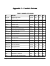
957 operator’s manual, rev. B page 169 appendix c - geodetic datums table 9: available 957 datums id datum name ellipsoid delta x delta y delta z adi_mn adindan mean—africa cl1880 -166 -15 204 adi_e adindan—ethiopia cl1880 -165 -11 206 adi_ma adindan—mali cl1880 -123 -20 220 adi_se adindan—senegal c...
Page 178
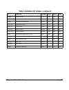
Page 170 957 operator’s manual, rev. B ad714 astro dos 71/4 (atlantic isl.) intl -320 550 -494 as52 astronomic station 1952 intl 124 -234 -25 ag66 australian geodetic 1966 austr -133 -48 148 ag84 australian geodetic 1984 austr -134 -48 149 bel bellevue (ign) intl -127 -769 472 ber bermuda 1957 cl186...
Page 179
957 operator’s manual, rev. B page 171 eur50_sa european 1950—sardinia intl -97 -103 -120 eur50_si european 1950—sicily intl -97 -88 -135 eur50_nf european 1950—norway and finland intl -87 -95 -120 eur50_ps european 1950—portugal and spain intl -88 -109 -122 eur79 european 1979 intl -86 -98 -119 gan...
Page 180
Page 172 957 operator’s manual, rev. B masi marco astro—salvage islands intl -289 -124 60 mass massawa (africa) b1841 639 405 60 merch merchich (africa) cl1880 31 146 47 ma61 midway astro 1961 intl 912 -58 1227 mina minna (africa) cl1880 -92 -93 122 nah_o nahrwan—masirah island (oman) cl1880 -247 -1...
Page 181
957 operator’s manual, rev. B page 173 nad27_gr north american 1927—greenland cl1866 11 114 195 nad27_mx north american 1927—mexico cl1866 -12 130 190 nad83 north american 1983 grs80 0 0 0 ob1966 observatorio 1966 (atl. Isl.) intl -425 -169 81 oeg old egyptian helm -130 110 -13 ohw_mn old hawaiian—m...
Page 182
Page 174 957 operator’s manual, rev. B psa56_gy provisional s. American 1956—guyana intl -298 159 -369 psa56_pr provisional s. American 1956—peru intl -279 175 -379 psa56_vn provisional s. American 1956—venezuela intl -295 173 -371 prico puerto rico cl1866 11 72 -101 quat qatar national intl -128 -2...
Page 183
957 operator’s manual, rev. B page 175 sebas southeast base intl -499 -249 314 swbas southwest base intl -104 167 -38 timb timbalai 1948 (malaysia) evrst -689 691 -46 tok_mn tokyo mean value b1841 -128 481 664 tok_jp tokyo—japan b1841 -123 483 662 tok_kr tokyo—korea b1841 -128 481 665 tok_ok tokyo—o...
Page 184
Page 176 957 operator’s manual, rev. B.
Page 185: Appendix D - Glossary
957 operator’s manual, rev. B page 177 appendix d - glossary accuracy absolute accuracy—the accuracy of displayed lat/lon coordinates of your present position as compared to true lat/ lon determined from a chart or other reference source. Repeatable accuracy—the ability to return to the same locatio...
Page 186
Page 178 957 operator’s manual, rev. B course-up an orientation on the chart screen in which the viewing angle matches your true course during the last few seconds, as determined by the gps receiver. Coverage the extent to which a geographical area is encompassed by usable gps or loran signals. Cros...
Page 187
957 operator’s manual, rev. B page 179 identifier 9960 (northeast us) indicates that the gap between the start of any two adjacent master signals is 99,600 microseconds long. Hdop h orizontal dilution of precision. Heading the compass direction toward which the longitudinal axis of a vessel points. ...
Page 188
Page 180 957 operator’s manual, rev. B master the primary loran transmitter in a “chain” of at least three stations which initiates a series of coded pulses and is followed by the secondaries. Mile (statute) a unit of measurement (distance) equal to 5,280 feet (1,609.3 meters). Nautical mile (nm) an...
Page 189
957 operator’s manual, rev. B page 181 sog speed over ground. The actual speed of your vessel relative to the sea bottom. Td time difference. The measured amount of time—in millionths of a second—between loran signals received from the master and the secondary stations. Track a desired line of trave...
Page 190
Page 182 957 operator’s manual, rev. B.
Page 191
957 operator’s manual rev. B page 183 a accuracy absolute 160 comparing loran to gps in 160 definition of 157, 177 with dgps 161 with gps 161 of the dgps receiver 55, 159 of the gps receiver 55 repeatable definition of 157, 177 with dgps 161 with gps 160 with loran 159, 161 with phantom loran 61 aid...
Page 192
Page 184 957 operator’s manual rev. B removing from waypoint 76 setting alarm to beep 74 b beacon baud rate 56, 149 beacon receiver. See dgps receiver 148 brightness key 32 brightness. See display screen 19 browse mode changing to vessel mode 41 definition of 41 c cartography, definition of 177 char...
Page 193
957 operator’s manual rev. B page 185 chart boundary lines 34 displaying outlines of 46 understanding 34 clear key 31 clearing alarms. See alarms 20 cog. See course-over-ground. Connecting the 957. See interfacing 64 contacting northstar 3 controls (keys) introducing the functions of 18 course-over-...
Page 194
Page 186 957 operator’s manual rev. B using 14 dgps accuracy 161 choosing as nav source 142 corrections differential 148, 157, 161 handling interruptions in 150 indicator on screen 56 receiver accuracy of 148 automatic control of 148 changing the settings 147 displaying position information from 55–...
Page 195
957 operator’s manual rev. B page 187 ete definition of 178 displaying on steering screens 107 exporting all waypoints and routes from a unit 77 f factory defaults 128, 140, 143, 149, 150 feedback, sending yours to northstar 4 first start-up 5–7 fishfinder displaying 13 setting up and using 13, 151 ...
Page 196
Page 188 957 operator’s manual rev. B definition of 178 method of calculating distance and bearing 139 group repetition interval (gri) definition of 178 setting for loran 59, 69, 71, 103 for phantom loran 62 h honking alarms. See alarms, audible 129 horizontal dilution of precision (hdop) definition...
Page 197
957 operator’s manual rev. B page 189 setting precision of display 140 leg (route), definition of 86, 179 lists displaying waypoints on 64–66 routes displaying on 98 editing on 98 waypoints displaying different coordinates 66 displaying on 64 editing on 75 entering on 70 updating coordinates on 77 l...
Page 198
Page 190 957 operator’s manual rev. B menu keys, overview of 31 messages alarm 20, 119 clearing 119 displaying 27 gps status 53 information 20, 21 loran warnings 60 owner identification 140 question 20, 22 mob key 29 n nav log 114–116 nav log function key 28 navigation aids 35–36, 47 cautions 34, 35...
Page 199
957 operator’s manual rev. B page 191 displaying 7, 52–62, 142 increasing accuracy of 148 pwr key 26 r returning the 957 for service 4 rhumb line, definition of 139 rma number. See service rotating the chart 42 routes adding waypoints to beginning of routes 94 to end of routes 96 to middle of routes...
Page 200
Page 192 957 operator’s manual rev. B status on first start-up 9 save key 29, 89, 153 serial number required for repair 4 viewing your 957’s 153 service obtaining technical support 3 returning the 957 for repair 4–5 rma number 4 warranty statement 4 setting up your 957 138–151 sharing waypoints and ...
Page 201
957 operator’s manual rev. B page 193 arrows for routes 93, 109, 110 arrows for sog and cog 105 buoys 35 cursor 28, 30, 38, 178 diamond shaped box 38 dotted line 94, 95 hourglass 19 landmarks 36 miscellaneous for waypoint 67 series of dots (track line) 47 slashed circle 72–73 star 130 vessel 7 t tds...
Page 202
Page 194 957 operator’s manual rev. B displaying track history 47 relative to cross-track distance 145 transmitters 177 turning off the 957 7 turning on the 957 5 turning the chart (rotating) 42 u updates, installing software 152 v vessel mode changing to browse mode 40 understanding 40 video image ...
Page 203
957 operator’s manual rev. B page 195 importing and exporting between two 957’s 77 listing 64 making a new waypoint on the chart screen 68–70 on the waypoints screen 70–72 naming 75, 88, 91 navigating to quick 15 navigating to stored 104 steering to 104–108 storing 67 transferring to a personal comp...
Page 204
Page 196 957 operator’s manual rev. B.

