- DL manuals
- Javad
- Receiver
- TRIUMPH-LS
- Quick Start Manual
Javad TRIUMPH-LS Quick Start Manual
Summary of TRIUMPH-LS
Page 1
Q u i c k s ta r t g u i d e to t h e t r i u m p h - l s w i t h j - f i e l d 2 . 0 e version 20160930
Page 2
Www.Javad.Com www.Javad.Com 3 2 introduction. ......................................................................................3 anatomy - exterior of triumph-ls ............................................4 screen anatomy - home screen .................................................7 chargin...
Page 3
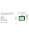
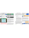
Www.Javad.Com www.Javad.Com 5 4 external gnss antenna port external uhf antenna port warning led / battery led (when off and charging) rs232 port lan port slant height measurement point charging port setup - cycle between the setup and advanced setup screens speaker collect - cycle through the colle...
Page 4
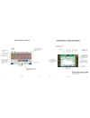
Updates available messages available rams connection established www.Javad.Com www.Javad.Com 7 6 uhf antenna 400-470 mhz, 2.5db, rt angle, sma (optional, if uhf module is installed) ac power cable ext power/charger power cable ac power adapter charging kit shown assembled while the triumph-ls is bei...
Page 5
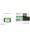
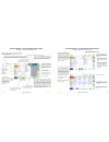
Www.Javad.Com www.Javad.Com 9 8 screen anatomy - home screen 2 interference - complete gnss spectrum analyze camera - capture photos with the front and bottom cameras data exchange - export / import various data formats system - receiver details and information, etc. Language - specify the language ...
Page 6
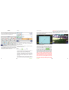
Www.Javad.Com www.Javad.Com 11 10 points calibration the triumph-ls is an advanced scientific surveying instrument. It is highly sensitive to its environment and includes a built-in magnetometer and 3-axis accelerometer. For the visual stakeout features and the ahead/back and right/left white boxes ...
Page 7
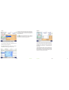
Www.Javad.Com www.Javad.Com 13 12 points points point filters points are displayed in the coordinate system of the current page in the cogo functions and in the map. All new survey points and points created with the cogo functions are created in the current page. The current page can be selected by ...
Page 8
Www.Javad.Com www.Javad.Com 15 14 points points origin of distance filter options hide staked hides points that have already been staked. A point is considered staked after it has been staked with a surveyed coordinate accepted for it. Hide vertices hides points created from imported lines from bein...
Page 9
Coordinate systems the coordinate systems screen allows you to quickly access and create new coordinate systems based on the predefined systems with just a tap on this icon. It is important to note that this screen does not set the current coordinate system for the project. To change a project’s coo...
Page 10
Www.Javad.Com www.Javad.Com 19 18 coordinate systems coordinate systems now highlight the duplicated system and tap the edit icon and choose adjust grid-to-ground & rename: adjust grid-to-ground & rename screen tap the default button to change the coordinate system name to the default name: tap the ...
Page 11
Www.Javad.Com www.Javad.Com 21 20 coordinate systems files and data exchange the beginning of the coordinate system name: press ok and then apply to create this coordinate system: you can now use this coordinate system as the project coordinate system or just for some pages if you choose. Files and ...
Page 12
Www.Javad.Com www.Javad.Com 23 22 files and data exchange files and data exhange after signing in you will be prompted to grant access. Click generate key and a new alphanumeric key will appear. In j-field open system>dropbox/google drive and tap handshake key to enter this key. Then click establish...
Page 13
Www.Javad.Com www.Javad.Com 25 24 files and data exhange files and data exhange then enter the network path as shown above along with your windows account name and password. Press ok and you should now see this folder shared in the root directory where it can be used to import and export files. Note...
Page 14
Www.Javad.Com www.Javad.Com 27 26 files and data exhange files and data exhange a summary screen will be displayed. The points will be imported into the selected page and be imported to the coordinate system of that page. Tap import to finish importing the points. Exporting points to a text file to ...
Page 15
Www.Javad.Com www.Javad.Com 29 28 files and data exhange shapetags & codes exporting photos, screenshots, gnss data and project archives to export media files that include photos, screenshots, audio files and raw gnss data files choose the project archive file (zip) format option in the save file sc...
Page 16
Www.Javad.Com www.Javad.Com 31 30 setup setup setup j-field’s settings are divided into 3 profile groups: the general group, action group and favorite shapetags and codes. These groups exist so that different settings groups can quickly and easily be saved and recalled. The general groupprofilestore...
Page 17: Base/rover Setup
Base/rover setup www.Javad.Com www.Javad.Com 33 32 base/rover setup base/rover setup setup screen - creating a new general group profile enter a profile name (“uhf” or “fh915 ss” are suggested) in the next screen and tap ok. The next screen will prompt you to select the operating mode, choose rtk ro...
Page 18
Www.Javad.Com www.Javad.Com 35 34 base/rover setup base/rover setup immediately a scan of available bluetooth devices will begin and a few seconds later will be completed. If a base station is found that has been previously used, j-field will automatically connect to it. If not, you will be presente...
Page 19
Www.Javad.Com www.Javad.Com 37 36 base/rover setup base/rover setup tapping the uhf or fh915 configuration button will trigger an immediate search for the radio via bluetooth between the base and the radio. If a bluetooth enabled radio is not found to be currently paired to the base, you will be pro...
Page 20
Www.Javad.Com www.Javad.Com 39 38 base/rover setup base/rover setup return to main base/rover setup screen by tapping ok twice. Press to base to send modified parameters to the base. After doing this all the parameter values should be yellow. The base broadcast coordinate should now be set. Tap on t...
Page 21
Www.Javad.Com www.Javad.Com 41 40 base/rover setup base/rover setup once the base is broadcasting you can check that the rover is correctly receiving corrections at the set transmission rate. Open the collect or stake action screen. The position solution button should display the correct incoming co...
Page 22
Www.Javad.Com www.Javad.Com 43 42 collect collect which opens a screen to configure the collection settings for points. The rtk verification and validation settings are configured from action setup screen. Collect prepare screen pressing the action hardware button or next from the collect prepare sc...
Page 23
Www.Javad.Com www.Javad.Com 45 44 collect collect action profile setup the action setup screen can be opened by tapping the bottom middle button on the collect and stake prepare screens. It contains all the settings related to the collection of points. Action setup screen - recommended settings for ...
Page 24
Www.Javad.Com www.Javad.Com 47 46 collect collect rtk verification and validation it is very important that you read and understand the information about rtk verification and validation contained in this manual. Verify settings screen - recommended settings for multipath environments when located in...
Page 25
Www.Javad.Com www.Javad.Com 49 48 collect collect screen anatomy - collect action screen the map displaying point and lines contained in pages that are enabled. To expand the user defined buttons press the action hardware button. Maximizes map view to full screen unassigned user defined button, tap ...
Page 26
Www.Javad.Com www.Javad.Com 51 50 collect collect gnss satellite count used in given engine gps glonass 3d rms for the current epoch in given engine number of seconds since the last reset for a given engine distance from the solution of the 1st engine manually reset engines to compel new fixed solut...
Page 27
Www.Javad.Com www.Javad.Com 53 52 collect stake final averaged position of all positions number of epochs used in final position consistency level of the point confidence level of the point screen anatomy - map screen screenshot after phase-2 and validation phase of rtk verification is completed hrm...
Page 28
Www.Javad.Com www.Javad.Com 55 54 stake real-time position shift stake sequence screen the suggested user defined button options for new users are displayed in the follow two screenshots. Stake action screen when near the target point being staked tap start to begin collecting data and to average th...
Page 29
Www.Javad.Com www.Javad.Com 57 56 hybrid rtk with dpos hybrid rtk with dpos hybrid rtk with dpos when a gnss rtk base station is started by assuming an autonomous position, it is necessary and good practice to later adjust and correct the coordinates with a gnss solution referenced from known coordi...
Page 30
Www.Javad.Com www.Javad.Com 59 58 hybrid rtk with dpos hybrid rtk with dpos processing raw data with dpos to post-process the data, open the dpos tool found in the cogo menu and select the base file you wish to process. It can also be open by tapping the dpos button found in the points screen. Dpos ...
Page 31
Www.Javad.Com www.Javad.Com 61 60 hybrid rtk with dpos hybrid rtk with dpos screen anatomy - processed point info screen example of a screenshot for a base point screen anatomy - processed point info screen example screenshots for a rover point point name - the name of the current point being review...
Page 32
Www.Javad.Com www.Javad.Com 63 62 m-local m-local m-local m-local coordinates shift the associated surveyed points with the same base station session to known coordinates. Some possible uses for m-local include: adjusting an autonomous base station to local control points adjusting an autonomous bas...
Page 33
Www.Javad.Com www.Javad.Com 65 64 cogo cogo cogo most cogo (coordinate geometry) functions in j-field are rather self-explanatory after viewing their diagrams. Cogo direct, inverse, shift and rotate are found in the basic group of cogo functions that will be explained here. Cogo basic functions in a...
Page 34
Www.Javad.Com www.Javad.Com 67 66 cogo cogo inverse cogo inverse - ground distance is displayed, tap the d button to cycle through the other distance type inverse calculates the bearing (b) and distance (d) of a line between two known points (p 1 & p 2 ). The (multi-select) button can be used as a q...
Page 35
Www.Javad.Com www.Javad.Com 69 68 cogo cogo shift cogo shift cogo shift and rotate are useful for shifting and rotating design points to desired geodetic surveyed locations. Upon opening the shift, move or rotate functions you will be prompted two options: to create new points or move existing point...
Page 36
Www.Javad.Com www.Javad.Com 71 70 appendix a: creating a rtn profile appendix a: creating a rtn profile appendix a: creating a rtn profile open the setup menu and create a new general group profile enter a name for the new profile select rtk rover as the operating mode select the base reference fram...
Page 37
900 rock avenue, san jose, ca 95131 usa phone: +1(408)770-1770 fax: +1(408)770-1799 www.Javad.Com copyright © javad gnss, inc., 2016 all rights reserved. No unauthorized duplication..


