- DL manuals
- Raymarine
- Monitor
- gS Series
- Installation And Operation Instructions Manual
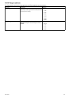
Raymarine gS Series Installation And Operation Instructions Manual - Storage Capacity
15.5 Waypoints, routes and tracks
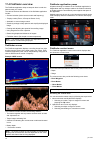
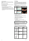
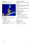
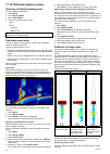
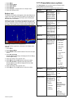
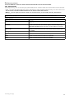
storage capacity
The display can store the following quantities of waypoints,
routes and tracks
Waypoints
• 3000 waypoints
• 100 waypoint groups, each group can contain up to 3000
waypoints
Routes
• 150 routes, each route can contain up to 200 waypoints
Tracks
• 15 tracks, each track can contain up to 10,000 points
152
gS Series
Summary of gS Series
Page 1
Gs series installation and operation instructions english date: 06-2014 document number: 81344-4-en © 2014 raymarine uk limited release 10 gs series.
Page 2: Contents
Contents chapter 1 important information.......................... 9 certified installation ..................................................... 9 product operation in high temperatures ......................... 9 power over ethernet (poe)......................................... 10 tft displays .....
Page 3
9.1 document viewer overview ................................. 100 chapter 10 autopilot control ............................ 103 10.1 autopilot control ............................................... 104 10.2 pilot bar .......................................................... 106 10.3 pilot set-up ...
Page 4
19.4 customizing the data application ....................... 231 19.5 resetting minimum and maximum readings.................................................................. 241 19.6 resetting all datapages .................................... 241 chapter 20 thermal camera application — pan and ti...
Page 5
32.6 seatalk ng cabling components .......................... 352 32.7 seatalk ng cables and accessories ..................... 353 32.8 seatalk accessories......................................... 354 appendix a nmea 0183 sentences ................. 355 appendix b nmea data bridging ...................
Page 6: Connection
4.19 bluetooth remote control connection you can control the multifunction display wirelessly using a raymarine remote control unit. The remote control uses a bluetooth wireless connection. D12918-1 1 2 3 1. Multifunction display. 2. Bluetooth connection. 3. Raymarine bluetooth remote control (for e...
Page 7
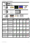
4.20 remote control functions ra n g e bu tto n s p a ir s e le c t o r d 12051-2 arrow buttons shortcut button button application where function available: default functions: chart radar fishfinder weather homescreen range / zoom. • press up or down arrow for momentary response. • hold up or down a...
Page 8
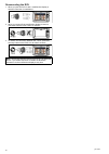
Reconnecting the rcu 1. When you pair the rcu-3 with a multifunction display a wireless connection is established. 2. When you power off the multifunction display it loses its connection with the rcu-3 after 10 minutes. > 10 minutes = 1 0 15 20 25 30 minutes 35 40 45 50 55 60 5 3. To restore the con...
Page 9
Chapter 6: getting started chapter contents • 6.1 display power on page 70 • 6.2 controls on page 70 • 6.3 homescreen overview — touch only displays on page 72 • 6.4 pages on page 74 • 6.5 applications on page 75 • 6.6 splitscreen controls on page 76 • 6.7 screen overview on page 77 • 6.8 basic touc...
Page 10: 6.1 Display Power
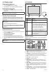
6.1 display power powering the display on 1. Press the power button on the display. 2. Select accept to acknowledge the disclaimer message. Powering the display off 1. Press and hold the power button until the countdown reaches zero. Note: if the power button is released before the countdown reaches...
Page 11
Configuration display state momentary press press and hold off power on* — 1 multifunction display on open shortcuts page power down all displays off power on all displays* — all displays on open shortcuts page on active display power down all displays multiple multifunction displays 1 display on an...
Page 12: Only Displays
6.3 homescreen overview — touch only displays the homescreen provides a central point of access for your display's applications, data and settings. • the homescreen provides quick access to your data (waypoints, routes, tracks, images and videos) and backup settings. • the homescreen consists of a n...
Page 13
Symbol radar power mode description off scanner powered off when radar not required, but display is in use for other applications, such as the chart. When selected, the system counts down. During this time you cannot re-power the scanner. Timed transmit scanner switches between on/transmitting, and ...
Page 14: 6.4 Pages
6.4 pages pages are made up of 1 to 4 panes that are used to display applications on your multifunction display (mfd). Pages are accessed using the icons on the homescreen. • you can create up to 2 application panes per page using an mfd that has a screen size of 7 inches or less. • you can create u...
Page 15: 6.5 Applications
3. Select reset. A warning message is displayed asking for confirmation. 4. Select yes to reset the homescreen to the default range of pages, or no to cancel the operation. 6.5 applications chart application — provides a 2d or 3d graphical view of your charts to help you navigate. Waypoint, route, a...
Page 16: 6.6 Splitscreen Controls
6.6 splitscreen controls when viewing a page with more than 1 application displayed you can switch applications from the splitscreen view to fullscreen view. Example 1 — splitscreen page example 2 — fishfinder application expanded to fullscreen selecting the active window when viewing a splitscreen ...
Page 17: 6.7 Screen Overview
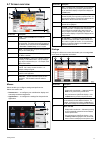
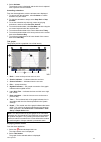
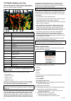
6.7 screen overview d12196-2 7 6 1 2 3 4 5 screen item description 1 home — select the home icon to access the homescreen. 2 databar — provides information about your vessel and its environment. The position and type of information in the databar can be customized from the homescreen > customize > d...
Page 18
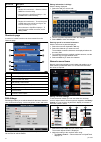
Screen item description 4 close • displays with a touchscreen — select the onscreen close icon to close the dialog. • non–touchscreen or hybridtouch displays — use the back button to close the dialog. 5 scroll bar • displays with a touchscreen — to scroll through the available items, press and hold ...
Page 19
Ii. The onscreen up and down arrows — touchscreen displays. 3. To access the on-screen numeric keypad: • touch operation — select the onscreen keypad icon from the numeric adjust control. • non-touch operation — press and hold the ok button. The onscreen numeric keypad is displayed. 4. Enter the req...
Page 20: 6.9 Multi-Touch Gestures
6.9 multi-touch gestures raymarine a series and gs series multifunction displays support multi-touch. Multi-touch means that the display is capable of recognizing multiple simultaneous touch inputs. This means that you can use 2 or more fingers on the screen at the same time to perform multi-touch g...
Page 21
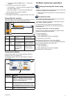
Adjusting the display brightness 1. Press the power button once. The shortcuts menu is displayed. 2. Adjust the brightness to the required level using the rotary control. Note: the brightness level can also be increased by pressing the power button multiple times. Setting the vessel minimum safe dep...
Page 22: 6.12 Engine Identification
6.11 enabling autopilot control enabling the autopilot control function — seatalk and spx seatalk ng autopilots to enable control of your seatalk or spx seatalk ng autopilot using your multifunction display follow the steps below. From the homescreen: 1. Select set-up. 2. Select system settings. 3. ...
Page 23
Iv. Turn on the center engine and select ok. The wizard will now listen for data and assign the engine instance as the center engine. V. Turn on the center starboard engine and select ok. The wizard will now listen for data and assign the engine instance as the center starboard engine. Vi. Turn on t...
Page 24: 6.14 Software Updates
6.14 software updates raymarine’s multifunction display software is updated regularly to provide new and enhanced features and improved performance and usability. You should ensure you have the latest software by regularly checking the raymarine website for new software. You can identify your multif...
Page 25: Chapter 7: System Checks
Chapter 7: system checks chapter contents • 7.1 gps check on page 86 • 7.2 radar check on page 87 • 7.3 sonar check on page 88 • 7.4 thermal camera setup and checks on page 89 system checks 85.
Page 26: 7.1 Gps Check
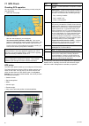
7.1 gps check checking gps operation you can check that the gps is functioning correctly using the chart application. 1. Select the chart page. 2. Check the screen. With the chart displayed, you should see: your boat position (indicates a gps fix). Your current position is represented by a boat symb...
Page 27: 7.2 Radar Check
7.2 radar check warning: radar scanner safety before rotating the radar scanner, ensure all personnel are clear. Warning: radar transmission safety the radar scanner transmits electromagnetic energy. Ensure all personnel are clear of the scanner when the radar is transmitting. Checking the radar fro...
Page 28: 7.3 Sonar Check
7.3 sonar check sonar transducer and sonar module selection you must select the sonar transducer and sonar module that you want to use in the displayed fishfinder application pane. Sonar module selection • sonar and downvision tm variant displays are fitted with an internal sonar module. • all varia...
Page 29
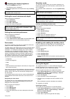
5. Adjust the offset to the required value. Setting the speed offset from the fishfinder application: 1. Select menu. 2. Select set-up. 3. Select transducer set-up. 4. Select speed offset. The speed offset numeric adjust control is displayed. 5. Adjust the offset to the required value. Setting the t...
Page 30
Resetting the thermal camera to the home position when connected to a pan, tilt thermal camera the home position of the camera can be set. In the thermal camera application: 1. Select menu. 2. Select camera home. The camera returns to its currently defined home position, and the “home” icon appears ...
Page 31
Chapter 9: document viewer application chapter contents • 9.1 document viewer overview on page 100 document viewer application 99.
Page 32
9.1 document viewer overview you can view pdf documents on your multifunction display. The document viewer is available from the homescreen and is used to view and search pdf documents (such as product handbooks). D12755-1 1 2 3 1 opens the microsd card file browser. 2 opens the user manual stored o...
Page 33
• move your finger up to scroll down the document. • move your finger down to scroll up the document. When the document width is greater than the width of the application window, move your finger left or right to pan the width of the document. Note: you can also use the scroll bars to navigate throu...
Page 34
102 gs series.
Page 35
Chapter 11: alarms and man over board functions chapter contents • 11.1 using man overboard (mob) functions on page 116 • 11.2 alarms on page 117 alarms and man over board functions 115.
Page 36: Functions
11.1 using man overboard (mob) functions man overboard if you lose a person or object overboard, you can use the man overboard (mob) function to mark the position that the vessel was at when the mob function was activated. The mob function is available at all times, regardless of which application i...
Page 37: 11.2 Alarms
11.2 alarms alarms alert you to a situation or hazard requiring your attention. You can set up alarms to alert you to certain conditions, such as collision warnings and temperature limits. Alarms are raised by system functions, and also external equipment connected to your multifunction display. Whe...
Page 38
Alarms menu menu item description options mob data type determines whether position or dead reckoning (dr) data is displayed. Assuming that your vessel and the mob are subject to the same tide and wind effects, the dead reckoning setting normally gives a more accurate course. • dead reckoning • posi...
Page 39
Menu item description options • deep fish limit — specifies the upper value for the fish alarm depth limit. • 2 ft (or equivalent units) to the maximum of the transducer range deep fish limit • 2 ft (or equivalent units) to the maximum of the transducer range fuel manager in the fuel manager alarm o...
Page 40
120 gs series.
Page 41: Chapter 14: Ais Function
Chapter 14: ais function chapter contents • 14.1 ais overview on page 128 • 14.2 ais prerequisites on page 129 • 14.3 ais context menu on page 129 • 14.4 enabling ais on page 130 • 14.5 displaying ais vectors on page 130 • 14.6 ais status symbols on page 131 • 14.7 ais silent mode on page 131 • 14.8...
Page 42: 14.1 Ais Overview
14.1 ais overview the ais feature enables you to receive information broadcast by other vessels, and to add these vessels as targets in the chart and radar applications. With an optional ais unit connected to your system you can: • display targets for any other ais-equipped vessels. • display voyage...
Page 43: 14.2 Ais Prerequisites
14.2 ais prerequisites you must have suitable ais hardware connected to your multifunction display to make use of the ais functionality. In order to run ais, you will need: • a receive-only ais unit or a full ais transceiver (a unit that sends and receives). • a vhf antenna. • a gps - to provide pos...
Page 44: 14.4 Enabling Ais
14.4 enabling ais enabling ais in the chart application to enable the ais overlay in the chart application follow the steps below. To enable the ais overlay your system must include an ais receiver or transceiver. The ais overlay is not available in 3d view. From the chart application menu: 1. Selec...
Page 45: 14.6 Ais Status Symbols
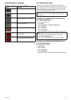
14.6 ais status symbols ais status is indicated by a symbol in the databar. Symbol description ais unit is switched on and operating. Ais currently unavailable. Ais unit is switched off, or not connected. Ais unit is in silent mode. Ais unit is in silent mode, with active alarms. Ais unit is connect...
Page 46: 14.8 Ais Target Symbols
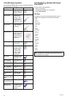
14.8 ais target symbols your multifunction display shows a range of symbols to represent the different types of ais target. Target type description symbol transmitting target target is moving or at anchor (target is not activated, dangerous or lost). Activated target target activated — that is, ais ...
Page 47
14.10 viewing all ais targets • from the chart application with only the ais overlay enabled go to: menu > ais options > targets > view ais list • from the chart application when the radar overlay is also enabled go to: menu > radar & ais options > targets > view targets lists > view ais list. • fro...
Page 48
5. Select safety messages. Selecting safety messages will switch between safety messages on and off. Note: *when radar overlay is also enabled the menu name becomes radar & ais options. ** step 3 is only required when radar overlay is enabled. Enabling and disabling ais safety messages in the radar ...
Page 49: 14.12 Target Options
14.12 target options the target options menu for the chart application and radar application are shown below. Parameter description options vector length the length of the vector lines displayed depends on the distance that an ais target travels in the time period that you specify for this setting. ...
Page 50: 14.13 Ais Alarms
14.13 ais alarms the ais functions generate a number of alarms to alert you to dangerous or lost targets. In addition to the dangerous target alarm, the system generates an alarm when a dangerous target becomes a lost target i.E. Its signal has not been received for 20 seconds. Your ais receiver gen...
Page 51
1. Select the ais target. The ais target context menu is displayed. 2. Select add buddy. I. Select yes to enter a name for the buddy vessel ii. Select no to save the vessel to your buddy list without entering a name for the buddy vessel. The vessel will now be added to your buddy directory. Adding a...
Page 52
138 gs series.
Page 53
Chapter 15: waypoints, routes and tracks chapter contents • 15.1 waypoints overview on page 140 • 15.2 routes on page 147 • 15.3 tracks on page 150 • 15.4 import and export on page 151 • 15.5 waypoints, routes and tracks storage capacity on page 152 waypoints, routes and tracks 139.
Page 54: 15.1 Waypoints Overview
15.1 waypoints overview waypoints are position markers used for the purposes of navigation. Your multifunction display can create waypoints, which can then be selected for active navigation. There are a range of features for placing, navigating and managing waypoints, these can be accessed from the ...
Page 55
• slew thermal camera (only available when thermal camera is connected and operating.) for active waypoints the following menu items are available: • stop goto • restart xte • advance waypoint • measure • build route • acquire target (only available if radar overlay is switched on.) • slew thermal c...
Page 56
Placing a waypoint at a known position you can place a waypoint at a specified location using latitude and longitude coordinates: 1. Select wpt. 2. Select place waypoint at lat/lon. The waypoint details dialog is displayed. 3. Select the position field. 4. Enter the latitude/longitude position. 5. S...
Page 57
2. Select assign symbol. A list of all available symbols is displayed. 3. Select the symbol that you want to use for the waypoints in the selected group. A confirmation dialog is displayed. 4. Select yes to apply the new symbols to the waypoints, or select no to cancel. Moving a waypoint to a differ...
Page 58
Moving waypoints moving a waypoint using the context menu with the application page displayed: 1. Select the waypoint symbol on-screen. The waypoint context menu is displayed. 2. Select move waypoint. 3. Select the new position for the waypoint. Moving a waypoint by entering new coordinates with the...
Page 59
4. Select erase wpts to erase the list of waypoints from your system, or 5. Select move wpts to move the waypoints to a new or existing group, or 6. Select assign symbol to assign a new symbol to all the waypoints in the search results list. You can also select a waypoint from the list to view its d...
Page 60
Red racemark anti-clockwise red racemark clockwise marker restriction bottom mark top mark route start route end diver down diver down 2 oil rig filled circle fad (fish attracting device) concrete rubble seaweed oyster green can green nun red can red nun yellow can yellow nun fish trap brushpile pre...
Page 61: 15.2 Routes
In the example above the day trip group will not be displayed in the chart application. 3. Select sort by: to switch between groups and symbols. A list of symbols or groups is displayed. 4. Select the group or symbol from the list that you want to show or hide. If show is displayed in the list then ...
Page 62
2. Select build route. The build route menu is displayed. 3. Select a location on screen to be the starting position. 4. Select relevant locations to place subsequent waypoints in order. The route is saved and displayed as each waypoint is placed. 5. When complete select finish build. The finish rou...
Page 63
Showing or hiding routes and tracks from the chart application: 1. Select menu. 2. Select my data. 3. Select routes or tracks. 4. Select show/hide. 5. Select the route or track to switch between show and hide. Selecting a route to review or edit 1. Do one of the following to select the required rout...
Page 64: 15.3 Tracks
15.3 tracks a track is an on-screen trail that shows the passage you have taken. This trail is made up of a series of track points which are created automatically. You can save the track to create a permanent record of where you have been d 11754-2 with tracks you can: • review where you have been. ...
Page 65: 15.4 Import And Export
Track context menu selecting a track in the chart application displays a context menu showing the track length, number of points and menu items. The context menu provides the following menu items: • stop goto (only available during active navigation.) • erase track • hide track • create route from •...
Page 66: Storage Capacity
15.5 waypoints, routes and tracks storage capacity the display can store the following quantities of waypoints, routes and tracks waypoints • 3000 waypoints • 100 waypoint groups, each group can contain up to 3000 waypoints routes • 150 routes, each route can contain up to 200 waypoints tracks • 15 ...
Page 67
Chapter 16: chart application chapter contents • 16.1 chart application overview on page 154 • 16.2 electronic charts overview on page 155 • 16.3 navigation options on page 158 • 16.4 chart ranging and panning on page 160 • 16.5 chart selection on page 160 • 16.6 vessel position on the chart display...
Page 68
16.1 chart application overview the chart application provides route planning and navigation features. The chart application is pre-loaded with a basic world base map. Compatible electronic charts can be used to expand the information and detail regarding your surroundings and charted objects. Depen...
Page 69
2. Select display preferences. 3. Select chart ctxt menu to switch between touch or hold. • hold — requires you to touch and hold on a chart object to access the context menu. • touch — requires you to touch a chart object to access the context menu. 16.2 electronic charts overview your multifunctio...
Page 70
Vector charts vector charts are computer generated, consisting of a series of points and lines that make up the chart. Chart objects and overlays on vector charts can be switched on and off and chart objects can be selected to provide further information. Ranging in and out of vector charts will mak...
Page 71
Unzipping files to memory card the lighthouse charts download file must be unzipped / extracted to memory card for use on your multifunction display. Note: the instructions below are provided for guidance only. Depending on your pc’s operating system and the archiving (zip) software in use the steps...
Page 72: 16.3 Navigation Options
1 navionics servers 2 download navionics freshest data to mobile device (internet connection required) 3 mobile device running navionics mobile app 4 download navionics freshest data to mfd (wi-fi connection to mfd required) 5 mfd 6 * upload sonar logs and community edits to mobile device (wi-fi con...
Page 73
Navigating to the cursor position on the chart using the menu d 11764-2 from the chart application: 1. Position the cursor at the desired destination on the chart. 2. Select menu. 3. Select navigate. 4. Select goto cursor. Cancelling navigation to a waypoint 1. Select any position anywhere on-screen...
Page 74: 16.5 Chart Selection
16.4 chart ranging and panning ranging in and out the table below shows the range controls available for each display variant. Rotary control • c series • e series • rmk-9 keypad range in and range out buttons • c series • e series (excluding e7 and e7d • rmk-9 keypad range in and range out on-scree...
Page 75: Display
16.6 vessel position on the chart display your current position is represented on-screen by the vessel symbol. The vessel symbols are only displayed when heading or cog data is available. The vessel symbol varies depending on selected settings and the availability of heading data. Motor vessel the m...
Page 76: 16.8 Chart Motion Mode
3. Bearing to waypoint. 4. Instantaneous heading. If heading data becomes unavailable whilst in this mode, a warning pop up message is displayed and the chart uses 0° heading in relative motion. Setting the chart orientation from the chart application menu: 1. Select presentation. 2. Select view & m...
Page 77: 16.9 Chart Views
True motion d 12304-1 when the motion mode is set to true motion, the chart is fixed and the vessel moves in true perspective to fixed landmasses on-screen. As the vessel’s position approaches the edge of the screen, the chart picture is automatically reset to reveal the area ahead of the vessel. No...
Page 78
3d chart view the 3d view can display a range of information to help you navigate. 000°t 1 5 6 9 1 0 1 1 1 2 3 2 8 4 7 1 4 1 3 d12307-2 item description 1 range — horizontal chart scale indicator (shown in selected system units). 2 depth scale — approximate depth beneath your vessel (optional). 3 wa...
Page 79: 16.10 Chart Display
2. Select view & motion. 3. Select 3d display options. 4. Select transducer cone so that on is highlighted. Selecting transducer cone will switch the function on and off. Enabling depth scale in 3d view, to enable a depth indicator at your vessel’s location follow the steps below. From the chart app...
Page 80: 16.11 Overlays
16.11 overlays the chart has a number of overlays that display different views and information. The overlays require electronic charts with the appropriate feature support and may also require additional hardware and service subscriptions. You can overlay the following data onto a 2d chart to give g...
Page 81
Aerial photo overlay your electronic charts may include aerial photography. Aerial photos cover the navigable waters up to 3 miles inside the coastline. The resolution is dependent on the region covered by the chart card. Enabling aerial photo overlay from the chart application: 1. Select menu. 2. S...
Page 82
By default the chart grid is switched off. Switching the chart grid on and off the chart grid can be switched on and off by following the steps below. From the chart application menu: 1. Select presentation. 2. Select overlays. 3. Select chart grid: so that on is selected to turn the grid on, or 4. ...
Page 83
Chart boundaries chart boundary lines can be shown on-screen, these lines indicate the boundary of the cartography currently in use. D13005-1 1 2 1. Chart boundaries on. 2. Chart boundaries off. By default chart boundary lines are switched on. Switching chart boundary lines on and off chart boundary...
Page 84
Fuel range rings the fuel range ring gives an estimated range that can be reached with the estimated fuel remaining on-board. The fuel range ring can be displayed graphically in the chart application and indicates an estimated range that can be reached with the: • current rate of fuel consumption. •...
Page 85: 16.12 Chart Vectors
16.12 chart vectors chart vectors are available for heading, cog, wind direction and tide direction. Chart vectors are only available in 2d view. A range of vector graphics can be displayed in the chart application when in 2d chart view. The following vectors can be independently enabled or disabled...
Page 86
Cartography objects if supported by you cartography type, cartographic objects can be individually switched on and off. The table below show a list of these objects. The objects menu is accessed from: menu > presentation > objects. Note: the objects menu is only available when the cartography in use...
Page 87: 16.14 Object Information
16.14 object information if supported by your cartography type, you can view detailed information about specific cartographic objects. Depending on the cartography type you are using, you can view some or all of the following additional information: • details of each cartographic object that is mark...
Page 88
When you select animate the animate menu is displayed and the diamond-shaped current symbols are replaced with dynamic current arrows which indicate the direction and strength of the currents: current animation. • arrows indicate the direction of current flows. • the length of the arrow indicates th...
Page 89
2. Select animate. The animate menu is displayed and the tide icon is replaced with a dynamic tide bar indicator. Controlling animations from the chart application, with the animate menu displayed: 1. To start or stop the animation, select animate: to switch between play and pause. 2. To view the an...
Page 90
16.15 depth & contour options if supported by your cartography type, the following depth and contour settings are available. Note: the menu items available are dependant upon your cartography type. The depth options are dependant upon the units of measure in use on your system. Menu item cartography...
Page 91
Depth soundings and contours if supported by your cartography type, depth soundings and contours can be used in the chart application to provide awareness of water depth. When using vector based cartography you can adjust the depth at which the contours and soundings appear on-screen. D13009-1 1 2 3...
Page 92: 16.16 My Data Options
16.16 my data options the my data menu provides access to your user data. The options are found in the my data menu: menu > my data. • waypoints — view the waypoints group list. • routes — view the routes list. • tracks — view the tracks list. Refer to chapter 15 waypoints, routes and tracks for fur...
Page 93: Bearings
16.18 measuring distances and bearings you can use the databar and context menu information you can use the measure function to measure distances in the chart application. You can determine the distance and bearing: • from your vessel to the position of the cursor; • between two points on the chart....
Page 94
180 gs series.
Page 95
Chapter 17: fishfinder application chapter contents • 17.1 how the fishfinder works on page 182 • 17.2 sonar technologies on page 182 • 17.3 raymarine sonar modules on page 183 • 17.4 fishfinder overview on page 184 • 17.5 multiple sonar module support on page 185 • 17.6 custom channels on page 186 ...
Page 96: 17.2 Sonar Technologies
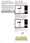
17.1 how the fishfinder works the fishfinder application uses a sonar module and a suitable sonar transducer. The sonar module interprets signals from the transducer and builds up a detailed underwater view. Various sonar technologies are available, all of which work on the same basic principles. Th...
Page 97
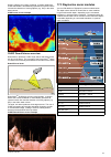
Sonar is effective at a range of speeds. In deeper waters the chirp bandwidth is automatically optimized to improve bottom lock and the detection of moving objects (e.G. Fish) in the wider water column. Chirp sonar screen example chirp downvision tm overview downvision tm produces a wide–angle side-...
Page 98: 17.4 Fishfinder Overview
17.4 fishfinder overview the fishfinder application helps to interpret what is under the water around your vessel. The various functions and features of the fishfinder application include: • channel selection (active sonar module and frequency). • *display modes (zoom, a-scope or bottom lock). • aut...
Page 99
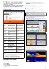
17.5 multiple sonar module support your multifunction display supports multiple active sonar modules on the same network. You can select which sonar channel you want to be displayed on-screen. Only 1 channel can be displayed at a time in a single fishfinder application pane. Multiple channels can be...
Page 100: 17.6 Custom Channels
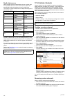
Depth data source where multiple sources of depth data exist on a system and the depth data source is set to auto then the system will automatically select the optimum source for depth data. The system will set the data source for depth according to the priority table below: 1 st cp450c seatalk hs 2...
Page 101: 17.7 The Sonar Image
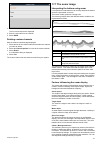
3. Select rename. The on-screen keyboard is displayed. 4. Enter the new name for the channel. 5. Select save. Deleting custom channels with the channel selection page displayed: 1. Select the tab for the sonar module that contains the channel you want to delete. 2. Select the channel options icon ne...
Page 102: 17.8 Range
Transducer frequency the same target will appear differently when using different transducer frequencies. The lower the frequency the broader the mark. Recovering lost bottom if the seabed floor (bottom) is lost then follow the steps below to recover the bottom depth. From the fishfinder application...
Page 103: 17.9 Fishfinder Scrolling
Range shift the range shift function enables a specific area of the water column to be displayed on-screen. In the below example the top 20 feet of the water column is not displayed using range shift the default setting adjusts the display to keep the bottom in the lower half of the screen. Alternat...
Page 104
17.10 fishfinder display modes selecting a fishfinder display mode from the fishfinder application: 1. Select menu. 2. Select display mode. 3. Select select mode:. 4. Select the required display mode: • none • zoom • * a-scope • * bottom lock note: * not available on the downvision tm channel on dow...
Page 105
1. Select menu. 2. Select display mode. 3. Select select mode:. 4. Select a-scope. 5. Select a-scope: to display the list of a-scope modes. 6. Select the required mode. Bottom lock the bottom lock display mode applies a filter which flattens the image of the bottom and makes any objects on or just a...
Page 106: 17.12 Depth And Distance
Note: • * not available on downvision tm channels. 17.12 depth and distance the fishfinder application provides a number of features to help you determine depths and distances. These features detailed below: d12222-5 1 2 4 3 5 7 6 description 1 depth reading — current depth of bottom. 2 depth target...
Page 107: Application
17.13 waypoints in the fishfinder application placing a waypoint in the fishfinder application enables you to mark a position so that you can return to it later. When a waypoint is placed its details are added to the waypoint list and a vertical line showing the waypoint symbol is displayed on-scree...
Page 108
When connected to a legacy sonar module or a traditional internal sonar module the automatic gain has 3 modes. When connected to external chirp, external traditional or downvision tm sonar modules gain modes are not required. When in manual mode the slider bar control is shown. Enabling and disablin...
Page 109
3. Select contrast. The contrast slider bar control is displayed. 4. Adjust the control to the required value. 5. Select back to confirm setting and close slider bar, or 6. Select auto to enable automatic contrast. Time varied gain (tvg) the time varied gain (tvg) setting controls the amount of atte...
Page 110
Adjusting tvg manually using on-screen controls touch only and hybridtouch multifunction displays have on-screen tvg controls. 1. Select the on-screen tvg control located on the left hand side of the fishfinder application. 2. Select the auto box to switch between auto and manual tvg. 3. Adjust the ...
Page 111: 17.15 Fishfinder Alarms
17.15 fishfinder alarms the following fishfinder alarms can be set when a depth data source is available. • fish — alarm sounds when a target meets the specified sensitivity level and, is within the depth limits (if enabled). • fishfinder deep — alarm sounds when the detected depth is greater than t...
Page 112
Sweep the transducer’s available frequency range in each ping. • high chirp — chirp mode (e.G. 130 to 210 khz) — no fine-tuning is not needed as the chirp sonar module will sweep the transducer’s available frequency range in each ping. With the chirp sonar module set to a non-chirp mode the frequenc...
Page 113
17.17 sounder set-up menu options this section details the options available in the sounder set-up menu: (menu > set-up > sounder set-up). Menu item description options ping rate hyper ping is a setting only available on traditional internal and legacy sonar modules, for use in shallow waters (depth...
Page 114
17.18 transducer set-up menu options the transducer set-up menu should be used when setting up your multifunction display for the first time or when installing a depth transducer. Menu item description options transducer select the appropriate transducer type from those displayed. Some transducers m...
Page 115: 17.19 Resetting The Sonar
17.19 resetting the sonar the reset function restores the unit to its factory default values. Note: performing a factory reset will clear speed and temperature calibration settings and the depth offset. 1. Using a compatible raymarine multifunction display go to the fishfinder application page. 2. S...
Page 116
202 gs series.
Page 117
Chapter 18: radar application chapter contents • 18.1 radar overview on page 204 • 18.2 radar scanner status symbols on page 205 • 18.3 radar display overview on page 206 • 18.4 radar range and image quality on page 207 • 18.5 target tracking on page 209 • 18.6 distances, range, and bearing on page ...
Page 118: 18.1 Radar Overview
18.1 radar overview radar is used to provide information that can help you to track targets and measure distances and bearings. Radio detection and ranging (radar) is used at sea to detect the presence of objects (known as ‘targets’) at a distance, and if they are moving, detect their speed. Radar w...
Page 119
18.2 radar scanner status symbols the radar scanner power mode status is indicated in the databar. Symbol radar power mode description transmit (tx) rotating icon, signifying that the scanner is on and transmitting. When scanner is set to on, select this mode to activate the scanner. This is the usu...
Page 120
18.3 radar display overview with your radar scanner connected and the radar in transmit mode, the radar picture provides a map-like representation of the area in which the radar is operating. D 12207-2 1 0 1 3 1 4 1 1 1 3 5 6 7 9 8 2 4 1 5 1 2 item description 1 range 2 on-screen controls (touchscre...
Page 121
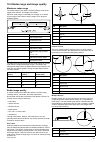
18.4 radar range and image quality maximum radar range the usable range of the radar is limited by factors such as the height of the scanner, and height of the target. Maximum radar range is essentially line-of-sight, so is limited by the height of the scanner and the height of the target as illustr...
Page 122
Blind sectors obstructions such as funnels and masts near the radar antenna may obstruct the radar beam and cause radar shadows or ‘blind sectors’. If the obstruction is relatively narrow, there will be a reduction of the beam intensity, though not necessarily a complete cut-off. However, for wider ...
Page 123: 18.5 Target Tracking
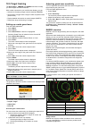
18.5 target tracking the guard zone , vrm/ebl and marpa functions will help you track targets and avoid collisions. With a radar connected to your multifunction display, you can: • assess how far away a target is and its bearing (vrm/ebl). • set an alarm to trigger when a target is within a specifie...
Page 124
There are conditions where acquiring a target may become difficult. These same conditions may be a factor in successfully tracking a target. Some of the conditions are: • the target echo is weak. The target is very close to land, buoys or other large targets. • the target or your own vessel is makin...
Page 125
Vessel vectors (cpa graphics) overview cpa graphics show vectors for your vessel and a selected target. A vector is a line on-screen showing the predicted courses of your vessel and the selected target if you both remain on your present course. These vectors vary in length due to vessel speed and ve...
Page 126
Measuring using vrm/ebl variable range markers (vrm) a variable range marker (vrm) is a circle centred on your vessel’s position and fixed with respect to the heading mode. When this circle is adjusted to align with a target, its range from your vessel is measured and displayed on the radar context ...
Page 127
2. Press the ok button. The radar context menu is displayed. 3. Use the rotary control to select float center. 4. Press the ok button. 5. Using the joystick, move the center position of the circle to the desired position. 6. Press the ok button to confirm the new position. Unfloating a vrm/ebl on th...
Page 128
Course-up n n 1 2 d 12210-1 item description 1 current course upwards. 2 as your vessel's heading changes: • radar picture is fixed • shm rotates accordingly if you select a new course, the picture will reset to display the new course upwards. The reference used for course-up depends upon the inform...
Page 129
18.8 radar presentation menu options function description options dual range this menu item allows you to turn dual range mode on and off. • on • off dual range channel this menu item allows you to choose long or short channel for dual range. • 1 • 2 orientation & motion mode this menu item contains...
Page 130
Function description options color palette this menu item allows you to select a color palette for the radar application. • bold • professional 1 • professional 2 • classic • night vision range rings this menu item allows you to turn the range rings on and off. • on • off safe zone ring this item al...
Page 131
True motion mode example d12745-1 2 3 1 4 d r a ft d r a ft d r a ft t e t e t e t e t e t e t e t e t e t e t e t e t e t e t e t e t e t e t e t e t e t e t e t e t e t e t e t e t e t e t e t e t e t e t e t e t e t e t e t e t e t e t e t e t e t e t e t e t e t e t e t e t e t e t e t e t e t e...
Page 132: 18.9
18.9 radar tuning: on-screen gain controls touchscreen multifunction displays provide on-screen access to controls for gain, rain and sea clutter. Gain control rain control sea control note: non-touchscreen controls are accessed by the menu options: menu > rain and menu > adjust gain. Enabling and d...
Page 133
18.10 hd and superhd radar adjustments you can use the presets and other functions to improve the quality of the radar picture. The following settings are available from the radar menu and apply to hd radomes, hd and superhd open array scanners: menu item description options preset mode the radar ga...
Page 134
Adjusting radar anti sea clutter from the radar application menu, with the required preset mode selected: 1. Select adjust preset , where shall be the preset mode already selected. 2. Select sea: . 3. The sea clutter slider bar control is displayed. 4. Adjust the sea clutter slider bar control to th...
Page 135
18.11 non-hd digital radomes adjustments you can use the gain presets and other functions to improve the quality of the radar picture. The following settings apply to non-hd digital radomes and are available from the radar menu: menu item description options rain the radar scanner detects echoes fro...
Page 136
18.12 dual range radar operation the dual range radar function enables you to view 2 ranges at the same time in separate windows. The function is available with superhd and hd radar scanners. Using your multifunction display and an hd or superhd radar scanner, you can view either a short or a long r...
Page 137: 18.13 Radar Scan Speed
18.13 radar scan speed superhd open array radars with software version 3.23 or above or hd radomes support multiple scan speeds. Radar scan speed is set up using the radar set-up menu. When the system detects a scanner that is capable of operating at both 24 rpm and 48 rpm, 2 options are provided fo...
Page 138: 18.14 Radar Set-Up Menu
18.14 radar set-up menu the radar set-up menu enables you to configure the performance and behavior of your radar scanner. Function description options timed transmit set-up this menu item contains a sub-menu that enables you to adjust the timed transmit options: • timed transmit • transmit period •...
Page 139: 18.15 Resetting The Radar
18.15 resetting the radar to reset radar settings to defaults follow the steps below: from in the radar application: 1. Select menu. 2. Select radar set-up. 3. Select advanced. 4. Select reset advanced. A confirmation pop up message is displayed. 5. Select yes to confirm reset. Radar application 225.
Page 140
226 gs series.
Page 141
Chapter 19: data application chapter contents • 19.1 data application overview on page 228 • 19.2 selecting datapages using touch on page 230 • 19.3 selecting datapages on page 230 • 19.4 customizing the data application on page 231 • 19.5 resetting minimum and maximum readings on page 241 • 19.6 re...
Page 142
19.1 data application overview the data application enables you to view data generated by the multifunction display or data that is available on your system. Data can be obtained from devices connected using seatalk hs , seatalk ng or nmea protocols. Pre-configured datapages the default datapage con...
Page 143
4. Heading (red) and cog (green) arrows 5. True wind arrow (yellow) 6. Apparent wind arrow (yellow) 7. Tide arrow (blue) environment page the environment page is available for all boat types. D13059-1 3 5 7 4 6 8 1 2 9 1 0 1. Wind dial 2. Awas and aws 3. Air temperature 4. Water temperature 5. Set 6...
Page 144: 19.2
19.2 selecting datapages using touch you can scroll through all available pages using the touchscreen. D12878-1 from the data application: 1. Touch the screen. 2. Slide your finger up and let go of the screen to go to the next datapage. 3. Slide your finger down and let go of the screen to go to the...
Page 145
19.4 customizing the data application you can customize the data application to show the system and instrument data that you require. In addition to displaying the default, pre-configured datapages in the data application, you can also: • change the order datapages appear. • customize datapages cont...
Page 146
Engine identification engine data can be displayed on your mfd using the data application, which provides some preset engine pages for displaying some of the most common types of engine data. Important: before you can display engine data on your mfd, you must: • ensure that your mfd is running light...
Page 147
1. Select menu. 2. Select presentation. 3. Select color theme. Selecting color theme will switch color between light and dark. Data application 233.
Page 148
Units set-up you can specify your preference for the units of measurement that will be used in all applications. Menu item description options distance units the units of measure that will be used in all applications for the display of all values related to distance. • nautical miles • nm & m (major...
Page 149
List of data items categories of data available to display in the data application, databoxes, databar, and expanded databar are shown below. Dial graphics are not available in databoxes or databars. The following table shows the data items available by category. Data category description data item ...
Page 150
Data category description data item data application graphics rpm rpm & speed coolant temperature coolant pressure oil temperature oil pressure oil pressure & coolant temperature transmission oil temperature transmission oil pressure transmission gear boost pressure fuel pressure fuel flow rate fuel...
Page 151
Data category description data item data application graphics fuel level (%) total fuel (vol) fuel flow total economy estimated fuel remaining distance to empty time to empty fuel used (trip) fuel** types of data related to the fuel system. For example, fuel levels. Fuel used (season) pressure air t...
Page 152
Data category description data item data application graphics maximum water temperature vessel position cog & sog cog sog maximum sog gps gps-related data. For example, vessel position. Average sog heading heading and speed (data application only.) locked heading locked heading error lh error and lh...
Page 153
Data category description data item data application graphics bearing to waypoint btw & dtw (data application only.) course made good cmg & dmg cmg & vmg (data application only.) distance to waypoint distance made good waypoint eta waypoint ttg route eta route ttg pilot pilot-related data. For examp...
Page 154
Data category description data item data application graphics local time time time-related data. For example, local time. Local date awa maximum awa minimum awa aws maximum aws minimum aws twa maximum twa minimum twa tws maximum tws minimum tws twd cardinal wind ground wind beaufort awa and twa awa ...
Page 155: Readings
Data category description data item data application graphics twa & tws twa (ch) and tws twa and vmg gwd and beaufort gwd & gws none note: *dials and graphical representations are only available from the data application. Databar and data cell overlays can only display digital items. Note: **the bat...
Page 156
242 gs series.
Page 157
Chapter 21: thermal camera application — fixed mount cameras chapter contents • 21.1 thermal camera application overview on page 258 • 21.2 thermal camera image on page 258 • 21.3 controls overview on page 259 • 21.4 camera control on page 260 • 21.5 image adjustments on page 260 • 21.6 fixed mount ...
Page 158: Overview
21.1 thermal camera application overview the thermal camera application enables you to control a connected thermal camera and display its image on your multifunction display. Thermal imaging (also known as infrared) cameras enable you to see clearly in low-light and no-light conditions. For example,...
Page 159: 21.3 Controls Overview
Icon description zoom setting: 4x zoom. Single active controller on network. Multiple active controllers on network. Pc / laptop detected on network. Ffc (flat field correction) periodically the camera will perform a flat field correction (ffc). This will fine tune the thermal image to suit the curr...
Page 160: 21.4 Camera Control
21.4 camera control power up and standby when the breaker connecting power to the camera is switched on, the camera will run a boot up sequence lasting for about 1 minute, after which the camera will be in standby mode. In order for the camera to operate, you must bring the camera out of standby mod...
Page 161
Thermal camera reverse video you can reverse the polarity of the video image to change the appearance of objects on-screen. The reverse video option (video polarity) switches the thermal image from white-hot (or red-hot if the color mode setting is active) to black-hot. The difference between white-...
Page 162
21.6 fixed mount camera menu the thermal camera application menu options for a fixed mount thermal camera are shown below. Activate camera brings the thermal camera out of standby mode. (only available when camera is in standby.) pause image • on • off (default) image options select to display the i...
Page 163
Jcu icon shows or hides the on-screen jcu connected icon. • on (default) • off pc icon shows or hides the on-screen pc connected icon. • on (default) • off restore factory defaults enables you to restore the camera’s settings to factory default values. Note: the thermal camera menu options available...
Page 164
264 gs series.
Page 165
Chapter 27: customizing your display chapter contents • 27.1 language selection on page 300 • 27.2 boat details on page 301 • 27.3 units set-up on page 302 • 27.4 time and date set-up on page 303 • 27.5 display preferences on page 304 • 27.6 databar and databox overview on page 306 • 27.7 list of da...
Page 166: 27.1 Language Selection
27.1 language selection the system can operate in the following languages: english (us) english (uk) arabic bulgarian chinese croatian czech danish dutch finnish french german greek icelandic italian japanese korean norwegian polish portuguese (brazilian) russian slovenian spanish swedish turkish wi...
Page 167: 27.2 Boat Details
27.2 boat details you can customize various settings to make them specific to your vessel. Menu item description options boat type you can change the appearance of the vessel in the chart application. Select the option that most closely resembles the type and size of your vessel. Note: when boat typ...
Page 168: 27.3 Units Set-Up
27.3 units set-up you can specify your preference for the units of measurement that will be used in all applications. Menu item description options distance units the units of measure that will be used in all applications for the display of all values related to distance. • nautical miles • nm & m (...
Page 169
27.4 time and date set-up you can specify your preference for the way that time and date will appear in all applications. Menu item description options date format allows you to specify the preferred format for the display of date information in all applications. • mm:dd:yy (month, day, year) • dd:m...
Page 170: 27.5 Display Preferences
27.5 display preferences you can specify your preference for general display behavior. Menu item description options starting page allows you to select what page the display opens at start up. • homescreen (default) • last page — after power up the last used page is displayed. • choose page — after ...
Page 171
Shared brightness you can set up shared brightness groups to adjust the brightness on multiple units simultaneously. The following units are compatible with shared brightness groups: • new a series • new c series. • new e series. • gs series • i50 • i60 • i70 • p70 / p70r pilot controllers • st70 • ...
Page 172
27.6 databar and databox overview you can customize the data displayed in the databar and onscreen databoxes. Customizable data is displayed in the databar, extended databar (hybridtouch displays only) or databoxes. The databar, extended databar and databoxes are available in all applications. These...
Page 173: 27.7 List Of Data Items
27.7 list of data items categories of data available to display in the data application, databoxes, databar, and expanded databar are shown below. Dial graphics are not available in databoxes or databars. The following table shows the data items available by category. Data category description data ...
Page 174
Data category description data item data application graphics rpm rpm & speed coolant temperature coolant pressure oil temperature oil pressure oil pressure & coolant temperature transmission oil temperature transmission oil pressure transmission gear boost pressure fuel pressure fuel flow rate fuel...
Page 175
Data category description data item data application graphics fuel level (%) total fuel (vol) fuel flow total economy estimated fuel remaining distance to empty time to empty fuel used (trip) fuel** types of data related to the fuel system. For example, fuel levels. Fuel used (season) pressure air t...
Page 176
Data category description data item data application graphics maximum water temperature vessel position cog & sog cog sog maximum sog gps gps-related data. For example, vessel position. Average sog heading heading and speed (data application only.) locked heading locked heading error lh error and lh...
Page 177
Data category description data item data application graphics bearing to waypoint btw & dtw (data application only.) course made good cmg & dmg cmg & vmg (data application only.) distance to waypoint distance made good waypoint eta waypoint ttg route eta route ttg pilot pilot-related data. For examp...
Page 178
Data category description data item data application graphics local time time time-related data. For example, local time. Local date awa maximum awa minimum awa aws maximum aws minimum aws twa maximum twa minimum twa tws maximum tws minimum tws twd cardinal wind ground wind beaufort awa and twa awa ...
Page 179
Data category description data item data application graphics twa & tws twa (ch) and tws twa and vmg gwd and beaufort gwd & gws none note: *dials and graphical representations are only available from the data application. Databar and data cell overlays can only display digital items. Note: **the bat...
Page 180: 27.8 System Set-Up Menus
27.8 system set-up menus the system set-up menus enable you to configure your display and connected external devices. The following menus are available: menu item description notes touch-lock enables you to lock the touchscreen of a touch only display when the display is paired with a remote keypad....
Page 181
Alarms menu menu item description options mob data type determines whether position or dead reckoning (dr) data is displayed. Assuming that your vessel and the mob are subject to the same tide and wind effects, the dead reckoning setting normally gives a more accurate course. • dead reckoning • posi...
Page 182
Menu item description options • deep fish limit — specifies the upper value for the fish alarm depth limit. • 2 ft (or equivalent units) to the maximum of the transducer range deep fish limit • 2 ft (or equivalent units) to the maximum of the transducer range fuel manager in the fuel manager alarm o...
Page 183
Ground trip resets menu this menu enables you to resets the chosen ground trip distance counter to zero. Menu item description ground trip 1 reset resets the ground trip 1 distance counter to zero. Ground trip 2 reset resets the ground trip 2 distance counter to zero. Ground trip 3 reset resets the ...
Page 184
Multiple data sources (mds) overview installations that include multiple instances of data sources can cause data conflicts. An example is an installation featuring more than one source of gps data. Mds enables you to manage conflicts involving the following types of data: • gps position. • heading....
Page 185
Data sources menu this menu enables you to select the external sensors and devices that will provide data to the display. Auto / manual selection each dialog enables you to view and select your preferred data source. Selection of data source can be manual or set to automatic: • auto — the display wi...
Page 186
External devices menu this menu enables you to configure the external devices connected to the display. Menu item description notes pilot set-up when connected to an evolution autopilot this option allows you to enable and disable pilot control and the pilot bar. You can also access certain pilot se...
Page 187
Connections menu this menu enables you to connect wireless bluetooth and wi-fi devices to the display. Menu item description options bluetooth enable or disable bluetooth on the display. • on • off (default) wi-fi enable or disable wi-fi on the display. • on • off (default) connection manager provid...
Page 188
Nmea set-up menu this menu enables you to configure settings for nmea devices. Menu item description options bridge nmea heading if set to on, nmea heading data will be bridged onto the seatalk data bus, and will be sent to all nmea-connected devices. If set to off, nmea heading data will not be bri...
Page 189
System preferences menu menu item description options bearing mode determines how all bearing and heading data is displayed in. This does not affect how the chart or radar displays are drawn. • true (default) • magnetic variation source this setting compensates for the naturally occurring offset of ...
Page 190
Maintenance menu this menu provides access to systems settings reset and diagnostics. Menu item description options touchscreen alignment if the touchscreen is misaligned to your touch, you can realign it to improve the accuracy. Realignment involves a simple exercise to align an on-screen object wi...
Page 191
Diagnostics menu if you encounter problems with your multifunction display or peripheral devices you can use the diagnostics menu to view information about your device and connected equipment. Select device enables you to view a list of all devices connected to the seatalk hs network. You can also s...
Page 192
326 gs series.
Page 193
Chapter 28: maintaining your display chapter contents • 28.1 service and maintenance on page 328 • 28.2 cleaning on page 328 maintaining your display 327.
Page 194: 28.2 Cleaning
28.1 service and maintenance this product contains no user serviceable components. Please refer all maintenance and repair to authorized raymarine dealers. Unauthorized repair may affect your warranty. Routine equipment checks raymarine strongly recommends that you complete a number of routine check...
Page 195
Chapter 29: troubleshooting chapter contents • 29.1 troubleshooting on page 330 • 29.2 power up troubleshooting on page 331 • 29.3 radar troubleshooting on page 332 • 29.4 gps troubleshooting on page 333 • 29.5 sonar troubleshooting on page 334 • 29.6 thermal camera troubleshooting on page 335 • 29....
Page 196: 29.1 Troubleshooting
29.1 troubleshooting the troubleshooting information provides possible causes and corrective action required for common problems associated with marine electronics installations. All raymarine products are, prior to packing and shipping, subjected to comprehensive test and quality assurance programs...
Page 197
29.2 power up troubleshooting problems at power up and their possible causes and solutions are described here. Problem possible causes possible solutions check relevant fuses and breakers. Check that the power supply cable is sound and that all connections are tight and free from corrosion. The syst...
Page 198: 29.3 Radar Troubleshooting
29.3 radar troubleshooting problems with the radar and their possible causes and solutions are described here. Problem possible causes possible solutions check that the scanner power supply cable is sound and that all connections are tight and free from corrosion. Check relevant fuses and breakers. ...
Page 199: 29.4 Gps Troubleshooting
29.4 gps troubleshooting problems with the gps and their possible causes and solutions are described here. Problem possible causes possible solutions geographic location or prevailing conditions preventing satellite fix. Check periodically to see if a fix is obtained in better conditions or another ...
Page 200: 29.5 Sonar Troubleshooting
29.5 sonar troubleshooting problems with the sonar and their possible causes and solutions are described here. Problem possible causes possible solutions unit power supply fault. Check the unit power supply and cables. Other unit fault. Refer to the instructions supplied with the unit. Check that th...
Page 201
29.6 thermal camera troubleshooting problems with the thermal camera and their possible causes and solutions are described here. Problem possible causes possible solutions camera is in standby mode. The camera will not display video if it is in standby mode. Use the camera controls (either the therm...
Page 202
29.7 system data troubleshooting aspects of the installation can cause problems with the data shared between connected equipment. Such problems, their possible causes and solutions are described here. Problem possible causes possible solutions check the data bus (e.G. Seatalk ng ) wiring and connect...
Page 203: 29.8 Video Troubleshooting
29.8 video troubleshooting problems with the video inputs and their possible causes and solutions are described here. Problem possible causes possible solutions no signal message on screen (video image not displayed) cable or connection fault check that the connections are sound and free from corros...
Page 204: 29.9 Wi-Fi Troubleshooting
29.9 wi-fi troubleshooting aspects of the installation can cause problems with the data shared between wireless devices. Such problems, their possible causes and solutions are described here. Problem possible causes possible solutions ensure that wi-fi is enabled on the multifunction display (homesc...
Page 205
29.10 bluetooth troubleshooting aspects of the installation can cause problems with the data shared between wireless devices. Such problems, their possible causes and solutions are described here. Problem possible causes possible solutions ensure that bluetooth is enabled on the multifunction displa...
Page 206
29.11 touchscreen troubleshooting problems with the touchscreen and their possible causes and solutions are described here. Problem possible causes possible solutions touch lock is enabled. Use the joystick to turn off the touch lock on the home screen. Screen is not being operated with bare fingers...
Page 207
29.12 miscellaneous troubleshooting miscellaneous problems and their possible causes and solutions are described here. Problem possible causes possible solutions check relevant fuses and breakers. Check that the power supply cable is sound and that all connections are tight and free from corrosion. ...
Page 208
Www.Ra ym a rin e .C o m.

