- DL manuals
- Volvo
- Other
- S60 - ANNEXE 931
- Navigation System Owner's Manual
Volvo S60 - ANNEXE 931 Navigation System Owner's Manual - Contents
Summary of S60 - ANNEXE 931
Page 1
Volvo navigation system (vns) l:7:9>i>dc s60, xc60, xc70 & s80
Page 2
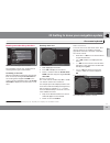
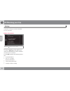
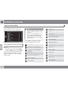
Types of roads color freeways orange main roads dark gray secondary main roads gray normal roads light gray local roads white text and symbols on the screen direction to take at next guidance point distance to the next guidance point name of next street or road stored location symbol for final desti...
Page 3
Volvo navigation system (vns) with rtt vns is a navigation system developed by volvo that is designed to help guide you to the destination of your choice and provide information along the way. Rtt 1 (real time traffic) is an information system developed by volvo, which can detect roads/streets with ...
Page 4: Contents
Contents 2 01 01 quick guide getting started............................................ 8 02 02 getting to know your navigation system this manual............................................... 14 before you begin....................................... 15 dvds and the screen...........................
Page 5: Contents
Contents 3 04 04 traffic information introduction............................................... 64 reading information.................................. 66 dealing with traffic problems.................... 68 05 05 symbols on the map points of interest (pois)............................ 72 06 06 qu...
Page 6: Contents
Contents 4 07 07 index index......................................................... 82.
Page 7: Contents
Contents 5.
Page 8
6 getting started.......................................................................................... 8.
Page 9
Q u i c k g u i d e.
Page 10: 01 Quick Guide
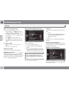
01 quick guide getting started 01 8 activating the system with the ignition switched on (see the section "ignition modes" in the owner's manual): 1. Press the remote key fully into the ignition slot to activate ignition mode i. 2. If the navigation system does not start within a few seconds, press n...
Page 11: 01 Quick Guide
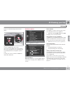
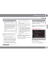
01 quick guide getting started 01 `` 9 steering wheel keypad center console controls turn the thumb wheel turn tune press the thumb wheel press ok/menu press exit press exit guidance to a street address step screen/ menu action 1 do as follows if a map is not displayed on the screen: press the nav b...
Page 12: 01 Quick Guide
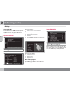
01 quick guide getting started 01 10 step screen/ menu action 7 results list scroll to the desired alterna- tives in the list + ok. 8 navigation menu scroll to set single desti- nation + ok. 9 map the system will begin guiding you to your destination..
Page 13: 01 Quick Guide
01 quick guide 01 11.
Page 14
12 this manual............................................................................................. 14 before you begin..................................................................................... 15 dvds and the screen....................................................................
Page 15
G e t t i n g t o k n o w y o u r n a v i g a t i o n s y s t e m.
Page 16
02 getting to know your navigation system this manual 02 14 heading level 1 heading level 2 this is a sub-heading of heading level 1. Heading level 3 this is a sub-heading of heading level 2. Heading level 4 this is a sub-heading of heading level 3. Using this manual a quick guide is available to he...
Page 17
02 getting to know your navigation system before you begin 02 15 general information the volvo navigation system uses the wgs84 reference system, which provides the vehicle's location in terms of longitude and latitude. The vns system can be used even if a desti- nation has not been specified. Warni...
Page 18
02 getting to know your navigation system before you begin 02 16 note the system can be used even when the engine is not running. To help avoid battery drain, the system should be turned off when it is not in use. Demo (simulated guidance) for an overview of how guidance functions, specify a destina...
Page 19
02 getting to know your navigation system dvds and the screen 02 17 contents of dvds new dvds are issued regularly with updated maps and the most current system software. The latest dvds can be purchased from a volvo retailer. Note the map information may not fully cover all areas/countries. The are...
Page 20
02 getting to know your navigation system dvds and the screen 02 18 3. " new software found " will be displayed. Press ok to start the update (or exit to cancel). 4. " please enter licence code: " will be displayed. Enter the license code using the number keys on the center console, see page 23. 5. ...
Page 21
02 getting to know your navigation system dvds and the screen 02 19.
Page 22
02 getting to know your navigation system system overview 02 20 the above illustration is schematic; certain details may vary, depending on the car model and market.
Page 23
02 getting to know your navigation system system overview 02 * option/accessory, for more information, see introduction. 21 global positioning system (gps) antenna the antenna is integrated into the roof module. Voice control a number of navigation system commands can be voice controlled. The microp...
Page 24
02 getting to know your navigation system system overview 02 22 steering wheel keypad the thumb wheel on the steering wheel keypad can be turned to navigate in lists and menus and pressed to confirm a selection. Use the exit button to go back in a menu or to cancel a selection. For additional inform...
Page 25
02 getting to know your navigation system navigation system controls 02 `` 23 about navigation system controls the navigation system can be operated with the controls in the center console, the steering wheel keypad or with a remote control (certain models only). The buttons in all cases function si...
Page 26
02 getting to know your navigation system navigation system controls 02 24 voice control see the section "voice control" beginning on page 26. Remote control 1 the remote control can be used to control var- ious functions in the vehicle. The functions described in this section pertain to the naviga-...
Page 27
02 getting to know your navigation system navigation system controls 02 25 additional information in certain cases, more information may be available than is currently displayed on the screen. In this case, the line of text will end with the # sign. Press the info button to display all of the availa...
Page 28
02 getting to know your navigation system voice control 02 26 * option/accessory, for more information, see introduction. Introduction the navigation system's voice control feature enables you to voice-activate certain system functions. Voice commands offer convenience and help avoid distractions so...
Page 29
02 getting to know your navigation system voice control 02 27 3. The text on the screen will change to " repeat instruction / navigation go to address / itinerary ." say " itinerary ." 4. Continue as prompted. When a dialogue has been initiated, grayed-out texts or texts in parentheses are not part ...
Page 30
02 getting to know your navigation system voice control 02 28 note the tutorial feature can only be started when the vehicle is parked and the parking brake is applied. • by pressing the voice control button and saying "voice tutorial." • by pressing my car and going to settings voice settings voice...
Page 31
02 getting to know your navigation system on-screen keyboard 02 `` 29 entering text and making selections screen view showing the free-text field the navigation system uses a text wheel for entering various types of information. Activating a selection when the desired function/menu selection has bee...
Page 32
02 getting to know your navigation system on-screen keyboard 02 30 the number 5 in the upper right corner of the screen indicates that the there are five alterna- tives containing the characters entered ( bez ). No list an empty list and the characters *** in the upper right corner indicates that th...
Page 33
02 getting to know your navigation system on-screen keyboard 02 31.
Page 34
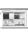
02 getting to know your navigation system maps, types of roads and the compass 02 32 map views the above illustration is schematic; certain details may vary, depending on the car model and market.
Page 35
02 getting to know your navigation system maps, types of roads and the compass 02 33 map views of the current location the way in which the map is displayed depends on the vehicle’s location and the set- tings that have been made in the system, such as map scale, geographic location, the sym- bols t...
Page 36
02 getting to know your navigation system main menu, scroll menu 02 34 the menu system the various sections of this manual present all of the navigation system's menus and alterna- tives. Note the system's menus and alternatives can- not always be selected, for a number of rea- sons. • if a menu or ...
Page 37
02 getting to know your navigation system main menu, scroll menu 02 35 returning to the map there is a quick way to display the map on the screen again, regardless of where you are in the menu structure: • press and hold exit for several seconds. Scroll menu the scroll menu makes it possible to move...
Page 38
02 getting to know your navigation system menu selections 02 36 three levels of the menu structure are shown here. A number of the third level menus also have sub-menus, which are described in detail in their respective sections in this manual. The menus are structured as follows: menu level 1 menu ...
Page 39
02 getting to know your navigation system menu selections 02 `` 37 latitude & longitude p. 47 postcode p. 47 route details itinerary start guidance add another waypoint edit itinerary p. 49 avoid p. 50 next destination p. 50 route instructions p. 51 map of entire route p. 51 map of remaining route p...
Page 40
02 getting to know your navigation system menu selections 02 38 system information gps information map version: map loading progress p. 58 import/edit mypoi p. 58 reset navigation settings p. 59 delete all user data p. 60 pause guidance or resume guidance p. 35 a not available in all areas/countries...
Page 41
02 getting to know your navigation system 02 39.
Page 42
40 setting a destination............................................................................... 42 itinerary................................................................................................... 49 current position....................................................................
Page 43
P l a n n i n g y o u r t r i p.
Page 44: 03 Planning Your Trip
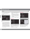
03 planning your trip setting a destination 03 42 address there are several different ways of program- ming a destination. It is enough to only enter the name of a town, village, etc. To be guided to the center of the specified town/villages. If you know the destination's latitude and lon- gitude, t...
Page 45: 03 Planning Your Trip
03 planning your trip setting a destination 03 43 note if the number entered does not exist for a street address, the system will provide infor- mation to this effect. More about information select an address/street + ok to select the fol- lowing: • map : displays a map of the location with addition...
Page 46: 03 Planning Your Trip
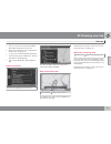
03 planning your trip setting a destination 03 44 along the route this searches for pois along a route in the itin- erary. Around point on map this search is performed by scrolling the cross- hairs on the map, see page 35. • the scroll map will be displayed. Move the crosshairs to the desired positi...
Page 47: 03 Planning Your Trip
03 planning your trip setting a destination 03 `` 45 my poi around point on map this function initiates a search for pois that the user has added to the my poi list 1 near the cursor's position on the map. The search cov- ers a radius of approx. 20 miles (32 km. The search is carried out with the sc...
Page 48: 03 Planning Your Trip
03 planning your trip setting a destination 03 46 • name : enter the name of the location of your choice • icon : select a symbol to represent the location on the map • address : enter an address • phone: enter a phone number • edit voice tag : record a voice tag. Follow the on-screen instructions. ...
Page 49: 03 Planning Your Trip
03 planning your trip setting a destination 03 `` 47 searching for a location on the map set destination select point on map this displays a map with the current location marked. See also "scroll menu" on page 35. • turn tune to change the map scale. 1. Move the crosshairs using the number keys on t...
Page 50: 03 Planning Your Trip
03 planning your trip setting a destination 03 48 1. Select postcode: + ok to display the text wheel. 2. Select characters with tune and enter them by pressing ok (or use the center console number keys). Note zip codes/post codes may be presented differently, depending on the country/area..
Page 51: 03 Planning Your Trip
03 planning your trip itinerary 03 49 menu overview route details the system can handle one itinerary at a time with a maximum of 8 intermediate destinations. The first destination entered becomes the final destination and any others are treated as inter- mediate destinations. Note the menu selectio...
Page 52: 03 Planning Your Trip
03 planning your trip itinerary 03 50 • clear itinerary : erase the current itinerary. • route options : opens a shortcut to settings route options , see page 53. Intermediate destinations in an itinerary each intermediate destination in the itinerary can be updated by marking it and pressing ok. • ...
Page 53: 03 Planning Your Trip
03 planning your trip itinerary 03 51 • delete : remove the current intermediate destination and show the next one. • map : show a position on the map with the scroll menu, see page 35. • >> : go to the next intermediate destination in the itinerary (at the end of the list, this will loop back to th...
Page 54: 03 Planning Your Trip
03 planning your trip current position 03 52 where am i? Current position this feature displays a map with the vehicle's current location and information such as the location's name and coordinates..
Page 55: 03 Planning Your Trip
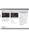
03 planning your trip settings 03 53 traffic information settings traffic information additional settings that can be made for traffic information, see also page 66. Traffic messages traffic message several selections can be made here for dis- playing traffic messages. • all : information about all ...
Page 56: 03 Planning Your Trip
03 planning your trip settings 03 54 route proposal when the start guidance command has been given, two alternatives will be presented: • select 1 to let the navigation system choose the most suitable type of route • select 3 and the system will present up to 3 route proposals (if more than one poss...
Page 57: 03 Planning Your Trip
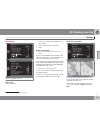
03 planning your trip settings 03 `` 55 map options settings map options map colors choose between: • automatic : a light sensor detects if it is day or night. • day (see the previous illustration) • night single map settings • map orientation : select heading or north . North : the map will always ...
Page 58: 03 Planning Your Trip
03 planning your trip settings 03 56 map scale in dual map mode to view each map in different scales: 1. From map view, turn tune clockwise or counter-clockwise to highlight the map on the right or left side of the screen. 2. Press ok to "activate" the highlighted side of the screen. 3. Turn tune to...
Page 59: 03 Planning Your Trip
03 planning your trip settings 03 `` * option/accessory, for more information, see introduction. 57 vehicles with road sign information (rsi)* speedometer with rsi. Vehicles equipped with road sign information only display the current speed limit on the speedometer. The speed limit will not be displ...
Page 60: 03 Planning Your Trip
03 planning your trip settings 03 58 alert for my poi select mypoi alert + ok to activate a preset audible alert when the vehicle approaches a mypoi location, see page 58. System information settings system information gps information the screen shows: • number of received satellites: • received pos...
Page 61: 03 Planning Your Trip
03 planning your trip settings 03 59 note • supplementing the map database requires a certain knowledge of com- puters. • the poi file formats and procedures for downloading these files are set by the respective manufacturers/distributors. This means that there is no standard procedure for downloadi...
Page 62: 03 Planning Your Trip
03 planning your trip settings 03 60 navigation settings? , continue with ok cancel with exit . Delete all user data settings delete all user data the menu alternative settings delete all user data + ok displays: do you want to delete all navigation user data? , continue with ok cancel with exit pre...
Page 63: 03 Planning Your Trip
03 planning your trip demo 03 61 start the demo (system simulation) route details start demo when the vehicle is at a standstill, this function offers simulated guidance to the currently set destination. To interrupt the simulation: • the previous memo selection ( start demo ) changes to stop demo ....
Page 64
G000000 62 introduction............................................................................................. 64 reading information................................................................................ 66 dealing with traffic problems...................................................
Page 65
T r a f f i c i n f o r m a t i o n.
Page 66: 04 Traffic Information
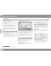
04 traffic information introduction 04 64 display and reception broadcast traffic information is always received and presented, even if no destination is specified. The way in which traffic information is presen- ted can be set and changed in settings traffic information , see page 53. The way in wh...
Page 67: 04 Traffic Information
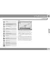
04 traffic information introduction 04 65 accident contraflow (two-way traffic, single lanes in each direction) detour (diversion) information narrow road parking information traffic jam road work slippery road other hazard road closed extent certain traffic messages also contain informa- tion on th...
Page 68: 04 Traffic Information
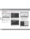
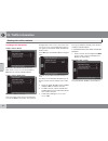
04 traffic information reading information 04 66 read traffic message a traffic problem and the area affected, marked by arrows when the crosshairs are placed over an area where there is a traffic disruption (marked by arrows along the road), a flashing box with the traffic symbol is dis- played. In...
Page 69: 04 Traffic Information
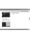
04 traffic information reading information 04 67 • expected duration • limitations (speed, vehicle width/height, etc.) • roads affected if there is more than one traffic disruption within the box, press ok to display information about the problem closest to the center of the cross- hairs first. Numb...
Page 70: 04 Traffic Information
04 traffic information dealing with traffic problems 04 68 avoiding traffic disruptions traffic events ahead menu row 2 when no itinerary has been set. With traffic events ahead selected, press ok to list the current traffic disruptions. Traffic events along route menu row 2 with a set itinerary. Th...
Page 71: 04 Traffic Information
04 traffic information dealing with traffic problems 04 69 a list with one alternative that can be edited. The following can be done: • clear all : unmark all alternatives. • select one of the alternatives + ok: the alternative will be unmarked. • select one of the alternatives + # info: detailed in...
Page 72
70 points of interest (pois).......................................................................... 72.
Page 73
S y m b o l s o n t h e m a p.
Page 74: 05 Symbols On The Map
05 symbols on the map points of interest (pois) 05 72 specify individual pois to be shown on the map or select all or none , see page 56. Marked pois will be shown on the map settings map options poi on map selected to do so: • select/deselect a poi by turning tune and pressing ok. Finish by pressin...
Page 75: 05 Symbols On The Map
05 symbols on the map points of interest (pois) 05 73 opera house/theater bar/nightclub zoo restaurant restaurant restaurant, chinese restaurant, sea food fast food café grocery store shopping mall dry cleaner news stand barber shop/hair salon park & recreation rest area hotel convention/exhibition ...
Page 76
74 frequently asked questions.................................................................... 76 eula – license agreement..................................................................... 78.
Page 77
Q u e s t i o n s & a n s w e r s.
Page 78: 06 Questions & Answers
06 questions & answers frequently asked questions 06 76 the vehicle’s position on the map is incorrect. The global positioning system (gps) indicates the car’s position with an accuracy of about 65 feet (20 meters). Accuracy may be even less when driving on roads lying parallel to another road, wind...
Page 79: 06 Questions & Answers
06 questions & answers frequently asked questions 06 77 2. Switch on the ignition again and restart vns, but remain at a standstill for a short time before driving off. I am planning a long trip but do not want to specify destinations in the cities that i will be passing through. What is the easiest...
Page 80: 06 Questions & Answers
06 questions & answers eula – license agreement 06 78 end-user terms the map data disc ("data") is provided for your personal, internal use only and not for resale. It is protected by copyright, and is subject to the following terms and conditions which are agreed to by you, on the one hand, and nav...
Page 81: 06 Questions & Answers
06 questions & answers eula – license agreement 06 `` 79 disclaimer of warranty nt and its licensors (includ- ing their licensors and sup- pliers) disclaim any warran- ties, express or implied, of quality, performance, mer- chantability, fitness for a particular purpose or non- infringement. Some st...
Page 82: 06 Questions & Answers
06 questions & answers eula – license agreement 06 80 delivered or otherwise furnished shall be marked and embedded as appropriate with the following "notice of use," and shall be treated in accordance with such notice: notice of use contractor (manufacturer/ supplier) name: navteq contractor (manuf...
Page 83: 06 Questions & Answers
06 questions & answers 06 81.
Page 84: 07 Index
07 index 07 82 a about this manual...................................... 14 activating the system.................................. 8 address entering................................................. 42 avoiding an area........................................ 50 c change scale of traffic information...
Page 85: 07 Index
07 index 07 83 symbols on........................................... 72 version.................................................. 58 map areas.................................................. 17 map mode................................................. 15 map scale.....................................
Page 86: 07 Index
07 index 07 84 system settings......................................... 15 delete user data.................................... 60 resetting................................................ 59 t traffic information.......................... 21, 53, 66 broadcasts..........................................
Page 88
Kdakd8vg8dgedgvi^dc51 64"$bobeb "5 1sjoufejo4xfefo (zufcpsh $pqzsjhiu©7pmwp$bs$psqpsbujpo.


