- DL manuals
- Garmin
- Remote Control
- GPSMAP 4208 - Marine GPS Receiver
- Owner's Manual
Garmin GPSMAP 4208 - Marine GPS Receiver Owner's Manual
Summary of GPSMAP 4208 - Marine GPS Receiver
Page 1
Gpsmap ® 4000 series owner’s manual.
Page 2
© 2008 garmin ltd. Or its subsidiaries garmin international, inc. 1200 east 151st street, olathe, kansas 66062, usa tel. (913) 397.8200 or (800) 800.1020 fax (913) 397.8282 garmin (europe) ltd. Liberty house hounsdown business park, southampton, hampshire, so40 9rb uk tel. +44 (0) 870.8501241 (outsi...
Page 3: Introduction
Gpsmap 4000 series owner’s manual i i ntroduction introduction this manual includes information for the following products: gpsmap ® 4208 gpsmap® 4210 gpsmap ® 4212 tips and shortcuts press home from any screen to return to the home screen. Press menu from any of the main screens to access advanced ...
Page 4: Table of Contents
Ii gpsmap 4000 series owner’s manual i ntroduction table of contents introduction ............................................... I tips and shortcuts ........................................ I manual conventions ..................................... I quick links ......................................
Page 5: Getting Started
Gpsmap 4000 series owner’s manual g etting s tarted g ettin g s tarted getting started unit overview to turn on your unit for the first time, refer to the initializing unit settings paragraph, page 58 . Front and rear panels sd card slot automatic backlight sensor gpsmap 4212 - front power range (+/...
Page 6: Power/backlight
2 gpsmap 4000 series owner’s manual g etting s tarted g ettin g s tarted power/backlight to turn the chartplotter on, press and release the power key. When the warning screen appears, press select to open the home screen. Note: the first time you power on your unit, you must go through a setup seque...
Page 7: Restoring Factory Settings
Gpsmap 4000 series owner’s manual g etting s tarted g ettin g s tarted for more information about gps, visit the garmin web site at www.Garmin.Com/aboutgps . Inserting and removing sd cards your unit supports secure digital (sd) cards. Insert optional bluechart ® g2 vision ™ sd cards to view high-re...
Page 8: •
4 gpsmap 4000 series owner’s manual g etting s tarted g ettin g s tarted to turn the simulator mode on: from the home screen select configure > system > simulator > on . Select setup to set speed, track control (simulated heading), position, simulator time, and simulator date. Understanding the home...
Page 9: Using Charts
Gpsmap 4000 series owner’s manual u sing c harts u sin g c hart s using charts the gpsmap 4000 series chartplotters have a basic worldwide imagery map, and built-in detailed bluechart g2 offshore cartography for us waters. Navigation chart—displays all relevant navigation data available on your prel...
Page 10: Navigation Chart Settings
Gpsmap 4000 series owner’s manual u sing c harts u sin g c hart s navigation chart settings to access additional settings or options for the navigation chart, press menu. Weather—turns the nexrad weather overlay on or off. Only available when connected to a garmin xm network device. See page 48 for ...
Page 11: Panning The Navigation Chart
Gpsmap 4000 series owner’s manual u sing c harts u sin g c hart s panning the navigation chart use the rocker on your gpsmap 4000 series unit to move the map pointer ( ) away from your current location and to scroll to other areas on the navigation chart. As you pan past the edge of the current map ...
Page 12: Using Mariner’S Eye
Gpsmap 4000 series owner’s manual u sing c harts u sin g c hart s accessing additional object information use the map pointer ( ) to view information about on-screen map items, waypoints, and charts. Selected item additional item information viewing tide station information tide station information ...
Page 13: Range (+)
Gpsmap 4000 series owner’s manual u sing c harts u sin g c hart s to access the mariner’s eye screen, from the home screen, select charts > mariner’s eye . Mariner’s eye navigation chart the range (+) key moves the view closer to your boat and lower to the water, while the range (-) key moves the vi...
Page 14: Auto
0 gpsmap 4000 series owner’s manual u sing c harts u sin g c hart s orientation—changes the perspective of the map display: north up—sets the top of the map display to a north heading. Track up—sets the map display to the current track heading. Course up—sets the map so the direction of navigation i...
Page 15
Gpsmap 4000 series owner’s manual u sing c harts u sin g c hart s to turn the track log on: from the navigation chart, select menu > chart setup > tracks > on . A trailing line on the chart indicates your track. To save the active track: 1. From the home screen, select information > user data > trac...
Page 16: Record Mode—Select
2 gpsmap 4000 series owner’s manual u sing c harts u sin g c hart s to set active track options: from the home screen, select information > user data > tracks > active track options . Record mode—select off , fill , or wrap . Off—does not record a track log. Fill—records a track log until the track ...
Page 17: Using Mariner’S Eye 3D
Gpsmap 4000 series owner’s manual u sing c harts u sin g c hart s bluechart g2 vision sd cards are not waterproof. When you are not using the card, keep it in the original packaging for safekeeping and store it away from exposure to sun and rain. Bluechart g2 vision sd cards are susceptible to damag...
Page 18: Colors —Selects Between
4 gpsmap 4000 series owner’s manual u sing c harts u sin g c hart s colors —selects between normal (default), water hazard , and all hazard . The normal setting shows the land as seen from the water. The water hazard setting indicates shallow water and land with a color scale. Blue indicates deep wa...
Page 19: Using Fishing Charts
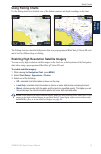
Gpsmap 4000 series owner’s manual u sing c harts u sin g c hart s using fishing charts use the fishing chart for a detailed view of the bottom contours and depth soundings on the chart. Fishing chart navigation chart the fishing chart uses detailed bathymetric data on a preprogrammed bluechart g2 vi...
Page 20: Viewing Aerial Photos
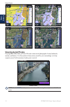
Gpsmap 4000 series owner’s manual u sing c harts u sin g c hart s blend at 50% blend at 100% photo overlay off land only photo overlay viewing aerial photos preprogrammed bluechart g2 vision sd cards contain aerial photographs of many landmarks, marinas, and harbors. Use these photos to help orient ...
Page 21: Review
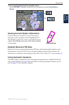
Gpsmap 4000 series owner’s manual u sing c harts u sin g c hart s to access aerial photos from the navigation chart: use the rocker to highlight a camera icon with the pointer, and select aerial photo or review . Perspective overhead viewing current station information if current stations are availa...
Page 22: Using Combinations
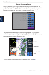
Gpsmap 4000 series owner’s manual u sing c ombinations u sin g c o m b in at io n s using combinations use the combinations screen to view a combination of different screens at the same time. The number of options available on the combinations screen depends on the optional network devices you have ...
Page 23
Gpsmap 4000 series owner’s manual u sing c ombinations u sin g c ombina tion s to customize the screen combinations: 1. While viewing the combinations screen, select menu > change combination , or, from the home screen, select combinations > unused combo (if one is available). Combination screen com...
Page 24: Where To?
20 gpsmap 4000 series owner’s manual w here t o ? W here t o ? Where to? Use the where to? Option on the home screen to search for and navigate to nearby fuel, repairs, services, waypoints, and routes. Note: you must create waypoints and routes before you can navigate to them. You can navigate to a ...
Page 25
Gpsmap 4000 series owner’s manual 2 w here t o ? W here t o ? 3. Select the marine service item to which you want to navigate. A screen containing information about the selected marine service appears. 4. Select navigate to . 5. Select go to . Or select guide to when using a preprogrammed bluechart ...
Page 26
22 gpsmap 4000 series owner’s manual w here t o ? W here t o ? 2. Use the rocker or numeric keypad (4210/4212 only) to select characters and spell at least a portion of the name of your destination. 3. Select done to view the 50 nearest destinations that contain your search criteria. 4. Select the b...
Page 27
Gpsmap 4000 series owner’s manual 2 w here t o ? W here t o ? To mark your current location as a waypoint: from any screen, press the mark key. Edit waypoint—designates a specific name, symbol, water depth, water temperature, or position. Delete—deletes the waypoint. Man overboard—designates the cur...
Page 28: Creating and Using Routes
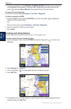
24 gpsmap 4000 series owner’s manual w here t o ? W here t o ? 6. If entering coordinates, use the rocker or numeric keypad (4210/4212 only) to enter the new coordinates for the waypoint. If using the chart, highlight the new location with the map pointer ( ), and select move waypoint . The waypoint...
Page 29
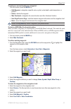
Gpsmap 4000 series owner’s manual 2 w here t o ? W here t o ? 6. Select done to finish the route or cancel route to delete the route. To create a route in another location: 1. From the home screen, select information > user data > routes > new route . 2. By pressing the rocker , use the map pointer ...
Page 30: Viewing Information
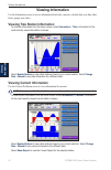
2 gpsmap 4000 series owner’s manual v iewing i nformation v ie w in g i nforma tion viewing information use the information screen to access information about tides, currents, celestial data, user data, other boats, gauges, and video. Viewing tide station information to view tide information from th...
Page 31: Viewing User Data
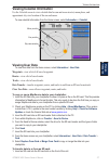
Gpsmap 4000 series owner’s manual 2 v iewing i nformation v ie w in g i nforma tion viewing celestial information use the celestial screen to view celestial data for sun and moon rise/set, moon phase, and approximate sky view location of the sun and moon. To view celestial information from the home ...
Page 32: Information
2 gpsmap 4000 series owner’s manual v iewing i nformation v ie w in g i nforma tion 2. From the home screen, select information > user data > data transfer > card . Complete one of the following: select save to card to save waypoints, routes, and tracks to the sd card. Select merge from card to tran...
Page 33: Viewing Gauges
Gpsmap 4000 series owner’s manual 2 v iewing i nformation v ie w in g i nforma tion dsc log—displays a list of all dsc calls, sorted by most recent, sender, or by type (distress calls or position reports). View by time—shows the most recent dsc calls received, sorted and listed chronologically by ti...
Page 34: Viewing Fuel Gauges
0 gpsmap 4000 series owner’s manual v iewing i nformation v ie w in g i nforma tion viewing fuel gauges to view fuel gauges from the home screen, select information > fuel . Fuel flow for each engine, total fuel flow, fuel level in each tank, total fuel remaining, fuel economy, and the range for you...
Page 35: Configuring The Unit
Gpsmap 4000 series owner’s manual c onfiguring the u nit c o n fig u r in g the u nit configuring the unit use the configure screen to configure unit settings. Configuring system settings to change general system settings, from the home screen, select configure > system . Simulator—turn simulator mo...
Page 36: Miles Per Hour
2 gpsmap 4000 series owner’s manual c onfiguring the u nit c o n fi g u r in g the u nit speed—individually set the units of measure for speed readings ( miles per hour , kilometers per hour , or knots ). Elevation—individually set the units of measure for elevation readings ( feet or meters ). Volu...
Page 37: Off
Gpsmap 4000 series owner’s manual c onfiguring the u nit c o n fig u r in g the u nit 4. Select off to disable, or select on to enable the 0183 nmea output sentence. Posn. Precision—adjust the number of digits ( two digits , three digits , or four digits ) to the right of the decimal point for trans...
Page 38: Setting System Alarms
4 gpsmap 4000 series owner’s manual c onfiguring the u nit c o n fi g u r in g the u nit setting system alarms to set a system alarm, from the home screen, select configure > alarms > system . Clock—sets an alarm using the system (gps) clock. The unit must be on for the clock alarm to work. Battery—...
Page 39: 200Khz
Gpsmap 4000 series owner’s manual c onfiguring the u nit c o n fig u r in g the u nit to adjust the keel offset: 1. From the home screen, select configure > my boat > keel offset . 2. Use the select screen keyboard to specify the offset. 3. Select done to accept the number. Note: select cancel to ca...
Page 40: Configuring Xm Audio
Gpsmap 4000 series owner’s manual c onfiguring the u nit c o n fi g u r in g the u nit safe zone (ais and marpa only)—turn a safe zone around your boat on or off. This is used for collision avoidance, and can be customized. To customize safe-zone settings: from the home screen, select configure > ot...
Page 41: Using The Marine Network
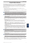
Gpsmap 4000 series owner’s manual m arine n etwork m arine n et w ork using the marine network the garmin marine network allows you to share data from garmin peripheral devices between garmin chartplotters quickly and easily. You can connect your gpsmap 4000 series chartplotters as well as the gpsma...
Page 42: Configure >
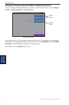
Gpsmap 4000 series owner’s manual m arine n etwork m arine n et w ork viewing connected garmin marine network devices to view all connected garmin marine network devices, from the home screen, select configure > system > system information > network devices . Network devices aliases defined no alias...
Page 43: Using Radar
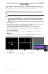
Gpsmap 4000 series owner’s manual u sing r adar u sin g r adar using radar when you connect your chartplotter to an optional garmin marine radar such as a gmr 404/406 or a gmr 18/24, you can view more information about your surroundings. The radar connects through the garmin marine network and share...
Page 44: Range
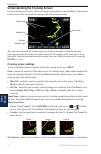
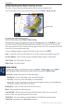
40 gpsmap 4000 series owner’s manual u sing r adar u sin g r adar understanding the cruising screen use the cruising screen to view a full-screen image of the gathered radar information. Your position is in the center of the screen, and the rings provide distance measurements. Range rings heading li...
Page 45: Rocker
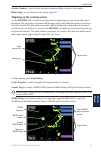
Gpsmap 4000 series owner’s manual 4 u sing r adar u sin g r adar overlay numbers—shows or hides cruising, navigation, fishing, sailing, or fuel numbers. Radar setup—access advanced radar settings ( page 43 ). Targeting on the cruising screen use the rocker while viewing the cruising screen to begin ...
Page 46: Radar > Radar Overlay
42 gpsmap 4000 series owner’s manual u sing r adar u sin g r adar understanding the radar overlay screen the radar overlay screen places the radar picture directly onto the navigation chart. To access the radar overlay screen, from the home screen select radar > radar overlay . Radar range to access...
Page 47: High
Gpsmap 4000 series owner’s manual 4 u sing r adar u sin g r adar xtalk reject (crosstalk)—filters out interference caused by another radar operating in close proximity. Advanced—opens a menu of advanced settings: ftc (fast time constant)— controls unwanted screen clutter caused by rain at a distance...
Page 48: Using Sonar
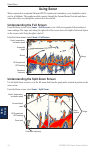
44 gpsmap 4000 series owner’s manual u sing s onar u sin g s onar using sonar when connected to an optional garmin gsd 22 sounder and a transducer, your chartplotter can be used as a fishfinder. The sounder module connects through the garmin marine network and shares sonar data with every chartplott...
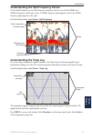
Page 49: Understanding The Temp Log
Gpsmap 4000 series owner’s manual 4 u sing s onar u sin g s onar understanding the split frequency screen use the split frequency screen (dual frequency transducer only) to view both the 50khz and 200khz frequencies on the same screen. A 200khz frequency graph appears on the left; a 50khz frequency ...
Page 50: Setting Up Sonar
4 gpsmap 4000 series owner’s manual u sing s onar u sin g s onar setting up sonar use the sonar setup screen to define and adjust settings universal to all sonar screens. From the home screen, select sonar > sonar setup . Color scheme—choose white (black, if using night mode colors) or blue. This af...
Page 51: Down
Gpsmap 4000 series owner’s manual 4 u sing s onar u sin g s onar magnified area. 4x zoom—four times the magnification. Select up , down , or auto to set the depth range of the magnified area. Bottom lock—locks the zoom window to the bottom. Select up , down , or auto to set the depth range of the ma...
Page 52: Using Xm Wx Weather
4 gpsmap 4000 series owner’s manual u sing xm u sin g x m using xm wx weather and audio in order to use xm weather, you must have a garmin gdl 30 or 30a xm receiver and an activated xm weather subscription. To use xm audio, you must have the garmin gdl 30a xm receiver and an xm audio subscription. T...
Page 53: Weather
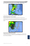
Gpsmap 4000 series owner’s manual 4 u sing xm u sin g x m to view the weather legend from the home screen, select weather > weather setup > legend > show . Nexrad is shown independently or with a variety of other weather information. To turn cloud cover on or off, select menu > cloud cover > hide or...
Page 54
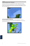
0 gpsmap 4000 series owner’s manual u sing xm u sin g x m understanding hurricane information the hurricanes feature shows the current position of a hurricane, tropical storm, or tropical depression, as well as its projected path (indicated by a red line). The darkened dots that appear along the red...
Page 55: Viewing Forecast Information
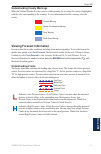
Gpsmap 4000 series owner’s manual u sing xm u sin g x m understanding county warnings when the national weather service issues a weather warning for a county, the county is highlighted with the color corresponding to the warning. To view information about the warning, select the county. Tornado warn...
Page 56: Understanding City Forecasts
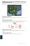
2 gpsmap 4000 series owner’s manual u sing xm u sin g x m understanding city forecasts city forecasts appear as standard weather symbols. The forecast is viewed in 12-hour increments for the next 48 hours. Viewing sea conditions sea conditions provide surface conditions including winds, wave height,...
Page 57: Understanding Wave Direction
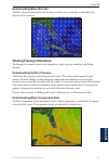
Gpsmap 4000 series owner’s manual u sing xm u sin g x m understanding wave direction the wave direction feature shows the direction in which a wave is moving, as indicated by the direction of the red arrow. Viewing fishing information the fishing view contains current water temperature, surface pres...
Page 58: Viewing Fish Forecasting
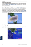
4 gpsmap 4000 series owner’s manual u sing xm u sin g x m viewing fish forecasting to view areas that contain optimal weather conditions for specific species of fish, from the home screen select weather > fishing > menu > fish species . Select a species of fish. Shaded areas indicate optimal fishing...
Page 59: Buoy
Gpsmap 4000 series owner’s manual u sing xm u sin g x m to view a buoy report, select a buoy on the screen. Select buoy . Using xm audio when a gdl 30a is connected to the garmin marine network and to the audio input of your boat, you can listen to xm audio channels. To display the xm audio interfac...
Page 60: Mute—Silences The Audio.
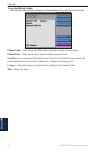
Gpsmap 4000 series owner’s manual u sing xm u sin g x m to use the xm audio guide: while the xm audio interface is displayed on the navigation chart, press the bottom soft key. Channel guide—selects the specific xm channel within the currently selected category. Channel entry—allows you to enter a c...
Page 61: Appendix
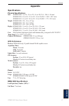
Gpsmap 4000 series owner’s manual a ppendi x a ppendix appendix specifications physical specifications size: gpsmap 4208: 7 in. H × 11¼ in. W × 4⅛ in. D (176.9 × 284.4 × 106 mm) gpsmap 4210: 8⅞ in. H × 13⅜ in. W × 4⅛ in. D (226.9 × 340.4 × 105.1 mm) gpsmap 4212: 9½ in. H × 14¾ in. W × 4⅛ in. D (240....
Page 62: Initializing Unit Settings
Gpsmap 4000 series owner’s manual a ppendix a ppendi x initializing unit settings the first time you turn your unit on, you must configure a series of initial settings. These settings must also be configured when restoring factory settings ( page 3 ). Note: all of these settings can be configured la...
Page 63: Nmea 2000
Gpsmap 4000 series owner’s manual a ppendix a ppendi x approved nmea 0183 sentences: gpbwc, gprmc, gpgga, gpgsa, gpgsv, gpgll, gpbod, gprmb, gprte, gpvtg, gpwpl, gpxte, and garmin proprietary sentences pgrme, pgrmm, and pgrmz. This unit also includes support for the wpl sentence, dsc, and sonar nmea...
Page 64: Messages And Alarms
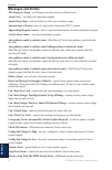
0 gpsmap 4000 series owner’s manual a ppendix a ppendi x messages and alarms ais: dangerous target—an ais target currently presents a collision threat. Alarm clock— the alarm clock alarm has sounded. Anchor drag alarm—boat has drifted out of the user-set distance range. Antenna input is shorted —the...
Page 65
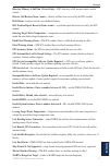
Gpsmap 4000 series owner’s manual a ppendix a ppendi x directory memory is full can’t create entry—dsc directory is full, no more entries can be created. Distress call received from —distress call has been received by the dsc module. Drift alarm—boat has moved a user-defined distance. Dsc position r...
Page 66
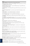
2 gpsmap 4000 series owner’s manual a ppendix a ppendi x marpa: target lost—(radar) unable to track a marpa target any longer. Mdb waypoint memory is full, can’t create waypoint—mdb waypoint memory is full. Erase existing mdb waypoints to make room. Nmea depth is below transducer—(sonar) the nmea de...
Page 67
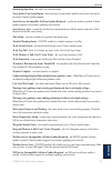
Gpsmap 4000 series owner’s manual a ppendix a ppendi x simulating operation—the unit is in simulator mode. Sonar failed, unit needs repair—there has been a sonar failure and the unit needs to be sent in for repair. Contact product support. Sonar service incompatible. Software update required—a softw...
Page 68: Product Registration
4 gpsmap 4000 series owner’s manual a ppendix a ppendi x product registration help us better support you by completing our online registration today! Connect to our web site at http://my.Garmin.Com . Keep the original sales receipt, or a photocopy, in a safe place. Contact garmin contact garmin if y...
Page 69: Software License Agreement
Gpsmap 4000 series owner’s manual a ppendix a ppendi x this product was developed using dafif ™ , a product of the national geospatial-intelligence agency. This product has not been endorsed or otherwise approved by the national geospatial-intelligence agency, or the united states department of defe...
Page 70: Index
Gpsmap 4000 series owner’s manual i ndex index a a-scope 47 additional object information 8 aerial photos 12, 16 ais 28, 35 alarms 33 battery 34 deep water 34 fish 34 messages 60 water temp 34 antenna size 43 auto guidance 12, 34 auto mag var 32 automatic guidance 17 b backing up data 28 backlight a...
Page 71
Gpsmap 4000 series owner’s manual i ndex other boats 28, 35 overlay numbers 6, 9, 14, 31, 40, 41, 46 p panning the navigation chart 7 photos 16 poi data 17 position 32 position icon 7 power key 1 precipitation information 48 precipitation information 48 preferred devices 33 pressure center 51 pressu...
Page 74
For the latest free software updates (excluding map data) throughout the life of your garmin products, visit the garmin web site at www.Garmin.Com. © 2008 garmin ltd. Or its subsidiaries garmin international, inc. 1200 east 151 st street, olathe, kansas 66062, usa garmin (europe) ltd. Liberty house,...


