- DL manuals
- Garmin
- Remote Control
- GPSMAP 4008 - Marine GPS Receiver
- Owner's Manual
Garmin GPSMAP 4008 - Marine GPS Receiver Owner's Manual
Summary of GPSMAP 4008 - Marine GPS Receiver
Page 1
Gpsmap ® 4000/5000 series owner’s manual.
Page 2
© 2007 garmin ltd. Or its subsidiaries garmin international, inc. 1200 east 151 st street, olathe, kansas 66062, usa tel.(913) 397.8200 or (800) 800.1020 fax (913) 397.8282 garmin (europe) ltd. Liberty house hounsdown business park, southampton, hampshire, so40 9rb uk tel.+44 (0) 870.8501241 (outsid...
Page 3: Ntroduction
Gpsmap ® 4000/5000 series owner’s manual i i ntroduction i ntroduction this manual includes information for the following products: gpsmap ® 4008 gpsmap ® 4012 gpsmap ® 5008 gpsmap ® 5012 tips and shortcuts press or touch home from any screen to return to the home screen. Press or touch menu from an...
Page 4: Able
Ii gpsmap ® 4000/5000 series owner’s manual i ntroduction t able of c ontents introduction ...............................................I tips and shortcuts .....................................I manual conventions ..................................I quick links ......................................
Page 5: Etting
Gpsmap ® 4000/5000 series owner’s manual g etting s tarted g ett in g s tarted g etting s tarted unit overview sd card slot automatic backlight sensor gpsmap 4012 power range (+/-) rocker mark select home menu numeric keypad (gpsmap 402) soft keys note: use the soft keys to select menu items on the ...
Page 6: Turning The Unit On Or Off
2 gpsmap ® 4000/5000 series owner’s manual g etting s tarted g ett in g s tarted power connector marine video connector nmea 2000 connector nmea 083 connector garmin marine network connectors turning the unit on or off press and hold the power key until the garmin screen appears. When the warning sc...
Page 7: To Adjust The Color Mode:
Gpsmap ® 4000/5000 series owner’s manual 3 g etting s tarted g ett in g s tarted to adjust the color mode: 1. Pressandreleasethe power key. 2. Select color mode . 3. Select day , night ,or auto . Acquiring gps satellite signals when you turn the unit on, the gps receiver must collect satellite data ...
Page 8: Using Simulator Mode
4 gpsmap ® 4000/5000 series owner’s manual g etting s tarted g ett in g s tarted using simulator mode simulator mode turns the gps receiver off for use indoors or for practice. The unit does not track satellites in simulator mode. Caution: do not try to navigate using simulator mode because the gps ...
Page 9: Sing
Gpsmap ® 4000/5000 series owner’s manual 5 u sing c harts u sin g c harts u sing c harts your unit has a basic worldwide imagery map. By purchasing an optional blue chart ® g2 vision™ preprogrammed sd card, you can view detailed information for your region, including: navigation chart—displays all r...
Page 10: Rocker
Gpsmap ® 4000/5000 series owner’s manual u sing c harts u si n g c harts navigating to a point on the chart 1. Fromthehomescreen,select charts . 2. Select navigation chart , fishing chart ,or radar overlay . 3.Selectthepointonthechartwhereyouwanttogo. 4. Selectnavigateto. 5. Select go to or guide to...
Page 11
Gpsmap ® 4000/5000 series owner’s manual u sing c harts u sin g c harts accessing additional object information use the map pointer ( ) (gpsmap 4008/4012) or touch an item on the screen (gpsmap 5008/5012) to view information about on-screen map items, waypoints, and charts. Selected item additional ...
Page 12: Using Mariner’S Eye
8 gpsmap ® 4000/5000 series owner’s manual u sing c harts u si n g c harts using mariner’s eye mariner’s eye provides a view from above and behind the boat (according to your course), and provides a visual navigation aid. This view is helpful when navigating tricky shoals, reefs, bridges, or channel...
Page 13: Changing The Chart Settings
Gpsmap ® 4000/5000 series owner’s manual u sing c harts u sin g c harts changing the chart settings to change chart settings, from the home screen, select charts > chart setup . Orientation—change the perspective of the map display: north up—sets the top of the map display to a north heading. Track ...
Page 14: Using Bluechart G2 Vision
0 gpsmap ® 4000/5000 series owner’s manual u sing c harts u si n g c harts using bluechart g2 vision optional bluechart g2 vision preprogrammed sd cards allow you to get the most out of your unit. In addition to detailed marine charting, bluechart g2 vision has the following features: mariner’s eye ...
Page 15: Mariner’S Eye 3D Settings
Gpsmap ® 4000/5000 series owner’s manual u sing c harts u sin g c harts mariner’s eye 3d settings to access additional settings or options from the mariner’s eye 3d screen, press menu . Colors —choose between normal (default), water hazard , and all hazard . The normal setting shows the land as seen...
Page 16: Fish Eye 3D Settings
2 gpsmap ® 4000/5000 series owner’s manual u sing c harts u si n g c harts fish eye 3d settings to access additional settings or options for the fish eye 3d screen, press menu . Sonar cone—turn a cone on or off that shows the area covered by your transducer. Sonar data—visually show the sonar readin...
Page 17: To Enable Satellite Imagery:
Gpsmap ® 4000/5000 series owner’s manual 3 u sing c harts u sin g c harts enabling high resolution satellite imagery you can overlay high-resolution satellite images on the land, sea, or both portions of the navigation chart when using a preprogrammed bluechart g2 vision sd card. To enable satellite...
Page 18: Viewing Aerial Photos
4 gpsmap ® 4000/5000 series owner’s manual u sing c harts u si n g c harts viewing aerial photos preprogrammed bluechart g2 vision sd cards contain aerial photographs of many landmarks, marinas, and harbors. Use these photos to help orient yourself to your surroundings or acquaint yourself with a ma...
Page 19: Sing
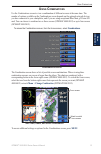
Gpsmap ® 4000/5000 series owner’s manual 5 u sing c ombinations u sin g c omb ina tions u sing c ombinations use the combinations screen to view a combination of different screens at the same time. The number of options available on the combinations screen depends on the optional network devices you...
Page 20
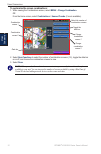
Gpsmap ® 4000/5000 series owner’s manual u sing c ombinations u si n g c omb ina ti ons to customize the screen combinations: 1. Whileviewingthecombinationsscreen,select menu > change combination. Or fromthehomescreen,select combinations > unused combo (ifoneisavailable). Combination screen combinat...
Page 21: Here
Gpsmap ® 4000/5000 series owner’s manual w here t o w here t o w here t o use the where to option on the home screen to search for and navigate to nearby fuel, repairs, services, waypoints, and routes. Note: you must create waypoints and routes before you can navigate to them. You can navigate to a ...
Page 22: To Stop Navigating:
8 gpsmap ® 4000/5000 series owner’s manual w here t o w here t o 4. Select navigate to . 5. Select go to . Or select guide to whenusingapreprogrammedbluechartg2visioncardtouseauto guidance. 6. Followthecoloredlineonthescreentothedestination. To stop navigating: fromthechart,select menu ,andthenselec...
Page 23: To Create A New Waypoint:
Gpsmap ® 4000/5000 series owner’s manual w here t o w here t o 3. Select done toviewthe50nearestdestinationsthatcontainyoursearchcriteria. 4. Selectthebestlocation,thenselect navigate to > go to (or route to ). Creating and using waypoints you can store up to 1,500 waypoints with a user-defined name...
Page 24
20 gpsmap ® 4000/5000 series owner’s manual w here t o w here t o to mark your current location as a waypoint: 1. Atanytime,pressthe mark key(gpsmap4008/4012)ortouch mark onthehomescreen (gpsmap5008/5012) 2. Select edit waypoint to designate a specific name, symbol, water depth, water temperature, o...
Page 25: Creating and Using Routes
Gpsmap ® 4000/5000 series owner’s manual 2 w here t o w here t o to view a list of all waypoints: fromthehomescreen,select information > user data > waypoints . To delete a waypoint or mob: 1. Fromthenavigationchart,touchthewaypoint(gpsmap5008/5012)orusethemappointer ( )(gpsmap4008/4012)tohighlightt...
Page 26: To Edit A Route
22 gpsmap ® 4000/5000 series owner’s manual w here t o w here t o to create a route in another location: 1. Fromthehomescreen,select information > user data > routes > new route . 2. Touchthelocation(gpsmap5008/5012)orusethemappointer( )(gpsmap4008/4012) toselectthelocationyouwanttostartthenewroute....
Page 27: Iewing
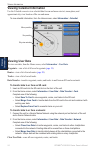
Gpsmap ® 4000/5000 series owner’s manual 23 v iewing i nformation v ie wi n g i nforma tion v iewing i nformation use the information screen to access information about tides, currents, celestial data, user data, other boats, gauges, and video. Viewing tide station information to view tide informati...
Page 28: Viewing User Data
24 gpsmap ® 4000/5000 series owner’s manual v iewing i nformation v ie wi n g i nforma ti on viewing celestial information use the celestial screen to view celestial data for sun and moon rise/set, moon phase, and approximate sky view location of the sun and moon. Toviewcelestialinformation,fromtheh...
Page 29: Viewing Other Boats
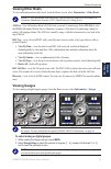
Gpsmap ® 4000/5000 series owner’s manual 25 v iewing i nformation v ie wi n g i nforma tion viewing other boats to view information about other boats, from the home screen, select information > other boats . Note: to view information about other boats, your unit must be connected to an external ais ...
Page 30: Viewing Video
2 gpsmap ® 4000/5000 series owner’s manual v iewing i nformation v ie wi n g i nforma ti on viewing video your unit can display video if you connect to a video source using the supplied video cable. See the gpsmap 4000/5000 series installation instructions for details. To view video from the home sc...
Page 31: Onfiguring
Gpsmap ® 4000/5000 series owner’s manual 2 c onfiguring the u nit c o n fig u r in g the u n it c onfiguring the u nit use the configure screen to configure unit settings. Configuring system settings to change general system settings, from the home screen, select configure > system . Simulator—turn ...
Page 32: Configure
28 gpsmap ® 4000/5000 series owner’s manual c onfiguring the u nit c onf ig ur in g the u n it configuring communications settings to change the communications settings, from the home screen, select configure > communications . Port types—select each port’s input/output format ( nmea std. Or nmea hi...
Page 33: Setting System Alarms
Gpsmap ® 4000/5000 series owner’s manual 2 c onfiguring the u nit c o n fig u r in g the u n it setting system alarms to set a system alarm, from the home screen, select configure > alarms > system . Clock—set an alarm using the system (gps) clock. The unit must be on for the clock alarm to work. Ba...
Page 34: 200Khz
30 gpsmap ® 4000/5000 series owner’s manual c onfiguring the u nit c onf ig ur in g the u n it sonar cone angles—when using a transducer other than the standard garmin transducer, you can set the angle, in degrees, of the sonar cone so that it is accurately depicted on the fish eye 3d screen. Select...
Page 35: Sing
Gpsmap ® 4000/5000 series owner’s manual 3 u sing the g armin m arine n etwork m ar ine n et w ork u sing the g armin m arine n etwork the garmin marine network allows you to share data from garmin peripheral devices between garmin chartplotters quickly and easily. You can connect your gpsmap 4008/4...
Page 36: Configure >
32 gpsmap ® 4000/5000 series owner’s manual u sing the g armin m arine n etwork m ar ine n et w ork viewing connected garmin marine network devices to view all connected garmin marine network devices, from the home screen, select configure > system > system information > network devices . Network de...
Page 37: Sing
Gpsmap ® 4000/5000 series owner’s manual 33 u sing r adar u sin g r adar u sing r adar when you connect your chartplotter to an optional garmin marine radar such as a gmr 404/406 or gmr 18, you can view more information about your surroundings. The garmin marine radar connects through the garmin mar...
Page 38: Range
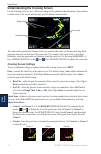
34 gpsmap ® 4000/5000 series owner’s manual u sing r adar u si n g r adar understanding the cruising screen use the cruising screen to view a full-screen image of the gathered radar information. Your position is in the center of the screen, and the rings provide distance measurements. Range rings he...
Page 39: Rocker
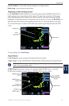
Gpsmap ® 4000/5000 series owner’s manual 35 u sing r adar u sin g r adar overlay numbers—show or hide cruising, navigation, or fishing numbers. Radar setup—access advanced radar settings. Targeting on the cruising screen use the rocker (gpsmap 4008/4012) or touch the target location (gpsmap 5008/501...
Page 40: Radar > Radar Overlay
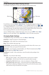
3 gpsmap ® 4000/5000 series owner’s manual u sing r adar u si n g r adar understanding the radar overlay screen use the radar overlay option to overlay radar information on the navigation chart. Map scale radar range from the home screen select radar > radar overlay . The radar picture appears in or...
Page 41: Sing
Gpsmap ® 4000/5000 series owner’s manual 3 u sing s onar u sin g s onar u sing s onar when connected to an optional garmin gsd 22 sounder module and a transducer, your chartplotter becomes a powerful fishfinder. The gsd 22 connects through the garmin marine network and shares sonar data with every c...
Page 42: Sonar
38 gpsmap ® 4000/5000 series owner’s manual u sing s onar u si n g s onar understanding the split freq screen use the split freq screen (dual frequency transducer only) to view both the 50khz and 200khz frequencies on the same screen. A 200khz frequency graph appears on the left; a 50khz frequency g...
Page 43: Setting Up Sonar
Gpsmap ® 4000/5000 series owner’s manual 3 u sing s onar u sin g s onar setting up sonar use the sonar setup screen to define and adjust settings universal to all sonar screens. From the home screen, select sonar > sonar setup . Color scheme—choose white or blue. This affects the background on all s...
Page 44: Advanced Sonar Settings
40 gpsmap ® 4000/5000 series owner’s manual u sing s onar u si n g s onar advanced sonar settings to adjust advanced sonar settings, press menu while viewing a sonar screen. Range—the range of the depth scale on the right side of the screen ( auto or manual range) . Gain—controls the sensitivity of ...
Page 45: Ppendix
Gpsmap ® 4000/5000 series owner’s manual 4 a ppend ix a ppendix a ppendix specifications physical specifications size: gpsmap 4008: 7" h x 11.2" w x 4.2" d (176.9 x 284.4 x 106 mm) gpsmap 4012: 9.5" h x 14.8" w x 4.13" d (240.5 x 375 x 105.1 mm) gpsmap 5008: 6.8" h x 10.1" w x 4.17" d (173.5 x 256 x...
Page 46: Initializing Unit Settings
42 gpsmap ® 4000/5000 series owner’s manual a ppendix a ppend ix initializing unit settings the first time you turn your unit on, you must configure a series of initial settings. These settings must also be configured when restoring factory settings. Note: you can change these settings later using t...
Page 47: Alarms and Messages
Gpsmap ® 4000/5000 series owner’s manual 43 a ppendix a ppend ix alarms and messages accuracy alarm (gps)—the gps accuracy has fallen outside the user-set value. Ais: dangerous target—an ais target presents a collision threat. Alarm clock—the alarm clock has sounded. Anchor drag alarm—boat has drift...
Page 48
44 gpsmap ® 4000/5000 series owner’s manual a ppendix a ppend ix nmea depth is below transducer—(sonar) the nmea depth input is using the dbt sentence which does not include keel offset. No dgps position—unit lost differential gps reception (waas). Make sure you have a clear view of the sky. No prox...
Page 49: Product Registration
Gpsmap ® 4000/5000 series owner’s manual 45 a ppendix a ppend ix product registration help us better support you by completing our online registration today! Connect to our web site at http://my.Garmin.Com . Use this area to record the serial number (9-digit number located on the back of the product...
Page 50: Nmea 0183 And Nmea 2000
4 gpsmap ® 4000/5000 series owner’s manual a ppendix a ppend ix nmea 0183 and nmea 2000 the gpsmap 4000/5000 series chartplotters can accept data from both nmea 0183 compliant devices and certain nmea 2000 devices connected to an existing nmea 2000 network on your boat. Nmea 0183 the nmea 0183 data ...
Page 51: Ndex
Gpsmap ® 4000/5000 series owner’s manual 4 i ndex i ndex a a-scope 40 additional object information 7 aerial photos 14 ais 25 , 30 alarms 28 , 43 antenna size (radar) 36 automatic guidance 14 b backlight adjusting 2 sensor 1 backlight sensor 1 beeper 27 bluechart g2 vision 10 , 31 c calibrate water ...
Page 52
48 gpsmap ® 4000/5000 series owner’s manual i ndex range keys 1 registration 45 restoring factory settings 3 review 6 rings 8 , 36 roads 14 rocker 1 routes creating 21 editing 22 route to 17 s safe depth 8 , 11 , 29 safe height 29 safe zone 30 satellite signals 3 scroll speed 39 sd cards inserting a...
Page 54
For the latest free software updates (excluding map data) throughout the life of your garmin products, visit the garmin web site at www.Garmin.Com. © 2007 garmin ltd. Or its subsidiaries garmin international, inc. 1200 east 151 st street, olathe, kansas 66062, usa garmin (europe) ltd. Liberty house,...


