- DL manuals
- Garmin
- Tools
- Cessna Caravan G1000
- Pilot's Manual
Garmin Cessna Caravan G1000 Pilot's Manual
Summary of Cessna Caravan G1000
Page 1
G1000 tm g1000 tm multi function display pilot’s guide for the diamond da40
Page 2
Garmin g1000 mfd pilot’s guide for the da40 190-00381-03 rev. A record of revisions revision date of revision revision page range description rev. A 06/28/05 ------------ initial release.
Page 3
Garmin g1000 mfd pilot’s guide for the da40 190-00381-03 rev. A 8-1 introduction 8.1 introduction this g1000 pilot’s guide describes the multi function display (mfd) as installed in diamond da40, da40f, and da40d aircraft. Description the display portion of the g1000 integrated cockpit system consis...
Page 4
Garmin g1000 mfd pilot’s guide for the da40 190-00381-03 rev. A 8-2 introduction mfd backlighting see the primary flight display pilot’s guide for instructions on adjusting mfd backlighting. Mfd softkeys the mfd softkeys are located below the display screen and provide control over flight management ...
Page 5
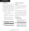
Garmin g1000 mfd pilot’s guide for the da40 190-00381-03 rev. A 8-3 introduction selecting a procedure group depending on the specific airframe, there are a certain number of groups of procedures with their respective checklists available to the pilot. To select a procedure group: 1. Press the chklis...
Page 6
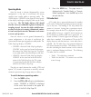
Garmin g1000 mfd pilot’s guide for the da40 190-00381-03 rev. A 8-4 introduction one-button access to emergency procedures the emergency softkey is available at all times when the checklist page is displayed. Press the emergency softkey at any time to immediately access the emergency procedures. Che...
Page 7
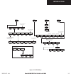
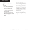
Garmin g1000 mfd pilot’s guide for the da40 190-00381-03 rev. A 8-5 introduction figure 8.1.3 mfd softkeys back rst fuel system engine lean engine map dcltr back system lean engine engine lean back system press the engine softkey on any level to return to the default engine page traffic topo terrain...
Page 8
Garmin g1000 mfd pilot’s guide for the da40 190-00381-03 rev. A 8-6 introduction mfd page groups the mfd displays gps/navigation flight information in four main page groups: • map (map): navigation map page traffic map page terrain proximity page • waypoint (wpt) : airport information page intersectio...
Page 9
Garmin g1000 mfd pilot’s guide for the da40 190-00381-03 rev. A 8-7 introduction working with menus much of the operation of the g1000 mfd is accomplished using a menu interface. The g1000 has a bezel-mounted dedicated menu key (menu) when pressed, displays a context-sensitive list of options. This ...
Page 10
Garmin g1000 mfd pilot’s guide for the da40 190-00381-03 rev. A 8-8 introduction this page intentionally left blank..
Page 11
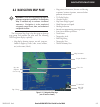
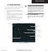
Garmin g1000 mfd pilot’s guide for the da40 190-00381-03 rev. A 8-9 navigation map page 8.2 navigation map page warning: use of the navigation map page for pilotage navigation is prohibited. The navigation map is intended only to enhance situational awareness. Navigation is to be conducted using onl...
Page 12
Garmin g1000 mfd pilot’s guide for the da40 190-00381-03 rev. A 8-10 navigation map page to select the navigation map page: 1. Turn the large fms knob to select the map page group. 2. Turn the small fms knob to select the naviga- tion map page. The page group name and page title is displayed below t...
Page 13
Garmin g1000 mfd pilot’s guide for the da40 190-00381-03 rev. A 8-11 navigation map page navigation map page operations the following navigation map page operations can be performed: • changing the map orientation • selecting a map range • using the auto zoom feature • identifying aviation map data ...
Page 14
Garmin g1000 mfd pilot’s guide for the da40 190-00381-03 rev. A 8-12 navigation map page identifying aviation map data the following aviation data is displayed on the navigation map page: airport symbols: • non-towered airports (purple in color). • towered airports (blue in color). • non-serviced ai...
Page 15
Garmin g1000 mfd pilot’s guide for the da40 190-00381-03 rev. A 8-13 navigation map page decluttering the map the navigation map page can be quickly decluttered by repeatedly pressing the dcltr softkey until the desired detail is displayed. The declutter level label is displayed above the dcltr soft...
Page 16
Garmin g1000 mfd pilot’s guide for the da40 190-00381-03 rev. A 8-14 navigation map page map panning map panning moves the map beyond its current limits without adjusting the map range. When the panning function is selected by pushing in the joystick, a panning arrow flashes on the map display. A win...
Page 17
Garmin g1000 mfd pilot’s guide for the da40 190-00381-03 rev. A 8-15 navigation map page panning arrow latitude and longitude position of pointer distance, bearing and elevation figure 8.2.3 map panning.
Page 18
Garmin g1000 mfd pilot’s guide for the da40 190-00381-03 rev. A 8-16 navigation map page displaying topographic data on the navigation map page the navigation map page displays various shades of topography land colors representing the rise and fall of land elevation similar to aviation sectional cha...
Page 19
Garmin g1000 mfd pilot’s guide for the da40 190-00381-03 rev. A 8-17 navigation map page note: press the topo softkey again to remove topo data from the navigation map page. When topo data is removed from the page, the jeppesen nav data is presented on a black background. Displaying terrain informat...
Page 20
Garmin g1000 mfd pilot’s guide for the da40 190-00381-03 rev. A 8-18 navigation map page mfd data bar the mfd navigation status window displays four, user-configurable fields which can display the following data: • bearing to next waypoint (brg) • distance to next waypoint (dis) • desired track to nex...
Page 21
Garmin g1000 mfd pilot’s guide for the da40 190-00381-03 rev. A 8-19 navigation map page orientation there are four map orientation selections: north up, track up, dtk up, and hdg up. • north up fixes the top of the map to a north head- ing. • track up adjusts the top of the map display to the curren...
Page 22
Garmin g1000 mfd pilot’s guide for the da40 190-00381-03 rev. A 8-20 navigation map page auto zoom the automatic zoom feature automatically adjusts the map range from 2000 nm through each lower range, stopping at 1.5 nm as the aircraft approaches the destination waypoint. To enable/disable automatic...
Page 23
Garmin g1000 mfd pilot’s guide for the da40 190-00381-03 rev. A 8-21 navigation map page track vector the navigation map page can display a track vector as a dashed cyan line segment with an arrowhead attached to the end, extended to a predicted location in 60 seconds along the current aircraft trac...
Page 24
Garmin g1000 mfd pilot’s guide for the da40 190-00381-03 rev. A 8-22 navigation map page nav range ring the nav range ring shows the direction of travel (ground track) on a rotating compass card. The range of the nav compass is determined by the map range, 125 feet (500 feet map range) to 500 nm (20...
Page 25
Garmin g1000 mfd pilot’s guide for the da40 190-00381-03 rev. A 8-23 navigation map page topo range the topo range setting enables or disables the topography range box located in the lower right corner of the navigation map page. To enable/disable the topo range box: 1. With the navigation map page ...
Page 26
Garmin g1000 mfd pilot’s guide for the da40 190-00381-03 rev. A 8-24 navigation map page obstacle data obstacle data can be enabled or disabled on the navigation map page using the ‘obstacle data’ setting. A data range can also be selected. The data range is the maximum map range that terrain data i...
Page 27
Garmin g1000 mfd pilot’s guide for the da40 190-00381-03 rev. A 8-25 navigation map page traffic group the display of traffic information on the navigation map page closely resembles tcas display symbology. Traffic is only displayed on the navigation map page if aircraft heading data is available. If h...
Page 28
Garmin g1000 mfd pilot’s guide for the da40 190-00381-03 rev. A 8-26 navigation map page to select a traffic mode: 1. With the navigation map page displayed, press the menu key to display the navigation map page menu. The cursor flashes on the ‘map setup’ option. 2. Press the ent key. The map setup me...
Page 29
Garmin g1000 mfd pilot’s guide for the da40 190-00381-03 rev. A 8-27 navigation map page the traffic label displays the altitude separation above or below the symbol and the vertical speed sense arrow to the right of the symbol. To select a traffic label zoom range: 1. With the navigation map page dis...
Page 30
Garmin g1000 mfd pilot’s guide for the da40 190-00381-03 rev. A 8-28 navigation map page • airspace boundaries (class b/tma, class c/tca, and class d) - the airspace zoom range sets the maximum range at which the three classes of airspace appear on the display. The zoom range sets the maximum range ...
Page 31
Garmin g1000 mfd pilot’s guide for the da40 190-00381-03 rev. A 8-29 navigation map page to select an aviation group item text size: 1. With the navigation map page displayed, press the menu key to display the navigation map page menu. The cursor flashes on the ‘map setup’ option. 2. Press the ent ke...
Page 32
Garmin g1000 mfd pilot’s guide for the da40 190-00381-03 rev. A 8-30 navigation map page • states and provinces, rivers and lakes, and user waypoints (state/prov, river/lake, user waypoint) - the label range sets the maximum range at which the three categories appear on the display. The zoom range s...
Page 33
Garmin g1000 mfd pilot’s guide for the da40 190-00381-03 rev. A 8-31 navigation map page measure bearing/distance the second map setup option is ‘measure bearing/ distance’ which provides a quick and easy method for determining the bearing and distance between any two points on the navigation map pa...
Page 34
Garmin g1000 mfd pilot’s guide for the da40 190-00381-03 rev. A 8-32 navigation map page reference pointer bearing, distance, and elevation information pointer latitude and longitude figure 8.2.9 measuring bearing and distance.
Page 35
Garmin g1000 mfd pilot’s guide for the da40 190-00381-03 rev. A 8-33 traffic map page 8.3 traffic map page the traffic map page is the second page in the map group and displays the following information: • current aircraft location, surrounding traffic information system (tis) traffic, and range mark- ...
Page 36
Garmin g1000 mfd pilot’s guide for the da40 190-00381-03 rev. A 8-34 traffic map page tis symbology tis traffic is displayed on the traffic map page according to tcas symbology. A traffic advisory (ta) symbol is displayed as a solid yellow circle (or half circle on the outer range ring if the traffic is...
Page 37
Garmin g1000 mfd pilot’s guide for the da40 190-00381-03 rev. A 8-35 traffic map page operating mode once the aircraft is airborne (determined by system configuration at the time of installation) the system switches from standby mode to operating mode. The g1000 displays ‘operate’ in the upper left h...
Page 38
Garmin g1000 mfd pilot’s guide for the da40 190-00381-03 rev. A 8-36 traffic map page tis traffic status the mfd indicates the following tis traffic status to the pilot. Traffic banner • age - if traffic data is not refreshed within 6 seconds, an age indicator (i.E., ‘age 00:06’) is displayed in the low...
Page 39
Garmin g1000 mfd pilot’s guide for the da40 190-00381-03 rev. A 8-37 terrain proximity page 8.4 terrain proximity page caution: use of terrain proximity informa- tion for primary terrain avoidance is prohibited. The terrain proximity map is intended only to enhance situational awareness. It is the p...
Page 40
Garmin g1000 mfd pilot’s guide for the da40 190-00381-03 rev. A 8-38 terrain proximity page terrain proximity page operations there are two terrain/obstacle viewing options available (relative to the position of the aircraft), a radar-like arc (120°) display and a 360° default display. To change the...
Page 41
Garmin g1000 mfd pilot’s guide for the da40 190-00381-03 rev. A 8-39 terrain proximity page displaying obstacle data the terrain proximity page displays obstacle data with heights greater than 200 feet above ground level (agl) located at their geographical position loca- tion throughout the world. O...
Page 42
Garmin g1000 mfd pilot’s guide for the da40 190-00381-03 rev. A 8-40 terrain proximity page this page intentionally left blank..
Page 43
Garmin g1000 mfd pilot’s guide for the da40 190-00381-03 rev. A 8-41 direct-to navigation 8.5 direct-to navigation the “direct-to” function provides a quick method of setting a course to a destination waypoint. Once a direct-to is activated, the g1000 establishes a point-to- point course line from t...
Page 44
Garmin g1000 mfd pilot’s guide for the da40 190-00381-03 rev. A 8-42 direct-to navigation direct-to navigation operations selecting a direct-to waypoint in addition to selecting a direct-to waypoint using an identifier, a direct-to waypoint can be selected in the following ways: • by facility or city...
Page 45
Garmin g1000 mfd pilot’s guide for the da40 190-00381-03 rev. A 8-43 direct-to navigation selecting a direct-to destination from the active flight plan any waypoint contained in the flight plan may be selected as a direct-to destination from the direct-to waypoint page when navigating an active flight...
Page 46
Garmin g1000 mfd pilot’s guide for the da40 190-00381-03 rev. A 8-44 direct-to navigation selecting the nearest airport as a direct-to destination the direct-to page always displays the nearest airports (from the present position) on the nrst field. To select a nearby airport as a direct-to destinati...
Page 47
Garmin g1000 mfd pilot’s guide for the da40 190-00381-03 rev. A 8-45 direct-to navigation canceling direct-to navigation once a direct-to is activated, the g1000 provides navigation guidance to the selected destination until the direct-to is either replaced with a new direct-to or flight plan, or can...
Page 48
Garmin g1000 mfd pilot’s guide for the da40 190-00381-03 rev. A 8-46 direct-to navigation this page intentionally left blank..
Page 49
Garmin g1000 mfd pilot’s guide for the da40 190-00381-03 rev. A 8-47 flight plans 8.6 flight plans the g1000 can create up to 99 different flight plans with up to 31 waypoints in each flight plan. The flight plan (fpl) page group consists of three pages: • active flight plan • flight plan catalog • ver...
Page 50
Garmin g1000 mfd pilot’s guide for the da40 190-00381-03 rev. A 8-48 flight plans departure airport identifier active leg active leg information flight plan page group active flight plan page flight plan information estimated safe altitude destination airport identifier figure 8.6.1 active flight plan...
Page 51
Garmin g1000 mfd pilot’s guide for the da40 190-00381-03 rev. A 8-49 flight plans to edit a flight plan: 1. Press the fpl key and turn the small fms knob to display the flight plan catalog page. 2. Press the fms knob to activate the cursor. 3. Turn the large fms knob to highlight the desired flight pl...
Page 52
Garmin g1000 mfd pilot’s guide for the da40 190-00381-03 rev. A 8-50 flight plans store flight plan whenever an approach, departure or arrival is loaded into the active flight plan, a set of approach, departure or arrival waypoints is inserted into the flight plan along with a header line describing t...
Page 53
Garmin g1000 mfd pilot’s guide for the da40 190-00381-03 rev. A 8-51 flight plans invert flight plan ‘invert fight plan’ reverses the active flight plan. After traveling along a flight plan, the route can be reversed for navigation guidance back to the original departure point. To invert and (activate...
Page 54
Garmin g1000 mfd pilot’s guide for the da40 190-00381-03 rev. A 8-52 flight plans load a departure ‘load departure’ allows a published departure procedure for the departure airport to be loaded into a flight plan. It also replaces the current departure with a new selection. When using a direct-to, th...
Page 55
Garmin g1000 mfd pilot’s guide for the da40 190-00381-03 rev. A 8-53 flight plans load an arrival ‘load arrival’ allows a published standard terminal arrival route (star) for the destination airport to be loaded into a flight plan. It also replaces the current arrival with a new selection. An arrival...
Page 56
Garmin g1000 mfd pilot’s guide for the da40 190-00381-03 rev. A 8-54 flight plans load an approach ‘load approach’ allows for the selection of a published instrument approach for the destination airport. It also replaces the current approach with a new selection. In many cases, it is more convenient...
Page 57
Garmin g1000 mfd pilot’s guide for the da40 190-00381-03 rev. A 8-55 flight plans remove a departure, arrival, or approach • ‘remove departure’ deletes the current dp from the active flight plan. • ‘remove arrival’ deletes the current star from the active flight plan. • ‘remove approach’ deletes the c...
Page 58
Garmin g1000 mfd pilot’s guide for the da40 190-00381-03 rev. A 8-56 flight plans change fields ‘change fields’ allows for the default fields of dtk (distance) and dis (distance) to be changed to one of the following: • cum (cumulative distance) • dis (distance) • dtk (desired track) • esa (estimated...
Page 59
Garmin g1000 mfd pilot’s guide for the da40 190-00381-03 rev. A 8-57 flight plans flight plan catalog page the flight plan catalog page is the second flight planning page and provides flight planning information and editing capability. Once a direct-to or flight plan has been activated, the active flig...
Page 60
Garmin g1000 mfd pilot’s guide for the da40 190-00381-03 rev. A 8-58 flight plans activate a flight plan once a flight plan is defined using the flight plan catalog page it can be activated for navigation. Activating the flight plan overwrites any previous information at that location. To activate (beg...
Page 61
Garmin g1000 mfd pilot’s guide for the da40 190-00381-03 rev. A 8-59 flight plans invert and activate a flight plan ‘invert & activate fpl’ allows the active flight plan to be inverted and activated for navigation. To invert and activate a flight plan: 1. Press the fpl key and turn the small fms knob ...
Page 62
Garmin g1000 mfd pilot’s guide for the da40 190-00381-03 rev. A 8-60 flight plans copy a flight plan ‘copy flight plan’ copies the active flight plan to a flight plan catalog location. The copy function is useful for duplicating the active flight plan before making changes. To copy a flight plan to ano...
Page 63
Garmin g1000 mfd pilot’s guide for the da40 190-00381-03 rev. A 8-61 flight plans delete all flight plans ‘delete all’ removes all flight plans from memory at one time. To delete all flight plans: 1. From the flight plan catalog page, press the menu key to display the flight plan catalog page options....
Page 64
Garmin g1000 mfd pilot’s guide for the da40 190-00381-03 rev. A 8-62 flight plans point-n-shoot flight plan creation feature the “point-n-shoot” flight plan creation feature is acti- vated using the navigation map page and the active flight plan page. To create a point-n-shoot flight plan: 1. Push the...
Page 65
Garmin g1000 mfd pilot’s guide for the da40 190-00381-03 rev. A 8-63 flight plans vertical navigation (vnav) page the vertical navigation page allows the creation of a three-dimensional profile which guides the aircraft from it’s present position and altitude to a final (target) altitude at a specified...
Page 66
Garmin g1000 mfd pilot’s guide for the da40 190-00381-03 rev. A 8-64 flight plans 3. With the ‘target altitude’ field highlighted, turn the small and large fms knobs to select the target altitude and press the ent key. 4. Turn the small fms knob to select ‘above wpt’ (agl) or ‘msl’, and press the ent...
Page 67
Garmin g1000 mfd pilot’s guide for the da40 190-00381-03 rev. A 8-65 procedures 8.7 procedures arrivals and departures based upon the active flight plan or direct-to destination, the procedures page provides direct access to approaches, departures and arrivals. In either case, the departure and desti...
Page 68
Garmin g1000 mfd pilot’s guide for the da40 190-00381-03 rev. A 8-66 procedures approaches the g1000 allows you to fly non-precision and precision approaches to airports with published instrument approach procedures. All available approaches are part of the jeppesen database stored internally in each...
Page 69
Garmin g1000 mfd pilot’s guide for the da40 190-00381-03 rev. A 8-67 procedures selecting approaches in order to select an approach, there must be an active flight plan or direct-to which terminates at an airport with a published approach. To select an approach: 1. Press the proc key to display the p...
Page 70
Garmin g1000 mfd pilot’s guide for the da40 190-00381-03 rev. A 8-68 procedures figure 8.7.3 selecting an approach transition figure 8.7.2 selecting an approach procedure not all approaches in the database are approved for gps use. As you select an approach, a ‘gps’ designation to the right of the p...
Page 71
Garmin g1000 mfd pilot’s guide for the da40 190-00381-03 rev. A 8-69 procedures to activate an approach procedure: 1. With an approach loaded in the active flight plan, press the proc key to display the proce- dures page. 2. Turn the large fms knob to highlight ‘activate approach’. 3. Press the ent k...
Page 72
Garmin g1000 mfd pilot’s guide for the da40 190-00381-03 rev. A 8-70 procedures this page intentionally left blank..
Page 73
Garmin g1000 mfd pilot’s guide for the da40 190-00381-03 rev. A 8-71 waypoint page group 8.8 waypoint page group the waypoint page group (wpt) provides informa- tion for the thousands of airports, vors, ndbs, intersec- tions, runways, frequencies and procedures stored on the sd card. In addition, a ...
Page 74
Garmin g1000 mfd pilot’s guide for the da40 190-00381-03 rev. A 8-72 waypoint page group airport information page (info) the airport information page shows the following detailed information for the selected airport: • airport information • runways • frequencies airport information page operations t...
Page 75
Garmin g1000 mfd pilot’s guide for the da40 190-00381-03 rev. A 8-73 waypoint page group location field facility field figure 8.8.2 waypoint facility or city location to select a facility name or city location, where duplicate entries exist: 1. Select the desired facility name or location. 2. As you...
Page 76
Garmin g1000 mfd pilot’s guide for the da40 190-00381-03 rev. A 8-74 waypoint page group airport runway information field the airport runway information field displays runway designations, length, surface type and lighting for the selected airport. A map image of the runway layout and surrounding are...
Page 77
Garmin g1000 mfd pilot’s guide for the da40 190-00381-03 rev. A 8-75 waypoint page group airport frequency information field the airport frequency information field displays radio frequencies and frequency types for the selected airport, as well as sector and altitude restrictions (where applicable)...
Page 78
Garmin g1000 mfd pilot’s guide for the da40 190-00381-03 rev. A 8-76 waypoint page group airport frequency descriptions the airport frequency information field uses the following descriptions and abbreviations: • frequency — communication frequencies which may include restrictions: • approach • arriv...
Page 79
Garmin g1000 mfd pilot’s guide for the da40 190-00381-03 rev. A 8-77 waypoint page group departure information page (dp) the departure information page shows the available departure procedures (dps; also referred to as sids) for the selected airport. Where multiple runways or transitions are associa...
Page 80
Garmin g1000 mfd pilot’s guide for the da40 190-00381-03 rev. A 8-78 waypoint page group arrival information page (star) the arrival information page shows the available standard terminal arrival (star) procedures for the selected airport. Where multiple transitions or runways are associated with th...
Page 81
Garmin g1000 mfd pilot’s guide for the da40 190-00381-03 rev. A 8-79 waypoint page group an arrival can be loaded from the arrival information page. To load an arrival procedure from the arrival information page: 1. Select the desired arrival, transition and runway using the steps described previous...
Page 82
Garmin g1000 mfd pilot’s guide for the da40 190-00381-03 rev. A 8-80 waypoint page group approach information page the approach information page shows the available approach procedures for a selected airport. Where multiple initial approach fixes (iafs) and feeder routes are available, that informati...
Page 83
Garmin g1000 mfd pilot’s guide for the da40 190-00381-03 rev. A 8-81 waypoint page group an approach can be loaded from the airport informa- tion page. To load an approach from the airport approach information page: 1. Select the desired approach and transition. 2. Press menu to display the approach...
Page 84
Garmin g1000 mfd pilot’s guide for the da40 190-00381-03 rev. A 8-82 waypoint page group intersection information page the intersection information page displays the following information for a selected intersection: • map of surrounding area • intersection identifier and symbol • name • general loca...
Page 85
Garmin g1000 mfd pilot’s guide for the da40 190-00381-03 rev. A 8-83 waypoint page group intersection information page operations to change the map range, turn the joystick to the left to select a lower range, turn it to the right to select a higher range. Note: intersections can only be selected by...
Page 86
Garmin g1000 mfd pilot’s guide for the da40 190-00381-03 rev. A 8-84 waypoint page group ndb information page the ndb information page displays the following information for a selected non-directional beacon: • map of surrounding area • ndb identifier and symbol • name • closest city • general locati...
Page 87
Garmin g1000 mfd pilot’s guide for the da40 190-00381-03 rev. A 8-85 waypoint page group ndb information page operations the ndb information page allows the following operations: • ndb selection by identifier • ndb selection by name • ndb selection by closest city to change the map range, turn the jo...
Page 88
Garmin g1000 mfd pilot’s guide for the da40 190-00381-03 rev. A 8-86 waypoint page group ndb information page options the following ndb information page options are available by pressing the menu key (with the ndb information page displayed): • ‘view recent ndb list’ which allows you to view the mos...
Page 89
Garmin g1000 mfd pilot’s guide for the da40 190-00381-03 rev. A 8-87 waypoint page group vor information page the vor information page displays the following in- formation for a selected vor: • map of surrounding area • identifier and symbol • name • closest city • general location • latitude/longitu...
Page 90
Garmin g1000 mfd pilot’s guide for the da40 190-00381-03 rev. A 8-88 waypoint page group vor information page operations the vor information page allows the following operations: • vor selection by identifier • vor selection by name • vor selection by closest city the map range is adjustable by rotat...
Page 91
Garmin g1000 mfd pilot’s guide for the da40 190-00381-03 rev. A 8-89 waypoint page group vor information page options the following vor information page options are available by pressing the menu key (with the vor information page displayed): • ‘view recent vor list’ which allows you to view the mos...
Page 92
Garmin g1000 mfd pilot’s guide for the da40 190-00381-03 rev. A 8-90 waypoint page group user waypoint information page the g1000 allows the storage of up to 1,000 user- defined waypoints. The user waypoint information page displays the waypoint name (up to six characters long), identifier and radial ...
Page 93
Garmin g1000 mfd pilot’s guide for the da40 190-00381-03 rev. A 8-91 waypoint page group user waypoint information page the g1000 allows the storage of up to 1,000 user- defined waypoints. The user waypoint information page displays the waypoint name (up to six characters long), identifier and radial ...
Page 94
Garmin g1000 mfd pilot’s guide for the da40 190-00381-03 rev. A 8-92 waypoint page group creating user waypoints user waypoints may be created from the user waypoint information page or the navigation map page. To create a new user waypoint from the user waypoint information page, enter its name (id...
Page 95
Garmin g1000 mfd pilot’s guide for the da40 190-00381-03 rev. A 8-93 waypoint page group creating user waypoints from the navigation map page the navigation map page and panning target pointer provide a quick means of saving your present position as a user-defined waypoint. To capture and save your p...
Page 96
Garmin g1000 mfd pilot’s guide for the da40 190-00381-03 rev. A 8-94 waypoint page group modifying user waypoints to modify an existing waypoint, select that waypoint on the user waypoint information page and enter the new position information directly over the old information. To modify a user wayp...
Page 97
Garmin g1000 mfd pilot’s guide for the da40 190-00381-03 rev. A 8-95 waypoint page group user waypoint information page options the following user waypoint information page options are available by pressing the menu key (with the user waypoint information page displayed): • delete all user waypoints...
Page 98
Garmin g1000 mfd pilot’s guide for the da40 190-00381-03 rev. A 8-96 waypoint page group use ‘present position’ when selected will move the currently selected user waypoint to the present position of the aircraft. Note: the user waypoint is set to the airplane’s position at the time when this option...
Page 99
Garmin g1000 mfd pilot’s guide for the da40 190-00381-03 rev. A 8-97 waypoint page group create new waypoint allows the pilot to create a new user waypoint. To create a new waypoint: 1. From the user waypoint information page, press the menu key to display the user waypoint information page options ...
Page 100
Garmin g1000 mfd pilot’s guide for the da40 190-00381-03 rev. A 8-98 waypoint page group this page intentionally left blank..
Page 101
Garmin g1000 mfd pilot’s guide for the da40 190-00381-03 rev. A 8-99 auxiliary page group 8.9 auxiliary page group the auxiliary page group (aux) provides detailed trip planning information, satellite status, raim prediction, system settings, lru status and database information. The aux group page n...
Page 102
Garmin g1000 mfd pilot’s guide for the da40 190-00381-03 rev. A 8-100 auxiliary page group figure 8.9.2 trip planning page menu trip planning trip planning allows you to view desired track (dtk), distance (dis), estimated time enroute (ete), estimated time of arrival (eta), and enroute safe altitude...
Page 103
Garmin g1000 mfd pilot’s guide for the da40 190-00381-03 rev. A 8-101 auxiliary page group fuel planning using fuel flow (ff) and/or fuel totalizer data, the aux trip planning page displays current fuel conditions along the active direct-to or flight plan. You may also manually enter fuel flow, ground ...
Page 104
Garmin g1000 mfd pilot’s guide for the da40 190-00381-03 rev. A 8-102 auxiliary page group other statistics to calculate density altitude and true air- speed 1. Select ‘manual’ page mode by pressing the manual softkey. 2. Turn the large fms knob to select the ‘ind altitude’ field. Turn the small and ...
Page 105
Garmin g1000 mfd pilot’s guide for the da40 190-00381-03 rev. A 8-103 auxiliary page group utility page the utility page displays timers, trip statistics, and scheduler information for flight planning purposes. Figure 8.9.3 utility page figure 8.9.4 utility page menu.
Page 106
Garmin g1000 mfd pilot’s guide for the da40 190-00381-03 rev. A 8-104 auxiliary page group utility page operations to set the generic timer direction (up, down): 1. Select the aux utility page. 2. Press the fms knob. The ‘generic’ timer field is highlighted. 3. Turn the small fms knob to display the ...
Page 107
Garmin g1000 mfd pilot’s guide for the da40 190-00381-03 rev. A 8-105 auxiliary page group trip statistics to reset trip statistics readouts: 1. Press the menu key to display an options window with the following reset options: • reset trip odom/avg gs – resets trip aver- age ground speed readout and...
Page 108
Garmin g1000 mfd pilot’s guide for the da40 190-00381-03 rev. A 8-106 auxiliary page group gps status page the gps status page provides a visual reference of gps receiver functions: figure 8.9.5 gps status page figure 8.9.6 gps status page menu.
Page 109
Garmin g1000 mfd pilot’s guide for the da40 190-00381-03 rev. A 8-107 auxiliary page group satellite status page • satellite constellation displaying the following for each satellite being tracked: azimuth elevation prn number tracking status • a receiver tracking status display that displays the fo...
Page 110
Garmin g1000 mfd pilot’s guide for the da40 190-00381-03 rev. A 8-108 auxiliary page group the satellite status page also indicates the accuracy of the position fix, using estimated position error (epe) and dilution of precision (dop) figures. Dop measures satellite geometry quality (i.E., number of s...
Page 111
Garmin g1000 mfd pilot’s guide for the da40 190-00381-03 rev. A 8-109 auxiliary page group raim prediction “raim” is an acronym for receiver autonomous integrity monitoring, a gps receiver function that performs a consistency check on all tracked satellites. Raim ensures that the available satellite...
Page 112
Garmin g1000 mfd pilot’s guide for the da40 190-00381-03 rev. A 8-110 auxiliary page group figure 8.9.7 raim.
Page 113
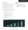
Garmin g1000 mfd pilot’s guide for the da40 190-00381-03 rev. A 8-111 auxiliary page group gps signal strength the satellite status page can be helpful in troubleshooting weak (or missing) signal levels due to poor satellite coverage or installation problems. Refer to this page occasionally to monit...
Page 114
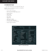
Garmin g1000 mfd pilot’s guide for the da40 190-00381-03 rev. A 8-112 auxiliary page group system setup page the system setup page is the fourth aux page and provides access (via a list of menu options) to manage the following system parameters: • local or utc time display • units of measure setting...
Page 115
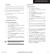
Garmin g1000 mfd pilot’s guide for the da40 190-00381-03 rev. A 8-113 auxiliary page group pilot profiles the pilot profile section of the system setup page al- lows the pilot to select, create, delete, and rename up to a total of 25 profiles. Profiles can be created based on garmin factory defaults, de...
Page 116
Garmin g1000 mfd pilot’s guide for the da40 190-00381-03 rev. A 8-114 auxiliary page group deleting a profile to delete a profile: 1. Select the system setup page. 2. Press the fms knob momentarily, to activate the flashing cursor. 3. Turn the large fms knob to highlight the delete field in the pilot pr...
Page 117
Garmin g1000 mfd pilot’s guide for the da40 190-00381-03 rev. A 8-115 auxiliary page group date/time the date/time box provides settings for time format (local or utc; 12- or 24-hour) and time offset. The time offset is used to define current local time. Utc (also called “gmt” or “zulu”) date and tim...
Page 118
Garmin g1000 mfd pilot’s guide for the da40 190-00381-03 rev. A 8-116 auxiliary page group the display units section of the system setup page allows the following operations: • to select a nav angle (auto, true) • to select distance and speed units (metric or nautical) • to select altitude and verti...
Page 119
Garmin g1000 mfd pilot’s guide for the da40 190-00381-03 rev. A 8-117 auxiliary page group airspace alerts the airspace alerts fields allow the pilot to turn the controlled/special-use airspace message alerts on or off. This does not affect the alerts listed on the nearest airspaces page or the airsp...
Page 120
Garmin g1000 mfd pilot’s guide for the da40 190-00381-03 rev. A 8-118 auxiliary page group to turn an airspace alert on or off: 1. Select the system setup page. 2. Press the fms knob momentarily, to activate the flashing cursor. 3. Turn the large fms knob to highlight the desired ‘airspace alerts’ fie...
Page 121
Garmin g1000 mfd pilot’s guide for the da40 190-00381-03 rev. A 8-119 auxiliary page group audio alerts the audio alert section of the system setup page gives you the option of selecting a male or female voice for au- dio alerts. To change the audio alert voice: 1. Select the system setup page. 2. P...
Page 122
Garmin g1000 mfd pilot’s guide for the da40 190-00381-03 rev. A 8-120 auxiliary page group gps cdi the cdi section of the system setup page allows you to define the range for the on-screen course deviation indicator. The range values represent full range deflection for the cdi to either side. The defa...
Page 123
Garmin g1000 mfd pilot’s guide for the da40 190-00381-03 rev. A 8-121 auxiliary page group to change com channel spacing: 1. Select the system setup page. 2. Press the fms knob momentarily, to activate the flashing cursor. 3. Turn the large fms knob to highlight the ‘channel spacing’ field. 4. Turn th...
Page 124
Garmin g1000 mfd pilot’s guide for the da40 190-00381-03 rev. A 8-122 auxiliary page group system status page the system status page displays the status and soft- ware version numbers for all detected system lrus. Pertinent information of all databases in the system is also displayed. Active lrus ar...
Page 125
Garmin g1000 mfd pilot’s guide for the da40 190-00381-03 rev. A 8-123 auxiliary page group 8.10 nearest page group the nearest (nrst) page group is the fourth page group which consists of the following pages: • nearest airports • nearest intersections • nearest ndb • nearest vor • nearest user wpts ...
Page 126
Garmin g1000 mfd pilot’s guide for the da40 190-00381-03 rev. A 8-124 auxiliary page group navigating to a nearest waypoint the nrst pages can be used in conjunction with the direct-to function to quickly set a course to a nearby facility. This feature can be a real time saver compared to retrieving...
Page 127
Garmin g1000 mfd pilot’s guide for the da40 190-00381-03 rev. A 8-125 nearest page group figure 8.10.2 direct-to from nearest airports page direct to page.
Page 128
Garmin g1000 mfd pilot’s guide for the da40 190-00381-03 rev. A 8-126 nearest page group nearest airports page the nearest airports page displays the following information for a selected airport: • map of surrounding area • airport identifier, symbol, bearing, distance (up to 25 airports within 200 n...
Page 129
Garmin g1000 mfd pilot’s guide for the da40 190-00381-03 rev. A 8-127 nearest page group the nearest airports page can be used to quickly tune the com transceiver to a nearby airport. The selected frequency is placed in the standby field of the com window and activated using the com frequency toggle ...
Page 130
Garmin g1000 mfd pilot’s guide for the da40 190-00381-03 rev. A 8-128 nearest page group nearest intersections page the nearest intersections page displays the following information for a selected intersection: • map of surrounding area • intersection identifier, symbol, bearing, distance (within 200...
Page 131
Garmin g1000 mfd pilot’s guide for the da40 190-00381-03 rev. A 8-129 nearest page group to select the nearest intersections page: 1. From any page, press and hold the clr key to select the navigation map page. 2. Turn the large fms knob to select the nrst page group. ‘nrst’ is displayed in the page...
Page 132
Garmin g1000 mfd pilot’s guide for the da40 190-00381-03 rev. A 8-130 nearest page group to select the nearest ndb page: 1. From any page, press and hold the clr key to select the navigation map page. 2. Turn the large fms knob to select the nrst page group. ‘nrst’ is displayed in the page group ico...
Page 133
Garmin g1000 mfd pilot’s guide for the da40 190-00381-03 rev. A 8-131 nearest page group to select the nearest vor page: 1. From any page, press and hold the clr key to select the navigation map page. 2. Turn the large fms knob to select the nrst page group. ‘nrst’ is displayed in the page group ico...
Page 134
Garmin g1000 mfd pilot’s guide for the da40 190-00381-03 rev. A 8-132 nearest page group nearest user waypoint page the nearest user waypoint page displays the following information for a selected user waypoint: • map of surrounding area • identifier • symbol • bearing and distance • latitude/longitu...
Page 135
Garmin g1000 mfd pilot’s guide for the da40 190-00381-03 rev. A 8-133 nearest page group to select a nearest user waypoint from the nearest user waypoint page: 1. Select the nearest user waypoint page. 2. Press the fms knob and turn either the small or large fms knob and press the ent key to select ...
Page 136
Garmin g1000 mfd pilot’s guide for the da40 190-00381-03 rev. A 8-134 nearest page group to select a nearest fss from the nearest frequencies page: 1. Select the nearest frequencies page. 2. Press the fss softkey and turn the small fms knob to select a nearest fss. To select and load the nearest fss...
Page 137
Garmin g1000 mfd pilot’s guide for the da40 190-00381-03 rev. A 8-135 nearest page group nearest airspaces page the nearest airspaces page displays the following information for a maximum of 20 controlled or special use airspaces: • map of surrounding area • airspace alerts box displaying airspace n...
Page 138
Garmin g1000 mfd pilot’s guide for the da40 190-00381-03 rev. A 8-136 nearest page group airspace alerts box the airspace alerts box displays the airspace name, status, and time to entry. The status and time to entry (if applicable) is based on the following conditions: • if the projected course wil...
Page 139
Garmin g1000 mfd pilot’s guide for the da40 190-00381-03 rev. A 8-137 nearest page group airspaces the nearest airspaces page displays – and airspace messages are provided for the following airspace types: • alert • caution • class b • class c • tca • danger • moa • prohibited • restricted • tma • t...
Page 140
Garmin international, inc. 1200 east 151st street olathe, ks 66062, u.S.A. P: 913.397.8200 f: 913.397.8282 garmin at, inc. 2345 turner road se salem, or 97302, u.S.A. P: 503.391.3411 f: 503.364.2138 garmin (europe) ltd. Unit 5, the quadrangle abbey park industrial estate romsey, so51 9dl, u.K. P: 44...

